|
Paddling again in
Upernavik Gail Ferris |
|
Wednesday 7 27 2011
2011 07 27 0208
(0408)601 7/27 ( |
|
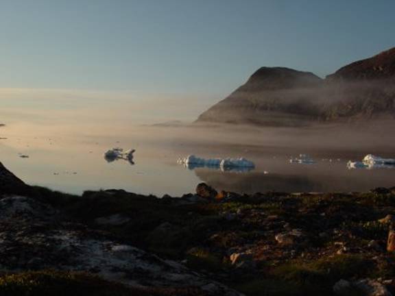
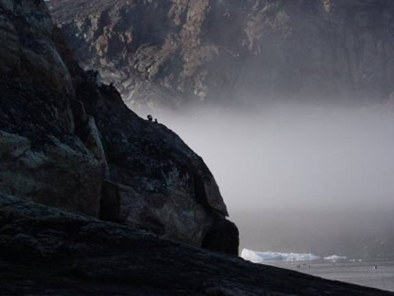
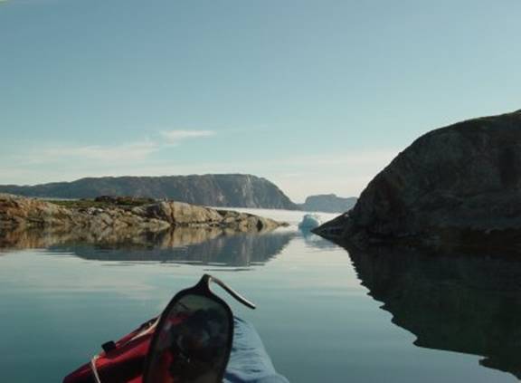
I awoke and decided to eat breakfast at I started out paddling south east with the goal of rounding the peninsula only a mile away. All too soon I found myself horribly enveloped in fog. I got scared and decided not to try some paddling along that coastline. While I was paddling in the fog, I decided not to attempt to crawl along the fog shrouded coastline south from this island. Then I found myself feeling that total feeling of abject fear so I turned around That was a good idea until I realized that I had to do something about it because I could not see anything. I was feeling totally helpless. |
|
2011 07 27 0553
(0653) 130fog.jpg++ some fog |
|
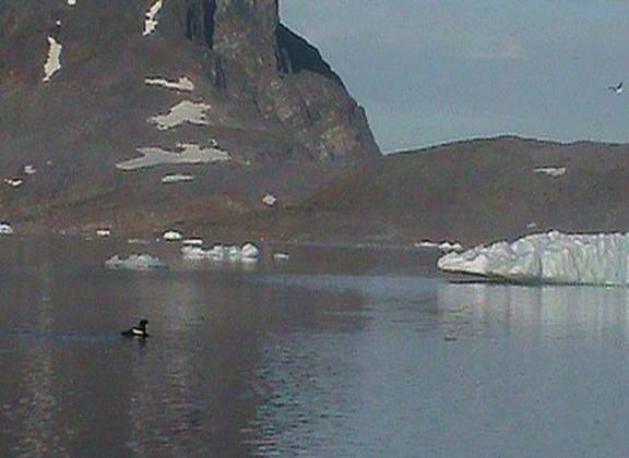
I turned on my GPS with MOB/map/enter/waypoint 12 - N72 47.006 W55 46.159- and followed the red arrow. Wow who would believe it, I actually missed my island, Simiataq. Luckily I had gone to the trouble of wearing contact lenses that allowed me to read my GPS screen arrow. I looked at my arrow on the screen to see how it was indicating my waypoint. I followed the direction indicated and back tracked to my #12 waypoint N72 47.006 W55 46.159. Whew! Scary stuff for me. |
|
How glad I was that I experimented with wearing higher magnification contact lenses before coming on this trip because I wanted to be able to read my GPS screen without needing reading glasses. |
|
2011 07 27 0553
(0753)131.jpg++ |
|
2011 07 27 0558
(0758)132.jpg++ |
|
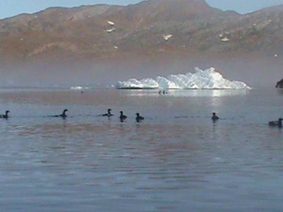
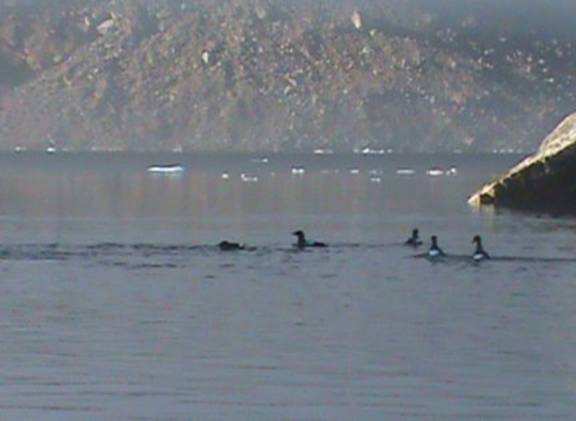
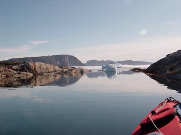
In 2009 I found my contact lenses did not magnify close up vision enough for me to be able accurately read the direction arrow on my GPS screen with enough detail to see where it was pointing. I would be very scared but the fog lifted at my Simiataq I decided to paddle slowly around it and take intimate photos of the guillemots they let me get close to them. |
|
2011 07 27 0558
(0758)133.jpg++ |
|
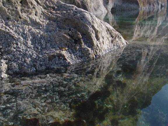
I took some interesting photos of the guillemots that I knew nested on the west side of this island, Simiataq. I had been by this same area in 1992 and 1993 a wonderful place to view the crystal clear bottom filled with seaweeds and sea anemones.
2011 07 27 0609
(0809)602 |
|
The appearance of this island is much different when walking rather than kayaking around Qeqertarsuit island. |
|
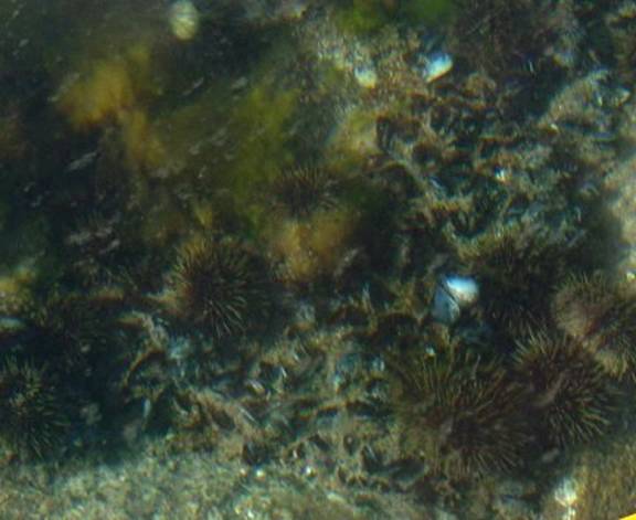
What a wonderful time I had with my cameras capturing from my cockpit these views of the bottom on the west side of Qeqertarsuit island. In this photo below you can see all the white feldspar rocks which it is very easy to spot all those lovely green sea urchins, Strongylocentrotus droebachiensis, busy at work feasting on the algae growing on the rocks. In paddling I have noticed that they seem to cluster most densely on feldspar maybe this mineral has an especially large quantity of phosphate that encourages seaweed colonization. Seaweeds which they prefer. |
|
2011 07 27 0618 (0818)604 Green Sea urchins
and endless acorn barnacles on pink feldspar. |
|
I happened to be able to photograph a solitary Grebe near
Gina’s island, Qeqertarsuit island what a big surprise as I saw both King and
Common eiders that were gathered together off my island, Simiataq. This is a view showing the rusty iron spots in the rocks in this photo I was trying to capture a grebe just sitting here but it is not visible in this photo.
2011 07 27 0648
(0848)605 |
|
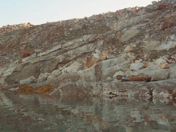
From this photo above I pottered along north in my kayak and arrived at this view to the east. Note how low the island is to the left side I bet it is covered in nasty storms. |
|
2011 07 27 0650 (0850)606 I am approaching the area on the other side where it is hopelessly shallow! |
|
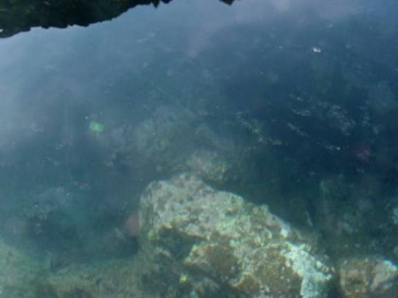
While I thought I was covering great territory when I was walking on this island starting on the south side actually I had never gotten far enough on the island to see this north portion. Was I ever just so slightly surprised when I realized what the topography was on the north side as I viewed it from my cockpit while I just glided by on the mirror calm water. |
|
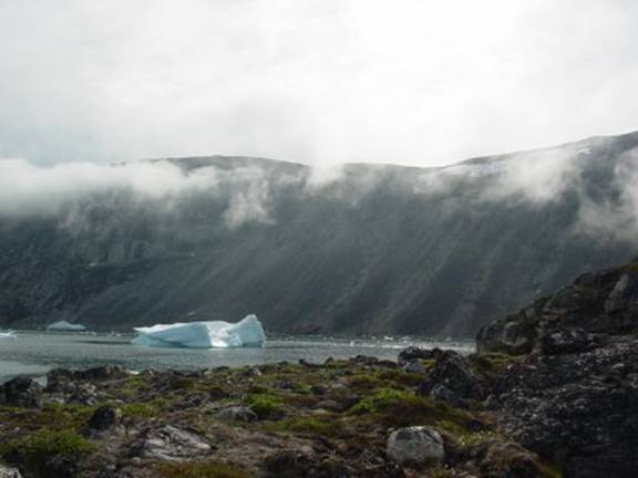
There were extensive shallows where I found myself ramming my bow by accident into some of these just barely submerged rocks. Now I realized that this was a place to look more closely at the bottom. For us kayak paddlers we usually don’t have to be bothered at looking at the bottom for threatening shallows but here the bottom was hopelessly very shallow. All in all I just had assumed that I could just glide through unscathed but to my shock and consternation here was an extensive area of shallows. Indeed it was the most extensive I had ever encountered. Boy! I was ever surprised! There I was caught in the myriad of assumptions oops! See all that ice the nearest pieces are just small chunks grounded out. |
|
201107270702Upv6w608
7/27 ( Notice all the ice in the passage, guess why? Wow was it ever shallow over there. |
|
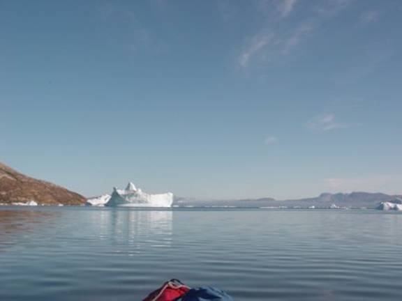
In the photo below I am looking and heading north. I just wanted to see that point in the photo where the large iceberg is in view. Me and my GPS got into a disagreement probably because I
had not properly set it up. My
waypoint 13 became a problem. Waypoint # 013 Problem
getting a waypoint GPS titled this reading as Area N72° 48.240 W55°47.027 |
|
2011 07 27 0712
(0912)609 |
|
|
|
There are those moments when it is such a delight to look into the shallows just over the side. The best is to take photos and videos in these moments. |
|
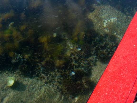
2011 07 27 0734 (0934)610 a wonderful view over the side of those blue mussels, Mytilus edulis just over the side red deck in view |
|
I wanted to show the mussels on the bottom their disposition, density and how heavily this population is covered with rock flour. The mussels were just about covered with this fine powder. On top of them are some sea urchins. Some of the fine green seaweeds are either Ulva or Monostroma, Sea lettuce. |
|
2011 07 27 0734 (0934)610 enlarged this is to show you more closely via this enlargement what I could see just over the side of my kayak in these shallows. I wanted to show you how deeply these mussels are submerged in the rock flour sediments. |
|
|
|
2011 07 27 0735 (0935)611 showing not only blue mussels but also barnacles and large leaves of the seaweed called Ulva |
|
2011 07 27 0746 (0946)612 I wanted to show these rock surfaces to avoid very bright backlight I tucked into the shadows to get this photo |
|
2011 07 27 0747
(0947)613 |
|
|
|
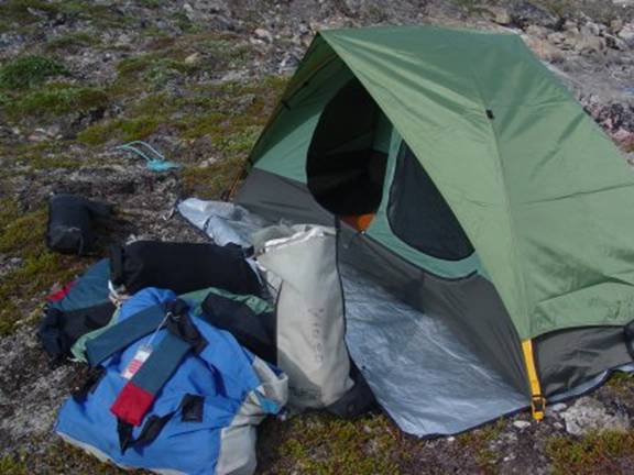
I am glad I brought my original U shaped tent stakes. The single short ones hold much better than the supplied single stakes. These U shaped stakes are much easier to ballast with rocks and hold much better in dirt. |
|
201107270925Upv6w614
7/27 ( my eureka tent note
that I use Mylar space blankets on the ground to protect the tent urethane
coated nylon floor from the sharp rock abrasion |
|
At Some clouds are coming in from the west |
|
2011 07 27 0945
(1145)615 |
|
2011 07 27 0946
(1146)616 |
|
2011 07 27 1409
(1609)134 |
|
|