|
Finding an Ammassat Fishing Site, more adventures
in my kayak at Innarssuit Greenland Gail
Ferris |
|
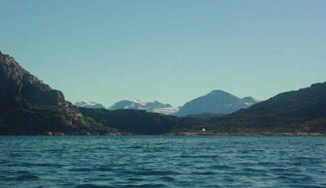
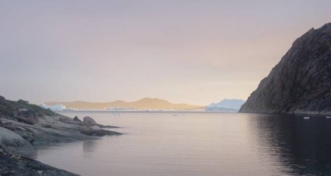
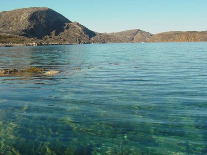
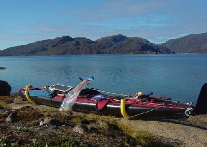
Here I am in |
|
Ammassat always swarm up freshwater outlets from
large bodies of fresh water, most often lakes, to lay their eggs from mid-June
to mid-July. I had watched the film Knud Rasmussen made
showing Greenlanders catching these little fish, Ammassat/capelin with
anything they could dip them up with. |
|
When I was visiting in Barrow Throughout the On In the Upernavik, I have some friends in this area who just love to
fry them for lunch. When I visit them
we always feast on fried ammassat for lunch. |
|
So there I am in my tent thinking to myself that
there just has to be somewhere around here where these tasty fish are caught
as I already knew that only a few miles away people always caught them in
Aappilattoq and Upernavik. |
|
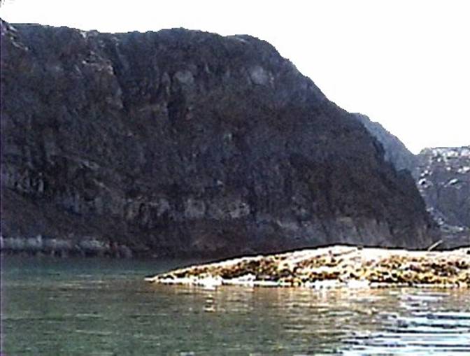
Somehow when I paddled down to the end of this U
shaped passage and saw a wooden rack covered with plastic near a tent I did
not recognize the use of the rack. |
|
01 |
|
Paddling down inside I could not really find the
freshwater outlet. I think I missed
the outlet because it was smaller than I expected to see. There was a drying rack that I did not realize
what it was for right next to what must have been the brook these fish swim
up. Nearby was a campsite even though it was not in
use I was somewhat shy about being too close to it. Later I realized that the motorboat with its
campsite occupants had just left a few minutes before I got to the
campsite. I like to respect people’s
privacy even though Greenlanders like visiting and visitors. From the back side of the tent I saw a codfish
hanging in the wind drying. It was
probably a month old. |
|
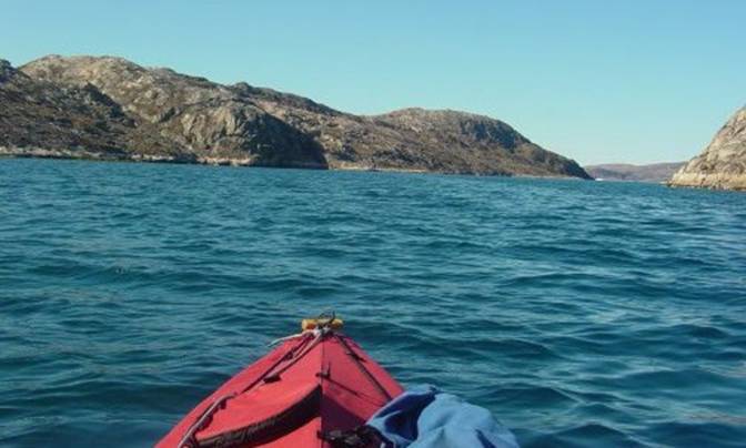
I was out in my kayak, on a toot, so to
speak. What I was really up to - was
to paddle to the very bottom of this U shaped passage which on the map looks
like a pocket off of the U. I just
wanted to see what was down there in the sense of rocks, flora and fauna. |
|
02 |
|
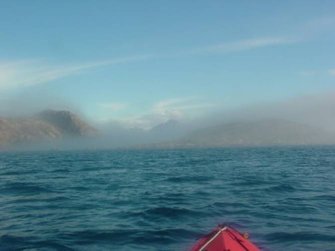
After my trip down to the bottom a few days went
by some fog rolled in back and forth and I did some other paddling. |
|
03 |
|
I still had it on my mind “where do people go to
catch Ammassat?” A motorboater told me that they catch them on
Qaersorssuatsiaq island. Then a clear day came by and I decided that I
ought to cross over to Qaersorssuatsiaq island only a mile or so away to the
west. Looking at the map, I noticed that the island had
some interesting inlets but most fascinating was an inlet that opened to the
north and turned into a T running east and west. The eastern section of the T seemed most
curious because it was long and large but with a bottleneck restriction at
its entrance only about 20 feet wide. |
|
04 |
|
Little squeaky places to paddle my kayak in just
fascinate me. I just love to wander in
them with my kayak. Who knows what I
will find there. Maybe hunters were
there ages ago. |
|
Padding this time of year is nice because here in
Weather-wise though there is a possibility that
the wind might come up and I would not want to get caught by the wind when
away from my camp. I was paddling with
an empty kayak, so getting caught by the wind was somewhat of a concern since
an empty kayak is more difficult to control than a kayak blasted with camping
gear. On my past kayak trips I paddled longer distances
from campsite to campsite always completely packing my all my camping gear in
my kayak. I also feared of getting
caught by foul weather. This area
seemed quite stable. |
|
I decided just to go for an afternoon paddle
crossing over to explore |
|
05 |
|
Paddling across to Qaersorssuatsiaq in the bright
sun was wonderful. On the way I dipped
up a butterfly that was fluttering on the surface of the water. This was my first time to see an Arctic
fritillary close up. Unfortunately I
did not think to take a picture. I let the butterfly sit on my black cockpit cover
to dry and rewarm itself. After
fifteen minutes the butterfly flew off heading back toward my campsite
island, a mile behind me. I hope this
butterfly made it back to the world of flowers on that island. I enjoyed eyeing the navigational aids as I
paddled across, watching them gain in definition and change in character with
the reduction of distance. It was very
strange to see what effect refractory atmospheric conditions have on something
so simple as a navigational aid. From a mile away the navigational aid looked like
it was larger and sitting right on the edge of the water. Then as I paddled closer and closer it
became smaller and smaller, farther back from the end of the point and edge
of the water and higher up on the rocks. How odd it is visually to experience refractory
atmospheric viewing it is notorious for tricking the eye. I should have just for fun taken a few
pictures at various distances to see how the camera reads this phenomenon. This is hard to believe can happen until you
actually experience it. So there I am paddling along. Oh things look fine and they are fine. I rounded the corner so to speak and kept
paddling. To get to the end took a
long time because the distance was one of those on and on deals. Really it was only half a mile but it
seemed longer, everything got smaller as I got closer some more visual
phenomena it just seemed like tread mill paddling because it was rather
boring. I did get to see a handful of
black guillemots but nothing much else, no plants just bare rock. |
|
The shoreline on the east side of the Qaersorssuatsiaq
island was not at all hospitable.
There was next to no vegetation.
The rock was granitic in character but bone dry granular and solid
chunk rock. The shore hosted just a
few glacially smoothed and rounded areas only on the points on the north side
here and there. Between these points on the north and on the east
side, the land rose at a modest 10
degree angle but there were innumerable three to ten foot high elevations
with some intermixed swirled metamorphosed rock that offered with no place to
land. Any flat areas were festooned with mostly cube
shaped yellow-brown rocks. I had to level with myself as I realized that
what was available to me aside from an emergency bivouac that I could forget
about finding any place for setting up a tent. |
|
06 |
|
The ground was just a dry lumpy rock terrain with
absolutely not even the slightest hint of water and absolutely no plants
aside from a few very spare lichens on this north and east side of Qaersorssuatsiaq
island. Later I was to find that it was even worse on
much of the south side had some extensive shear vertical cliff faces. All was yellow brown in color. |
|
As I got to the end where the opening becomes a
choice of left or right kept to the left side and headed for the
restriction. The water was showing a
brisk current on the surface when I got to the restriction. |
|
07 |
|
I wondered what would happen on the inside where
it opens out again. Luckily it was not
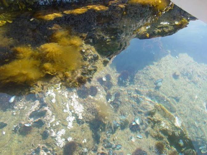
a threatening area for paddling. At the bottom I was delighted to see plenty of shallows
filled with seaweeds showing on the surface. I went down to the end where I found the feed
from what had to be the large lake showing on the Saga map as the source for Ammassat
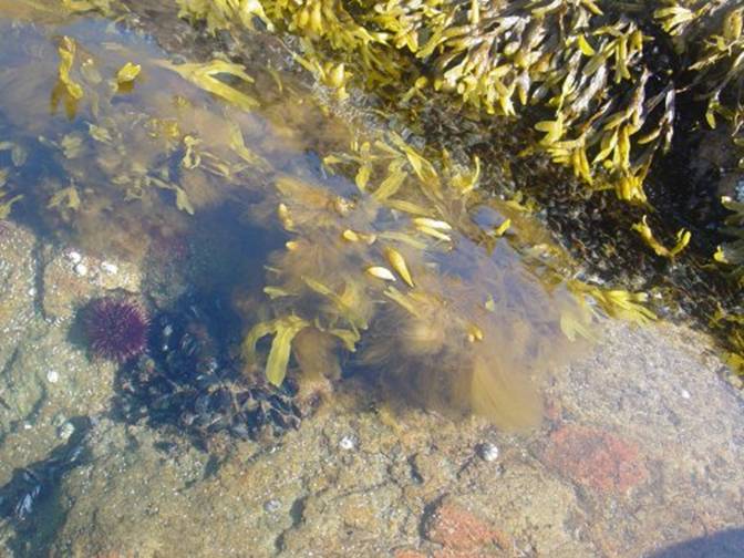
spawning. Among the dense seaweeds, profusion of mussels,
sea urchins I knew that this water had to be very rich and was the ideal type
of mixed salinity water very attractive to any biota that should need this
combination. |
|
08 |
|
The water emptying out of the lake must have been
rich in minerals and be quite warm because the lake is shallow, constantly
bathed in brilliant sunlight all summer.
This is a combination that really spurs growth of aquatic biota. They do not use the phrase “down in the warm
fjords for nothing in |
|
As I got down to the end heading due east I spied
a couple drying racks judiciously covered with plastic. Then I realized as I made my way up the
course through the rocks in the outlet from the lake that these were drying
racks for ammassat. By their number
and remains of tent sites this spot has to be where prolific numbers of these
fish come to spawn every June and July. Now it was too late in the season. All the dry fish had been retrieved and the
plastic covers of the racks had been dutifully tied down and weighed down
with rocks to keep them from blowing away |
|
And to my delight sure enough finally I found
another site where a half dozen Glaucous gulls have taken up residence along
the left shore complete with nests among the rock cliffs. They kept their eyes on me just in case I
might have something to share with them and also to let me know that I was
not welcome near their nests. Some of
their young were not quite ready to fledge yet. I enjoyed seeing the profusion of life on the
bottom, taking pictures and video shots but all too soon I found that I could
not buck the flushing freshwater in the quickly narrowing shallows |
|
09 |
|
Here at the lake outlet I saw a dominant
profusion of filamentous bluegreens and kelp blades varying in length from
three to six feet long. There was not
all that much fucus. I noticed colander kelp growing in open water and
inside low salinity areas. I was
surprised at how tolerant colander kelp / Agarum
cribosum is of variable salinity and, wave action. |
|
Although there is a huge population of green sea
urchins, they do not eat much of this kelp and they cannot eat the seaweed,
fucus, where it grows exposed to drying out at low tide. I noticed that when I happened to entangle
a sea urchin in fucus that sea urchins cannot untangle themselves
from fucus / bladder wrack seaweed. |
|
10 |
|
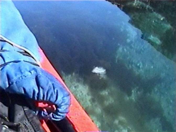
Gliding along in my kayak in the brilliant
sunlight the wind was barely blowing more than five knots. I enjoyed looking through the riffled,
crystal clear water at the bottom. |
|
11 |
|
After I had gotten away with paddling up the
inlet a about two hundred fifty feet I found myself facing the outgoing water
was limited to only one exit, a drop over between two rocks . I did not want to try this one. I did not want to risk negotiating paddling any
farther upstream even though I have whitewater paddling skills. I doubted I buck this amount of current and
the shallows. The tide was going out, conditions would only
become worse. |
|
Had I gotten there when the tide was just about
high I might have had a chance to get farther up the channel but then again I
might have gotten into a situation where I could not turn my kayak around. |
|
12 |
|
I had hoped that I could continue wending my way
nearer the lake but that was not to be.
I had to be content that after all these years I had finally found an
ammassat fishing site. I was thrilled. |
|
13 |
|
On my way out I paddled along the south side of
the inlet instead of the north side so that I could enjoy new sights. To my delight the water was only three feet
deep, not threatening to my kayak.
Still I did keep an eye out for erratic boulders that might be just
under the surface. This is one of those moments in paddling when I
say to myself thank God for polarized sunglasses because they block surface
glare so that I can see below the surface. Without polarized sunglasses I
could never see below the surface except in the shadow of my hull and by then
it is too late and I could look down at the seaweeds and anything else on the
bottom those denizens below, sea urchins, mussels, sea cucumbers, etc. That is one of my favorite paddling sports –
looking at who is down there in that crystal clear arctic water on a flat
day. This shoreline was lined with smaller typically
square shapes of basaltic rather than smoother gneissic rock on the other
side. After half a mile paddling westward as I
approached the twenty foot wide restriction where I noticed that large
amounts of fucus seaweed grew being attached to the rounded boulders six feet
below. Fucus is handy for those of us who paddle in
shallow waters because where it shows there are rocks lurking just below the
surface waiting for you to sort of find, so to speak, with either your kayak
or your paddle. Right! such a nice experience.
Kind of instantly wakes you up, all while on a flat calm paddle. We have this lovely paddling off Stony
Creek all over. I know, because I used
to risk paddling an inflatable kayak over our notorious granite bottom in the
calm during early evening hours when there were no riffles on the water to
indicate rocks just below. |
|
14 |
|
As I approached the restriction I saw several
twenty-foot diameter eddies in this area.
They were powerful enough to spin me around. I concluded that the effect this restriction has
on water circulation is to generate eddies along this south side. I think that the reason for the eddies on
the shallower side is just because the water has nowhere else to go other
than to be forced upward by these wide shallows putting a spin on the incoming
water making it swirl around in circles.
It is a bottleneck effect. The profusion of seaweed growth suggests that the
water is probably quite rich in nutrients to support this lush growth of seaweeds. In the dog sledding season this is something to
think about because eddy areas are not a good place for solid ice to form
which makes these eddy areas a dangerous place for dog sledding. |
|
The force of these twenty foot diameter eddies
near the shore was not enough to throw my bow around, but I was somewhat
concerned about it. Paddling past the restriction was fine and on the
south side the shore was shallow but stony with some plants growing. I saw that there were no tent rings or any
signs of sod houses. The soil in this
area has no sod, it is dry and stony. On the way out I briefly toured the other side of
the T. Even though it looked
interesting I decided that it was too small to be another ammassat site. The map showed only a small freshwater feed to
that area. All along this T on the south side there were
places where it was possible to camp but fresh water was only available at
each end and nowhere else. When I toured the south side of the island it was
amazing how inhospitable that area really was. There was hardly anything other than bare
rock drop offs and not a single source of fresh water flowing on the
surface. I was quite shocked. Thee was really no
place to camp on the south side. I paddled back to my campsite glad I had finally
after all these years actually found an ammassat site. |
|
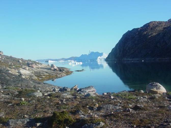
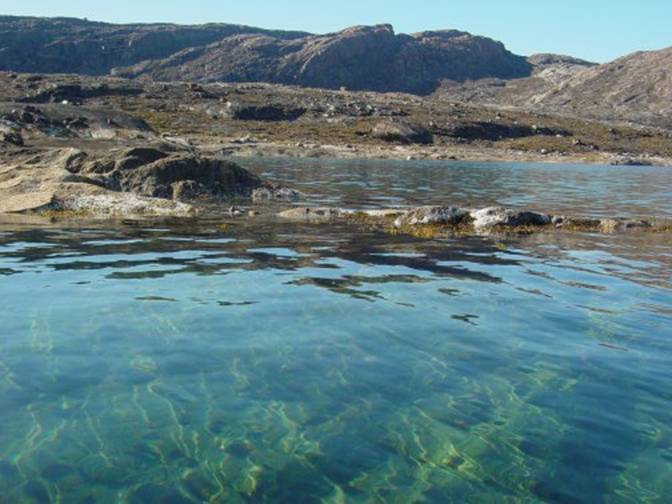
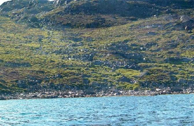
In 2009 I found another site viewed I the photo
below which does not look like much until you get out and walk on the
beach. Along the edge of the stream
were netting devices left there by the last fishermen when they were last
there in June. |
|
15 |
|
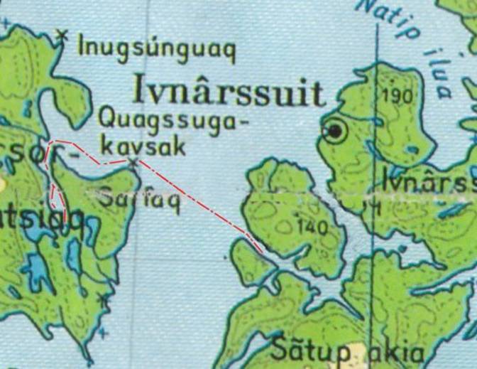
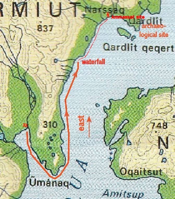
This photo is a scan of the map showing where
this site is located. |
|
|
|
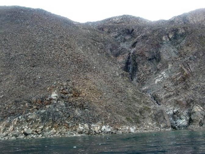
Before this site was this waterfall that is
marked on the map above. |
|
|
|
I find it is always best to explore by kayak when
looking for interesting places. |
|
18 |
|
Gail Ferris gaileferris@hotmail.com |