|
Clouds and Paddling Gail
Ferris |
|
There are clouds and there are clouds. The next question for me as a kayak paddler
is what are they doing? |
|
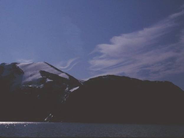
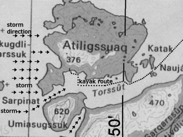
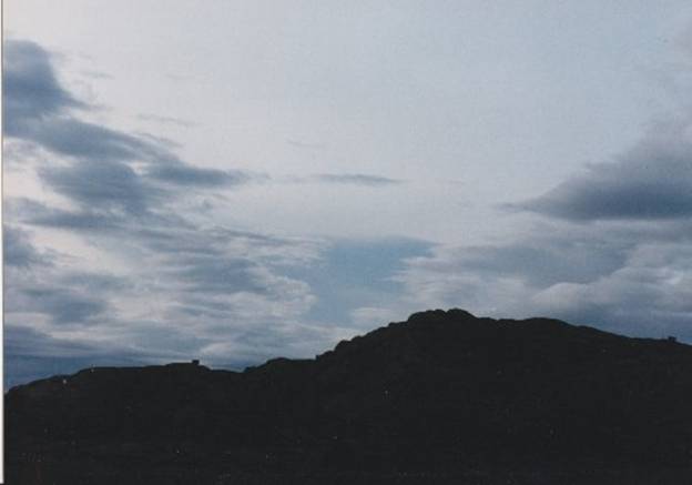
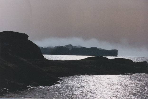
01 |
|
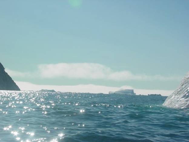
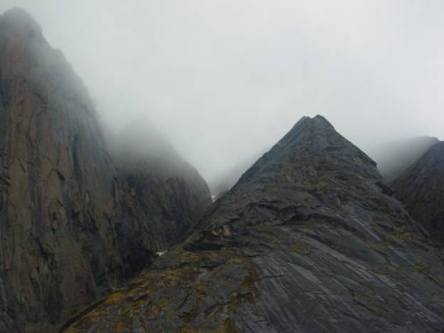
As you can see in the picture above some wind is
blowing the fog over the iceberg just to the right of center. I am viewing this from my kayak as I am
paddling out from the inlet. You can see by the size of the waves that the
wind is about ten knots. It is a
bright summer day but that the clouds which are low and blowing from somewhere
to my left which is actually south to my right on the north. This is not a storm coming in. |
|
Then again what about if I am in someone else’s
boat, a motor boat, what do I think about the clouds I can see. So there I was out with my friends on a Sunday
afternoon in their motorboat looking up at the clouds on top of the
rocks. I wondered to myself is this
going to turn into a dicey deal while we are out here spending the afternoon
fishing, gathering mussels and picnicking. |
|
02 |
|
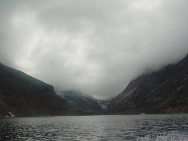
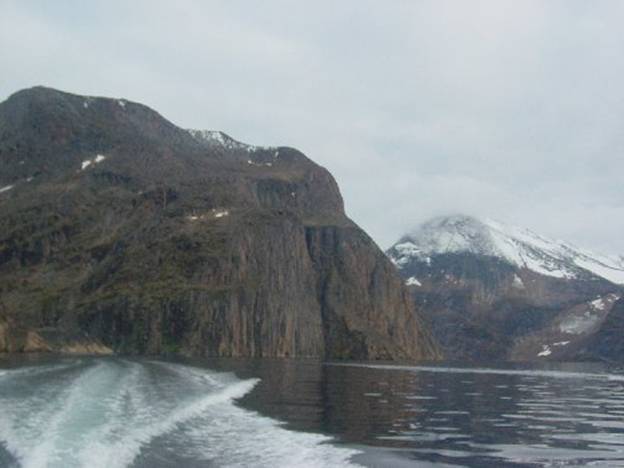
If I were out here in my own kayak what would I
be thinking? We were in the The dark brown stone walls were sheer rising 620
meters above the water. I was surprised I never knew this before in all
my years since 1992 of paddling in this area Upernavik the opening to Torssut
Passage behind |
|
03 |
|
So there I was gazing up at the clouds wondering
what is going to happen. The clouds
were not moving they were just resting. We stopped the motor and dropped over the side
our fishing lines with baited hooks. |
|
04 |
|
Drifting gently soon enough we caught some Ulk /
Sea Robins to roast and eat later. We
upped our lines and were on our way through the passage Torssut away from
this threatening mountain, In past years when I have paddled through this
passage in my kayak there were several times when I had experienced wind
storms coming suddenly on me from the west across Baffin Bay with no warning. |
|
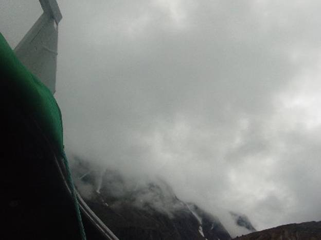
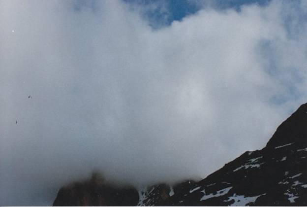
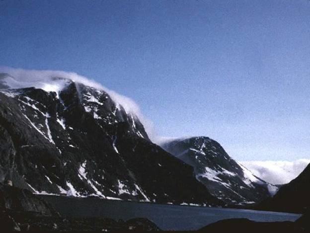
Below is a photo of Sanderson’s Hope with some
orographic clouds to the west. |
|
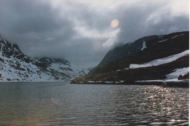
05 |
|
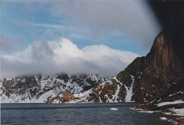
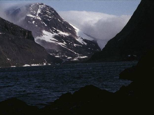
On our way back the conditions as forecast were
as you see in the photo below quite benign. To the right is Sanderson’s Hope
a pyramid shaped 3,800 foot high peak.
Note that there are no clouds on the top of this
mountain which are called a hat. Local people look at Sanderson’s because
clouds on top of this mountain indicated bad weather and that sort of
weather, usually very windy, can be really bad. |
|
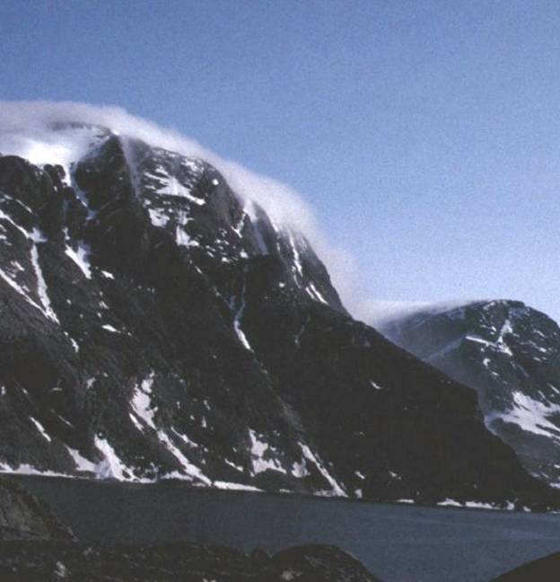
06 |
|
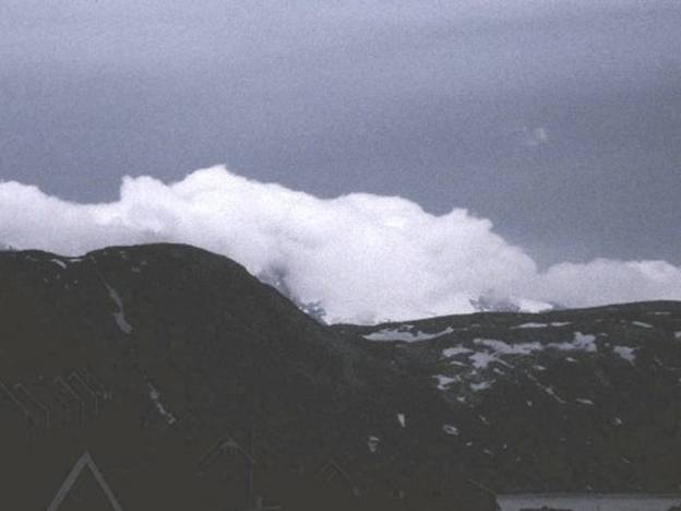
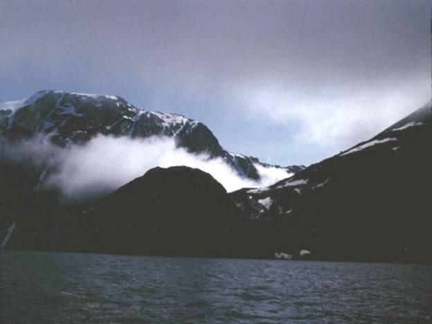
Below is a photo of a “hat” on Sanderson’s in
1995 which I took because the forecast said Upernavik was to be hit by a very
violent storm. Knowing that I happened to be staying at the home
of a friend in an area of Upernavik where I had a perfect view of Sanderson’s,
of the coastline and most of the skyline I recorded the cloud structures of
this incoming storm as they developed. I wanted to document what clouds from a violent
storm coming into Upernavik look like because as a kayak paddler I wanted to
know for sure what I might be looking at rather than find out later when I
was the victim. The storm lasted for three days with 30 to 40
knot winds my friend laughed at me as I so foolishly had assembled my kayak
and set it on the rocks. As the violent waves and wind set in some friends
carried my kayak up to safer ground.
The waves would have swept my kayak off the rocks or the wind would
have blown it off somewhere. As much as I wanted to just launch my kayak and
go I did not have enough time to get away before this storm struck. I was stormbound at a friend’s house for
three days. Looking at this photo you would never guess
Sanderson’s perfect pyramid peak is beneath this cloud cover. |
|
07 |
|
In 1992 in Upernavik when
I did not know what to look for when a storm is coming I started paddling
west in Torssut passage. The day was a
lovely summer day but I noticed that there seemed to be this strange sort of calm. The air seemed to feel stifling and It was
so calm that the water looked like it had been oiled. Just for curiosity I
paused paddling checked my wristwatch barometer to see if there was any
change. No there was absolutely no
change since I had set out from Aappilattoq a few hours earlier. Then as I was nearing
the end of the passage a few miles westward I saw some puffy clouds filing
down a valley hugging the ground blowing toward me. “Oh those puffy clouds are beautiful. I have never seen anything like this
before. Clouds here in the arctic are
so lovely and different than where I live in I had no idea what those
clouds in that defined array meant. Sitting there in my
kayak I felt safe as in there is nothing to worry about. I was still unaffected Wow was I naïve. I looked at my
barometer again because I had been told that a change in barometric pressure
indicates a storm is coming. I figured
that of course my barometer would tell me a storm is coming and that I should
just use my eyes to observe. And still there was no
barometric change. Moments later I was
hit by fierce gusts that nearly snatched the paddle from my hands. In alarm I knew now is
the time to tie my paddle to my bowline.
Immediately I grab the long bowline I always carry at the ready on my
deck just in front of my cockpit and tied my paddle to it. I knew just from practicality that resorting
to only fighting to hold onto my paddle was absurdly unwise. Losing my paddle would have rendered me absolutely
helpless. |
|
Luckily there was some
time between the wind blasts because the wind was sporadic not continuous
like a katabatic or gravity fed wind which is continuous. I was able in those
pauses to assess where I was and where I could land. I thought about reversing direction heading
for my old campsite. |
|
08 |
|
After first trying to
head back east and around the point I realized that the wind was so powerful
that it could pin me against those absolutely impossible to land anywhere on vertical
rock cliffs. I could feel the
violent wind just shoving me over broadside to the cliffs. I just knew how precariously unstable I
would be paddling down wind. I could feel it in my
body as I started paddling that the least risk would be for me to expend all
effort and head slightly broadside to the wind for the closest shore north
off to my right, where it was possible to land. This shore only a few hundred yards away. I hunkered down and
put all my strength into getting over there, my only safe refuge. Luckily there was a place to land and I
jumped out immediately dragging my kayak up on the waves. I opened the cockpit
sprayskirt pulled out as much cargo as possible to lighten the kayak. Then I was able to heist it between my legs
and drag it to a limited extent. At
all cost I wanted it out of harms way above the storm waves surges but of
great importance did not want to so as to not damage the frame or scratch the
hull up above what I estimated would be above the storm waves. I took my bow and
stern lines out and tied them off to big boulders, the bigger the better! When it is just you
and your kayak and you are all alone you realize that you must do everything
possible to not risk you kayak because you can’t get there from here without
your kayak. |
|
09 |
|
I happened to have
been very lucky because I could have been paddling just outside the opening
of Torssut passage where there would have been no landing site for miles. At that time I really
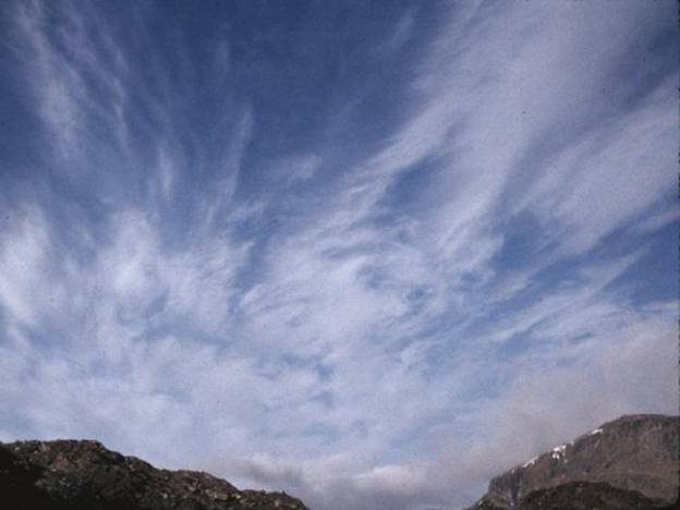
do not know if I had the skill to paddle in such winds. Later in The photo below is a close up of the clouds
blowing in. This was my first
experience with such a storm. The barometer did not register change until a hour after the storm had set in so I can tell you
without the slightest doubt that you have to watch the clouds not your
barometer when a storm of this type is coming in. This was one of those. The wind was blowing at something like 40 knots
and I estimate this speed because when I left my tent to get some water I had
trouble staying on my feet. I was very lucky to make land before it was
really impossible even paddling down wind to be in any control of my kayak. |
|
10 |
|
In the photo below is
what this storm looked like after I had set up my tent. You can see the wind
shadow on the water. |
|
11 |
|
My first shot at about 1 am below is a photograph
I took while peeking out from beneath my tent because did not dare open the
vertical zipper doorway my tent for fear my tent be torn to shreds by the
wind I couldn’t believe what the sky looked like
looking straight up. Below are the clouds
driven overhead by the wind. It sure
was windy! |
|
12 |
|
Note that the clouds are torn apart which is
probably the topographic effect on the cloud layer. Typically the temperature climbs for the first
four or six hours and then twelve hours later it drops to freezing. The climb in temperature is due to
compression of the air the same principle for katabatic winds coming down
mountains. |
|
13 |
|
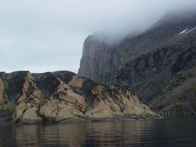
In 1995 another storm
in this same area just a mile or so east took place. This time I had carefully chosen to camp
where everyone else stopped to camp and picnic. Comparing notes and experiences I found out
why, from this experience. This little
spot which is on the eastern third of the north shore in Torssut passage
happens to be sheltered as is indicated by the thick deposit of rich dirt and
lush plant growth there. |
|
14 |
|
The whole day was a bright summer day and I just
kept an occasional eye on the ridge across the way because I had never seen
this ridge covered with a shallow cloud all day like this before. I thought it was curious. Then sure enough just
as I was looking at that ridge across the way to the south something started
happening to the cloud cover that had been clinging in the sense of slightly
draped over the ridge all day. I could
barely believe my eyes as I watched both ends of the cloud starting to twirl
in opposite directions. |
|
15 |
|
This was something I never imagined I might
witness. I was glad I was on land, not
in my kayak. I actually captured the development of this storm
on video and still camera because I happened to be standing just across the
way on the north side of Torssut with a good view to the south and west. |
Below is a photo of the western portion of
this cloud. Note that this cloud, just
to the center right, even though it is thin, is actually blowing down the
rocks. |
|
16 |
|
There I was watching as the end of the east end
started whirling and the same on the west end only they were whirling in
opposite directions – so much for the coriolis effect, I don’t think that
applies to this situation. |
|
Well it certainly was
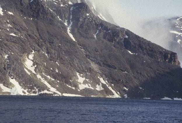
a down draft. In fact my friend, John Kislov as well as plenty of others have
warned me to stay away from that side, the south side, of Torssut because this
area is notorious for downdrafts that will even flip motor boats right over. As you can see below
the cliffs are just straight up and down rocks 400 meters high. The photo below is
taken in 2008. |
|
18 |
|
With rapt attention I
watched across the way roughly a mile across.
At first the water was plain navy blue but as I knew from previous
experience the downdraft would hit the water turning it silver. In the photo below I
also noticed that there was a build up of clouds behind where I could see in
the passage, Umiasugssup ilua, separating You can see that the
water is starting to show whitecaps and cats paws |
|
19 |
|
Then I began to notice
that low broken stratocumulus clouds were blowing up the passage from the
outside having come around the seaward side of Sanderson's Hope the highest
mountain at 1042 meters in this area.
The front could not quite get past the outer mountain, Sanderson's
Hope mountain on Qaersorssuaq island but it must have been hitting Upernavik.
|
|
20 |
|
Gradually something changed because nothing
especially the weather can be taken for granted here except change. The moving clouds the falling air off the
780 meter peak changed it's direction from west to
north and this began to do what katabatic winds do it hit the water at the
base of the mountain making whitecaps.
I grabbed my cameras
because this was just the same type of event I had experienced in 1992. I recorded the evolution of the wind first
hitting the water near the mountain then gradually the wind progressed across
the one mile fetch of Torssut hitting this area in an hour. |
|
My barometric readings of this storm I observed
in 1995 which confirms the behavior of a barometer. I estimate that there was about an hour lag
behind in the barometric measurements and the arrival of a fast moving
storm. I learned from this experience that the barometer
does not foretell the arrival of this type of windstorm so I keep an eye on
the clouds. I noted that the barometer had been hovering all
day at 1008 inches Hg. My initial
reading at The time I think the
barometer reflects the windstorm situation more closely because when the
barometer has been holding for several hours during a storm. Now when the barometer first starts to
rise, the wind will increase. This
again is the lag effect and probably the section of atmosphere low pressure
area overhead has a steep or compressed gradient. It is a relief to know
that when the barometer starts to rise again for the second time the wind
from the storm will start to slack off because the storm or low pressure
system leaving. High pressure is
replacing the low pressure system. |
|
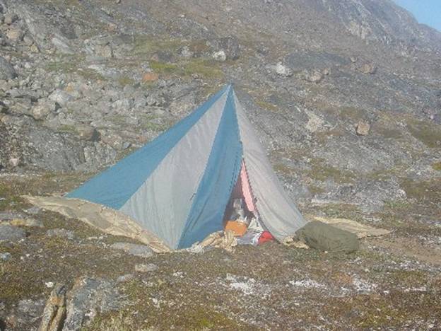
I took storm precautions by moving my kayak up
higher up the slope and tying it off to larger boulders. The photograph below of my tent was taken in 2008
even though it was not tied down for a storm you can what my tent is
like. You can see it is a pyramid,
floorless with a tie loop on the top and along the bottom only. I can reduce surface area exposure to the
wind by simply lowering the center pole.
No other tent offers this option.
Even though the tent is urethane coated nylon which collects condensate
I solved the condensation problem by making and suspending from the ceiling a
1.8mm ripstop nylon liner. My exhaled
vapor passes through the liner condensing as liquid the tent’s inner surface
or freezes to the outer surface of the liner. In Barrow To keep the tent warmer I had to add those snow
flaps which I ballast down with rocks or whatever is available to keep the
wind out. Baffin
Island Inuit say that the nice thing about a floorless tent is that “when a
polar bear comes in, it is nice to go out” any way you can. Luckily in |
|
21 |
|
To anchor my tent for heavy wind I devised a
structure of rocks to tie the tent down to the ground as low as possible. I did this by tying a guy line from the
loop at the peak in the direction of the oncoming wind. To secure the guy-line from the peak I tied the
line around a small rock on the ground weighted down as low as possible by placing
a large boulder on the guy-line in front of the small rock so that the heavy
rock functioned both as a weight and as guide to keep the guy-line as low to
the ground as possible I also tied off all the bottom points with extra
lines from the corners and midsections of the bottom of the tent using this
same big rock in front of small rock. The sides were also staked into the ground with
large rocks on top of the stake lines.
I was careful to arrange the rocks on the surface of the tent
fabric. I added extra tent stakes use
more large rocks. Then I decided to try
to reduce some of the slatting problem wind creates with this tent so this
time since I happened to have put in a second rescue rope 50 ft of 1/2 inch
line for difficult mooring situations I decided to guy the tent off. What a difference so far, the tent is not
slatting as much as it usually does when the wind comes up. The ropes go from a rock southwest to the
peak tie loop to a rock west, which is where all the wind will most likely be
coming from. So that is what I do
when I see nasty clouds upstairs. |
|
22 |
|
Gail Ferris gaileferris@hotmail.com 2 15 2009 |