|
Views from the Cockpit – Rocks Gail Ferris |
|
As kayak paddler my moment
came when I realized that it would be possible to explore areas of the John Dowd said at a kayak
symposium you can paddle your kayak provided you have a folding kayak
anywhere you can fly to. That cinched
it I would own a folding kayak the specific kind of a boat that is designed
for paddling in windy frigid open water of the For me, my kayak paddling
was to explore. To see what the I was always very curious
about what the I always wanted to see where
those fascinating rocks might have come from and what else was up there for
me to look at and wonder about. How
about the plants, what did they look like?
I like rocks and plants. |
|
I paddled in |
|
I had the opportunity to go
to Pond Inlet which is one of the northernmost communities on With all my years of
paddling in Stony Creek among our granitic islands I knew I liked rock
coastline to study and think about where I could from my cockpit enjoy the
shapes and colors of the rocks. |
|
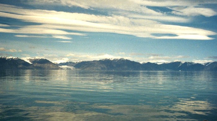
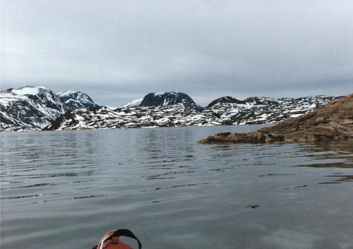
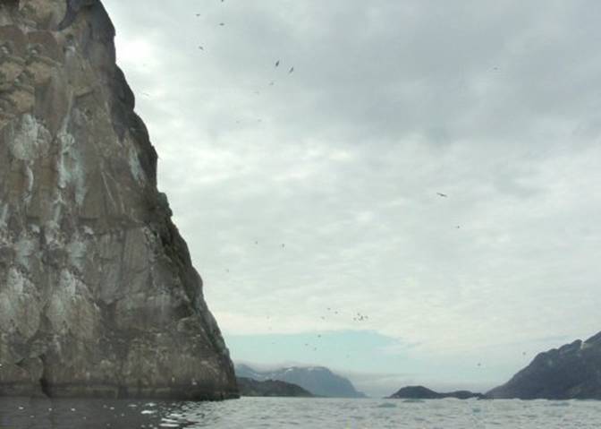
Flying up to Pond Inlet on
the east coast of When I got to Pond Inlet my
first view was of In awe I looked at that
coast line many times while I was there as you can see in the picture below, but
I did not venture across because that coast just looked too difficult for
someone of my skill to paddle along. It looked as though there
were few landing sites and I had heard that there were plenty of polar bears
to share the beach with as well. That
is not for me! I thought to myself “Nothing
like being stuck between the water and the sheer rock cliffs in the company
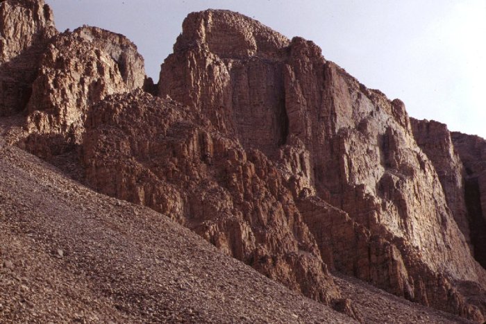
of a polar bear”. From Pond Inlet I watched
many interesting assortments of clouds come and go. Storms would occur over there on And this was happening all
the time from day to day over those pyramidal shaped mountains in the
picture. |
|
01 |
|
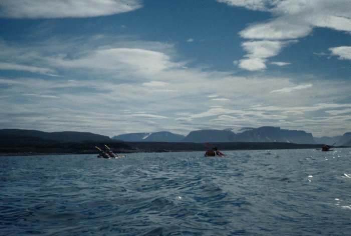
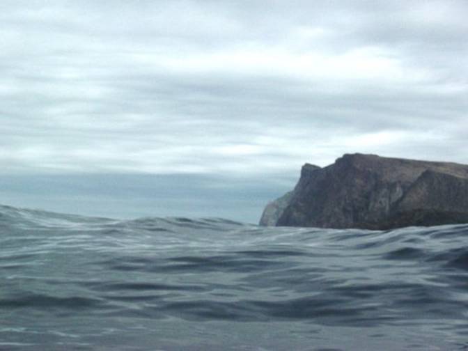
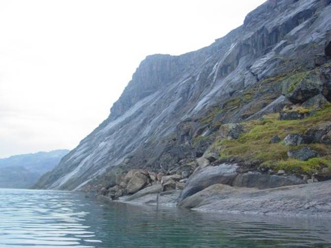
I joined a group of paddlers
from Before we left we found out
where there were campsites along our route within shorter distances and hopefully
the likely hood of fewer polar bears. In the picture below you can
see the cliffs in the background at the opening of In that area campsite area we
found remains of many sod dwellings from different periods of occupation and
a fish weir made with rocks. I knew
that this area had to have always very heavily used. |
|
02 |
|
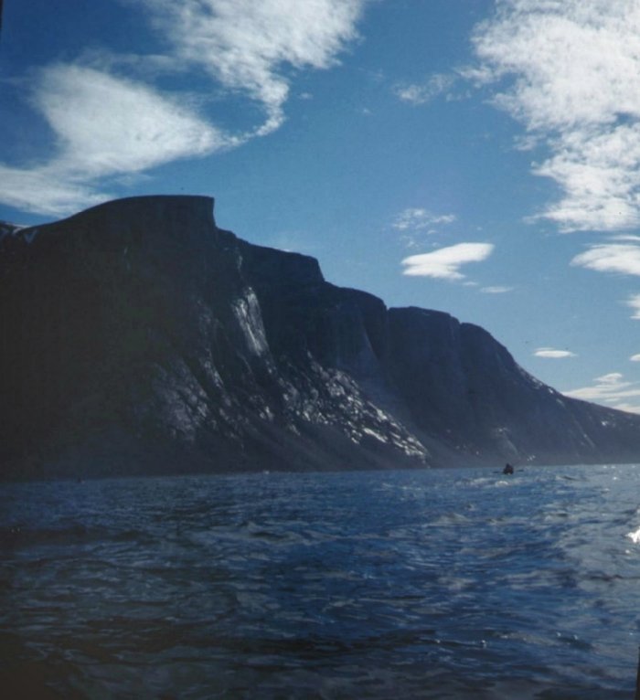
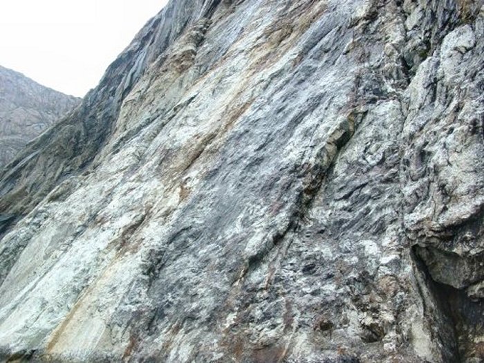
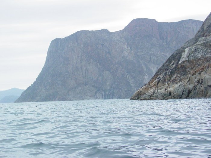
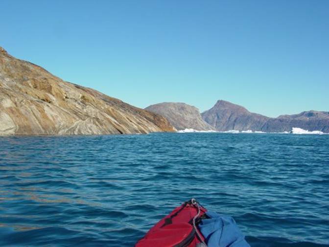
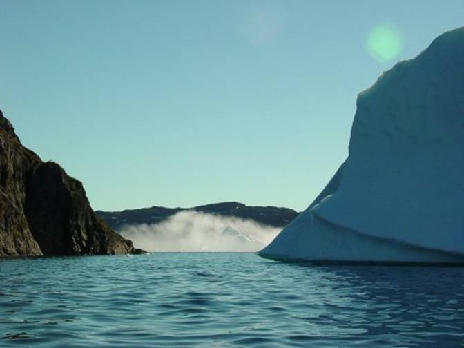
As we were crossing the
entrance to Oliver Sound, this our first crossing, the waves became
increasingly steep and chaotic but they were only three and four feet which
is not all that threatening for a loaded folding kayak like a Klepper. We kept going because we already
had been told that this spot is noted for being threatening. We knew that we were making a relatively
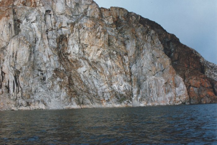
calm crossing. From my cockpit looking
south down Oliver Sound a couple miles down the east side of Qorbignaluk
Headland where we were not going, I saw a large rock slide cut loose from the
top of 3000 foot cliffs. The dust from
that rockslide hung in the air for a long time, about 20 minutes. Whew! I thought to myself
how lucky we were that we had not happened to be paddling in that area
because I wonder if we would have been able to get out of the range of those
falling rocks tumbling and bouncing down into the water immediately below. We could have been on the receiving end –
how terrible something I had not quite thought of before. I was glad that we had
decided to cross above nearer to Below is a picture of those migmatite
cliffs of Qorbignaluk Headland on the west side of |
|
03 |
|
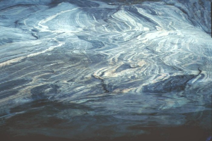
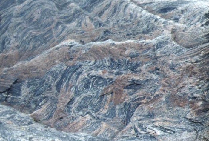
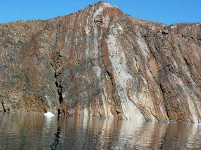
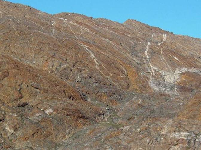
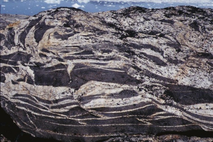
Farther on after we camped I
came across the most lovely colors and striation from the metamorphosed sedimentary
and volcanic strata in the rocks right at the edge of the shore. I could not believe the green pink and
white stripes all smoothed off by glaciation. Views from my kayak cockpit
like this make paddling wonderful. |
|
04 |
|
05 |
|
In |
|
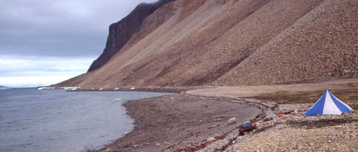
In this picture below I can
tell you that I had become sort of trapped by the ice that had followed me
down Adams Sound so my choices for the tent site were suddenly quite limited
to only one! I rather looked around, so
to speak, thinking about where it might be possible to set up my tent and not
be on the receiving end of rocks cutting loose and tumbling down on me. There were lots of rocks on
the bottom as a huge scree pile, but their sizes graded down to less
threatening closer to the beach. Then the question of “where
will the high tide come?” loomed in my mind.
Nothing like having my kayak
floating off to never - never land.
Next awakening to finding that the contents of my tent awash at some
very inopportune time at night! |
|
06 |
|
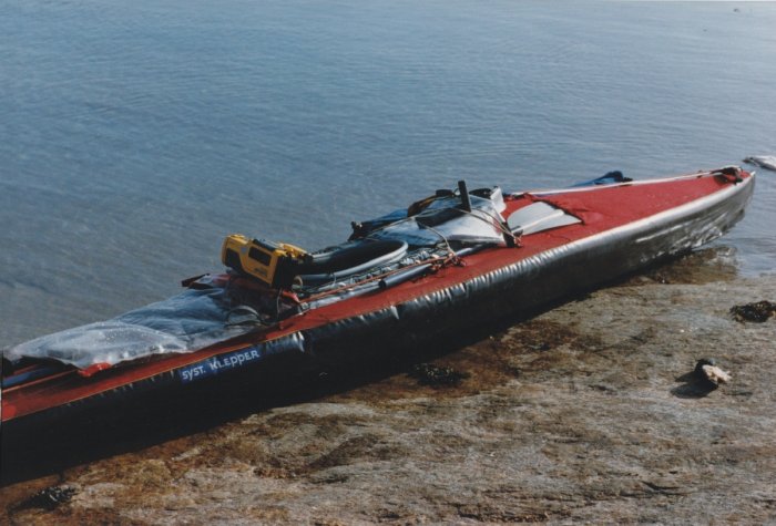
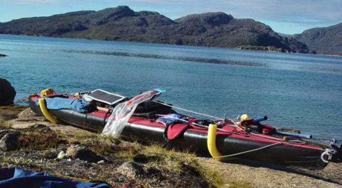
Well sure enough I noticed
that right in front of me was a nice, well defined, tent ring. Since I am somewhat superstitious in
circumstances such as this, here I am all alone. Wow was I lucky. You can see in the picture
below that my kayak was just at the tide line, of
course I did have it tied off. And the next day I went
exploring and found some very interesting rocks and even some ferns growing
hidden among the rock scree. |
|
07 |
|
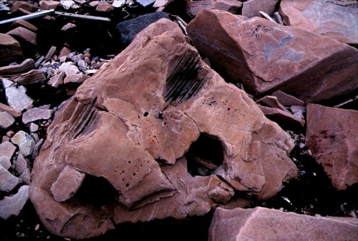
Below are pictures from this
immediate area showing these rocks. The first picture is quite
exotic in the sense that I have never seen such a type of metamorphosed
quartzite. It had to originally be of
sedimentary origin, fine pink sand with the major mineral component being
quartz. The fine quartzitic sand is
nicely changed into a homogenous material but within it are
less metamorphosed spherical chambers filled with layered quartzitic sand and
areas of small gas bubbles. The rock
was a stunning pink. Even though I did not
actually see these rocks from my cockpit I thought I would show them to you. |
|
08 |
|
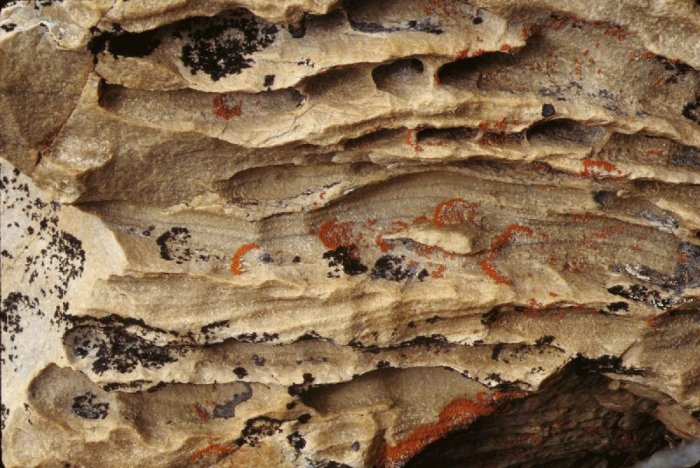
The sandstone quartzite
below must have been an Aeolian or wind deposit that was metamorphosed mainly
by pressure in this instance. The rock
is colonized by some brilliantly colored lichens in jet black and brilliant
orange. |
|
09 |
|
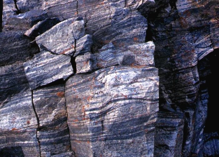
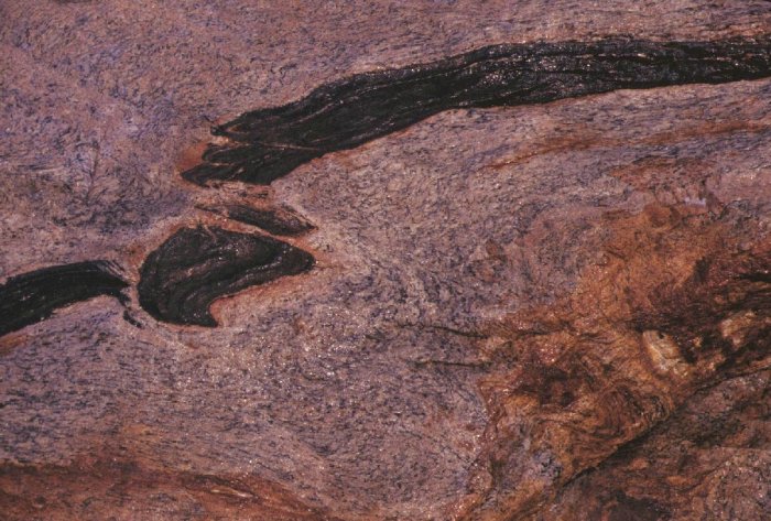
A few miles down Adams Sound
I came across this metamorphosed igneous intrusion complete with mica, pink
and white feldspar, all in the granite family. Finding this metamorphosed
stratified granitic rock made me feel completely at home since where I live
is a granite coast line. For a moment
all was well with the world, I thought I was at home only this rock was even
more varied in color and striations than what I find in Stony Creek. |
|
10 |
|
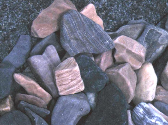
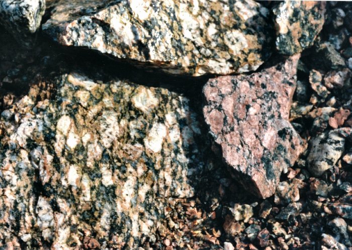
Below is a representative
sample of rocks I found just around the corner. The colors were exciting and of minerals
that were not only sedimentary, metamorphic but also igneous as well. |
|
11 |
|
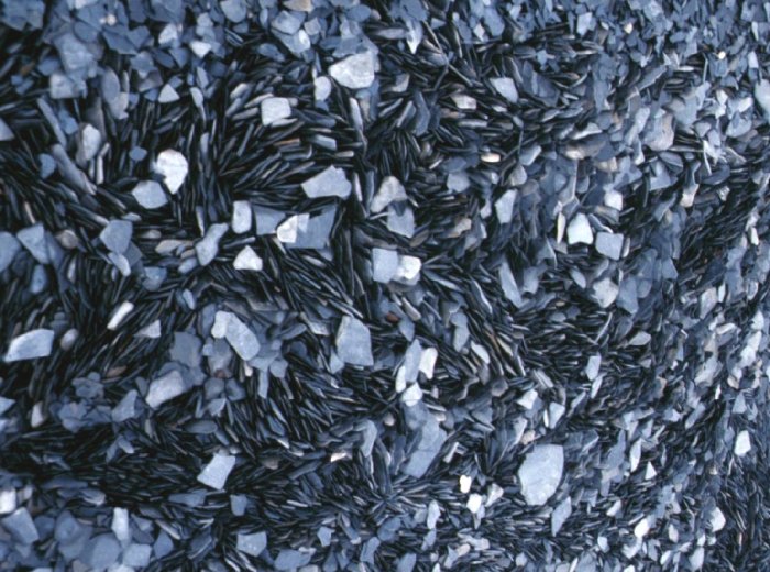
In this picture I was just
totally shocked to come across a beach, a very small beach, covered with slate
that was broken into similarly shaped sizes that consistent wave action had
arranged into this swirl pattern. At first I thought I was
imagining things but then I realized it could be possible because the source,
which I noticed was just above my head, was homogeneous. |
|
12 |
|
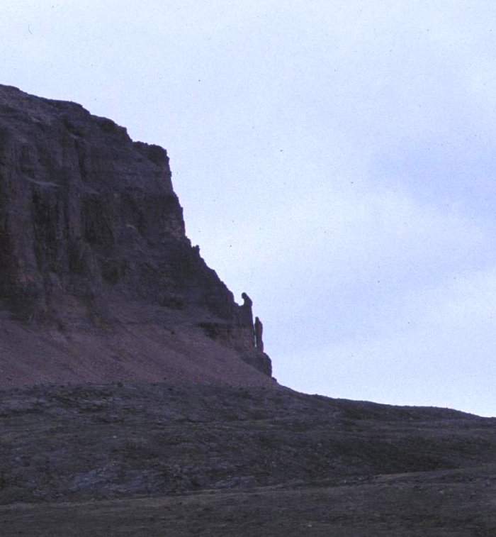
On my way back out of Adams
Sound I happened to be in the right moment when I saw this rather spooky
image. It was composed of quartzite
rock strata that had survived the weathering and wind. These statuesque figures
looked like Saint Francis and a monk in waiting. I think it is one on most
extreme examples of rocks and minerals I have ever seen. The sight of these human
looking spires made me feel as though Adams Sound was a haunted place. All I can say is that you
just never know what you might see from your cockpit especially in the |
|
13 |
|
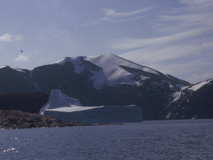
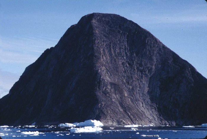
I have made several trips to
the Upernavik area of Local people have told me,
justifiably so, that the weather is judged by if it has a hat on it the
weather will be bad. In 2008 when I was about twenty
miles to the north it so happened on a refractory day that I was able to see
this mountain. It was a spectacular
sight from such a distance because there is nothing else that resembles this
nearly perfect pyramidal shape. |
|
14 |
|
I found that it is a good
idea to find out what type of topography and rock is in the area so that I
can look forward to seeing rocks from my cockpit that I enjoy just from the
colors and shapes they have. I avoid sedimentary rock
areas which is why I specifically choose to paddle in the Upernavik Greenland
area. I flew into town in 1992 by
helicopter and visited with the museum director to find out what to be aware
of. |
|
Along the base of
Sanderson’s Hope I found these colorful metamorphosed minerals. The colors and mixing is hard to believe,
yet just a few feet away is some very boring plain brown rock which you can
see on the island to the right. |
|
15 |
|
16 |
|
Below is a photo of a major
landmark visible for miles around, This picture is taken from
Aseritoq which is a village site on In the foreground to the
right is some of the typical limonite infused
yellow-brown colored granite of this area. |
|
17 |
|
I just happened to have
pulled my kayak up on this shallow stone ramp as others had done with their
boats and dog sledges. These ramps are
very common in this area, which I often found when boating in this area the
shallow ramps of igneous gneiss or granite made landing really very
convenient for campsites. |
|
18 |
|
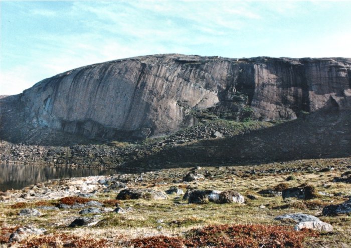
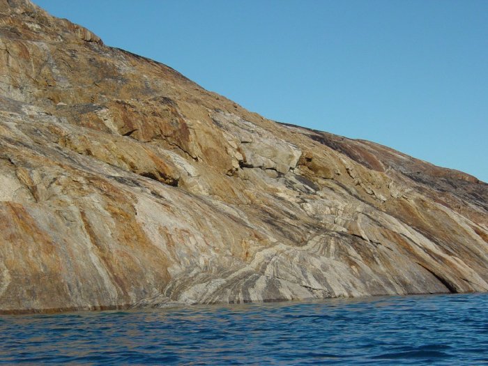
I visited a bay which was
noted for having many wild flowers what was very dramatic was the peninsula
flanking the bay on its north side.
Below is a picture of the rock and on the opposite side of that
peninsula the rock is just a mass of broken chunks. This side visible in the
picture is both a product of geological formation being a dome and glaciation
having been smoothed by the glacier. This bay and valley was
filled with glacial erratic rocks which I guess had been deposited by melt
deposition because they are positioned so precariously that they teetered
when I stepped on them. |
|
19 |
|
I went on a toot behind The crystals were brilliant
orange, pink and red pink mixed with black mica and white quartz. The size of the crystals was half an inch. I was so glad that I just
happened to be out scouting places where people might have lived when I came
across this stone. |
|
20 |
|
I paddled down to
Laksefjorden/ Eqalugarssuit. On my way
down I crossed the famous passage, where many birds nest, called Sortehul/Akornat
but across from that I went down Torssuktak passage which is flanked by
numerous waterfalls on |
|
From there I continued past
some razor bill/awk nesting cliffs and squeaked through a tiny passage that
was now quite defined on the map where people had once lived. |
|
21 |
|
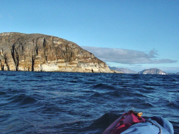
Across Amgmarqeaua passage was the entrance to Laksefjord which is flanked on both
sides by vertical cliffs of grey gneissic rock and no place to land. As a kayak paddler I was quite anxious
about where might I find an emergency landing place. Below is a photo of just the
moment when I am down in an oncoming wave as I am nearing Laksefjorden
entrance. You can see the brown color
of the mafic rock. I took the two pictures below in 2003. |
|
22 |
|
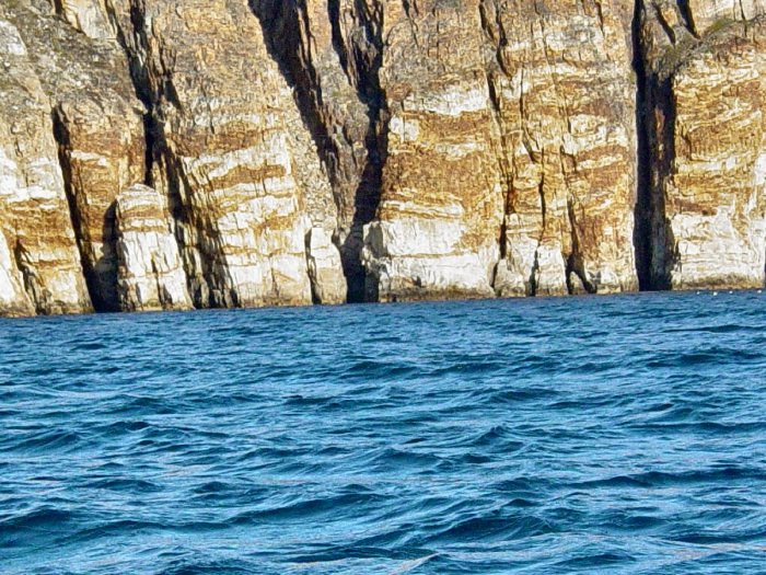
I paddle closer to the rocks
and take this next photo of this interesting mineral deposit in what looks
like basaltic stone. |
|
23 |
|
Now I am approaching
Laksefjorden entrance from the west and just before I turn the corner at the
entrance of Laksefjorden I notice that there starts to be a change from
basaltic to gneissic rock. Here
because the rocks now have some small shelves, which I find
hosts a nesting area for about six Black Guillemots. |
|
24 |
|
I have been paddling for a
number of miles without any place to land even in an emergency. Just a half a
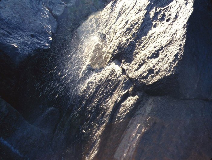
mile around this corner to the right there is a tiny emergency landing area. Rounding the corner of
Laksefjord, I happened to find this waterfall splashing down over the gray
rock from the heights. This was my most delightful
moment for photographing a waterfall from my cockpit because I happened to be
there when the sun was shining through the water. Below is this picture I took
in 1993 of that waterfall from my kayak cockpit and a more detailed 2003
photo of the minerals. This was one of those “who would believe” moments in a
kayak. |
|
25 |
|
The rock is changing to
granite which offers more places to land which you can spot on the lower
right in the photo. Note that there
are dense tussocks of plants indicating rich soil and possibly some former
habitation. |
|
26 |
|
North of Laksefjorden just
inside Torssut passage is a brightly colored cliff which might be white
feldspar with an area of iron sulfate that makes for a colorful
combination. Some auks were nesting on
these cliffs in 1992. |
|
27 |
|
In 2005 on an August day I
happened to be paddling north along Upernavik icefjord where I found on the
southwest tip of Sisuarigsut island something quite exciting to paddle by. What a fun photo this was to
take from the cockpit of my kayak edged in close to this rock in the
brilliant summer sun capturing the strata in detail. It is another one of those
“who would believe” moments from my cockpit. This rock was encrusted with
yellow limonite but where the crust had worn away beneath was exposed black
hornblende, white feldspar, dark brown iron and other metamorphosed mineral
strata. All around this area the
dominant rock is gneiss which is metamorphosed deposits of sand. was just plain boring yellow In fact there
were whole islands of this, one notable island Qaneq Island where that was
all there was to see on it was gneiss of brilliant yellow limonite fine
grained sand metamorphosed into rock. Qaneq
looked very boring because it was plain yellow with no variation in color or
strata looking like someone had poured bread dough out into a horse shoe
shape. Then Qaneq had also been
further rounded off by the glacier. It was boring to paddle past because
there were miles of this featureless rock however on its southeast tip there
was a perfect ramp to drag my kayak up.
This was almost identical to I saw no evidence of any
water on Qaneq and Aipee so I kept on paddling until I reached Sisuarigsut
where I knew water was available because camping without water is not a good
choice. |
|
North on the way to the
Innarsuit area I spotted this mineralogy on the edge of Upernavik
icefjord. It was spectacular. |
|
28 |
|
Just at the southern end of
Innarsuit island I came across this spectacular mineralization banding very
unique which can be seen for miles around.
Anyone who is lost in the area and sees this knows that they are
coming to Innarsuit and all they have to do is follow the coast to come to
Innarsuit just north on the west side. |
|
|
|
29 |
|
Innarsuit can be recognized
from miles away by colored strata of these cliffs. |
|
30 |
|
31 |
|
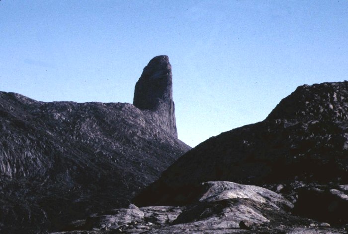
Kullorsuaq is an interesting
area where I found some combinations of minerals metamorphosed together that
were visually exciting. Kullorsuaq is
best known for its unique landmark, the devil’s thumb. Below is a photo that I took
while on a walk at Kullorsuaq looking at the west side of the devil’s thumb. |
|
32 |
|
Hornblende gneiss
beautifully metamorphosed commonly seen in Kullorsuaq. |
|
33 |
|
Iron mineralization in
gneiss a view from my kayak just after a rain, the rock is still wet. |
|
34 |
|
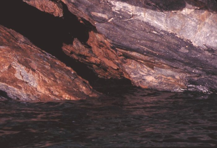
View within a small cave
just on the southeast side of Kullorsuaq from my kayak of mineralized strata
in gneiss, very colorful and dramatic. |
|
35 |
|
A landmark south of
Kullorsuaq called Uummanaq meaning heart-shaped photo taken from local ferry. One of those hard to believe
geological formations found in the Kullorsuaq Nussuaq area. |
|
36 |
|
In 2005 one of my most
exciting moments in my kayak is captured in this photo. It was taken between a small island which
had sheer drop offs on the back side in this picture and an iceberg but what
made it really exciting was the fog rolling in from the outside. |
|
37 |
|
I thought this was pretty
wild and I spent the next couple days watching the fog coming and going but
never actually covering this island. I
found places where people until fairly recently had lived. On the south side was a wonderful beach,
perfect for landing boats and bringing dogsleds up on. |
|
38 |
|
So that is my selection of
interesting rocks I have seen from my kayak cockpit. As an artist my spontaneous
watercolors are related to these images.
I have been fascinated with images of this type since childhood. The Kayak serves me as a way to access these
views. In the physical interaction
of my body with my kayak and with water there is this same connection, only
instead of the connection being visual it is physical. With the motion of the kayak when I paddle
as I interact with the water as though it is the artistic expression of
ballet on the water with myself as I paddle and how my kayak interacts with
the water beneath my hull. Gail Ferris gaileferris@hotmail.com 1/1/09 www.nkhorizons.com |