|
GPS Learning Experience Gail
Ferris |
|
This is
another one of those true confession stories and yes it really did happen to
me while I was out there in my kayak paddling on a perfectly clear day mind
you. You know
you would think life could not be this complicated, especially on a clear
day, but it happened to me. So there
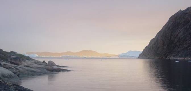
I was in the picture below off an island that was only a mile or so away from
this site where the picture is taken from. |
|
GPS
01 |
|
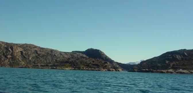
This picture is taken in the evening the sun was to
the north as you can see on the large iceberg on the far left side of the
picture. The island, Qaersorssuatsiaq,
is less than two miles away in the center. At the time I was paddling the
large iceberg to the far left had moved elsewhere on the current. From this view it does not look like it would be
hard to return to where I am standing does it? Ah that is where all the trouble
starts. I thought that it would be
very easy to see this place from where I was setting out because my route was
a straight line back from Qaersorssuatsiaq. I paddled across only occasionally looking back at
Innarsuit and the large bays on my right side behind me. These landmarks stayed in view not changing in the
slightest but I did not think about what might be happening to the view of
the opening I had started out from on my left behind me. Turning around in a kayak to view something directly
behind me is a ordeal for me because I find that I do
not have that much torso flexibility and I hate turning my entire kayak
around. I would rather just take my
chances and keep facing forward. Little did I realize how much that view behind me
was actually changing. I thought to myself “well this will be a practice
session with my GPS just to check on myself.
The session will be sort of like instrument flying in an airplane
where the pilot trusts that his instruments are telling him where he is
without using visual landmark references.” I had
taught myself to take waypoints and keep track of which point was which on
the GPS and then I taught myself, or so I thought, how
to use the “Go To” function. |
|
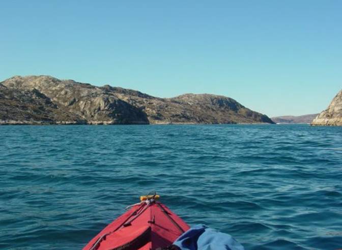
This is a close up photo of the passage I thought I
was supposed to be heading for. You
can see it is a large wide passage. I
became lost is this passage in the fog a few days earlier when I did not use
my GPS at all. |
|
GPS 02 the
crossing Qaersorssuasiaq |
|
Then I
began thinking about my perspective point because where I was starting out
from was really farther north than where I arrived when I crossed over to the
At least
I had the correct go to point but within the route my kayak was not pointing
exactly in the direction if the route. First I
thought that this can be – not me – never.
|
|
GPS
03 |
|
Then I
thought that maybe the arrow pointer was a little off because my GPS was not
oriented exactly with the center line of my kayak. So I carefully repositioned my GPS as
closely to the center line as could be.
And still the kayak orientation direction arrow was off as I paddled
along keeping my goal precisely in alignment. And worse yet doing everything
as precisely as possible so that all was lined up just right something was
wrong. Something
was definitely wrong because my orientation arrow was off and my distance was
increasing even though I was getting closer visually that what was really
happening was that I was heading for the wrong opening of this U shaped
passage. |
|
GPS
04 |
|
I thought
to myself “Oh, oh, now it is time to look really hard, time to get the
glasses out – this is getting bad. I
do not want to be paddling all sorts of extra miles because I am actually
heading for the wrong entrance and will have to back paddle to the actual
entrance. Oh! this
is dumb or the moon is made of green cheese. Ah there
is the arrow let me change the direction of my kayak so that the arrow lines
up with the go to path because the arrow is correctly reading the position of
my kayak. |
|
I will
look at the go to map that shows the midway waypoint because if I am not near
that and I should be right on it than it must mean that I am headed for the
most obviously visible entrance which is not at all the entrance I want to go
to. Oh now I
get it I am definitely heading the wrong way so if I change the orientation
of my kayak to follow the line exactly I will get to the entrance that I want
to go to. Whew little things like that
can really put me places I do not want to go.” Finally I
figured out that arrow is showing the orientation of my boat with the go to
line and goal. That is why there is an
arrow on the GPS rather than some amorphous dot. When I
realized the meaning of the arrow rather than the dot I told myself “follow
the arrow, dummy, yes point your kayak toward the “go to” point shown on the
screen otherwise all you are doing is crabbing the course. Crabbing will just add umpteen miles to the
course and you will never get to your goal shown on the screen which is where
you want to go. Wouldn’t it be nice if
they showed a map on the screen. All they show is course lines. Paddling through rocks is not too realistic
in a kayak. Somehow that just does not
work even though the GPS shows that is the course to follow to get to your
destination in the proverbial simplest course of just one point to another
point as a straight line. Some of
us like me are a little bit slow learning and figuring out things. Oh well! I had assumed that the opening I could see was also
the “go to “point to the south and my right where the entrance was for my
campsite. I added an extra half mile
before I realized my error paddling in the direction of the visible opening
to the left as I was completely convinced that I was heading the right way
for the northern larger entrance. From where I was starting to cross the opening of
the entrance really was not visible.
The opening was just narrow enough from where I was on the water that it
blended in perfectly with the rock cliff faces. I always paddle with my binoculars around my neck
readily available. This time even when I looked through my binoculars this
passage blended in so perfectly with the surrounding rock it looked as though
it was not there. Wow I did not expect this to happen. When I set out from the passage it seemed so easy as
if it would be so easy to spot that same opening when I headed back across. I had no idea that it would be impossible
not to see that entrance. - Big surprise. |
|
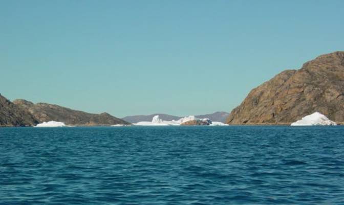
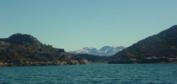
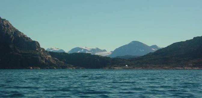
Just to
illustrate how the view changes I have selected three consecutive photos of
the same view from different changing perspective angle and distance. You can see how drastically the view
changes as you look at the mountains on the peninsula farthest back. I barely
missed a stroke when I took these photos because I used only the automatic
settings for focus light and speed as I clicked these digital photos from my
cockpit. |
|
GPS
05 |
|
GPS
06 |
|
GPS
07 |
|
GPS
08 |
|
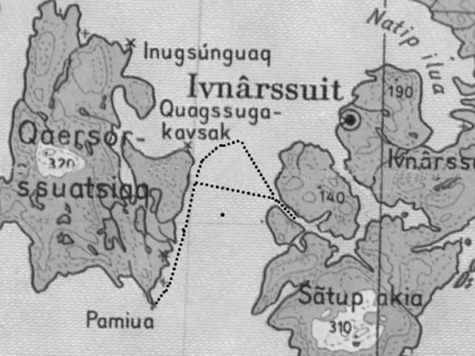
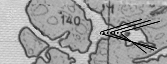
Returning
to my story about GPS navigation. The
map image above shows the change in perspective starting left and going
right. On my way
back across from Qaersorssuatsiaq there was an iceberg that really looked
unstable because it had a big arch in it that was dropping slabs of ice into
the water. Just before it would release
a slab I would hear this ominous click.
That click sound was emitted as the ice slab fractured as it was to
separating to split off the main body of the iceberg. Then some seconds later when the piece
split off it sounded like a small cannon going off every time it dropped a
slab. I decided that if that berg were to disintegrate catastrophically I
would be on the receiving end of a bunch of chunks of ice shooting instantly
across the water followed by fast moving steep waves. Farther
to the south of that berg with the arch was another berg that had a section
of dirty ice in it at the far end of it.
Suddenly dropped off a huge area of it suddenly splattering and
shooting out from the berg across the water much farther than I
expected. I was just shocked at the
sheer distance and distance that ice exploded out to from that berg. I could have easily been within its range
had been paddling in that area because it did not look all that dangerous. |
|
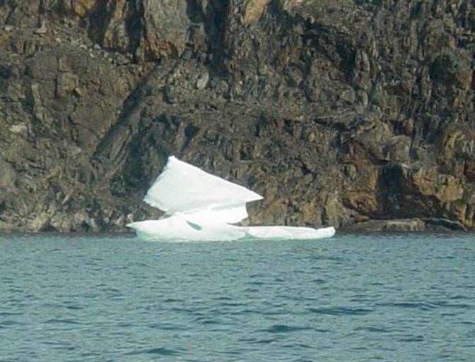
Near the
entrance where I had started out from I came across this particularly
sculptural iceberg. It was so elegant
I could not resist taking a photo of it. The stone
background is very typical of the yellow brown gneissic cliffs in this general
area but jus to the right of the iceberg is a tiny stone apron. I paddle in this region because there are
these stone aprons. For a campsite I
always look for a stone apron with some flat ground above. I use the apron as
a surface to roll my kayak above the high tide line using foam rollers rather
than having to lift the kayak up over jagged rocks. |
|
GPS
09 |
|
Written |