|
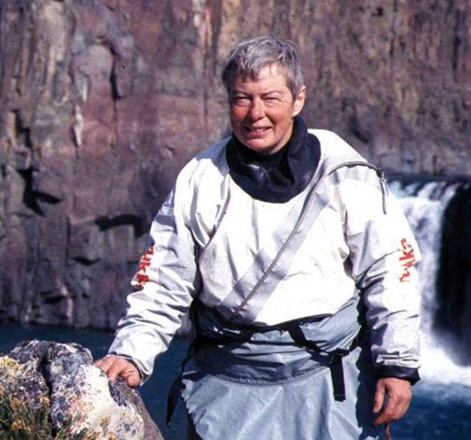
My Arctic Experience at Pond
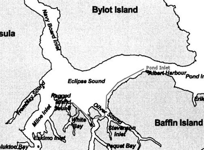
Inlet as a Sea Kayaker Gail E. Ferris www.nkhorizons.com/89PondInlet.htm |
|
The suspense of making
what seemed like an epic voyage started for me the moment I decided to make a
trip to the I had seen the boreal environment in |
|
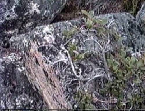
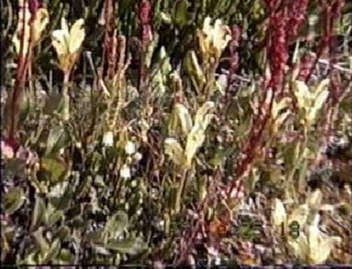
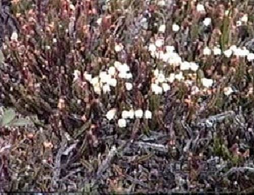
plants that are forced by the wind to grow over rocks |
|
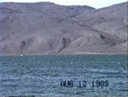
Upon scanning the NOAA Tides and Currents for Now the big question was, does the ice go out of Pond
Inlet, when and does the ice go out every year. |
|
|
|
From what I could find out I learned that the ice usually leaves
during the last week of July, if it is going to go out, and that the currents
are not severe because of the five to six foot tides. The reason for my concern about the currents
was that I did not want to combine paddling in freezing cold water with
threatening paddling conditions, such as tide rips and ice entrapment on my
first Arctic paddling experience. |
|
|
|
The weather, I learned
from some place, who knows? was moderate with light
winds averaging less that fifteen knots and temperatures warmer than other
places on The most precise source
of information for boating I found in the Pilot Guide at Mystic Seaport
library. My goal was to go
paddling in the I wrote for general
information to the Bureau of Economic Resources at Pond Inlet and wrote to
the Canadian government for information regarding ordering nautical charts
and topographic maps after having read that topographic maps provide better
information for choosing campsites than 1:250,000 scale nautical charts,
however from my on the water experience I found that the most likely
campsites are found at the mouth of rivers and streams, which are easily
found on either chart. I also made
note on my overall chart of the locations of traditional campsites designated
on a chart at the Office of Reneweable Resources in Pond Inlet to eliminate
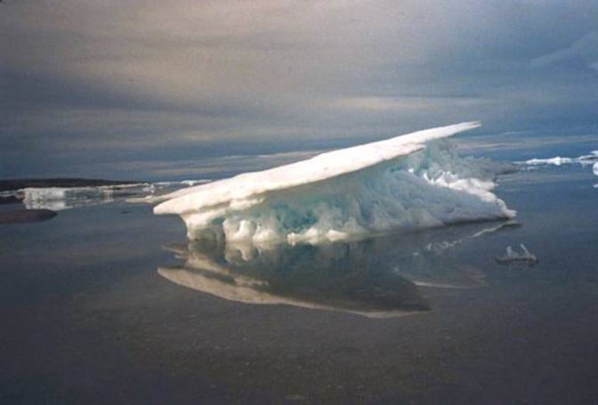
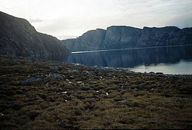
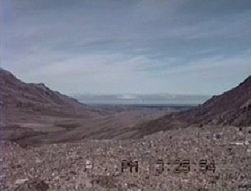
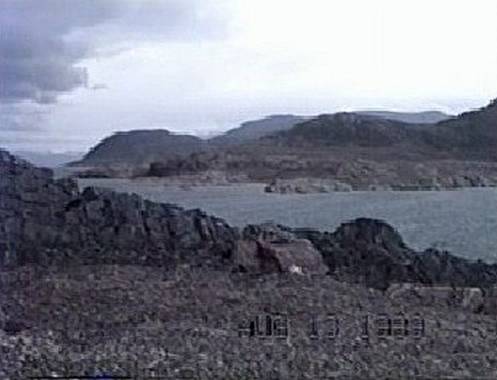
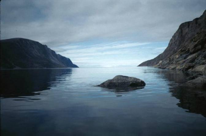
some of the guess work. Then again you can have
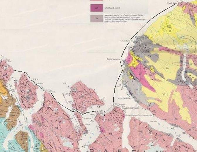
this sort of situation that the map does not show in the photo below. |
|
|
|
Now the fun begins as the
hours of planning and gathering suitable equipment with all its paper work
and exchanges began. After hours of reading, deciding what to do about those
friendly little white furry creatures, the polar bear, who might drop by for
a snack on me. You know they don't
always remember to knock before opening your tent for you while you are
snoring away. In fact this on one of
those situations where being the incredible edible might become a
reality. Having previously learned how
to handle a shotgun I found I was in luck, because a twelve gauge doesn't
weigh as much as a thirty-o-six rifle, and once I became accustomed to a
pump, the pump shotgun is the fastest and least apt to foul during shooting
multiple rounds. Its
nice to know that I am desirable and to be wanted but I have my limits. With polar bears you aren't going to be
around to be able to say "I gave him everything!" |
|
|
|
My shooting friends found
that Mossberg in Thoughts of future
applications during duck hunting season also loomed in my mind. What a perfect combination a Klepper and a
twelve gauge when those little dinners fly by next fall. I'd like to see some one try that trick in
a Knordkapp. First they would have to
outfit the Knordkapp with auxiliary floatation to keep it upright the moment
the trigger is pulled. My friends had a few
amusing moments as I experimented with different styles of skeet shooting,
but gradually I became familiar and completely accustomed to handling my gun
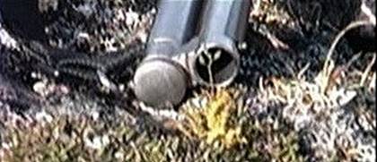
so that I knew how to shoot it in an emergency condition. The next question was how
do you carry a shotgun on a kayak and have it both be dry and
accessible. The answer is to keep the
gun loaded on the deck in a dry bag which can easily be opened with one hand. The gun has to also be attached to the deck
and also the paddle because for some strange reason guns don't float and
paddles float away when dropped in the water.
I arranged a "Bone Dry" gun bag to be tied to "D"
rings sewn onto the deck. |
|
|
|
|
|
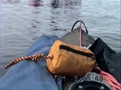
the shotgun is in the dark blue bag on the right, the sail
rig is on the left in the light blue bag, in front is the 50 foot throw rope
and down the middle is a 15 foot orange poly deck line coiled on the right
side. |
|
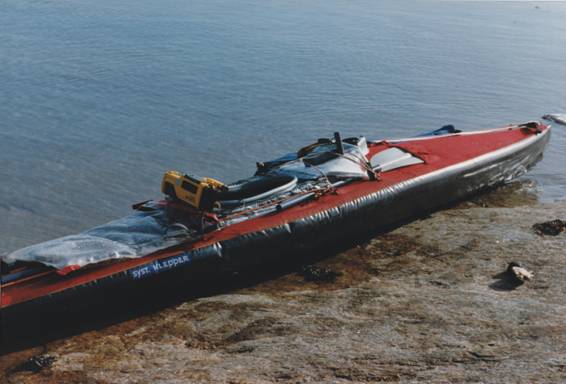
The nice thing about a
Klepper is that repairs can easily be done indoors because the skin and the
frame are easily dismantled and reduced to a size easy to bring indoors or to
ship on any airplane. The Expedition
Klepper skin can be repaired in below freezing temperatures with an ordinary
bicycle patch. Fiberglass boats can be
folded too but they just don't unfold very well. Below is the same model
Klepper I used in 1992 when I was in On the stern deck is my
solar panel that I used to recharge my video camera batteries. On the cockpit is the
video camera and on top of the map case is the GPS. |
|
this photo is of my newer red Klepper showing the solar panel behind
the seat, the video camera, the extra paddles, the Garmin GPS 50 and under it
is the chart bag |
|
Next question is will the
people at work let me take four weeks off in one block of time? Oh boy, what a thing to ask! Four weeks is a long time. I was so excited about
the trip that I was constantly consulting with anybody and everybody I knew
about any question that come to my mind such that my friends at work were
never hearing the end of my elaborate questions and ideas and by the time I
got around to asking if I could have four weeks off it was no surprise to
them and they were agreeable. Now I knew I had to go
through with my trip of a lifetime otherwise there would be a number of
people I would have let down; so I bought my airline tickets. That seemed simple enough. Then the plot
thickened as I discovered that shipping more than forty kilos of baggage
would not necessarily make it all the way with me to Pond Inlet and that
during early summer it was not unusual to have excess baggage delayed by two
weeks. With horror I imagined my
precious vacation time being wasted waiting for my baggage to arrive in Pond
Inlet while I stared helplessly at the water waiting for my Klepper to
arrive. Vainly trying to arrange for an air freight company to ship my gear
in advance to my destination in |
|
Arrangements were made to
air freight the gear to Now the next question was
how to take video pictures of my trip.
I had discovered on a previous trip that there is much better
continuity, and indeed the capture of motion accompanied by the record of
sound, which a video camera will record, projects a much more complete
communication with the audience that still pictures can ever provide. I knew that video cameras
had become small and light enough to consider using on a Klepper, but what
also had been introduced to the market was the Sony with a water resistant
case which was easy to operate and made very good quality video
recordings. I had found with other
Sony items that they are always ahead of their time. After hours of anguishing over the
financial commitment I purchased the eight millimeter Sony Cam-Corder CCD-SP7
and eight batteries. To my horror, I
learned that video cameras in cold conditions use twice as many batteries as
they do in warm conditions. I
desperately and vainly tried to find some means of recharging the batteries
either by solar panel or hand cranked generator, only to be treated as though
I had just landed from Mars during the Civil War era. Finally just two weeks
before leaving I spotted an advertisement for a store in After talking with my new
found friend, Gary Landau at Take-5-Audio in |
|
|
|
Navigation in this area
because it is so close to the magnetic North Pole has to be done without the
compass, because the compass will not provide reliable readings. The daily magnetic variation is twenty six
minutes, the deviation ranges between sixty five and seventy degrees west and
there are numerous iron ore deposits, one of which I saw and noticed that the
rocks have so much iron that they look like chunks of rusty iron scrap. With that I started to
realize that I would be confronted with two very confusing factors when it
came to navigation. Not only does the
compass spin around but the sun just keeps going around, never setting, is just
going along the horizon day after day.
Next what do I do on a cloudy day? After days of feeling
mentally like a helplessly confused navigator I raided my local library for
any books about solar navigation and purchased two books by David Burch
specifically written about emergency navigation and kayaks. I came upon an important
fact which I should have known long ago.
Did you realize that three hundred sixty degrees divided by
twenty-four hours equals fifteen degrees and therefore the earth rotates at
the rate of fifteen degrees every hour?
Thus each hour the sun has moved fifteen degrees in the sky. Well I felt better, but
next, you have to create a compass rose divided into fifteen degrees segments
starting at zero of three hundred sixty degrees for The solution I realized
had to be resolved by wearing a twenty four hour watch which also recorded
the date; otherwise I knew I was never going to know what part of the day it
was and what day it was. I might not
do very well getting back to Pond Inlet in time to fly home. I had visions of being
hopelessly lost with the sun going around and around and being completely
confused as to what day it might happen to be. Its okay to be dumb, but I
have my limitations and I didn't think that excuse would be very well
accepted at work as to why I returned several days late. That excuse would probably go over like a
lead balloon, especially since I am paid to perform scientific research, a
certain shadow of doubt as to my competence would be cast. The reaction of my co-workers would be
"Oh boy! Now we've heard everything!" The Bearing this in mind I
knew I had to seek a partner who had this character quality, otherwise many other
related problems could potentially develop especially since I am a very
fearful person. How about the polar
bears? |
|
The prospective partner
would have to had previous experience with cold water paddling and cold
weather camping. Minor mistakes in
judgment would unnecessarily complicate the straight-forward problem of
keeping warm and enjoying the trip.
Small items such as a hot cup of cider become a welcome reprieve from
the cold, but there is no compromise for the warmth of human intelligence and
understanding that is found among like companions and when that is lacking,
you might as well be better off alone.
A wrong decision based on ego and or ignorance can turn you into a
meal for the polar bears and ravens. Dealing with the Knowing as much as I do
about what effect the weather and topography as on paddling conditions, I was
unfamiliar with cloud formations, which indicated, wind direction and
barometric pressure and how make meaningful meteorological observations. I learned that when you
see lenticular clouds with a great combination of clouds; those lenticular
clouds are actually cumulus clouds being blown into that form by powerful
winds aloft accompanying a low pressure system. Do not go paddling unless you are in a
protected area and can easily put ashore.
Its nice to imagine that you can handle this, but it’s not nice to
find out you can't. Many fairly experienced
paddlers are unaware of the way cold water can suddenly drown even an
experienced paddler who is wearing a dry suit. Dry drowning where the throat closes up
upon immersion in this icy water is one unpredictable possibility. Another response is the
physiological reflex of gulping water into the lungs is initiated by sudden
immersion of the paddler's head in frigid water upon contact of frigid water
with the vagus nerve in the nose. The
paddler has a decrease in control of this response with aging. Cold water paddlers must wear
neoprene to reduce the shock of cold water to the head. I do not paddle in icy water as if I were
in the I got away with doing
some sailing for short periods when I was sure that conditions were suitable
I carefully avoided any erratic conditions and made sure that I could quickly
drop the sail and also just let it go if need be, because the sail was
designed to swing completely around the unstayed mast, if necessary. Sailing is a very cold
project here because all I am doing is just sitting there, whereas the
activity of paddling keeps me warmer. |
|
photo taken in |
|
I find it hard to believe
that there are still kayakers to refuse to wear either a wet suit or a dry
suit in Arctic waters. I always wear a
dry suit, which I have always found very comfortable and unobtrusive, durable
and tough during regular winter paddling.
During calm warm days the front entry diagonal zipper on the dry suit
is handy to open for ventilation.
Underneath two layers of light-weight polyethylene and a wool sweater
were comfortable. The reason for my choice
of the Aerius I Expedition Klepper was that it is easiest to fly to the Shipping ordinary
air-freight to the I learned the hard way
that it is often best to have the airline handle and store your
shipment. You should label your boxes
with your name, telephone number and date of your expected arrival with the
label "Hold for Arrival" on the boxes. Then check by telephone to find if all of
your shipment has arrived and it may be wise to have a separate waybill for
each box. When a box becomes lost it
is best to have had it only in care of the airline because they will recover
it for you not the local freight handler. |
|
|
|
There are misconceptions
about the Klepper, which relate to how well you prepare the boat for
paddling. If you notice that the boat
seems slow to paddle it is likely that you are paddling with soft air
sponsons and an unwaxed hull. I find
blisters on the hands are unsightly when pouring tea, so next time I'm
bringing my wax. The Aerius was not
designed for speed it was designed for touring at a reasonable rate. The best way to transport
the Klepper over ice is by sled, Would
you believe the Inuit invented this method just last week, just about the
same time they invented the harpoon? This
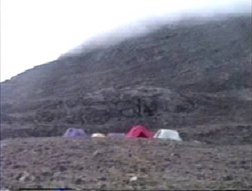
year, I only saw very rotten ice. My choice of tent was the
Gerry Mountain Tent, which is an above timberline, double entrance, semi free
standing design tent weighing about eight pounds. Next year I may use a Chouinard Mega-Mid
tent which has only a pole in the center, has no floor and is pyramid
shaped. The Inuit much prefer to camp
with a tent, which has no floor because "when the Polar Bear comes in,
it is nice to go out." I will
modify this tent by adding some pockets to hold ballast. The Mega-Mid tent weighs about two and one
half pounds, is easy to repair, is adaptable for other uses and most
important can be pitched almost instantly.
For camping on ice floes ice screws are used. |
|
|
|
Around the perimeter of
the tent and to protect your boat you will want to set up a trip wire with
explosive flares for those charming white hungry inquisitive visitors. I have not figured out the design of trip
wires, which are mentioned in Kingdom of the Ice Bear by Hugh Miles
and Mike Salisbury as being a very effective polar bear deterrent. On this trip I relied on the fact that being
with ten other people is a deterring factor known to apply to Alaskan Brown
Bears which I hoped would apply to Polar Bears and that we were in an area
less frequented by them and less accessible for them because the ice which
they on was out. Although it is not at all
wise to sleep out in the open without a tent because you look just like a
seal to a Polar Bear, you should have a bivouac with you in case of a
disaster to your tent. I brought a
non-rigid Gore-Tex bivouac, which was designed to allow you to have use of
your arms for cooking but also has a mosquito netting face guard. I had tested it many frosty nights at home
and found it excellent and easy to get in and out of. When it came to planning
on packing my kayak for bear country, which means just about everything, I
had the grand pleasure of finding out what it is like to reinvent the wheel
each time. Ignoring the sage advice of
my friends I used large bulky bags, which were most difficult to jam into the
pointed hull of the kayak. Watching
with horror and embarrassment as my friend unpacked his kayak in just moments
because he used long narrow nylon urethane coated bags. Packing my Klepper kayak was an awful
ordeal every morning because all had to go through the cockpit, there were no
loading ports. The large PVC coated bag
which I had allocated for my sleeping bag had the insidious habit of drawing
air in through the seal thus re-expanding it to an unloadable size if I
delayed in loading it immediately after filling and expelling excess air from
it. The PVC binds on any other surface
as well as becoming too stiff to form a seal in 40 degree temperature range. On my deck I kept my
shotgun in a "Bone Dry" bag made by Adventures and Delights in |
|
For a padded seat I sat
on a partially inflated Voyageur's Caboose bag with my clothes in it, which
made an excellent seat of variable height and softness, depending on how I
loaded it. It not only saved carrying
a seat but increased the loading volume and the paddlers comfort and gave a
measure of control over the position of my kayak's center of gravity. I purchased the Klepper S-1
drift sail in early spring and learned how to sail my kayak empty without
leeboards very conservatively in the cold water for two reasons. The first reason was to satisfy my
curiosity on what it is like to sail a kayak and the second was to have as
alternative means of propelling the kayak other than paddling for safety and
as a diversion from the monotony of paddling.
Dieter Stiller at Klepper
in The hull of the Klepper
has an unusually large margin of secondary stability because of the above waterline
surface area created by the sponsons, which the boat can actually be heeled
over onto this surface when sailing on a broadside reach. Essentially you have two types of hull in
the Klepper hull. I found sailing the
Klepper after so many years of paddling to be an absolutely delightful
thrilling experience. Cruising across
the harbor without lifting a finger, without making more than just the
slightest sound, being that of the hull passing over the water leaving a
delicate wake just seemed so extraordinary; and yet the entire boat can be
broken down to fit into canvas bags. Now if you are
resourceful the most secure method to ship your Klepper to the With a little stuffing
here and there and the judicious use of a broad brimmed hat you cannot only
ship your Klepper right beside you in the adjacent seat; but you can ship
some underwear, socks, clothes and sunglasses all as components of your
"Klepper" friend. Not only
that, but you can order double drinks and nobody will know until you try to
negotiate standing up sometime later, that the drinks you ordered for your highly
reticent companion just happened to have been consumed by yourself. Now of course either you want to do a
strenuous amount of weight lifting before trying to board an airplane with
your "Klepper" companion so that you don't create the appearance of
struggling with your shy friend or, heaven forbid, performing any unnatural
acts when boarding the airplane. I would suggest that your
"Klepper" friend board in a wheelchair and that solution avoids
these little problems. Now how
feasible would it be to fly with a fiberglass kayak as a passenger next to
you. Somehow I think it is not likely,
even if you were to saw your fiberglass kayak into sections, you would
probably be arrested and charged with traveling with an alien. |
|
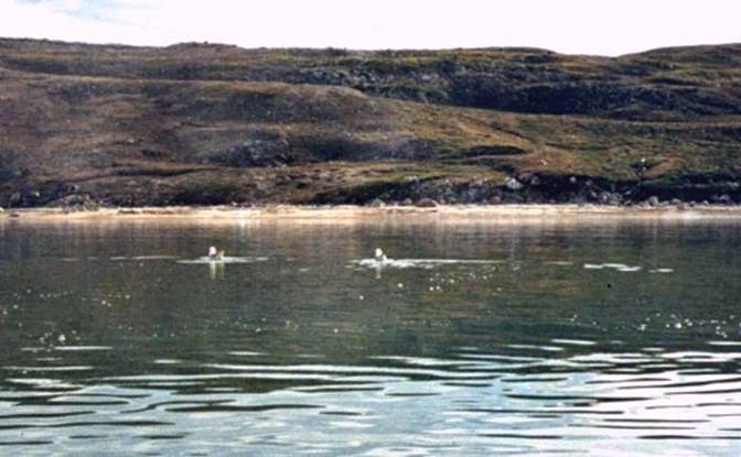
Northern Fulmars on the water off Pond Inlet |
|
For food I brought an assortment
similar in character to my regular diet, because keeping a routine lessens
the stress of travel. I made it a
priority to bring some items, which I knew I especially liked and could add
to embellish a less interesting meal.
These were nuts, spices and butter.
The butter was unusually pleasing when I found mushrooms to
sauté. I feasted on mushrooms with my
friends from Food has to nutritionally
balanced in each of the three meals because the
physical demands of paddling all day and emotional demands of travel soon
become compromised and the trip becomes an ordeal. Freeze-dried and dried food works well as a
base to which you can add to. I found that individually
packaged freeze-dried food was bulkier than necessary and I plan to work out
a different system next year.
"Knorr" dried cup soups were always pleasing for lunch,
which I made during breakfast and stored in my "Nissan" stainless
steel thermos. I dried at home in the
oven at less that 200 degrees F. a couple of corned beef briskets and If you can get some seal
of char from the Inuit, by all means try it, they are both very
delicious. If you suspect your diet
may be deficient in enzymes and vitamins eat the seal meat raw. |
|
After all this
preparation it seems as though I'm never going to get on the water. After hanging around town waiting to
recover my last box, which had become waylaid in Iqaluit. I put my Klepper together and found that
nothing had broken during shipping.
Next time I will ship from |
|
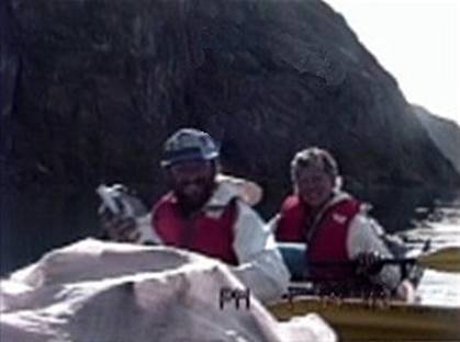
Above are the couple who guided this trip
they were from Paris, Ancien Homme. |
|
Due to unforeseen
circumstances I teamed up with this group of ten people from We left Pond Inlet the
next morning in overcast conditions with a wind from the east at about ten
knots heading west with out ultimate objective as Milne Inlet. Bert Dean, the Reneweable Resources officer
showed us on the chart where the traditional campsites were, advised us of
potentially dangerous crossings, how to handle them and described the general
area. He and everyone described Milne
Inlet as a wonderful area abounding with fish, seals and most importantly
where the Narwhal go in great numbers to suckle their young. The Narwhal were what we had come such a
great distance to see. We knew that we
would be most likely to closely approach them in our kayaks as the kayaks are
unobtrusive. In Greenland Narwhal can
only be hunted with harpoon from the kayak.
In |
|
|
|
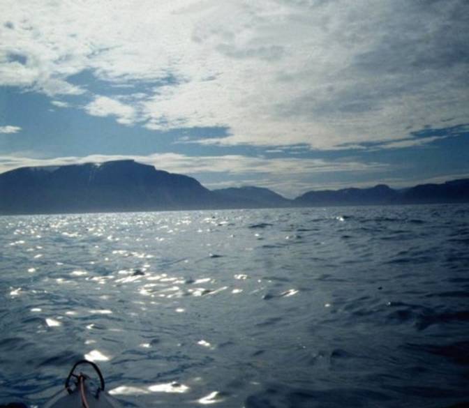
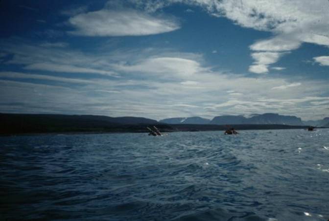
As out little kayak
armada departed from Pond Inlet, I took advantage of the following wind to
try out my Klepper drift sail. After
all, we might as well leave in style and not always are conditions going to
be so perfectly favorable. The prevailing
wind in the We were looking forward
to a long stretch of shallow near shore paddling along a gently sloping coast
line which could be landed on in most areas with sand beach areas. This coast was about twenty five nautical
miles long, a reasonable distance for resolving any problems with kayaks and
become accustomed do the paddling routine. After sailing about five
miles I became chilled. This is a
problem when sailing in the The bottom was shallow
and sandy except where the alluvial delta of the The Salmon River bank at
about 200 feet back from shore has the remains of |
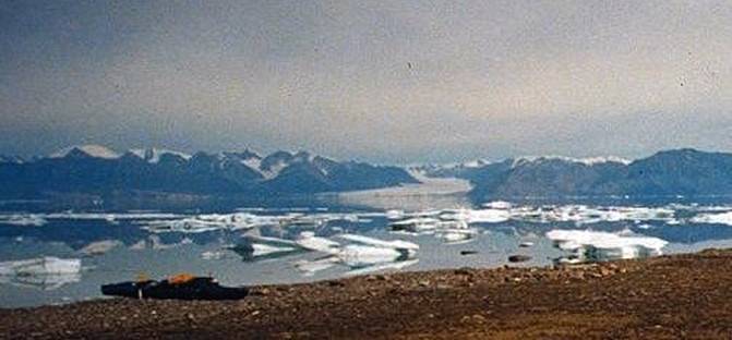
|
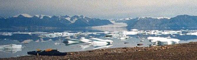
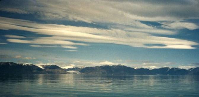
clouds over |
|
As the trip down the
coast progressed to the southwest, the last point from which we could see
Pond Inlet was Tunuiaqtalik Point, about twelve nautical miles away. That point was the only distinguishing mark
on the south side of Eclipse Sound.
Across to the north we could easily distinguish the peaks and glaciers
of Lenticular clouds are
actually cumulus clouds distorted by powerful winds aloft which have a
distinctly greyer more compacted appearance than the adjacent clouds. Although it was a dreary day we were not
worried about being beset with heavy wind, we were probably receiving the
edge of a low pressure system to the east of us. As out little kayak armada
departed from Pond Inlet, I took advantage of the following wind to try out
my Klepper drift sail. After all, we
might as well leave in style and not always are conditions going to be so
perfectly favorable. The prevailing wind
in the We were looking forward
to a long stretch of shallow near shore paddling along a gently sloping coast
line which could be landed on in most areas with sand beach areas. This coast was about twenty five nautical
miles long, a reasonable distance for resolving any problems with kayaks and
become accustomed do the paddling routine. After sailing about five
miles I became chilled. This is a
problem when sailing in the The bottom was shallow
and sandy except where the alluvial delta of the The Salmon River bank at
about 200 feet back from shore has the remains of As the trip down the
coast progressed to the southwest, the last point from which we could see
Pond Inlet was Tunuiaqtalik Point, about twelve nautical miles away. That point was the only distinguishing mark
on the south side of Eclipse Sound.
Across to the north we could easily distinguish the peaks and glaciers
of Lenticular clouds are actually cumulus
clouds distorted by powerful winds aloft which have a distinctly greyer more
compacted appearance than the adjacent clouds. Although it was a dreary day we were not
worried about being beset with heavy wind, we were probably receiving the
edge of a low pressure system to the east of us. |
|
|
|
The next day we had
stronger, more threatening wind from the east of about twenty knots, but the
sun was showing. I paddled closer to
shore to avoid incipient problems, which might occur with this amount of
wind. I really don't like rusty hair
pins. My friends in their Nautiraids
happened not to have brought drip rings for their paddles. They were uncomfortable that day as plenty
of water ran off the paddle shafts onto them.
We should have invented some sort of drip rings, Even an ordinary
piece of line tied around a paddle shaft will work as a drip ring. We pulled into shore for
the evening behind a cluster of melting grounded-out pans of rotten ice which
covered the harbor leaving but one access to shore. The ice was pan ice from last year melted
to the state which is called either rotten or brash ice. This ice is highly crystalline, loosely
structured, very weak, about eight feet thick, fresh water, severely undercut
by seawater at the mid line, thus it is constantly collapsing and rolling
over if it is not grounded. This annual ice is
unstable and is actively disintegrating.
You cannot expect to run up your kayak onto it or get out onto
it. It would crumble under such a load
stress. If multiyear ice is
available often if it is large enough you can get away with landing on it and
drifting around on it but you do run the risk of the chunk of ice drifting
into a mass of ice chunks. Polar bears
ride multiyear ice chunks. Annual and multiyear ice
is not anything like icebergs that are constantly changing their center of
gravity making them completely unstable. We carefully chose our
campsite considering the bears, but I would have preferred that we camp else
where access to the water was not so limited by ice and where polar bears
cannot so easily hide. Not only is ice
white but so are polar bears. My friends cooked over
driftwood which was planks from packing crates brought by ship into Pond
Inlet. I cooked on my trusty old Svea
123. Never have I had a problem with
the Svea that I couldn't resolve. I
like simple straight forward equipment especially a stove. The Optimus,
Primus and Svea stoves have been around for a very long time. Shackleton and Nansen as well as many others since the 1890's used these
stoves. |
|
08 |
|
Marshy groundwater and
snow meltwaterin this area of the My only explanation is
that the aquifers must be in an upended strata
similar to the Here I tried to maintain
dry feet by using my waterproof shoes and Gore-Tex socks. I did happily survive
with somewhat dry feet. The Gore-Tex
socks were an experiment but I thought "nothing ventured, nothing
gained." Our first day of paddling
was the most monotonous because conditions were not challenging and the
scenery was either of low profile or too distant to seem exciting. But we knew paddling would soon become
exciting as we could see from the topography of the fjords and islands we
were going to be encountering soon enough. |
|
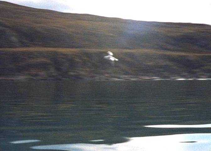
Fulmar with wings outstretched |
|
We had a lovely evening
with local flora gathering, cooking and eating. We ate a salad of leaves of a plant in the
Oxyria / Dock family. Their leaves are
round, very tender, dark green and especially high in vitamin A. Dock leaves are so high in Vitamin, I was
afraid to eat a full bowl of them. We picked mushrooms and
added them to our evening fare. I
saved some to sauté with my eggs in the morning. I found that powdered
eggs are tasty in the morning and most importantly they have completely
balanced protein. If I had been
concerned about cholesterol intake, I would have found a comparable
substitute without cholesterol, because breakfast with insufficient protein
soon catches up with me. We cashed our food away
from our boats and tents not wanting to attract polar bears. We found it was best to just keep a routine
of retiring for the evening at Because the light is
sufficient in early August all night travel sometimes at night the weather
will be calmer. The wind that is
generated by bright sunshine may stop blowing and you can paddle in these
better conditions. Katabatic winds can be
generated by bright sunshine and can be very powerful. |
|
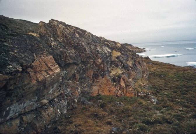
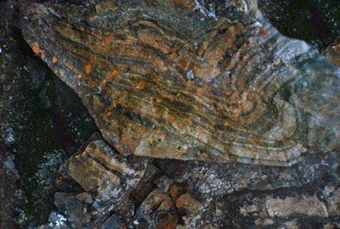
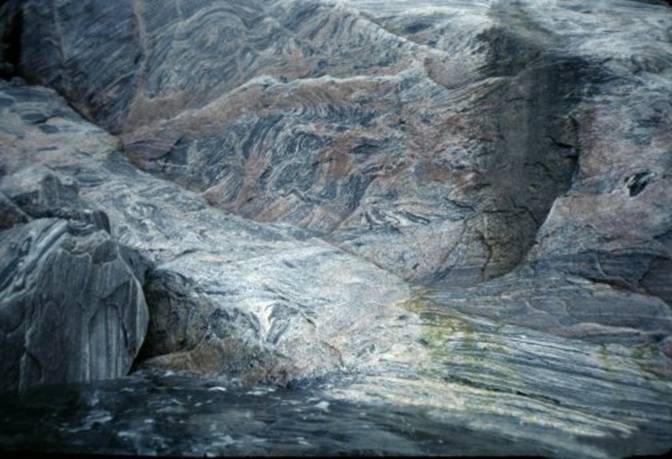
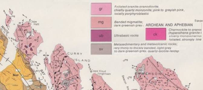
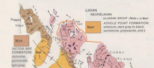
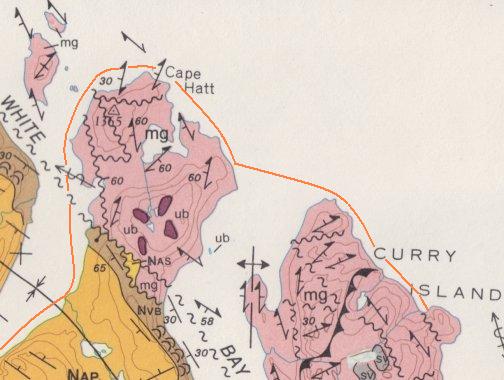
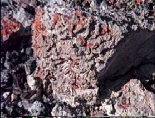
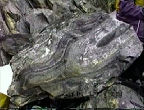
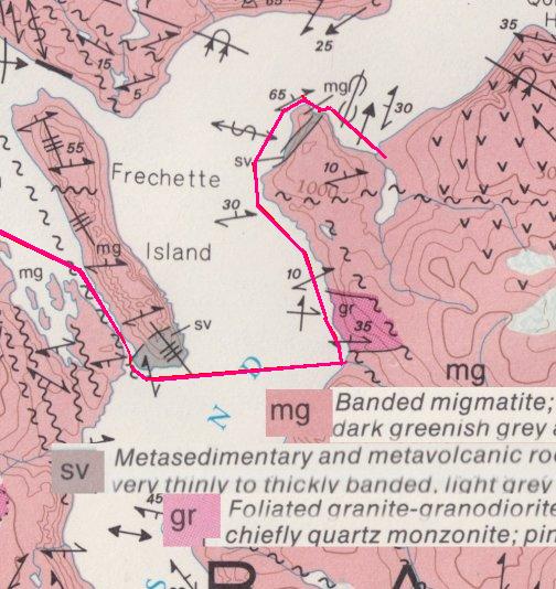
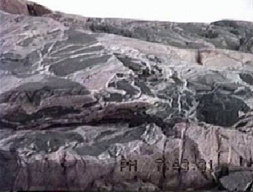
On our way down the coast
heading south we stopped at this area and found these rocks. Below is a photo showing
the very interesting metamorphic rocks found in the area just southwest along
the coastline from Pond Inlet. I
enjoyed the colors and striations on the rock. I was really looking forward to paddling in
this area to see some more exquisitely interesting rocks. |
|
|
|
Some close up detail of metamorphosed rocks which I found. |
|
|
|
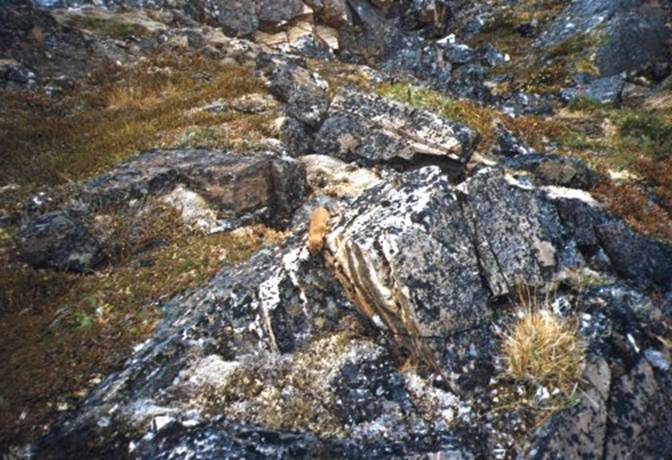
This is a very amusing moment when an ermine came out and ran over
these rocks. |
|
|
|
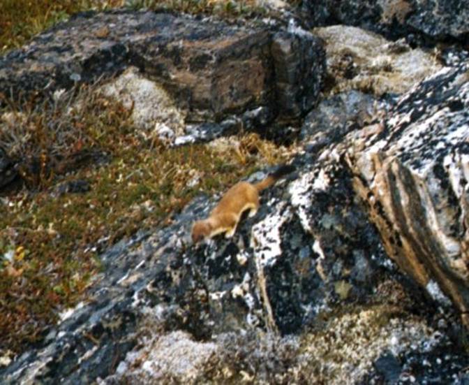
I could not believe my eyes when I saw this creature running down the
rocks. There he was in summer pelage
out and about looking for food. |
|
|
|
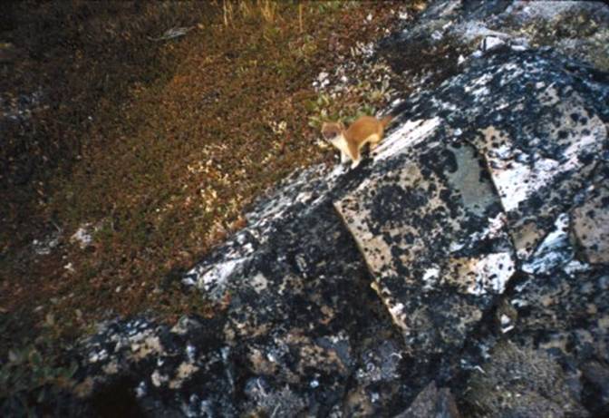
This ermine was so busy he never noticed my presence as I stood there
trying to barely move as I quietly took these photos. |
|
|
|
Our second day had been
very windy from the east and partially overcast. As a conservative paddler I suggested that
we keep together as a group and stay close to shore which was to the east of
us. With this offshore twenty to
twenty five knot wind I felt that a boat blowing away or capsizing would be
wise to avoid in these cold waters. I
was glad that we did not have to risk any paddling exposure greater that this
today. It was a good test of
judgment. I recognized that the waves
are much smaller on cold water for the same amount of wind as compared to
warm water because cold water is reacts more slowly to wind. The water in this area stays within five
degrees above and below freezing throughout the year. By the end of our
paddling day the effects of the cold water running down the paddle shafts of
those who did not happen to have drip rings made paddling a wet cold
ordeal. We cut short our day and found
a campsite on a rocky shore behind some chunks of brash ice. With a bustle of campsite preparation a
quickly made hot fire we made our usual hot soup appetizer, which immediately
came to the rescue. Once again we were
warm and relaxed. We ate some more
mushrooms, which we found and saved some for breakfast. In the photo below you
can see three double kayaks. We had at
this point just taken off from Pond Inlet.
You can see the coast line is very low but when you look at the
background you can see some of those mountains where we are planning to
paddle. Those mountains are in some
instances just straight up and down 3 and 4 thousand feet high. |
|
|
|
We knew that if the wind
subsided we could make our crossing of This would be a four mile crossing with no place to land because the
slopes of Qorbignaluk Headland and |
|
|
|
We had been advised that
we must not attempt to cross unless we had calm conditions. As luck would have it we awoke to a nice
morning to make our crossing. From
where we were located on low lying land we were about to approach the
mountain cliff faced fjords so famous.
All we knew was that we were about to encounter our first experience
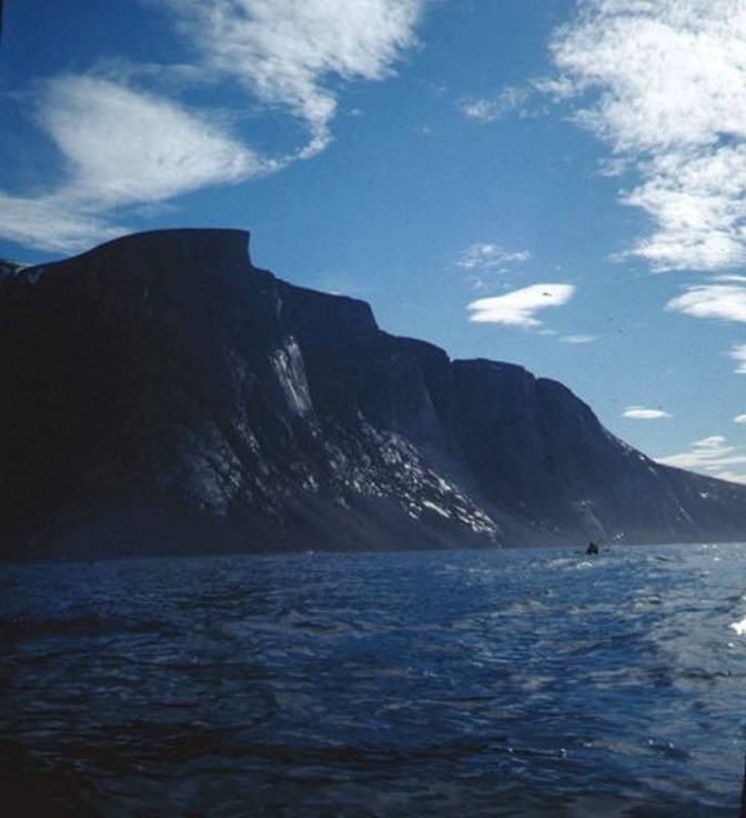
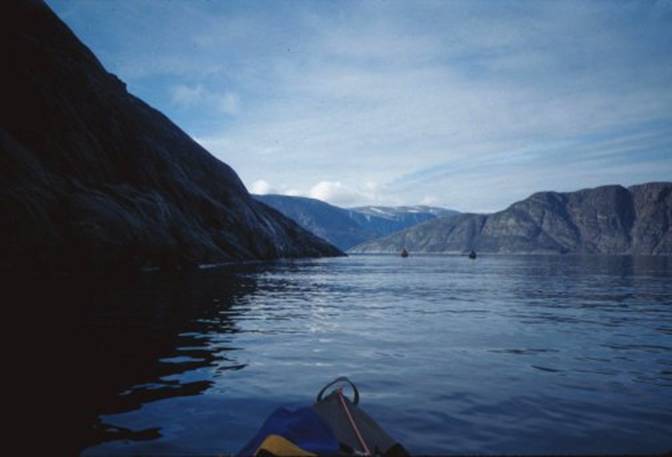
in paddling among mountains. As you can see above on
our third day we could see |
|
|
|
From what we could see as
we looked to our south down Oliver Sound we could see that there were many
other similar cliff faces lining both sides, appearing as though Oliver Sound
had been cut out just like one cuts out a piece of cheese. We felt very small, for
indeed we really were when we were next to these escarpments. We realized that we were about to enter a
much more challenging kayaking situation, one in which we would not have
continually available landing places. |
|
several thousand feet straight up and
down |
|
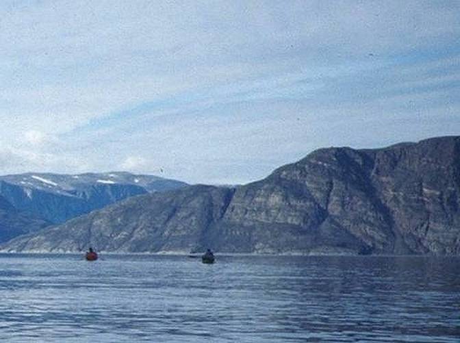
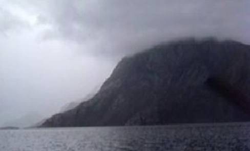
In this is a typical
kayaking situation one appreciates good equipment and being associated with a
group, which has some double kayaks.
You realize that you must be very aware of conditions and everyone’s
capabilities. We had no definite
knowledge of where we could even land; much less find an area large enough to
camp, but I concluded from our topographic maps that most river and stream
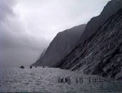
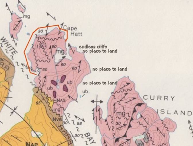
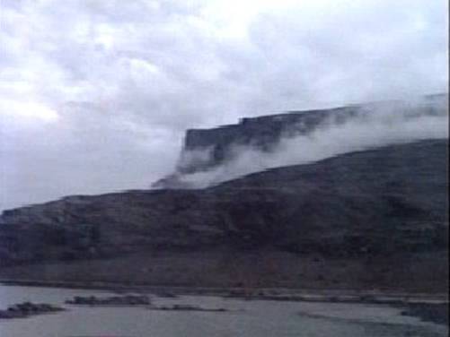
beds might be useable. These cliffs were so high
that the nimbus layer of clouds would form a ring midway up them, as this
level of clouds are the lowest level of clouds. A remarkable quality in the Against the 6,000 foot
mountains of |
|
|
|
Local people had warned
us not to cross |
|
|
|
At this stream we found
what were likely to have been the remains of a fish weir for trapping char. We had previously chosen this place because
the stream was fed by a lake, which we knew char would live in for part of
the year. The remains of what appeared
to be an extensive semicircle of rocks encompassing all but a narrow
midsection of the mouth of the stream.
The semicircle having about a hundred foot radius. On the west side of the
stream we found an extensive array of dwelling remains from recent stone
circles which were tent circles to much older structures representative of
some of the earlier cultures. These
stones were used to secure walls of hide tents. The age of the stone circles could be
estimated by the amount of lichens growing on these rocks, the more lichens
covering the rocks the older the tent circle.
Some circles had hearth remains in them and others were keyhole
shaped, having a defined entrance.
Still other circles had combinations of intersecting circles. Even more fascinating then
these tent circles were the remains of single and double level sod and whale
bone smaller houses dug into the stream bank.
This was not nearly as common to find as tent rings. These dwellings were tiny, but intricate by
comparison to the tent dwellings, suggesting that this area must have always
been a good place find fish and game.
Franz Boaz describes some of these types of structures in The Central
Eskimo. This area is probably used
extensively when the Inuit can travel in boats and when ice has formed thick
enough to be crossed with sleds, but approach from over land would be a very
long trip. |
|
|
|
As we made camp we found
that this area was an acidic peat bog with blue berries, more mushrooms and a
special herb called Ledum, which had a resin that made its tea smell and
taste slightly like eucalyptus. It was
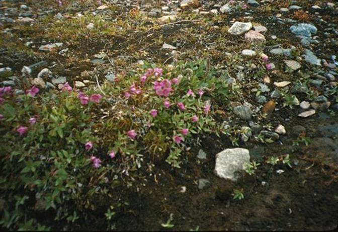
in the laurel family of shrubs, not very common and quite inconspicuous. Along the beach margin Arctic willows grew
over the rocks and among the crags strictly limited to espalier in the slightly
sandy soil. Below is a photo showing
Salix willow growing flat over the soil.
The pink flowers are Epilobium or fireweed which is edible as a salad
herb. The surface of soil is
covered with low growing dark green mosses. |
|
|
|
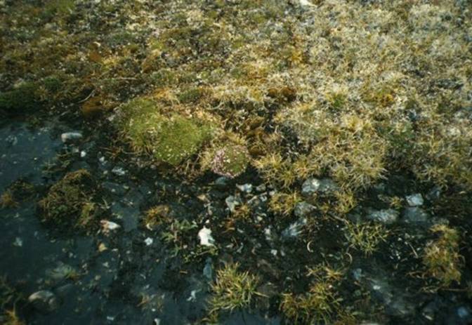
There was water all over
the place and endless moss, lichens and tiny pincushion plants such as this
Moss Campion in the photo below. Note the short grasses
and sphagnum moss here and there. The
white and gray splotches on the rocks are forms of lichens. You can see tall forms of lichens in the
background which are cetraria and reindeer lichens. These lichens prefer acid soils. There is a clump of Sedum right of center. In the water are dark forms of bluegreen
algae and mosses. |
|
|
|
We gazed across the
channel at the pink streaked grey cliffs of We ate another nice
dinner complete with soup and ending with several cups of Ledum tea. Then we let the fire die and watched the
evening close behind |
|
Our fourth day was an
idyllic summer day, bright and balmy.
We paddled along the western side of the cove, which we had camped at,
enjoying the endless swirls of quartz and both white and pink feldspar
striations in the charcoal grey gneiss.
|
|
|
|
The swirls of minerals
became so fine that they looked like cotton candy, something which seemed
absolutely extraordinary to me. We had
a wonderful time gazing in the clear water looking for Sea Urchins, which we
would have been delighted to gather for later consumption. We saw the loveliest
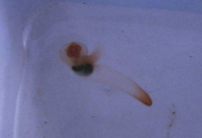
Ctenophores which are called Box Comb Jelly Fish and look slightly box shaped
having two wonderful three foot long tentacles that stream behind them in the
current to catch food but can be completely retracted when necessary. We saw another ethereal looking jellyfish
called a Medusa. |
|
We then started making
the crossing toward the southern |
|
|
|
These grey cliffs had wonderful wide bands of feldspar and other
layers in them. |
|
|
|
We were on our way west
to the northern tip of We no longer saw any Sea
Butterflies, which we had seen millions of in Pond Inlet. The Sea Butterflies are Pteropods, a type
of Mollusk that swims. Of these
Pteropods there are two types; one was a long tadpole shaped mostly clear
with orange spots and little flipper-like wings and the other was solid black
pill shaped with black little wings. Below is the clear one
with orange coloration. |
|
|
|
These creatures occurred
often in large swarms near the surface and I believe the Fulmars ate large
numbers of them. They are also food
for some Whales. |
|
|
|
We were happy to have
arrived none too soon at In the photograph I am at
the |
|
|
|
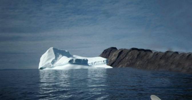
We had the company of a
stranded iceberg at our lunch place and some sand and rock shoals not noted
on our nautical charts. I guess nobody
expects any oceanic vessels to be calling at |
|
|
|
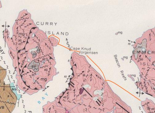
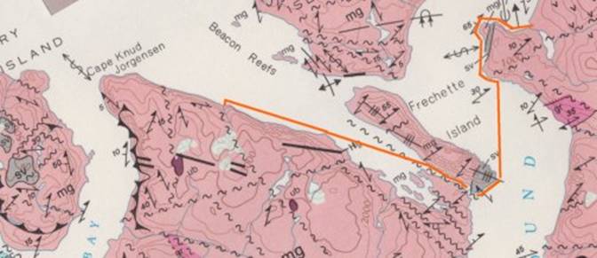
To our west for a
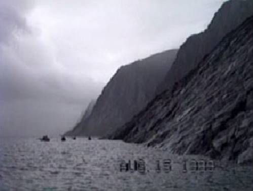
distance north of about five miles lay Cape Knud Jorgensen. What immediately caught my eye were the
cliffs. Although they ere the same
height of about 1,500 feet as the topography we had to our east from which we
had just come, they had the distinctive appearance of being sedimentary rocks
most likely of sandstone. They had very definite
straight stratification in these layers.
At the bottom of these cliffs were talus slopes extending up these
escarpments a long way, almost twenty to twenty five percent of the cliff
face. Only soft sedimentary finely
layered rock cliffs have this weathered appearance. I also thought we could easily have a
shower of these rapidly disintegrating rocks come down on us at any time if
we were to venture too close to them.
Massive rockslides are easily set off from this type of rock. I did see a rock slide let loose on
Qorbignaluk Headland from the 3,000 foot level and it was most
impressive. I was glad I did not
happen to be passing by that area at that moment. The rock dust from that rockslide hung in
the air for twenty minutes. I felt
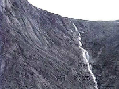
very small. From the top of Cape Knud
Jorgensen came three waterfalls, each more grand than the previous, as tons
of water hurled itself down the cliff face.
The aquifer feeding these waterfalls must have had some extraordinary
artesian pressure. At the base of only
one of these waterfalls could we possibly land in this expanse of five
nautical miles. |
|
|
|
|
|
|
|
As we rounded the tip of Cape Knud Jorgensen there were a few landing
places but not very suitable for camping. |
|
|
|
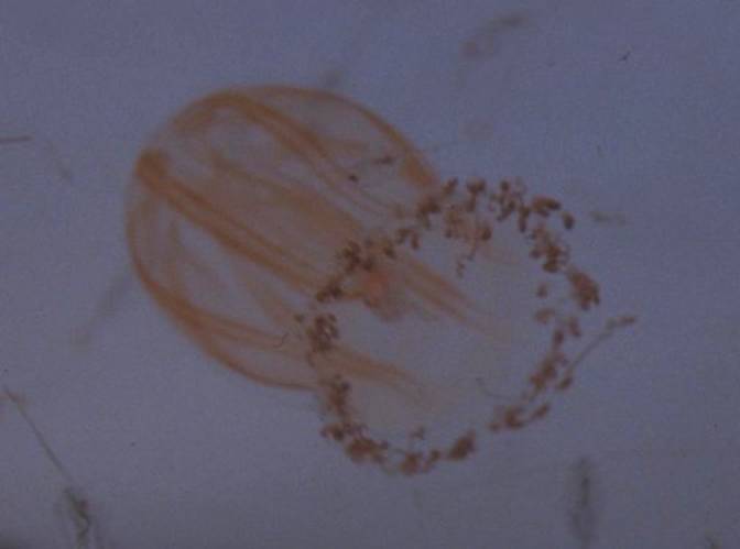
I looked for the Beroe
Ctenophores in this area of Eclipse Sound, which I had seen in large numbers
in Pond Inlet. These Ctenophores look
quite different than the majority of others, because they spread their mouths
into an umbrella shape with which they capture food by opening and closing
repeatedly. They are often stranded on
shore where they look like clear orange pink almond shaped Jellyfish. They have no tentacles like the rest of the
Ctenophores have. |
|
|
|
These
Plankton were being transported on the rapid current which sweeps around |
|
We could see lush green
areas of tundra across Fearing that someone
might accidentally slip into the frigid water when negotiating a landing on
the available inclined smooth rock face I suggested that we proceed further
west along the coast of Curry Island where most likely there might be a
campsite, because on the topographic map two streams were indicated. I was just taking a guess and we were all
starting to feel tired. I was glad
when we finally found the stream that was illustrated on my chart. There was no way of
knowing for sure, because our maps were not detailed enough to show the
inclination of the last few feet of land at the water edge was. Our campsite faced northwest from which
after preparing camp and eating dinner we were treated to a brilliant sun set
at |
|
|
|
Actually, since we were on Eastern Daylight Savings Time, the true |
|
|
|
The next morning we got underway on our fifth day heading west
again. We passed the other campsite on
the north Then we found as we were
rounding the northern tip of |
|
|
|
We crossed the western
arm of |
|
|
|
A couple miles after
having rounded |
|
|
|
We encountered a bright
yellow extensive low profile multiple layered stony and yellow sandy beach
and the accompanying shallows. The most unusual quality
this beach had was its size both in width and depth and the very clearly
defined layering which extended as much as thirty feet above sea level. It appeared to me as though storms would
drive the water carrying stones and sand up the beach, leaving these deposits
when the raging waters subsided. I
really didn't want to camp there with menacing aspect visible. Rounding a rocky
peninsula, we spotted an area, which looked safe and protected for
camping. Finally I had a favorable
wind for some downwind sailing and that's just what I did. After twenty minutes my teeth were
chattering. I was glad when I finally
made land. I was quite cold. We prepared camp, ate dinner and explored
the first sand beach we had seen in days. |
|
|
|
I thought it was curious
the amount of pink stone in this area probably due to iron. The color of pink feldspar. |
|
|
|
Pursuing my old interest
in contemplating natural phenomena, I noticed something very odd. Why on earth were there large amounts of
lime green clumps of filamentous algae growing in the brooks? Why were there extensive areas of all sorts
of grass growing everywhere? Where
were all the mushrooms and familiar acid soil plants? Some strange lichens were growing
here. The ground lacked the deep soft
spongy feel of a peat bog and the water was not tinted brown from tannins
leaching from peat. I had the feeling
that we were in a limestone area and indeed on the next day, which was too
windy for boating I found heavily eroded limestone. The photo below is poor
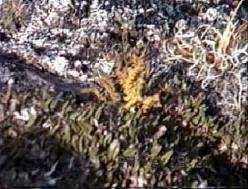
but it does show the limestone with iron included. |
|
|
|
There also was a capping stratum of granite, which occasionally
harbored areas of acid soil plants. |
|
|
|
This was the first
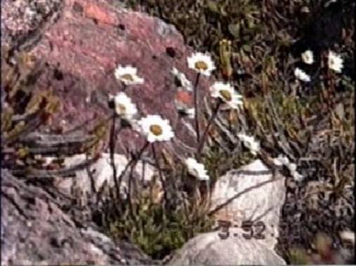
granite I had seen on These are the first Arctic
chrysanthemums I have ever seen the flowers are one inch diameter on three
inch stalks of brilliant white with gold centers. |
|
Chrysanthemums |
|
Among the granite I found a Woodsia fern which grows in Arctic areas
in granite ravines and crevasses. This
fern was so tiny that it had fronds only one inch high. This was the only fern I was to find. In the photo below the pale green plant in
the center is the fern. In front of the pale
yellow Woodsia fern is Dryas or Mountain Avens and in back are the large
Cladonia or Reindeer lichens. |
|
|
|
These rounded polished
granite rocks were much different that the other jagged metamorphic and
sedimentary crumbly rocks in the area.
We even found fossils of bivalve Mollusks in the limestone. |
|
looking north to Bylot and Navybord inlet |
|
From atop the knoll I
could see the shimmering blue passage behind |
|
looking south |
|
My friends decided that they would prefer to head back to Pond Inlet
with some extra days available in case of poor weather, which was a good idea
because the weather here changes very quickly and we could become wind bound
very easily. |
|
We were fortunate enough
to be given an Arctic char by some local hunters across the bay, which they
had caught in a net. It was very kind
of them to share their catch with us.
This was a wonderful experience in delicious eating after careful
baking with spices in aluminum foil over the fire. I only wished we had burned Arctic Heath
instead of wood as Arctic Heath gives a special flavor all its own to food
cooked over it. |
|
These local hunters also
warned us about Polar bears, which gave credence and plausibility to my
knowledge about Polar bears. It was
nice to, at long last, not be the only one carrying a functional firearm and
taking care not to leave any food in my boat at night. As for the layout of our tents, the bear would have six tents to
choose from, but at least we had no food in them. So as to not lure the
possible bear visitor, we did our cooking and toilet far away from the tent
site. We were all very smoky smelling
from our numerous wood fires, which is and odd odor to an Arctic animal. Bears are generally motivated to visit
campsites by curiosity and unfortunately we had generated more than our fair
share of curiosities. It is best to
smell as human as possible. You are probably
wondering where did this wood come from which we
were cooking with. There are no trees
in the |
|
Now on our seventh day the wind still blew and on the grey horizon to
our west I could see lenticular clouds.
My friends decided that we would that we would leave on that day to
return to Pond Inlet anyway. Below is a photo showing
our situation which is actually taken later in the day. |
|
|
|
I was glad I had my dry
suit and that I was in a Klepper. I was
scared and had the thoughts of "Don't call me, I'll call you." but
we launched anyway. The familiar
saying "You can lead a horse to water but you can't make him
drink." when used in this situation would be "You can lead a
kayaker to cold water, but you can't make him think." applies in this
instance, because and Chuck Sutherland so often noted "Cold water
kills." These people from These new friends from |
|
|
|
I knew one thing; and
that was when we rounded We hauled up off the
rocks on the point to take a gander of what was next. This is roughly what it
looked like – just a completely charming situation. |
|
|
|
All I knew from my past
experience was that the wind was just too much. I decided that I would split off from the
group and duck into the nearest area where I could land. Well, that was exactly
what happened; I started out ahead of everyone and ducked in at the nearest
stretch of sand. When I turned around
to find that everyone else had the same idea.
The rest of the group was
following me. It was supposed to just
be a lunch stop, but we were not interested in any more punishment by the
wind. Our narrow beach was just wide
enough to accommodate our boats. We
staggered up the steep knoll and set up camp, just too exhausted and scared to
do anything else. After some very careful
scouting we found a very tiny spring in the rock and clay bank, which some
thoughtful person had marked with a stake, this made me feel that we weren't
the first people to become stranded here.
The spring was tiny and filling the water jugs required great
patience, but it was the only water we found, so that was a small price to
pay for this precious commodity. I found some
extraordinary green and red metamorphic stone here. Some of it was, I believe, olivine,
pyroxene, tourmaline and malachite.
The colors were brilliant. I am
not sure what these rocks were. I
should have taken some samples, but the thought of extra weight was the
limitation. Below is a photo I took. |
|
|
|
As I was resting in my tent the came call out
that Narwhal were swimming by. I took
pictures as the pod of about one hundred passed by heading for Milne
Inlet. It was such a precious
experience not only to see them but to hear their rhythmic breathing as they
synchronously surfaced. It is hearing
the breathing of a sea mammal such as these Narwhal, which made me feel close
to them as fellow mammals. |
|
Had I not decided to duck into this beach we
would have never seen these Narwhals. |
|
|
|
Our eight day was crowned with sunny balmy weather. We rounded the eastern tip of |
|
On the water there were sandy shoals and we could
see the bright yellow, the color of Limonite, sandy bottom. We relaxed and
entertained ourselves looking at the panorama and cutting in and out around
the rocks with our kayaks while peering at the bottom and basking in the warm
sun. We disembarked at a
recently abandoned sod house area, both new and old structures. Here we found the recent
remnants of occupation such as tin cans and modern wood flooring. It was a warm sheltered area, easy to land
at by boat of skidoo because it faced south and was on a gentle slope. |
|
|
|
I found plenty of blueberries to eat on the
hillside, but we never found a water source, which may have been a habitation
limitation, making this site only useable when snow was on the ground. We headed east across the
eastern arm of White Bay for a green valley, which was now awash in the long
rays of the warm afternoon sun on the western side of Cape Knud Jorgensen
where we were to camp. We finally decided which
side of a stream delta was best after realizing that what seemed to look easy
was a long and difficult carry over many boulders to get the boats above the
tide line. We found the north side of
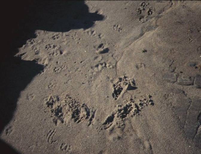
the delta to be shorter and not nearly as boggy. We also found recent Caribou prints and
other residues. This was our first
encounter with Caribou and we were delighted to at long last have found
them. We found some antlers, but they
were much too large to consider taking back. |
|
|
|
The stream, which ran down the hillside, had been
warmed by the brilliant sun on the dark peat soil enough to allow for a quick
sponge bath. My body had started
sending me messages such as "wash me or I will itch" most particularly
my hair. Before I had left I used it to soak up the
tiny amount of water that would seep into the bottom of my kayak but my most
important application was for drying my hair. I found that I could dunk
my head in the frigid water and wash my hair with an all purpose soap called
H2O Sun Shower Soap which was suitable both for use in salt as
well as fresh water. Well, to my
delight both the soap and towel worked to my great relief, I felt as though I
had returned to the world of the sane once again. On a previous trip, dirty
hair became very distracting as my scalp more and more urgently kept telling
me "I'm dirty, I don't like being dirty, I'm leaving." as the
itching increased. I do wonder though
how does one wash their hair in a space ship in a weightless environment? On our day nine heading
in a roundabout way home to Pond Inlet, once again a grey sky with mixed
clouds to the west showing some more lenticular clouds indicating strong wind
which was coming from the south, we set off to round Cape Knud
Jorgensen. We made the |
|
|
|
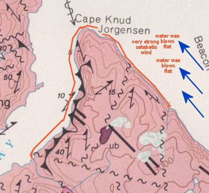
My naive friends blithely set off for possibly
the only landing point five miles south into a very powerful south wind which
was katabatic in nature. The wind was
not blowing horizontally, instead, it was blowing
vertically so that it blew the water flat.
|
|
|
|
Later upon consulting with a meteorologist, Hermann
Steltner, at Pond Inlet, he said that this does happen in this particular
area. As we worked our way down the
coast, hugging the cock cliffs to avoid as much as possible the inevitable
exposure to this fierce wind. There was no doubt in my mind that this
endeavor was not only futile, but courted disaster. Not only was making the nearest known
landing place which was five miles away impossible but trying to turn kayaks
180 degrees in this wind could easily result in a capsize of a kayak. Kayaks are very stable going into a wind,
but when run with the wind they do not have the same stability. The paddling became very strenuous and this
extreme amount of exertion could give a person a heart attack. I could barely move my boat. It was everyman for himself, a dead heat
battle. Then I noticed something
out of context. The leading boat was
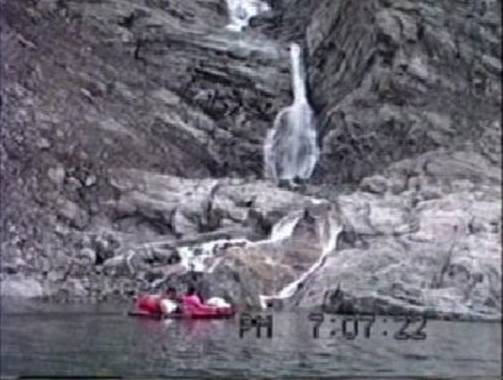
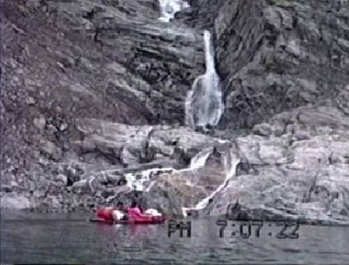
making for a landing at the base of a tumultuous cascading waterfall, which
had a tiny area just large enough for landing a kayak one at a time. I had
noted this disembarkation area when we previously by on our way
westward. This was our only chance
without having to risk turning around. From the water this site
looked challenging for camping by appearing only to be a steep side hill
punctuated by massive boulders. I quickly alighted from
my kayak, tent in hand, not waiting for protocol and quickly found a
reasonable tent site. Erecting the
tent in this wind required the judicious use of rocks strategically located
to keep my tent stakes in the ground and the tent upright in this mad
wind. I was glad I had taken my above
timberline tent on this trip. My feelings about the
discretion of not only the leader but of the group I was accompanying I
thought was best expressed by Scott Joplin in his music. Whew! |
|
|
|
The next day the weather was as somber as a tomb. We leisurely paddled south past To my left, which was
backlit by the brilliant |
|
|
|
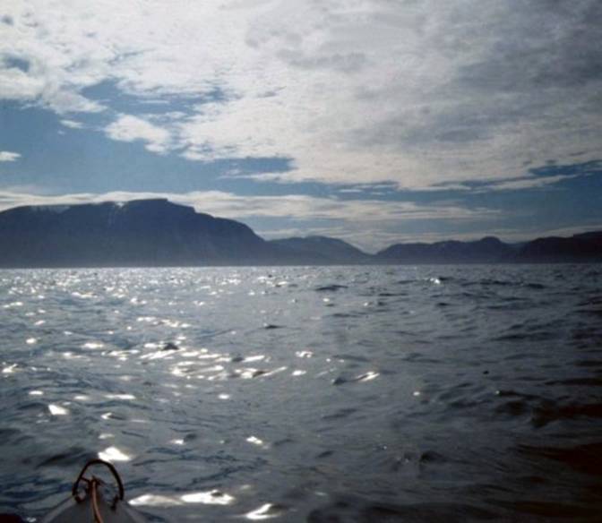
I decided to cross to |
|
Passing next to the vertical rock faces of |
|
|
|
Very suspiciously there appeared an odd arrangement of small boulders
across the dead flat water, which I happened to notice that stretched from |
|
|
|
Little bells went off in
my head, "something tells me that this is a very shallow spot about to
become exposed as the tide is now reversed and some of those small rocks look
like there isn't much water around."
Quickly I jumped out of my kayak, grabbed the bow and deftly "hot
footed it" dragging my kayak with just barely enough water to float it
across this strategically placed sand bar.
A few minutes later and I would have had to unload and carry
everything across. You never saw
anybody as glad as I was when I got to the other side, because in the next
instant the passage was dry. The
scenery was nice, but I was not in the mood for the tide to fill back in so
that I could float my boat. Whew that
was a close one! My friends got there
too late and had to carry their boats across.
Funny thing though, When we had stopped for lunch I just felt like I
should keep going, never imagining that the tide would create this situation. |
|
|
|
I wonder if that could have been a possible fish weir because the
placement of rocks seemed more likely to be the work of people that nature. |
|
Now I was faced with my first solo Arctic crossing. I was crossing the eastern arm of Tay Sound
in bright sunshine with completely benign conditions. |
|
|
|
I was not at ease about
this but this crossing was not only a paddling event that I could do but that
I had to do for myself. Sometimes fear
is not a good thing! But at long last I got to the other side. The crossing seemed to
have taken ages, but it was just a routine crossing. It is interesting how anxiety can make time
take so long. I stopped at a brook for
some nice fresh water, and there as I was leaving I spotted some delicious
Green Sea Urchins, large enough to eat distributed all over the submerged
rocks. I decided that I was going to
enjoy these tasty morsels in style. I
never passed a Green Sea Urchin I didn't like. My idea of style for sea
kayakers is that one should be grabbing and enjoying their catch while sitting
in the kayak. I decided that with a
little paddle juggling I could pry off the rocks my Sea Urchins, place them
on a flat area, smash them open with my paddle, and devour their gonads
material, which is orange egg shaped balls in the top of the shell or
test. Well it worked, and I dined
without candelabra - the sun was shining.
Actually you can leave the candelabra home, because it is never quite
dark enough in the |
|
I progressed along the fascinating
endlessly complex metamorphic gneiss in charcoal grey being awe inspired by
the never ending interwoven striations of white and pink feldspar resembling
cotton candy swirls. |
|
|
|
Quietly paddling along my
solitude was broken by the splash of a curious seal from behind me. Luckily I had experienced this before off
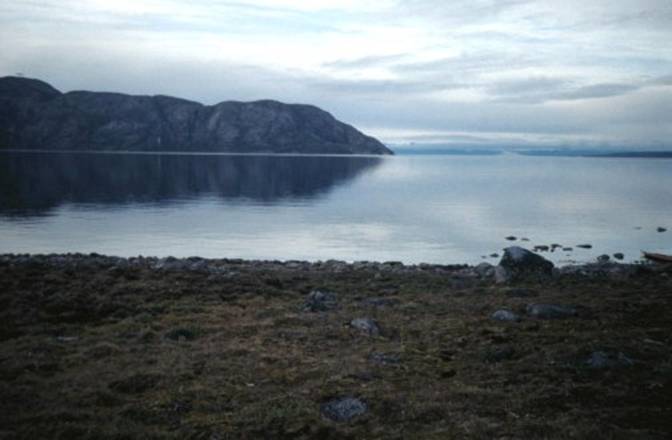
the coast of Once again I arrived at
our old campsite behind Qorbignaluk Headland on Tay Sound, where we last were
on our fourth day. About an hour later
after I had found a pleasingly soft, level, slightly dry campsite and set up
my tent I heard the familiar voices of my French friends. |
|
our tents with clouds over head creeping downward |
|
In the Arctic one does
not find dry soft areas as the softer they are the wetter they are too. They had been following
me after they had eaten their lunch. Unfortunately when they
arrived at the southwest tip of However after they
crossed Tay Sound they also found the same treasure of Sea Urchins I had
found, which they gathered in a bag and we dined on these as an evening
appetizer. Wow that was good! Nothing like eating some Uni freshly gathered
from the water. |
|
We had a rather innocuous
evening when we retired, however the next morning our eleventh day which we
had planned to rest and do some hiking for a change, turned out to be a
stagnant day for the weather |
|
another view of the clouds creeping up and down |
|
A rainy foggy storm,
which was a small stationary front, just hung in the air over us trapped in
this area and I could see five miles away another weather condition. I later learned that this can happen in
this area of fjords. We had
cumulonimbus clouds stuck so it seemed in our valley at about 1,000 feet on
the back slope of Qorbignaluk Headland. Here we could have pretended that we
were angels and St. Peter in these clouds just by walking in and out of
them. We spent the day relaxing and
exploring. |
|
|
|
Our twelfth day was
slightly windy, just ten knots, and we had bright sunshine. We crossed |
|
With the tide receding
and a light headwind I left my friends once again heading back to Pond Inlet. Being alone along this coast I knew was
unlikely to be dangerous, because I could land anywhere most of the way
back. There were no high cliffs, instead there was just a low sandy terrain. The possibility of finding a polar bear was
not likely in this area. |
|
|
|
The wind stopped
blowing. The tide assisted me as hour
after hour the miles went by. Being
alone I encountered a flock of Snow Geese at close range which I forgot to
record on my Cam-Corder. The water was
clear and the gravel and rocky bottom was colorful and interesting to
study. The only ice around were
occasional icebergs here and there in the shallows across the bay about
twenty miles away. I passed a large hunting
camp on a point, which had a few large tents. As the evening hours approached, a number of motorboats passed by heading in
the direction of the camp. Other motor
boats headed out to the west for |
|
|
|
At any one time you can ask a person where someone is in Pond Inlet
and it is very unlikely that person does not know another person's
whereabouts such as what camp they have gone to. But when it comes to time that is a
different concept. The Inuit do not
adhere to a time schedule but do traveling and tasks when they feel it is
appropriate. Sometimes this can be
difficult to relate to; but when the sun just keeps circling around twenty
four hours a day, time seems absurd. |
|
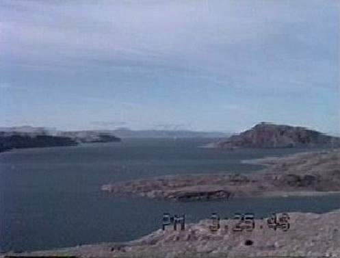
looking across at |
|
I found an expansive
sandy beach to land my kayak on and prepared camp. Now the motor boats were passing by so
frequently that I decided that I must have arrived at "Broadway and
42nd. Street." I didn't have to even consider that I was alone. As I was cooking dinner in the long orange
rays of the waning sun suddenly I found that I was being visited by a curious
Arctic fox. I was so completely
surprised that I did not even think to try to take some pictures of him. He danced and pranced on his toes around my
Kayak, inspecting everything. I had
not in my wildest imagination thought that an Arctic fox can be this precocious. I had read of this trait in Arctic foxes,
but I did not think that it would be likely I would encounter such a
fox. The only other wild animals I can
think of which are similar in personality to the fox are ravens and seals,
which enjoy heckling people especially campers and kayakers. I slept well and awoke to
a bright sunny thirteenth day. After a
leisurely breakfast, with two cups of Italian coffee no less, I launched for
the final push to Pond Inlet. It was
brilliantly sunny, a dead calm and then there came this soft wind from the
west generating gentle swells more widely spaced that they were high, which
had the character of ground swells.
These gradually increased in height as the wind blew for a more protracted
period. I came upon a shoal beach with
outlying islands, which seemed to enlarge these swells. As these swells
became restricted by the confining shallows, they were forced to crest and
break. Luckily the beaches were
varied enough so that a protected area could have been found if necessary. The water was just rolling but flat until I
noticed in the distance a darkening on the surface of the water. I just thought that it might be a color
difference because of a current since I was working my way up and around
beginning to head more and more easterly toward Pond Inlet where I knew there
was a distinct tidal current, which I had become aware of when I paddled
against it. |
|
|
|
Well, that darkening of
the water at a distance gradually drew closer and closer until it was upon
me. Guess what, it was caused by a
freshening wind coming from the east. The wind from the west,
which had generated the long swells dissipated and now I had wind in my
face. The cloudless sky had given away
to increasing clouds. Paddling became
interesting as waves from the east which were a short chop would intermingle every so many sets with a ground swell from
the west, some thing familiar to me in Long Island Sound paddling conditions
on occasions. The waves had a rhythm of
about three sets from the east and one roll from the west, which I took
advantage of, to make some progress against the wind coming from the
east. And as the wind speed from the
east increased the more ardently I paddled my craft, working harder and
harder to round one of the large unnamed points, which seemed to separate
east from south in Eclipse Sound and Pond Inlet. Now the tide had changed against me. I thought I was never going to see the last
of this unnamed point. I found that I
was engaged in treadmill paddling as I was inching my way eastward. I just did not want to give up. And so I plodded along the shore as the
time passed by. Finally as I had made
progress enough to see the town of |
|
When I found a suitable
ravine I took advantage of the intermittent larger swells to bring my Klepper
up as high on the beach as I could without having to carry it. Then I unloaded my boat, picked it up and
carried it up to the ravine. The
ravine had enough area to set up my tent and I enjoyed its shelter while the
wind pummeled the rest of the grey world. I slept and dozed in my
tent like a bug in a rug. Then I awoke
to find the sun peeping through the clouds.
The storm was subsiding. I
found that I could not ignore the brilliant yellow rays of the sun, and so
with renewed energy, I decided it was time for a celebration cup of my favorite
Espresso and some dinner. Further up in the ravine,
which I was camping at the mouth of, I found a protected cooking area. I gathered some water, which was also
conveniently available. Ah! Nothing
like a good cup of espresso to make a party. As I was waiting for my
espresso to erupt in its usual fashion in the pot, I glanced up to gaze at
the opposite side of the ravine when suddenly I saw an Arctic fox standing
there only about seventy five feet away.
I was shocked to see this little creature sniffing the wind trying to
figure out what I was doing. Then he
paced over to my left but a little closer and sat down. I had to watch the stove and coffee pot,
but that did not disturb my very curious fox visitor. Then after sitting a few moments the fox yawned,
as if bored in general, and then proceeded to scratch an itch behind his
ear. Some shedding hair came out of
his tan and brown coat as he scratched; and then just to be thorough, he
shifted to the other side to scratch that side. He paused in his toiletries to watch me
some more. He got up again and
resituated himself, this time to my right and a little closer and once again
resumed his toiletries of scratching and some more yawning. I shut off my noisy stove and dared to pour
myself some coffee, which didn't disturb my guest in the least. He could stand his curiosity no longer and
walked directly to within six feet of me, when in fear that he might be rabid
I shooed him away. He turned and ran
off continuing his endless tour of the tundra. I thought he might return of that I could
relocate him later, but after much walking and looking I found that he was
gone. All of this took place
and I did not dare to get up and go get my camera. Now in retrospect had I known that a fox
might have as tame as this one was, I would have taken the risk. He did not run away until I actually shooed
him away. I found that my encounters
with foxes took place when I was cooking and probably when cooking it would
be wise to have the camera available. |
|
Now that the wind had
died down and I felt energetic, I broke camp and headed for the I had the low tide
running with me, but I had to cut a wide berth of about a mile off shore to
avoid the shoals of the Salmon River. Happily I arrived back at
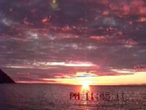
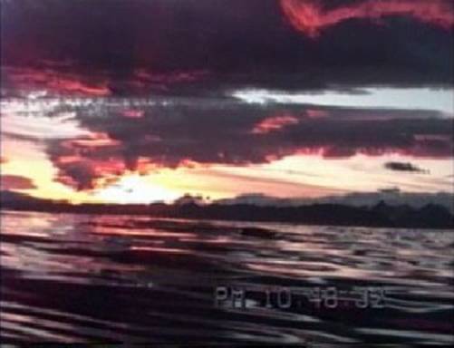
Pond Inlet at 11:00 p.m. as it was beginning to grow dark and the frost was
coming. This photo below I took
holding my video camera just above the water to capture the light on the
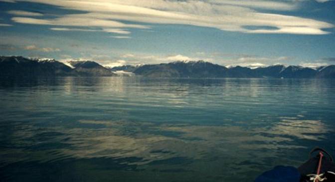
waves in this sunset. I wanted to capture what a sunset looks like from a
kayak at water level. |
|
|
|
The next day my friends
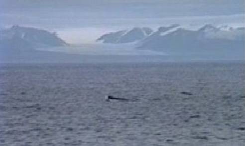
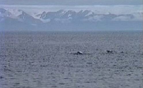
arrived and I made a day trip to My friends told me that
they were frightened that this pod might be some Killer Whales, how lucky I
was that they were seals. |
|
|
|
I took this photo from the shore of Bylot island across from the bay
just before Mount Herodier. |
|
|
|
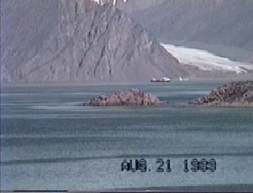
As I arrived at Mount Herodier the cargo ship from Montreal arrived. |
|
|
|
|
|
I turned around for my last paddle to Pond Inlet and who knows when
you take pictures and videos what you might get to tell people years later on
the internet! |
|
|
|
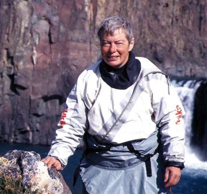
Gail E. Ferris, 1 Bowhay Hill, |