|
|
|
Adventures in Good Paddling 2005 Complete with
Another Visit to Upernavik Greenland - only this time I was paddling on the
edges of and crossing Upernavik Icefjord. |
|
Gail Ferris |
|
Gaileferris@hotmail.com |
|
Once again I decided to take my folding kayak, Mark I,
my camping gear, food and clothes for a month and spend August in the fjords
of Upernavik. For the purpose of
studying the kayak I have been coming and going since 1992. |
|
|
|
|
|
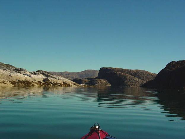
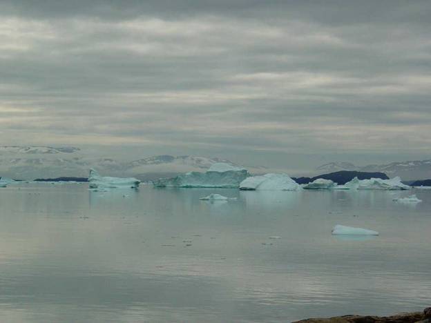
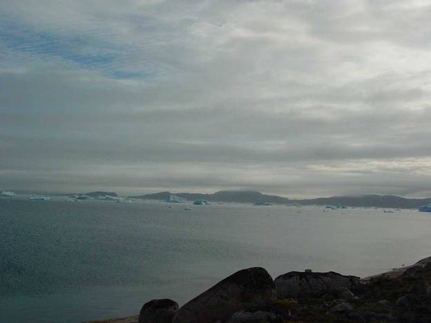
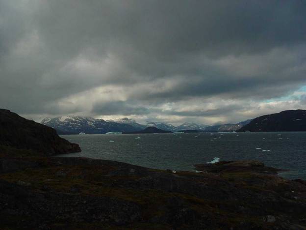
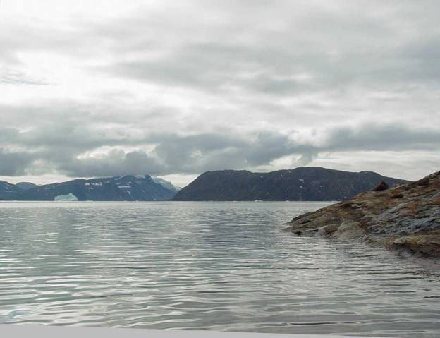
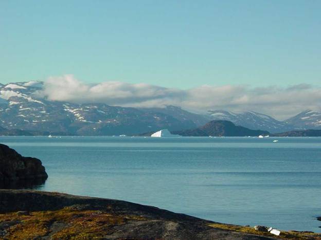
This time I was to paddle across the Upernavik Isfjord
at some point in my travels. This
crossing I feared because of its numerous, sometimes unstable and fast moving
icebergs. |
|
|
|
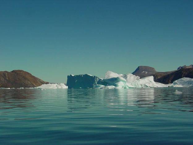
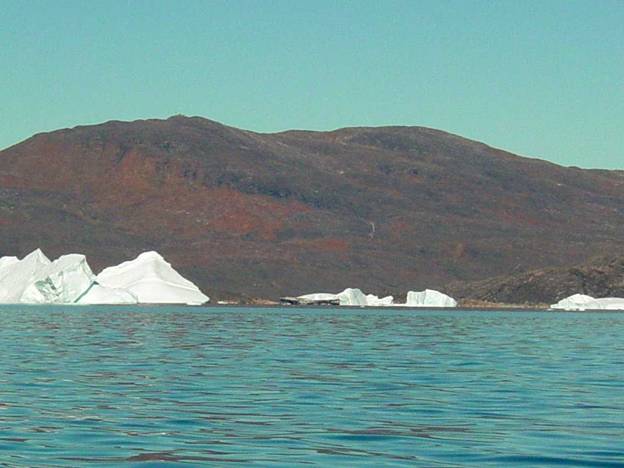
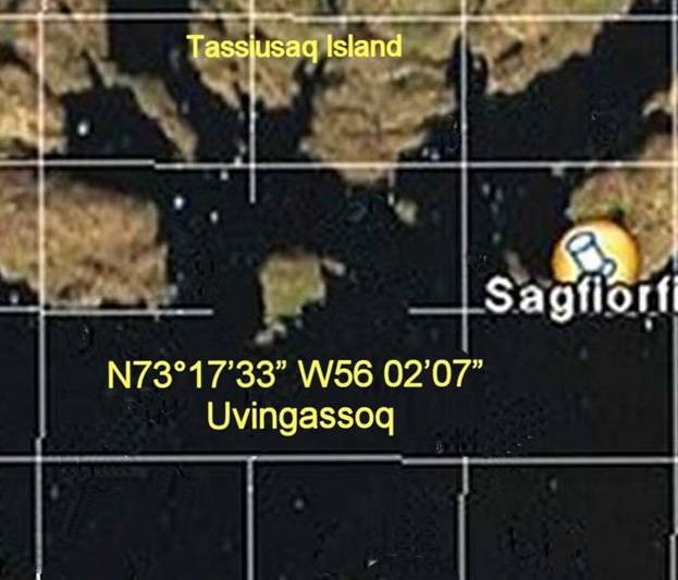
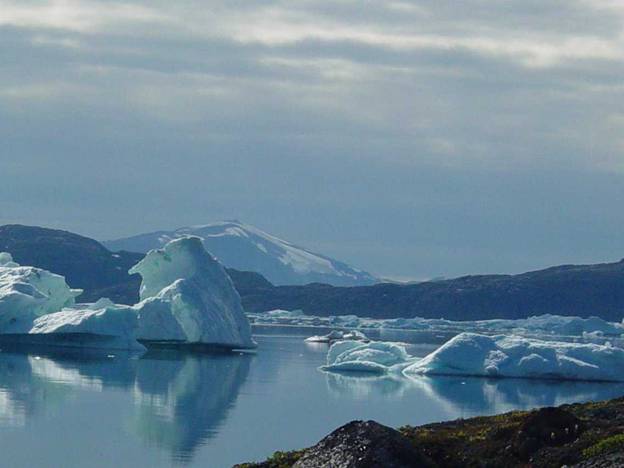
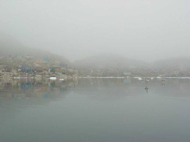
7304N 5630W Upv Aap compressed |
|
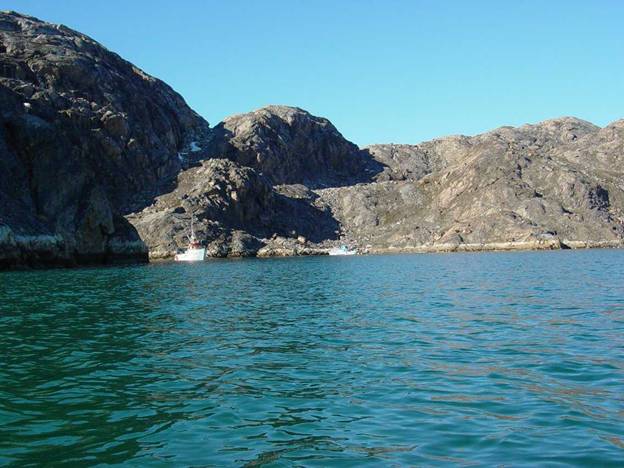
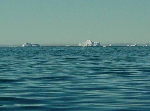
The shortest crossing distance was about four or five
miles but the icebergs were marching back and forth each to their self
appointed destination. Each iceberg
has its own personality. Some of them
are very stable, especially the tabular or smooth flat topped bergs. However I could never know when one of
these might decide to make a loud sound like thunder as it dropped a huge
chunk of ice into the water sending out a steep sided, fast moving wave
anywhere within range. |
|
Other bergs are even more threatening because they are
of unstable slab sided construction riddled with slabs of dirt interspersed
through out. These bergs can sudden
disintegrate sending out even larger waves along with a load of new chunks of
ice. I knew that I had to ask about
how to handle these threats in my little kayak. Even motor boaters, as fast as their
motorboats might be, give these saw toothed topped icebergs a wide berth to
avoid such encounters from their unpredictability. |
|
With all this on my mind this time I was without
question quite anxious about my once again undertaking another solo kayak
expedition. |
|
However I just could not say no to another trip but this
time I planned a different strategy. I
brought a satellite telephone so that I could actually communicate should the
need arise and I made arrangements to have myself transported by motor boat
across the Upernavik Isfjord to a camp site rather than set out from
Upernavik in my kayak. I was very
nervous maybe old age had caught up with me as I was now 59, but who knows,
all I knew was that I was anxious. |
|
This time I had the fine luck of booking my flights
completely through with no stop-over.
I was to begin by flying across the Atlantic Newark to |
|
In preparation for the physical demands of this
adventure I took Pilades exercise to give me better strength and
flexibility. |
|
For my back I sleep on the floor on a self-inflating
Therm-a-rest mattress. This has kept
most of my back problems under control as well as keeping me adjusted to
sleeping on the ground. |
|
A couple weeks before I left for to Upernavik I
telephoned every possible friend in town I could think of. I vainly tried to get a room in anybody’s
house to stay for a couple days while I would be making final arrangements
for my kayak travels in the fjords. |
|
As it happens, in July and August anyone in Upernavik
who can goes out visiting and traveling before school restarts, just as I
was. As can be expected none of my friends
were going to be around. I was stuck
thinking that I would have to rough by camping near the helicopter airport,
deal with all of that luggage and have to walk a long distance across town to
visit the Museum. |
|
|
|
1952 |
|
I happened to mention my problem to Bo Albrechtsen, the |
|
This house B-98 I had fond memories of because it had
been beautifully restored since I started visiting Upernavik in 1992. I was deeply pleased to see that it was
still in the same beautiful condition as when I last saw it in 1999. |
|
My greatest anxiety had been that drive to DWR, |
|
I did not feel confident in using regular passenger
transportation to |
|
Missing the first flight is not an option because the
connecting flights are much more difficult to access because of their more
limited scheduling and heavy passenger loads. |
|
To further add
complexity to this sort of travel, just add a little foul weather into the
picture like a wind storm or fog in Upernavik forcing a shutdown in air
service for that flight. Oh it’s just
another detail to add into the picture. |
|
Out of shear luck I learned that my neighbor is a
professional driver who could take me with my awkward heavy fabric luggage
bags in his pickup truck to the airport.
|
|
We had a grand time chatting on our way I so appreciated
his mature judgment and skill at getting me to the airport in plenty of time. |
|
Leaving my house Friday at before |
|
My second flight was Saturday morning, |
|
Søndrestrøm / Kangerlussuaq looked just the same as
always, bright and sunny, as we flew up the long fjord for our landing. |
|
It is amusing to think that this was established as a
weather station in the 1920’s by the |
|
So far so good, but that was easy. |
|
Now I had to successfully fly to Jacobshavn / Ilulissat. |
|
On one of my earlier travels that airport was fogged in
causing me to miss the ferry to Upernavik.
I had to loose a few days waiting for a seat on the very expensive
helicopter to Upernavik. In that
situation I had to camp out on the hillside in front of the airport so that I
could check a few times a day for the next possible flight to Upernavik. |
|
No kidding, my flight to Ilulissat / Jacobshavn went
without a hitch because we had good weather and we even got to touch down for
a quick stop at Aassiat to pick up and discharge a few more passengers. In the last moment we got to see the famous
Jacobshavn glacier constantly calving huge icebergs. |
|
The icebergs do not look all that huge until you see a
large boat or ship near them looking like a mere black speck. |
|
Now I was in familiar territory where at least I could
see some icebergs as we flew over |
|
Coming into Upernavik, the Dash 7 pilot did the usual
short runway landing. We did not have
a view of the airport until we were right on it. We just dropped out of the clouds and landed
almost simultaneously. It seems like a
Dash 7 could land almost on a dime. |
|
I arrived at |
|
One
thing I have learned from all my journeys to Upernavik starting in 1992 is to
just hop on the flight opportunities as they come along, because you never
know where you may find yourself unfortunately stuck somewhere for an in
determinant length of time because of bad weather or other problem. |
|
The
last time that I flew home from Upernavik in 2003, they gave me a pen and a
deck of cards. I thought to myself “is
this an omen that I might become stuck somewhere playing endless games of
solitaire and writing my memoirs?” |
|
I
kept those cards as a good luck charm so that I might not become get stuck
anywhere along the way. I thought to
myself “if that is all it takes, just carrying that deck of cards along so I
don’t get stuck, I’ll do it!” |
|
When I boarded SAS in |
|
At Upernavik airport, Heinz, the school and museum
janitor / pedel picked me up. He is
just such a wonderful helpful man who is especially considerate of being
helpful and about being places on time.
|
|
Bo
Albrechtsen, the |
|
Heinz loaded my bulky overly heavy bags drove me to B-98
and unloaded and stowed me safely away handing me the key to the house. |
|
I was to spend the next two nights resting and visiting
old friends. It was nice to be in town
just long enough to recuperate. I
needed to finalize those last minute details which could only be done once I
was actually there. |
|
All the while I was most anxious to get going because
the last thing I wanted to have happen was to be trapped there. How well I knew that some unknown problem
could arise or bad weather could keep me there. |
|
Adventure on the water has its own special calling and
after such a long time I felt the call to be once again reunited with my old
wonderful friend which is the world of kayaking on the open water from place
to place endlessly experimenting with paddling in the ever changing
waves. Those times of looking out the
window just wishing does not do it.
Now was the time for action. |
|
This time however I was quite anxious about the
icefjord. I had never actually paddled
across it. |
|
During my first visit in 1992 to Upernavik, |
|
On my previous visit in 2003, a normal year, the ice on
the north side of |
|
In planning this trip I had to consider that unknowns
such as the ravages of wind and tidal current can push the ice packing it
into areas making them impassable. |
|
Intense wind storms can come in from |
|
I had just arrived and found myself comfortably
ensconced in Upernavik museum’s guest house.
It was comfortably heated, complete with kitchen running hot and cold
water bathroom all in good order. I
had a bedroom all to myself and in the familiar living room I immediately
located the trusty old TV, figured out how to turn it on and collapsed on the
plush couch in front of it. I fell
asleep contentedly listening to the usual selection of KNR TV. |
|
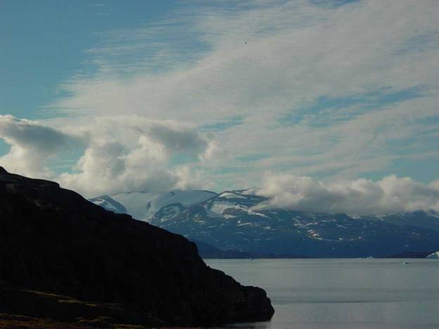
Out over the water the sun pierced the grey clouds. There were some islands and icebergs in
view through the west facing living room windows. I thought to myself, how many times before haveI seen this scene, because I lived and worked here at
the Museum 1997 into 1999. |
|
|
|
1949 |
|
The light at this latitude is different and makes things
such as those icebergs, islands and rocks look different than anywhere else in
the world. Today they have a
black-iron grey look to them. |
|
As I gazed at the water I was glad that I had arrived
with all of my equipment and that none of my baggage had gone astray. I was looking forward to getting on the
water. |
|
Out there were those exquisite granite islands and
peninsulas I had rounded so many times before in my kayak on my various
journeys over the years starting in 1992?
Once again I had come here to paddle my kayak alone on another adventure
into the unknown. This time it was to
an area I had only once glimpsed from a quick motorboat trip but never
experienced from my kayak. |
|
How glad I was that the weather was not some depressing
combination of nasty, cold, windy or rainy weather with gigantic waves
crashing against the rocks a few hundred feet out in front of this
house. |
|
Here near the |
|
Yet, out from the rocks, just a short distance away
these waves are mere swells not especially threatening unless there is a
strong wind over fifteen knots pushing them.
|
|
Once the wind is over fifteen knots weather forecast
conditions “cooling winds” in Danish are issued to warn small boaters of this
small craft warning. |
|
The trick I use when in my kayak is to not get trapped
in that type of wave situation when coming in for a landing. If I have to come in for a landing in these
conditions I make a quick landing, jump out pull my kayak up out of harms way
before the next wave rolls in and grabs me and my kayak. |
|
Unless I have no other choice, I would just look for
another spot. |
|
Out away from the rocks the waves are usually not that
large, however they usually have the same cadence or timing and size range as
waves in Long Island Sound. |
|
What a pleasure it was to have Heinz pick me up because
I was really wondering how functional I would be after having been traveling
for a day and a half non-stop. I
imagined myself just walking into objects etc. in a state of somnambulant
fatigue. |
|
In
previous years when there was only helicopter service to Upernavik it was
very common to be stuck waiting for the weather and in my case also waiting
for a helicopter that could accommodate my excess luggage too. I made many anxious trips to the airport
awaiting an opportunity for a helicopter flight. |
|
It
seemed strange to me not to have to worry about that problem anymore when
flying to and from Upernavik, but what a relief not to have to worry about
that anymore. |
Sunday
July 31st-
|
|
On
Sunday, typical of |
|
I
went to church and did not understand any of the service because it was all
in Greenlandic since nearly all the parishioners Greenlanders. Four babies were baptized in a lovely but
short ceremony. Some of the families I
knew but unfortunately I did not know the parents so I shyly left after the
service. |
|
It
was unfortunate that I have never become fluent in Greenlandic because this
was one of those moments when I would have been happy to chat with the
parishioners. I felt quite helpless not being able to communicate. |
|
On Sunday July 31st- Bo Albrechtsen was attending a special jubilee
celebration for the town / bygt, Kangersuatsiaq / Prøven. Many people in Upernavik have lived in
Kangersuatsiaq and have relatives there.
I paddled to Kangersuatsiaq in 2003 just to see this town because I
had heard about it from so many people in Upernavik. |
|
|
|
|
Bo Albrechtsen
told me the Greenlandic English meaning to many frequently repeated names on
the map of landforms. After all these
years it is nice to know these things.
I wish that I had known them sooner. |
|
The names describe, in the sense of how the land looks,
a particular name for an island, activities on an island or relate to the
historic usage of an island. |
|
Aappilattoq – red, |
|
Amarortalik – island with wolves, |
|
Ateqdrangitorssuaq – with no name, |
|
Augplia – in a, |
|
Ikerassuk – a passage, |
|
Ilua – inside, |
|
Innarsuit – steep, |
|
Miut – people from, |
|
Naajat or Naajat – breeding place for Roseate or small
white gulls, |
|
Nunatarssuaq – a large piece of land, |
|
Nutarmiut – new people, |
|
Puguta – dish, |
|
Pugutalik – place with a dish, |
|
Qterssuqq – big one in the middle, |
|
Sarqarssuaq – large south side, |
|
Simintaq – bottle stopper, |
|
Sinerraq – long side, |
|
Suaq – big, |
|
Ujaragssuit – big stones, |
|
Umanaq – looks like a heart, |
|
Out of interest I have assembled this list of the names
of birds in English, Latin and Greenlandic, because some areas are named for
the birds commonly found there. |
|
Arctic tern - Sterna paradisaea - Imeqqutaalaq |
|
Atlantic Puffin - Fratercula arctica - Qilanngaq |
|
Barnacle Goose - Branta leucopsis |
|
Black Guillemot - Cepphus grille - Serfaq |
|
Black-Bellied Plover - Pluvialis apricaria -
Anngilik |
|
Black-Headed Gull - Larus ridibundus - Nasalik |
|
Black-Legged Kittiwake - Rissa tridactyla -
Taateraaq |
|
Brant Branta bernicla - Nerlernaq |
|
|
|
Common Eider - Somateria mokkissima -
Meqsiorartooq (Aavooq) |
|
Common Loon - Gavia immer – Tuullik |
|
Common Redpoll - Carduelis flammea - Opimmiutaq |
|
Cormorant - Phalacrocorax carbo - Oquitsuit or
Oqaatsoq |
|
Dovekie - Alle
alle - Appaliarsuk (Appaaraq) |
|
Dunlin - Calidris alpine - Saarfaarsuk |
|
Glaucous Gull - Larus glaucoides - Naajaannaq |
|
Greater Black-Backed Gull - Larus marinus - Naajarluk |
|
Grey Gull - Larus hyperboreus - Naajarjussuaq |
|
Gyrfalcon - Falco rusticolus - Kissaviarsuk |
|
Harlequin Duck - Histrionicus histrionicus
- Toornaviarsaq |
|
Hoary Redpoll - Carduelis hornemanni -
Orpimmiutaq avannarleq |
|
Horned Lark - Eremophila alpestris -
Qutsissormintaq |
|
|
|
Ivory Gull - Pagophila eburnean - Naajavaarsuk |
|
King Eider - Somateria spectabilis - Miteqsiorakitsoq |
|
Kumliens Gull - Larus glaucoides - Naajaannaq |
|
|
|
Lesser Golden Plover - Pluvialis |
|
Long-Tailed Jaeger - Stercorarius longicaudus -
Papikkaaq |
|
Northern Fulmar - Fulmarus glacialis - Qaqulluk
or Timmiakuluk |
|
Northern Gannet - Morus bassanus - Sulabassana or
Timmik |
|
Northern Phalarope - Lobipes lobatus -
Naluumasortoq |
|
Northern Raven - Corvus corax - Tulugaq |
|
Oldsquaw - Clangula hyemalis - Alleq |
|
Parasitic Jaeger - Stercorarius parasiticus - Isunngaq |
|
Peregrine falcon - Falco pereginus - Kiinaaleeraq |
|
Pomarine Jaeger - Stercorarius pomarinus - Isunngarsuaq |
|
Purple sandpiper - Calidris maritime -
Saarfaarusuk |
|
Razorbill - Alca torda - Apparluk |
|
Red Knot - Calidris canutus - Qajorlak |
|
Red Phalarope - Phalaropus fulicarius - Kajuaraq |
|
Red-Throated Loon - Gavia stellata - Qarssaq |
|
Rock Ptarmigan - Lagopus mutus - Aqisseq |
|
Ross’ Gull - Rhodostethia rosea - Naajannguaq |
|
Ruddy Turnstone - Arenaria interpres Taliffak |
|
Sabine’s gull - Larus sabini - Taateraaruaq |
|
Sanderling - Calidris alba - Saartaarsuk |
|
Snow Bunting - Plectrophenax nivalis -
Qupeloraasuk (qupannaaq) |
|
Snow Goose - Anser caerulescens - Kangoq |
|
Snowy Owl - Nyctea scandiaca - Uppik |
|
Thick-Billed Murre - Uria lomvia - Appa |
|
Thin-Billed Murre - Uria aalge - Appa siqquttooq |
|
White-Fronted Goose - Anser albifrons - Nerleq |
|
Before I left Upernavik I took it upon myself to be
truthful with Bo
Albrechtsen and Tom Osterman, an old friend and policeman, about my
anxiety of taking this another solo kayak trip. This had been on my mind for quite some
time. I thought that rather than play
the foolish game of pretending that I was comfortable about taking this trip,
this time, in all honesty, I would talk my anxiety before I took this trip. |
|
In the old days I would never divulge any of this
anxiety until I had returned. I
assiduously choose who I would share with that I had any anxiety whatsoever;
because I did not want to risk anyone talking me out of my undertaking. |
|
This time I knew that there was really no way I could
cover-up my anxiety. My face and body
language had to be revealing all too clearly my acute feelings. |
|
How well I know that feelings do show very clearly in
body language. I thought it would be
best that I, for the first time in my life, discuss this delicate issue
before I embarked on this another one of my solo kayak adventures. |
|
Usually I would have avoided at any cost a discussion of
this nature because I did not want someone to talk me out of my undertaking,
but this time was different. Beginning
in 1992 I had made these trips so many times before, but now I am just that
much older, enough so seem to me as possibly being more of a factor. |
|
I was somewhat more concerned about being able to
physically handle the heavy demands of this sort of travel. Even though I had pared my overall load
down as low as possible, still the loaded kayak was very heavy to get up
above the high tide line. |
|
Bo is a most compassionate person and he most kindly
reassured me ”You will be alright you have done this
lots of times before, you know what you are doing”. He was right. I was so pleased that he really does
understand how skilled a kayak paddler I am.
How careful a planner I am and how scrupulously I had chosen the
particular kayak I was using and all the equipment. He confided in me that this area is really
not an easy place to chance paddling a kayak.
I agreed just an iceberg falling apart can change things in a
moment. I was so pleased that he
understood enough about kayaking and the tricky weather in this area to
truthfully tell me “you know what you are doing”. |
|
Tom told me”it is not a good thing to take a trip you
are so anxious about because your anxiety may cause you to get into trouble
you would have otherwise not had”. He
was right about that too. And from
that I took it upon myself to keep my head on and stay dead calm. It was either do that “Straighten out and
fly right” or quit. I did not want to
quit. |
|
My visit with Bo was confined to Monday because he was
leaving while I would be paddling and not returning until my departure date
of August 27th. This was
the same day that both Tom and Bo were returning to Upernavik on the same
plane I am leaving on. I was glad I
would at least see both of them even for just a short moment to tell them
face to face how things went to say a final farewell. |
|
I anticipate that this might be my last trip to
Upernavik because the cost, the stress and the physical requirements. |
|
Throughout my life curiosity to go see for myself what
things look like and to be able to share it with others has always been my
driving force for these travels. Still
it shall at some point be very hard for me to call it quits. |
|
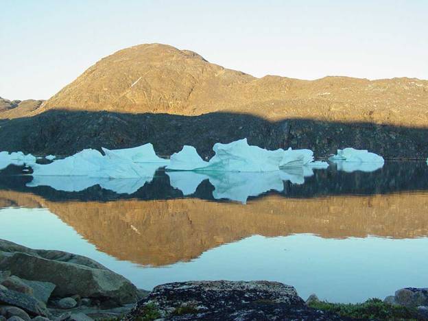
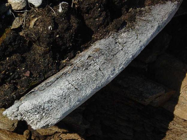
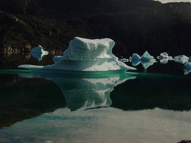
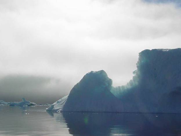
Icebergs, what are the different types and how do they
behave was my question for Bo. Just
before I left the museum at Upernavik Bo told me about the extreme danger dirty
jagged or saw tooth topped iceberg presents. This iceberg is tabular which seems safe
because tabular icebergs are usually stable.
Usually a tabular iceberg just drops small chunks off their sides from
time to time without rolling over crashing to pieces and catastrophically
splitting apart in great chunks. |
|
This tabular iceberg has the distinctive appearance of
looking dirty with a very jagged saw tooth top. The dirty appearance comes from the gobs
and black bands of dirt mixed with clear bands of ice stacked together
vertically like books on a bookshelf forming into a highly fractured jagged
topped berg with an overall tabular shape.
This iceberg has a much shorter life than an ordinary white tabular
iceberg because it will catastrophically split apart into huge chunks of ice
crashing into the water creating a huge wave.
|
|
There is no sort of warning when any iceberg will suddenly
collapse. However August is considered
as the most unstable time because of the cumulative effect of 24 hour summer
light exposure that began at the summer solstice. For some reason major collapses most often
occur at around 4 in the morning. |
|
You can just sit there and watch icebergs for hours and
absolutely nothing will happen and then out of the clear blue suddenly a berg
will with resounding thunderous explosion of sound disintegrate dropping
chunks off rocking back and forth, roll over, or possibly split up and then
become perfectly quiet as though nothing in the world has ever happened while
succinctly rolling back and forth until it restabilizes again on its new
center of gravity. |
|
An especially huge iceberg of this type grounded just
off Tussaq. In a single moment during
this spring that iceberg suddenly fell to pieces. This catastrophic collapse generated an
enormous very steep wave that roared up Tussaq nearly destroying nearly this
entire little village / bygter. In
Tussaq all was gone except a few of the houses highest above the
waterline. The huge wave had in an
instant taken away all the lower houses and pier structures within its
reach. |
|
Peter Aaronsen’s house survived because his house was
located above where the massive wave reached.
He is presently the only resident of Tussaq. All the other families have moved to
Upernavik or other small towns such as Aappilattoq. |
|
I was aware that icebergs with arches are unstable but I
was surprised to find that I was completely unaware of how dangerous dirty
jagged icebergs are. In my travel
experiences I had never seen any of that type. The glaciers in this area do happen to
generate them occasionally. Bo told me
that local boaters avoid getting anywhere near these icebergs giving them
miles of wide berth. I was very glad I
had asked Bo about icebergs because otherwise I would have never known and
might have been in very serious danger during my paddle. |
|
All I knew was that summer, especially late summer,
August is when icebergs are most unstable, don’t be dumb and paddle under
arches and grounded out icebergs could suddenly break apart catastrophically.
|
|
In preparation for arctic paddling, I took surfing
lessons and whitewater slalom racing lessons so that I could automatically
cope with the steep waves suddenly coming from a disintegrating iceberg: |
|
In 1998 while I was just out for a day paddle I passed
by what I thought were two medium sized icebergs. On my way back just as I was passing quite
luckily by the outside of them, I thought that I might just paddle to the
beach nearby to get out of my kayak for a break. |
|
All I can say is that luck was with me because in a
moment where there appeared to be two icebergs suddenly the nearest iceberg
reared up out of the water. In a
twinkling I found that these two bergs were actually one huge berg connected
together beneath the water. |
|
From my kayak I did not happen to see this ice bridge
underwater. I was very lucky not to
happen to be any closer than I was nor did I happen to have beached my kayak
at the nearby beach I was thinking about stopping at to take a short break. |
|
Among icebergs I have to think trigonometrically with
constant moving dynamics involved because icebergs constantly are changing
both in the direction they are moving laterally but also by dropping pieces
off, which changes their center of gravity thus causing them to roll side to
side or completely over, depending on how drastic the weight change has been. |
|
|
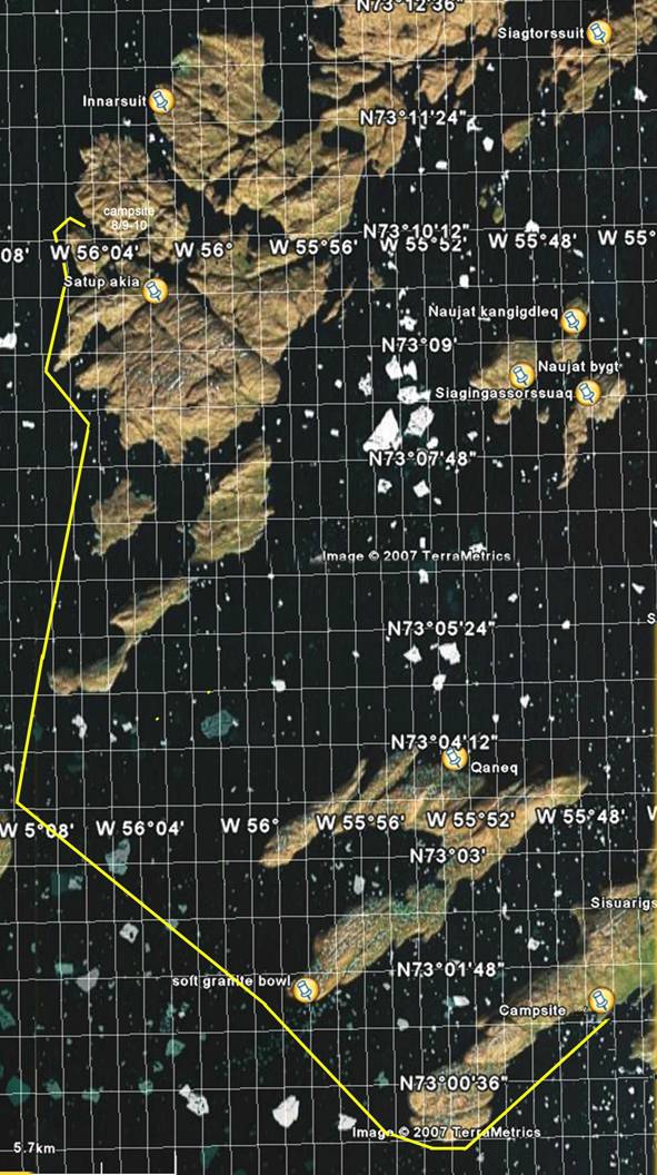
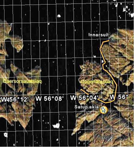
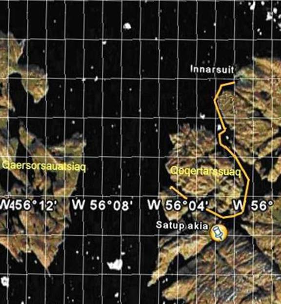
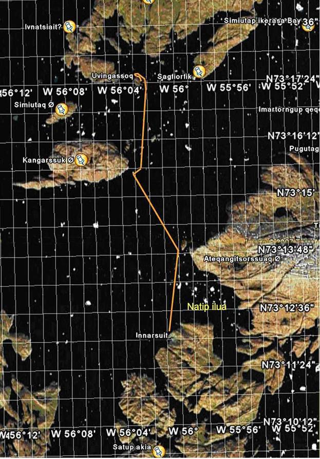
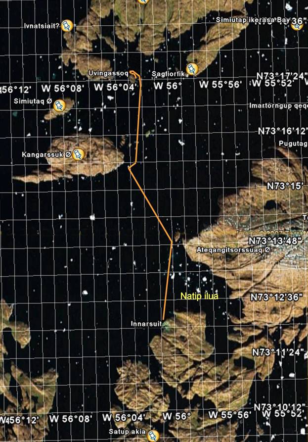
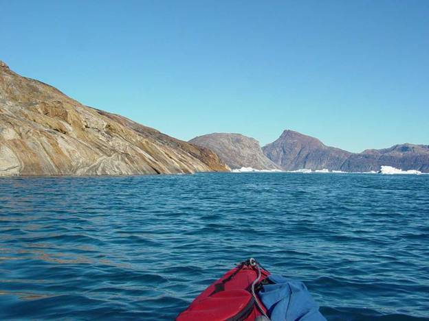
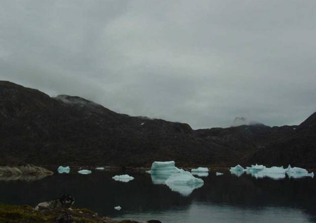
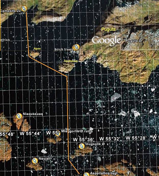
Monday on Puguta my first waypoint for this trip is 72°59.485’N, 55°39.623’W which is equivalent to
N72°59’29” W55°39’37”on |
|
David Thorliefsen, an old friend of mine and Ole Thorliefsen’s
brother, brought me by motorboat / yawl to the island Puguta (meaning dish in
Greenlandic named for its appearance) a distance of about fifteen miles. |
|
On our way we passed |
|
|
|
1962 |
|
I have always admired David for his great skill as a
hunter. He is a man of few words but
speaks perfect English. Some day, if
there is anyone I would like to go on a hunting or
fishing trip with it would be David Thorliefsen. |
|
Just as we were nearing Puguta David did ask me if I was
not sure that I might rather be dropped at |
|
Judging the size that island I figured that it must be
was large enough to have sufficient water available. |
|
Adam Grim told me that everybody used to summer on Aipee
and when they had been successful at hunting they would signal across to
their houses on Aappilattoq for boats to come and pick up the seals,
etc. That was fun to think about. Also Adam told me that he takes his family
every spring to Puguta. |
|
I have been visiting Adam and his family at Aappilattoq
since 1992 and this has always been fun. |
|
Aappilattoq is about fifteen miles away. |
|
Later I also found that taking Bo Albrectsen’s
suggestion to go to Puguta was the best choice because not only water
available but even more exciting was that there happened to be some birch
trees growing there. |
|
|
|
1961 |
|
As David let me off at my chosen destination, the
northwest corner of |
|
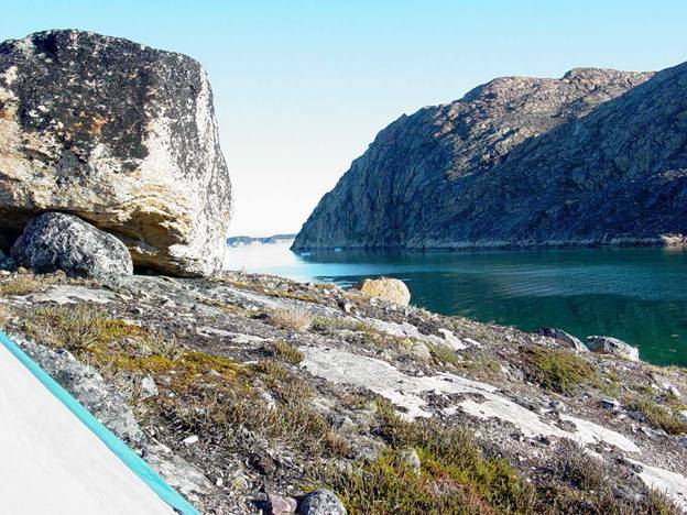
There was one complete with jagged top spanning from end
to end, a classic example, a few miles to the west. The route David took me to Puguta avoided
our coming anywhere near this iceberg.
|
|
Alone at my campsite on the point facing southwest I
cautiously kept a close eye on that insidious iceberg every few hours to see
if it was drifting toward or away from me.
This berg was to the west of me.
There was no incoming wind from the west to push this berg toward me
so the berg continued its westward out to sea drift on the outgoing tidal
fjord currents. |
|
I made sure that all my gear was well up the hillside on
the shoreline safely above any likely wave from the icebergs I could
see. The sudden break up of an iceberg
sends huge waves big enough to grab and sweep away any object in an
instant. |
|
At Kullorsuaq in 1995 I watched the break up of a
stranded berg. The loud crashing
noises brought the whole town to the shore edge grabbing their outhaul lines
to keep their motorboats from washing away.
The dogs absolutely terrified screeched in complete terror as the
water washed up to their tether lines.
How well these dogs who are on the edge of harbors know waves like
this can be deadly. |
|
As I made my camp I purposefully choose a spot that I
could set up my tent facing the doorway south to give me the best over all
view of the icefjord most especially of that insidious dirty jagged iceberg
to the west of my campsite. |
|
I thought it was a little warm as I sat in the bright
sun facing south. Sure enough I was
not imagining things, the temperature was 81°F barometric pressure was 29.80 inches
Mercury and had been very level for the past 24 hours with stable weather. |
|
The day was calm, sunny and warm which was it was just
perfect for the very robust population of mosquitoes to be out and
about. This was one of those moments
when I wished that I had brought mosquito repellant. |
|
I retrieved and donned my mosquito hat. I had modified the netting on my sewing
machine by cutting a hole in the netting so that I could see without the net
obstruction. I made the hole
adjustable by sewing Velcro around the edges so that I could reduce or
enlarge the opening as need be. I do
not like paddling and using cameras with partially obstructed vision. This design modification of my mosquito hat
worked out very well so that I could put on my baseball hat on beneath
it. |
|
I always wear a baseball cap because of its brim. I make sure that the underside of the brim
is dull black which
gives me the best distance vision on the water. I had also planned using the brim of the
baseball cap to keep the extra netting away from my face and flopping down
into my eyes. My hat worked fine. |
|
I tried out my new video camera and now was the perfect
time to quietly read the directions.
After years of paddling alone on these travels I have found that it is
best to just bringh the complete directions for
both the video and still camera. I
have found that I never know what information I might just happen to need at
the moment that I had not anticipated the need for. |
|
Specific instructions told me that the video camera
would work only after I put in the date and time. That is something I would have never
guessed. |
|
I was glad that this video camera was an 8 mm tape
camera because I was accustomed to tape video cameras and most important
reason was that I could replay the tape to see what it is recording. |
|
However just replaying the tape does make a break in the
control track of the recording if you stop when the recording ends so the
trick I use is to record a few additional seconds on the tape when I
anticipate that I will replay the tape.
At that point when I replay the tape I stop before the end of that
recording. Then I continue recording from that place on the tape. This gets rid of the break in the control
track. I do not have the patience to
prerecord control tracks, what is called blacking the tape, on new tapes. |
|
|
|
I was very excited about the birch trees because for me
so far this is the farthest north I have found birch trees growing. Birch trees have been written about by
Morten Porsild saying that Upernavik was the farthest north birch trees
grow. Unfortunately I do not know at
what latitude he last found them. |
|
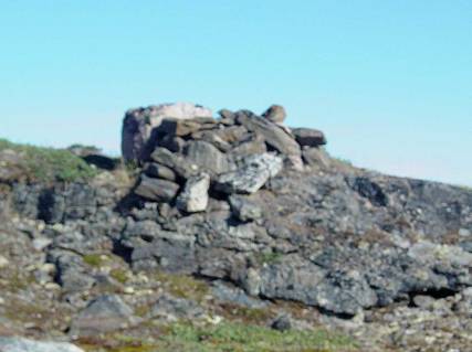
I am sitting on Puguta nua and numerous motor boats are
going by which makes me suspect that I am on the main drag to the three
bygter Innarsuit, Naujat and Tassiusak that are north and west from
here. How amusing the map doesn’t show
this double cabin fangsthus / hunters cabin right here where I am. |
|
|
|
1959 |
|
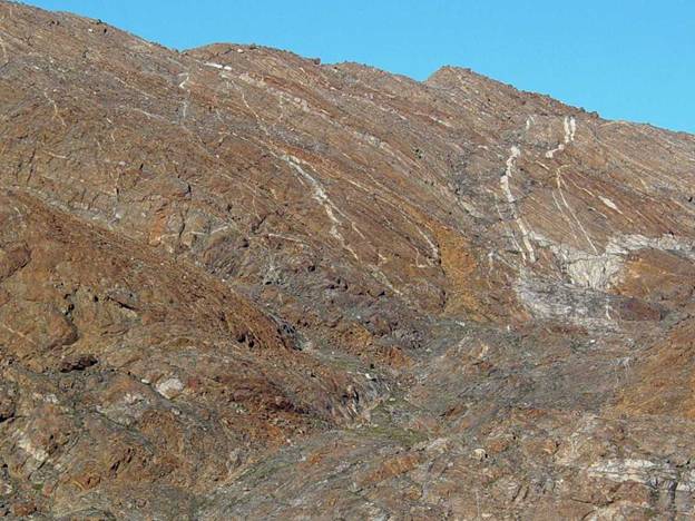
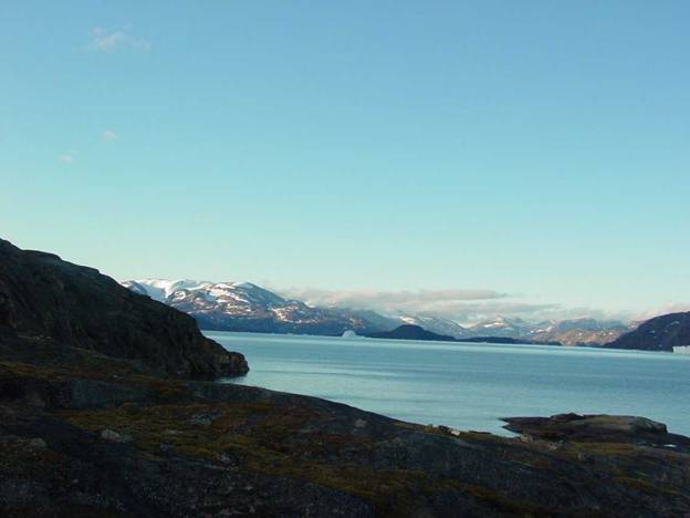
I can see the dramatic triangular peaked basalt
mountain, Sanderson’s Hope, very clearly from here. |
|
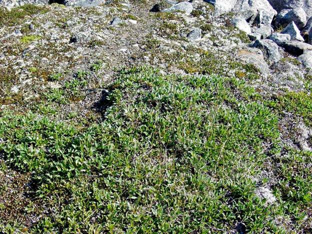
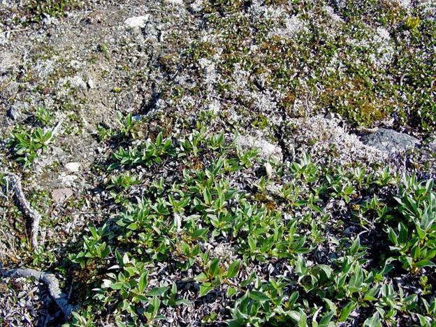
I walked around and enjoyed the vast unexpected
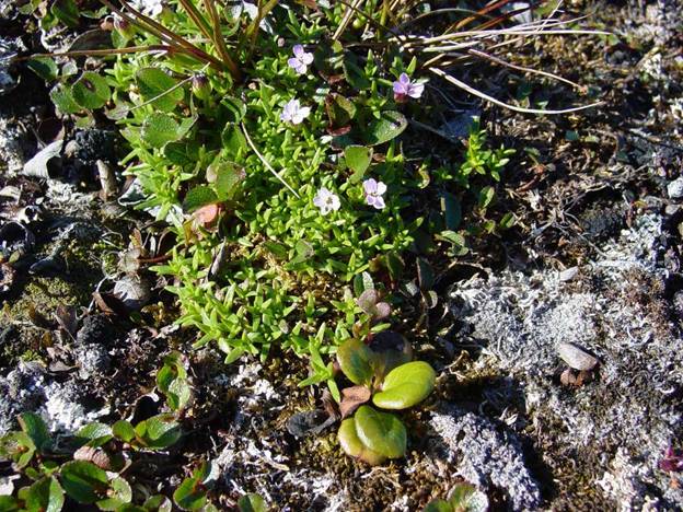
profusion of flowers, mushrooms and puffballs. Birch, Betula nana, grows here flat
to the ground in profusion. I was very
surprised to see birch growing here because the last place I had seen it was
south of here in the Torssut passage. |
|
|
|
1958 compressed |
|
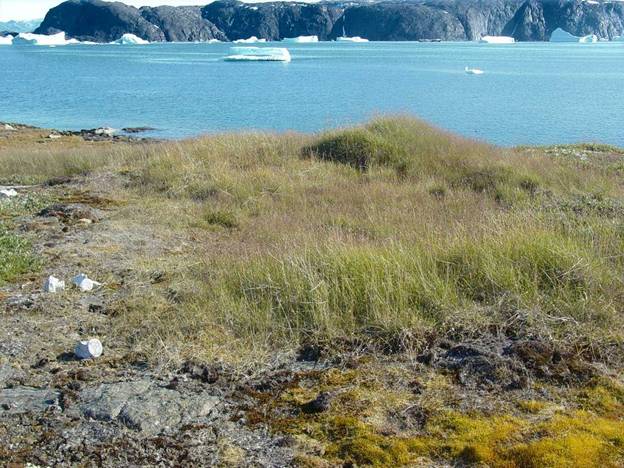
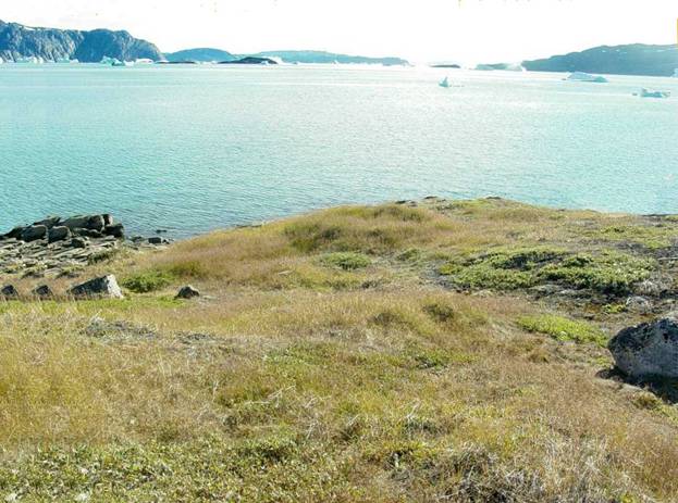
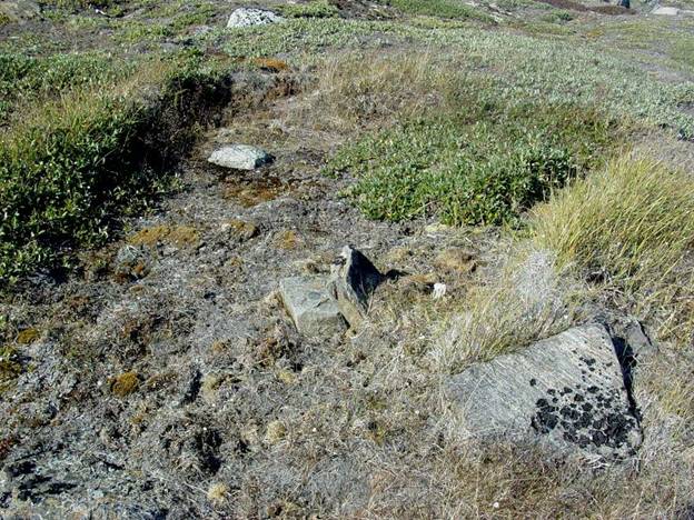
This spot was well used in the past as evidenced by very
old seal fat consolidated as a black crust on the rocks, house remains, bones
and current remains of fishing lines and seal nets. This site has many types
of grass, due to human habitation. And
grass is always a convent indicator of high nitrogen enrichment from either
human habitation or eider nesting. |
|
Here I am all alone.
Then add some anxiety – not good! Now there is no getting out of this
obligation to spend the next 24 days depending on just myself in a place
doing what I both love and fear. I lay
down under the blue sky and prayed “Lord have mercy” for as long as an
hour. I just did not know what to do
about my anxiety and then at last I found the answer that I can do this –
just pray “Lord have mercy, Lord have mercy”. |
|
For me not growing was unacceptable and life should not
to be squandered ending with “gee I wish I had experienced these adventures”. |
|
Recalling years ago, probably 1993, when a friend,
Jonhardt Dale-Jacobsen, in Upernavik gave me a pocket version of the New Testament,
how little did I know that on this trip I would make up my mind to spend
every other reading the New Testament and Psalms. Every day I would read the daily prayers in
the Orthodox Christian Little Prayer book and gaze at the icons. Through the prayers and icons I feel the
presence of God. |
|
To me these adventures, I find myself taking, have
always been a rugged challenge because people, who are not adventurers in
mind, don’t accept people like me. I
have this pervasive need for finding out what it is like by being there. Still I find that I just seem live for
these adventures, to solo kayak explore in arctic waters. |
|
I treasure the support of my friends, such as Bo at the |
|
There is a book written of collected stories from people
just such as this called We Remember.
Adam Grim’s father, Rasmus, is one of these people and another is
David and Ole Thorliefsen’s mother, Joanna.
How little did I know that these friends of mine have such kindred
spirits as their parents. This explains why, whenever I come to
Upernavik, they always welcome me.
They too share this love of adventure, exploring the unknown. |
|
I had a clear view across the icefjord as I sat on the
southwest corner of Puguta. I decided
now was the perfect time to practice sextant navigation. I sighted and compared the angles between
various familiar peaks with my chart, sextant and plotter. |
|
For many past years I have not had the patience to do
this and actually it was only in 1992, when I was not sure of where there
opening of a passage really was that I actually did use my sextant. Now I took my time carefully aligning the
mirrors, which I really enjoyed doing and then the sextant worked just
fine. Of course for starters I did
know exactly where I was which made the whole experiment go much easier. I really had fun this time because I love
when things work. Also there were some
points on the map I wanted to confirm that I had wondered about. |
|
The mirrors on this particular sextant were fine because
this sextant had not been exposed to enough saltwater to damage the necessary
silver backing coating of the mirrors. |
|
That is the only problem I found over the years is that
mirrors are not saltwater proof. The
salt just destroys the coating on mirrors.
Before I travel again I should spray the backs of those mirrors with a
waterproofing protective coating. |
|
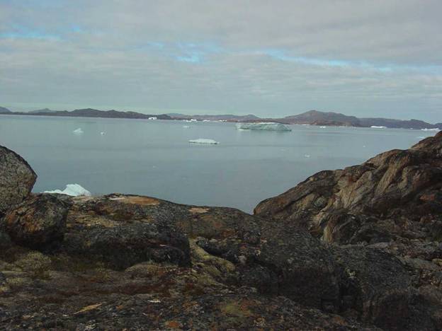
From where I was on Puguta, |
|
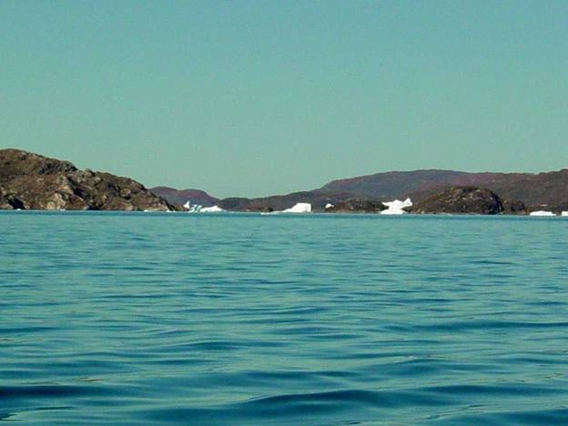
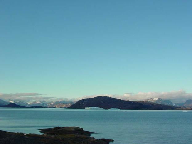
As I looked across the fjord I noticed, to my relief
that the spacing between the icebergs in icefjord was not threatening. However, icebergs are always moving around
on the currents and wind. |
|
Cloud cover was advancing over the sun. |
|
My new raincoat Helly Hansen design is fine although the
Teflon coated fabric is light the rain coat is solidly waterproof. |
|
My replacement tent was fine however I while I had the
opportunity at home I did not bother with sewing the additional sixteen inch
wide snow flaps onto the bottom edges. As I looked at the gaps here and there
along the hummocky ground I thought to myself how foolish I had been because
during those inevitable moments when the wind blows, the wind will just blow
right through these openings. The
flaps would have made the interior of the tent warmer and cut down on some of
the mosquitoes by closing the gap along the tent edge and the ground. |
|
|
|
Upv '05 15x11 8-14 2087 compressed |
|
I was very pleased that my original orange, uncoated rip
stop 1.9 oz. nylon liner tied into place just fine. I had transferred this
original liner into this new tent rather than use a substitute of lesser
untested quality. |
|
In four season nylon tents the liner fabric must be 1.9
oz. rip stop nylon because it has just the right porosity for the exhaled
vapor from my breath to pass through and condense on the inside of the
urethane coated nylon tent in cold conditions. This kept me from brushing against the wet
condensate accumulated on the inner surface of the tent. |
|
I like the color orange because it is very
cheerful. Once when I was camping on |
|
The only problem I really have with a tent is when the
wind blows so strongly that the fabric slats.
I really hate that constant noise.
One time in Tassiusak I actually went to a church service and spent
time thinking up anything I could do to escape my slating tent. |
|
More recently to avoid having to hear the noise of
slatting fabric I have resorted to bringing some ear plugs in my medical
supply kit. |
|
It really amuses me that one of my chief problems has
always been of not being sure of what was inside each stuff bag and dry
bag. There is no doubt about it being
very difficult to figure out what might be in each of these drybags because
all of them happen to be the same color, shape and size being light gray
urethane coated rollover seal nylon cylindrical bags. |
|
Finally after all these years of travel beginning in
1989 only now in 2005 did I figure out that I needed to have large labels
written on the outside with a wide sharpie pen, stitched on or tied on with
the information written on. I had to
use large black letters big enough for me to read without using my
glasses. |
|
I need to use glasses to be able to read regular
print. This seems to happen to most of
us after fifty who are far sighted – very humiliating. |
|
Wow what a relief, all those big labels I put on the
bags really paid off perfectly, no more of “what is in the bag
questions”. |
|
Wandering around my campsite I noticed that there were
numerous rabbit droppings, interestingly enough. I cannot explain why such a density of
rabbits here on this seemingly insignificant island area, but I do suspect
that there has to be a good supply of vegetation and water to feed the
rabbits in this area. |
|
I was glad that I brought my sextant and protractor in
addition to the GPS, a Garmin 76; because I enjoyed figuring out from the
sextant and protractor with the map just which peak twenty miles away I am
looking at. |
|
First I had to true my sextant by aligning the mirrors
and then I had to frequently recheck it because this inexpensive plastic
sextant will change its dimensions drastically with a minor temperature
change. Just a few minutes in the
shade, exposure to the bright sun or a change in the angle of the instrument
to the sun can cause a drastic change in mirror alignment. Thankfully these mirrors can be adjusted
into alignment quickly and easily. |
|
I was using my sextant to measure the angles between
geographic points, peaks and islands. If I didn’t attend to this detail of
rechecking the alignment whole mountains and indeed entire islands would seem
to move – imagine that! |
|
I was very pleased to find that from where I was sitting
on Puguta I could easily see two very prominent peaks. I was especially interested in keeping
track of two especially familiar peaks so that I would be absolutely sure I
was looking at them from any angle because these mountains are the highest
points to the south of me. I expected
that I would be north of them during this trip. |
|
Squinting at the map after awhile I did recognize the
mountains on Qaerdorssuaq / Sanderson’s Hope, |
|
I have always found it difficult to relate to the Saga
1:250 thousand scale topographic map.
Unfortunately this is the only map available in print. At this time I did not know about the
detailed satellite images on Google Earth. |
|
While I was in Upernavik Darius Sobczynski dariusz40@hotmail.com
showed me on the website, Google – Earth that you can find a high
resolution map of anywhere on the Earth.
This is very handy for me. I
was very excited to think this could be possible because finding any detailed
of map particularly for this immediate area. |
|
I can copy a Google map with all details by clicking on
Print Screen and Shift then copying the image into a photo editing program. |
|
What is especially nice about the Google Earth map is
that it is three dimensional which makes it easier to relate to at a glance
than the Saga topographic map although the Saga map very conveniently gives
land elevation in meters or feet denoting tops of peaks as well to improve
the map so that I would have a better chance of relating the map to the
precise GPS readings |
|
Drawing these lines accurately required very precise
measuring. Under the best controlled conditions I drew lines at home using my
drafting table with drafting pencil. I
drew lines on the map for each minute of latitude and every ten minutes of
longitude. I could not put lines on
the map for every minute longitude because this far north the minutes are too
close together. Longitude lines are
especially difficult to accurately draw because on a Mercator projection each
longitude very incrementally from latitude to latitude. I had to recalculate each new set of divisions
between each latitude line and precisely connect those dots. Any line drawing error would mean a
deviation of huge inaccuracy when trying to extrapolate to an on the money
GPS reading in minutes seconds, tenths and hundredths of seconds. |
|
I remembered how nearly impossible it is to match GPS
readings with this map without these reference lines on my previous travels
2003 in this area. I spent hours nearly going crazy just trying to find simple points
where I knew for sure that I really had been. |
|
I was glad that while I was relaxing in the sun to take
the time to compare the GPS with the sextant and the map. How well I know that I would be very
anxious if I was not sure of exactly where I am. I find looking at vague islands not
reassuring. |
|
Here in the Arctic perspective and depth perception is
affected by the refractory atmosphere.
Distances are very hard to estimate because different distances all
look the same. I had a most poignant
experience I shall never forget while paddling with Erwin Streisinger on the |
|
I was the lead paddler for the day but I found myself
fixedly staring at these two inexplicable huge boulders. Finally I could stand the tension no more
and condescended to stop and asked Erwin about them. With laughter in his voice he assured me
that I was experiencing a typical Arctic visual aberration. Sure enough, as I approached these rocks I
found that they were actually only six or ten inch diameter rocks. |
|
All the while when approaching those rocks I had been
imagining that we must be coming up on a huge set of rapids not shown on the
map. Was that ever a surprise! I found that it is not always so easy to
stay calm in the Arctic with among the assorted variables we temperate
climate people don’t have to deal with are these visual phenomena that
playing tricks in varying degrees on your eyes all the time. |
|
When I first arrived, the campsite was very warm with so
many mosquitoes that I had to put on my mosquito hat. Then as the sun headed more northerly in
its circumnavigation of this sky this far north of the |
|
I thought to myself, when it comes to mosquitoes, always
be prepared, you just never know when you might need that mosquito hat. There is nothing worse than a face full of
mosquitoes especially hundreds of them flying into your eyes, up your nose
and in your mouth. And here there are
two choices if you forgot your mosquito netting hat, either you have to retreat
to inside your tent or go find someplace too cold for them to be around. |
|
On the Barren-Grounds when they hatched it was
impossible to deal with their black clouds anyway other than by wearing a
mosquito hat. There were just so many
mosquitoes all packed together in mid air that they could not get out of each
others way. |
|
One time I paddled down deep into the bottom of
Laksefjorden to look at a refugium only to find myself smothered with
mosquitoes. My visit shortened down to
less than an hour, just long enough to make the essential observations and
then I high tailed out of there for the cooler outer fjord areas. I had not bothered to take too seriously
the remark by my local friends about how warm it is in the bottoms of the
fjords. |
|
Even though the water is just a couple degrees above
freezing and icebergs and bits of ice is all around does not necessarily mean
the air temperature should cool because calm air on a bright sunny day makes
for summer temperatures. It can be
just warm enough for the mosquitoes to come out looking for a high feast on
you, the unprotected victim. |
|
As I am sitting here on the southwest tip of Puguta I
notice that about five of six boats have gone by. I don’t know why but I guess that they are
avoiding that dangerous iceberg to the west.
Maybe they are coming this way because there is less ice in this
passage, Qarngup sarqaa. |
|
|
|
1954 |
|
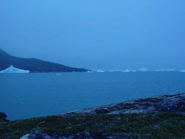
The huge berg had now moved west past |
|
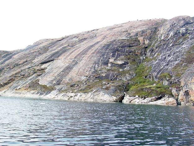
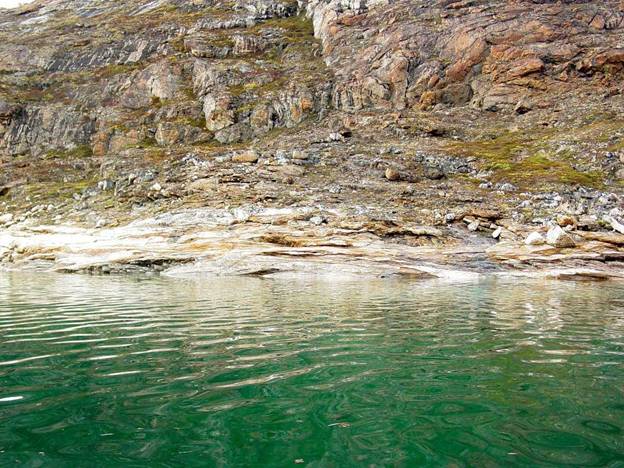
As I explored this campsite on this northwest tip of |
|
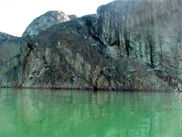
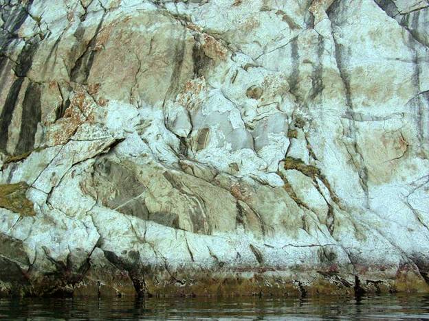
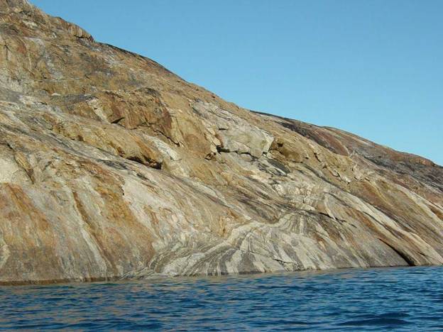
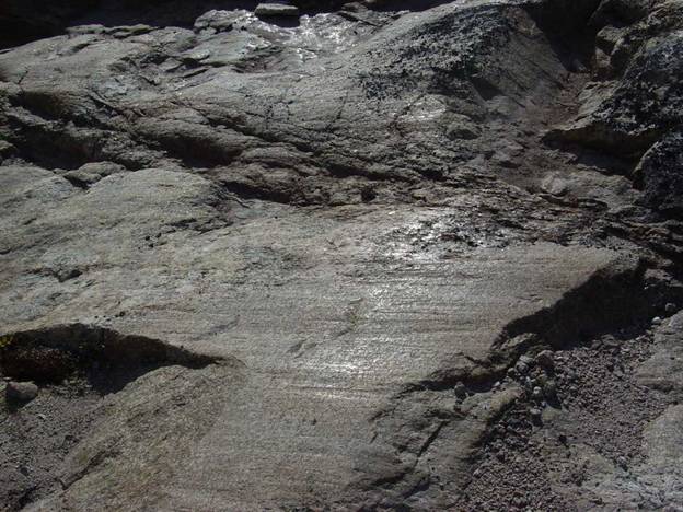
I found some interesting bits of red sandstone and there
is a large area of brilliantly colored red-orange pegmatitic white feldspar
the same as I saw on the east side of |
|
|
|
1966 |
|
I looked at a tiny restricted bay to see what grew there
in the brackish water. As usual there
were the regular seaweeds and intermixture of bluegreens, but the density
showed how rich the water is in this region from glacial mineralogical and
organic materials. This area supports
a fishery of halibut and most recently brown crabs of very large size. |
|
|
|
1964 |
|
|
Tuesday - putting kayak together, getting on the water
and heading to a new campsite |
|
Barometric pressure is 29.99 inches Mercury rising 0.1
inches. It is sunny at |
|
The huge jagged iceberg now to the west a few miles away
has broken apart extensively over night sounding like cannons and thunder |
|
The sounds throughout the night kept making me think, in
my half awaked moments, that there was a thundershower coming in but causing me
to wonder “why is there no wind?” if a thundershower is so close. |
|
Accessing my equipment; My REI Gore-Tex / Urethane
coated nylon bivi bag I have owned since 1980 something has started loosing
the urethane waterproof layer on the bottom.
The Gore-Tex upper layer is still fine and perfectly water proof,
which is a fine testimonial to its good quality. |
|
My old LL Bean sleeping bag designed for bicycling
insulated with a thin layer of Thermoloft is still fine. I am sleeping with a space blanket and a
Therm-a-rest pad on the ground and on top of my sleeping bag and Gore-Tex
fabric on my bivi bag still expels moisture from my clothing and sleeping bag
just fine. |
|
This morning as I was assembling my kayak, I found the
middle rib fold over clip that holds the coaming to
the frame had a broken. It was the
aluminum rivet which was just too soft to take the stress. Now in 2007 the manufacturer, designer Long
Haul has replaced all these aluminum clips with stainless and added a
security fitting so that the clip cannot open under stress. |
|
I was very glad that there just happened to be an
assortment of nylon fishing twine nylon fishing twine on the ground left by
other visitors such as Adam Grim. I found
a perfect piece to mend the fitting with that held for the entire trip. |
|
And wow! Was I very glad that I had brought my repair
kit with small vice grips and Pak-Man needle nose pliers as I usually do
because I found that one of the brass cylindrical chines had become squashed
out of round. I had to reround a
crushed cylinder. I was able to use
the rounded outsides of the needlenose pliers to round up the flattened
cylinder. I was most glad that those
Pak-Man pliers happen to be rounded on the outside. |
|
Of course this would have not happened if I had been
more careful about packing the parts.
I should have been more attentive to gathering likes with likes and tying
them together protected by the channels in the side or stringers of the kayak
frame. I remember that Deiter Stiller,
who originally sold me my two Kleppers, said you should pack similar pieces
together so that they as a group protect themselves from damage during
shipping. |
|
|
|
2013 |
|
I had also forgotten that I needed the extra bungie line
for the deck just in front of me to hold the chart / map case, binoculars and
GPS, so I improvised with a short piece of extra bungie scrounged from a dry
bag. |
|
I was careful to keep my binoculars readily available on
deck because I find that they are the best for spotting rock ramps. Binoculars have always saved me miles of
needless paddling and also grant me a safety margin by revealing to me
situations such as wave conditions or availability of water that I cannot see
from the cockpit of my kayak until I am right there. |
|
I always keep an extra paddle within easy reach. Unfortunately this particular paddle does
not have enough surface area to propel my loaded kayak in heavy wind
situations but it was better than nothing.
I never paddle anywhere even locally without a spare paddle. |
|
The paddle on the ground is a Werner Wenatchee
whitewater paddle set without feathering.
The pogies on the take apart shaft are home made of urethane coated
pack nylon. |
|
The Ritchie compass on the deck actually did not work. I should have tested it before
leaving. I did encounter a situation
when I was paddling in fog when a functioning compass would have been very
convenient. There is a possibility
that it was seated directly over a stainless steel fitting and this would
certainly hang it up. |
|
However there are areas in Upernavik where the iron
deposits on islands are dense enough to totally overwhelm the magnetic north
function of the compass. The compass
needle will just lead you to these deposits.
I saw one completely dark brown rusty iron deposit in a very narrow
passage between Augmaussqarssuaq and Uigordlia islands. |
|
Note the coiled black and white deck line, this is poly
propylene about 25 feet long specifically chosen because it floats. In the blue canvas bag is stowed a
waterproof kite with strong string as an alternative source of propulsion
should I not be able to paddle.
Carrying a sail rig with all its parts is much too difficult to bother
with. A kite works just as well and
can be flown in a figure 8 for propulsion other than down wind. Sailing a kayak in the arctic is a cold
ordeal. |
|
A kite can be used as propulsion and the best long time
visible object. A mirror which I
always carry in my lifejacket pocket is handy for signaling distress by pointing
it toward a boat or town where people might see it. Flares are just visible for too short a
time to be of practical use other than in an acute emergency last
resort. If nobody happens to see you when
you are trying to signal distress what is the point? |
|
|
|
2012 |
|
On my stern deck were the solar panel and drybag filled
with immediate use items. The red
elliptical shape is the stern deck loading port. I had both bow and stern loading ports
located on the port or left side of the kayak because I am right handed. I find that I need these loading ports
mounted on the same side otherwise I can’t relate to the kayak in terms
balancing relative to center of gravity.
Nothing is worse than loading a kayak throwing off the center of
gravity such that the bow is down and takes unnecessary effort to propel as
the bow is plowing water. |
|
|
|
2014 |
|
Well it actually happened on my first day on the water,
judging by the way my kayak was plowing the water I realized that I had
loaded it too heavy in the bow. Nothing like paddling a barge! However this
is very easy to accidentally do because the stow-space below deck in the bow
is so much larger than the stern. My
heaviest bags usually are small ones filled with food. I think I might have put one in the bow. Next
time I launch I will make it a point to put all of them into the stern next
time. |
|
I was able to load everything into my kayak even though
I had the extra baggage of the canvas boat packing bags and my shoes / snow
sneakers. I was a little apprehensive
as to whether I could actually fit all this stuff into the kayak because I
usually would leave the packing bags and shoes in Upernavik, but it all
worked out. It is amazing how much
space there is inside a folding kayak and how much easier it is to take
advantage of the space filling every nook and cranny when there are loading
ports on the deck. My Klepper Aerius I
did not have loading ports and I really doubt if I could have fitted all
these items inside and loading was a gruesome exhausting task. |
|
This is the first time in all my years of kayak paddling
that I carried regular shoes with me. I did this because I wanted to have
good solid shoes to walk around in and climb up and down rocks and slabs
with. In these igneous areas of |
|
I tried wearing fiberglass arch supports in my kayak
booties however these made my booties feel too tight, so I never used them. |
|
Later I discovered my problem was from falling arches
and that I should attach to my foot pedals some old
soles from my boots I always wear because my feet are accustomed to that
surface. |
|
I am very glad that I got my weight down to 180 pounds
and that this diet of soy protein drink sweetened with fructose, soy powder,
sunflower seeds, sesame seeds and yeast extract with occasional Gatorade is
working very well. |
|
As I put on my drysuit I found that I had forgotten that
old tried and true trick before pulling the suit up of smoothing the layers
down my back and waist out and then carefully tucking all those layers along
with my jacket inside of my
pants. That would have
made pulling up my drysuit above my waist much easier and I would have been
more comfortable. Oh well next time I
put on my drysuit I will remember. |
|
My Kokotat drysuit was just as comfortable and as
flexible as ever. |
|
On my feet I wore just a simple pair of nylon
socks. My drysuit Goretex
booties kept my feet dry and perfectly warm.
I was not expecting that such a thin layer of insulation to be
sufficient. I had brought other socks
but I found that they were less comfortable than ordinary nylon socks. |
|
My paddling booties were Ronstan GL-63 with zippers up
the inside of my ankles and no Velcro cross the ankle straps as were on my
Thunderware booties. I choose this
model because from years of experience I knew that the razor cut rubber soles
would not slip on slimy rocks. |
|
I found that I had forgotten that the spray skirt needed
stitching around the edge along the elastic to keep it from riding up in the
track. This made it very difficult to
seat the spray skirt over the cockpit lip.
I had a grand fight with that. |
|
As I have written previously. I have an artificial titanium
hip and launching is the most likely moment when I could damage the
joint. |
|
Clouds started showing as I was preparing to launch over
Sanderson’s Hope the tallest mountain in the picture and |
|
In many past visits I have camped in this passage and
experienced some powerful windstorms from |
|
I was not going
to just give up so I decided that I would not wait around to see what was
going to develop. Luckily just some
temporary light rain developed and minor wind behind me from the southwest. |
|
|
|
1968 |
|
I was very excited about launching and experienced one
of those foolish moments when I blithely made an assumption. I put the seat in and the foot pedals where
and as I assumed they ought to be without bothering to check them. Oh boy how foolish I was because this time
I was in big trouble as I launched. I
had so naively assumed that all would be well. And there I was a sight for sore eyes so to
speak as I settled myself into the cockpit only to find that I was sitting
precariously high because I was sitting on top of the now folded down seat
back. I had forgotten to clip the seat
back into the vertical position so that it would stay in place as I lowered
myself from the rear deck into the cockpit.
So there I was sitting on top of the seatback folded down beneath
me. This was one of those “I can’t believe
I just did this” very awkward situations to say the least. |
|
What I had to do was to simultaneously heist and keep
myself wedged at cockpit entry level above the seat while in the cockpit not
on the rear deck. If I sat on the rear
deck and attempted to reenter all that would happen would be the same old
seatback collapsing forward beneath me just at the moment as I slid into the
cockpit. |
|
To put the seatback behind me from under me required the
supreme effort of a contortionist with good balance. I had to wedge myself in the air above in
the cockpit high enough for the seat back to clear beneath me while I was
reaching beneath myself to lift the seatback up into the vertical position
before I lost it and slid back down into the cockpit as all the while I was
trying to lift the seatback up from under me.
Then I could sit in the seat. |
|
After three or so tries I finally got it – whew! Such a
humiliating ordeal I am glad nobody was around to see this apparition of
“more adventures in fine kayak paddling”.
|
|
Out of disgust with myself, since I was so foolish, I
had made up my mind that I was just not going to paddle back to shore and get
back out of the kayak to correct clip the seat back into position, which
would be too easy. |
|
During all my struggling, my precious home-made, foam
lined video camera bag flipped overboard from my cockpit. Just in the nick of time I noticed it
floating horizontally on the surface and I was able to grab it before any no
salt water was able to run down inside it.
Salt water and cameras are not a good combination! |
|
And a few moments later to further augment this already
horrid situation I had to admit to myself that I had also miscalculated the
length of the rudder cables. I had set
them much too long. As one of those
hard to believe solutions I tried some new really strange
hyperextensions. Just imagine here I
am only able to touch the pedals if I slither myself down in the cockpit so
that I am nearly lying down. Now only
my head is sticking out of the cockpit resting on the now upright seat back
and I am attempting to paddle with just my forearms, because the rest of my
torso was below deck. All I can stick
out is just my forearms and my head. “Another sight for sore eyes, some
paddler these American ladies! I
wonder what she is going to do next, I’m exhausted
just thinking about it!” |
|
Because the rudder cables were much too long, even
though I had vainly attempted to contort myself by stretching my legs and
feet far enough to depress the rudder pedal, I found myself helplessly unable
to have even the slightest affect on the rudder. |
|
And here we have some more moments in fine
paddling! Good thing it was dead
calm. |
|
I gave up on that impossibly contorted body position
soon enough and lifted the rudder. I
thought that maybe resorting to no rudder would be a fine idea. I thought to myself, “after all there are
those who claim that one should never use a rudder when paddling
regardless”. I thought to my self “who
knows maybe I don’t need a rudder after all”. |
|
Then I became ever so slightly aware that there was a
genuine, no doubt about it, tail wind of ten to
twelve knots. I tried vainly to paddle
without the rudder in the water. After
trying to just tough it out without the rudder but I found myself faced with
the arduous task of constantly having to correct the natural tendency of this
kayak to weathercock. What a lot of
work every two strokes on the left side I would have to correct on the right
side the weather cocking as the kayak would instantly swing into arc of some
degree as it invariably headed up wind.
I will never understand how anybody would consider expedition paddling
without a rudder. I find paddling just
impossibly arduous without a rudder and I offset the inherent rudder flat
surface area drag by adjusting the height of the rudder to just sufficient to
maintain steerage. I wish someday
dihedral low drag rudders were available because flat rudders induce drag
that automatically sacrifices a knot or so of speed. |
|
I did notice that I had unfortunately not paid strict
enough attention to balance when I loaded it so the result was that I was
loaded slightly bow heavy. Being down
in the bow further helps the kayak to weathercock. |
|
To any kayak paddler of even the most minimal skill I
must have looked like a sight for sore eyes. |
|
Then after I had been dealing with my cameras I thought
about it. Then I resorted to lifting
one knee, the knee on the opposite side of the wind and to running the
offending rudder cable up and over the top of my knee to maintain
steerage. |
|
After awhile I got tired of having to paddle with my
knee so rigidly held in place to keep the rudder under control. |
|
Finally I got an idea.
What I needed to do was to shorten the cable by tying it off on a
diagonal with a short piece of line. I
figured I would estimate what amount of shortening would be just about right
for the rudder to maintain direction downwind with just a touch of slack and
if it was not right I could easily change the tension by retying the knot to
further shorten the cable. If my
initial estimate was correct I could make minimal course corrections by
lifting me knee under the rudder cable to shorten the cable and also drop my
knee to resume the original cable setting. |
|
A while after I had launched I noticed that storm clouds
had accumulated over Sanderson’s and then were passing down the valleys
toward and over Nutaarmiut. Now came
some light rain and the light gray sky was overcast. |
|
|
|
1967 |
|
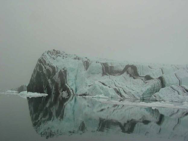
I saw a spectacular turquoise linear iceberg and took
video footage of this. |
|
It is annoying to have to take the battery out of the
video camera, every time, so that it does not discharge. However I next discovered
that actually all I do is to simply slide it up in its track in the holder a
quarter of an inch. That takes care of disconnecting it but still leaves it
in place so that I can simply slide in back into place when I want to use the
camera. |
|
I always eventually find myself imagining my audience as
I take pictures and video footage. I
like taking video because it shows action and I can narrate what I am seeing
with my thoughts about the moment. Compared
to taking still pictures with taking video I sort of feel as if I am holding
my breath. I worry that I will remember why I took the still picture later,
however I do write a log. I do
appreciate the detail that my still camera records because the lens and
electronic sensor system is amazing.
This makes it very handy for capturing tiny plants, such as
lichens. My digital still camera is
much easier to use than a film camera for these difficult shots especially
from the cockpit in following seas. |
|
Using my still camera from my car, when stopping was not
an option, I have done things like just point the camera while driving 50
miles an hour to take an interesting picture. |
|
Writing a log is very convenient because I can record
those memories of why I took a picture which is extremely helpful. I use Rite-in-the-Rain paper and pen. This paper and pen lasts reliably for years
and the pen will write on the paper even if it is wet. These records have lasted me since I first
started using them in 1989. The paper
has not turned yellow and the ink is still perfectly legible. |
|
On my way past the south side of Puguta I saw a few
hundred King Eider / Miteq siorakitsoq and Common Eider / Qingalik. Northern Fulmar were gliding over the
wavelets, about fifteen Guillemots which probably had their nests on the
nearby rocks, only two Cormorants, and a pair of Glaucous gulls. |
|
How foolish I was not to take a picture of them because
I never had the chance to see those spectacular King Eider again. They are a thrilling bird to see because
their brilliant colors and the unique shape of their heads are amazing. Their heads are considered a great
delicacy, indeed an aphrodisiac, by Arctic people. |
|
I saw several inviting lovely bays as I was heading east
down the south side of Puguta but I did not stop to investigate them. |
|
|
|
7304N 5630W Puguta camps |
|
I rounded the corner between Puguta and Manitsoq islands
heading down a very interesting passage called Ikerasaq. Bo told me that for motor boaters this
passage is risky because it is shallow.
I was just completely at home in my kayak wandering down the bay
looking at sights. |
|
I paddled closely to the vertical walls of Puguta
looking for some delicious sea urchins.
Unfortunately because the tide was just a little too high they were
just too deep for me to retrieve by scooping them off the rocks on my paddle
blade to bring up to the surface. I
missed the sublime pleasure of breaking them open and eating their orange
eggs. |
|
I find it curious that I do not always find them. I thought that sea urchins would be almost
everywhere but that is not true. There
is one convenient island near Aappilattoq which has white feldspar. I always find many urchins there. The reason may be that the currents weaker
in these areas where I do find urchins. |
|
When I lived in Kullorsuaq I used to have an arrangement
for retrieving urchins and a small fishing rod I would catch Sculpin / Ulk
with. They were easy to catch in the
shallows and tasty fried up too. |
|
Rounding the bend along the east side of Puguta at four
in the afternoon with my binoculars I spotted the ramp at the campsite listed
on my map that Bruce Simpson and family had used. The site was nicely tucked at the end of a
sheltered east facing bay on the east side of Puguta within Ikerasaq
passage. The campsite waypoint #043 is
at 72°58.139’ N, 55°21.672’ W. |
|
The measurements my GPS gives is not in minutes and
seconds. To convert them I have to
take the number in tenths of minutes 0.139’ N and divide it by 1.66666666666667 which converts it to
0.084 which is in seconds 8.4” which just enough to drive me a little bit
crazy. However most of the time I can
get away with numbers in minutes only and longitude is too close to read in
anything other than minutes this far north. |
|
There was the only one ramp within the bay and I was
glad to find it. |
|
For getting my kayak up above the waterline I need to
use a ramp. The easiest way to get my kayak up and out of the water is on
foam rollers. |
|
I particularly like the granite geology of this area for
paddling because I can usually find some sort of rock ramp to roll my boat up
on the foam rollers. |
|
The foam rollers I use are an inexpensive toy called,
pool noodles which happen to conveniently have a hole down the center as
rollers and auxiliary floatation. I
cut them into three foot lengths. I
have threaded through the center of the rollers polyethylene line knotted
with grab loops at each end for floatation.
I keep these pool noodles tucked just inside my cockpit for easy
retrieval. |
|
I pulled my kayak up the rock ramp on the foam rollers
so that I would scratch or gouge the hull fabric. |
|
|
|
1976 |
|
As I was negotiating the ramp I thought about how very
lucky I was that when David Thorliefsen happened to dropped me at my previous
campsite when the adjacent rock ramp was well exposed. |
|
Later where David had dropped me I noticed that when the
maximum high tide came in, the ramp was nearly covered. The only thing showing was a very narrow
band of rock hardly enough to even get out and stand on edged by to a three
foot step up to dry ground. |
|
This area happens to have unequal high tides featuring
one especially high tide and two normal low tides interspersed with a medium
level high tide. This called a
semidiurnal high tide. During this
period it so happened that the unequal range in maximum high tide during the
day was half the high tide height during the very early morning hours. This can be one of those situations where I
could be sleeping soundly while the tide silently comes in much higher than
it had some twelve hours earlier. |
|
So far I have not found any ripe blueberries or black
crow berries on this island Puguta. In
2003 same time of year I found an almost endless supply of berries behind on |
|
In this little bay at my campsite although I did not
find any live mussels or clams but I did find the empty shells and even a
bright pink shell of a sea scallop and some sea urchins crawling on the rocks
at low tide just below the surface. |
|
Camping here on this quiet inlet was much different than
on the outside next to the Upernavik Isfjord with all its icebergs coming and
going on the tides and currents. I had a much quieter evening with only
occasional icebergs breaking and they did not boom like thunder as if a
thunder shower was arriving. At my
first campsite on the icefjord I awoke several times thinking that a
thundershower was on its way wondering to myself why the wind was not coming
up heralding the thundershower. Then I
would have to tell myself that it was an iceberg shedding large chunks but
every time I looked outside for the source whatever berg it was that
thundered was way far away, who knows where.
So my look outside for the source of which berg that sounded just next
door was never to be found. I gave up
after awhile because it was all pointless. |
|
The tide looked as though it was fairly well in at |
|
My balaclava paddling hood had unfortunately become wet
because I had strapped it to the stringer frame of the kayak and water leaked
through the deck stitching onto the hood.
|
|
Water drips off my paddle loom onto the stitching in the
deck mid-ship and leaks through accumulating one to two liters a day
depending on how many hours I paddle.
I bail it out with a Packtowel. |
|
One of my equipment improvements was to my winter weight
polyethylene fleece balaclava which I used as paddling hood. On my last journey I found that the hood
needed an outer windproof over-hood, a thin layer of foam insulation and some
thin fleece to cover my neck reaching down to my shoulders. Unfortunately when I wore this hood while I
slept it was warm until the outer nylon shell slipped off, then I would feel
cold. |
|
At night even though the sun shines the temperature
drops and it feels considerably colder probably the temperature drops into
the 40’s and by the time the sun actually sets in mid-August frost shows on
the grass. |
|
|
The barometric pressure was 30.10 inches Mercury 08:00. |
|
I awoke to bright sun shining out from under a cloud
layer. Cirrocumulus cloud bands were
gathering closer. Wind was very
slight. |
|
The previous evening, I gathered water from the pools in
nearby stream as it flowed robustly down and over the rounded granite only 30
feet away. I always like to start out
my day with a ready supply of water. |
|
For me first thing in the morning I do not like having
to do balancing acts such as straddling the muddy unstable edges of boggy
brooks, just to get some water. That
is too complicated for me to coordinate in my half awake state. I know that I am very likely to do something
ignominious like fall in or fill up a boot with mud. I just know from near misses that I can’t
handle too many balancing acts first thing in the morning. Forget that idea! it
is not a good one! Whether I like it
or not I bite the bullet the night before and get myself a supply of water
for next morning. |
|
My system for handling water has for years just been a
couple four liter Mylar wine bags in a nylon carrying bags. My bags are now over ten years old, yet
their silicon stoppers continue to reclose and seal them perfectly. |
|
The easiest way to fill these water bags is by bailing
out of the shallows using a rectangular rather than a round polyethylene food
container. The water will pour cleanly
into the wine bag openings from the square corners of the food container. |
|
Just as I awoke I heard very soft chirping sounds accompanied
by occasional deep grunts. Very
carefully so as not to lose the moment by alarming them, I peaked out of my
tent to spy a large group about 12 or 15 of immature brown eider accompanied
by their maternal guardians’ one at each end of the flotilla. They were on their usual morning out and
about scouting for food. |
|
I also saw a female Miteqsiorartooq (Aavooq) – Common
Eider Somateria mokkissima with chicks swimming across the bay. The eider like this protected bay. |
|
|
|
Upv '05 15x11 8-15 2096 compressed |
|
Aside from the occasional collapse of an iceberg, the
only sounds I was to hear that day was this moment of the eider families
making their quiet chirps back and forth to each other. The eider talk
back and forth to each other as a group as they paddle along. Occasionally there is a low grunt from the
adults which serves to guide and alert the convoy to possible danger they had
not yet learned to be aware of. |
|
I find it very convenient to be concealed within a tent
not very obvious but still they were weary of me and did not stay very long
in the lower part of this bay near me.
They quickly made their way to the outer area away from my tent. I know that they were aware of me despite
my efforts at remaining very inconspicuous.
I sat as still as possible so as to not scare them away. I like these moments of being able to watch
this wildlife just being themselves. |
|
From my tent I noticed when looking at an opening on an
iceberg that the berg was rotating in the current ever so soundlessly. Just to give myself a sense of soundless
time, I captured this moment on still camera and video. |
|
You can see in the picture below that the background
shows the steep rock faces. This is on
the west side of |
|
Because I noticed from a distance that the south side of
Manitsoq looked just as forbidding I decided not to bother with paddling
along that side. Later during my
travels however I did find that the east side had numerous ramps scattered
among the glacially rounded escarpments. |
|
|
|
|
|
1969 & 1970 |
|
I ate my usual breakfast of soy powdered fructose
sweetened drink extract, brewers yeast, raw sesame seeds and raw sunflower
seeds mixed with water into a slurry. My choices are to try to have quickly
digestible simple and complex carbohydrates, protein and with unoxidized
fats. I assumed that I would find
epilobium /fireweed and crowberries for fresh greens and fruit along the way. |
|
From my vantage point in my tent my kayak looked just
fine. Then to my horror when I stood up and stepped outside my tent I found
that my kayak was actually not at all where I had left it. Indeed at some time while I was blissfully
sleeping my dear kayak had been ever so silently floated off by the early
morning high tide and left by the retreating tide stranded on top of flat
rocks a meter above where I had set it.
|
|
|
|
1971 |
|
In a moment of heedlessness during my arrival I had
merely wrapped just my bow line in a loose loop around a small rock wedged
between two larger rocks. Normally I
always moor with both a bow and stern line. |
|
I found my line had just barely held having moved to the
gap where the small rock was resting lightly against another rock. Talk about a touchy deal - that was
it! I told myself to not do that
again, it is a long walk home from here! |
|
Much to my relief I found no damage to my kayak, not
even scuff marks on the hull, so I gather that my kayak just rose with the
tide and gently drifted inward on the slight wind and tidal current coming to
rest on top of the flat rock. This was
a humiliating lesson in don’t be so casual about tying up your kayak no
matter how somber the sea may be. |
|
I had forgotten that this area of |
|
Unfortunately these early morning hour high tides are
quite inconvenient. I hate having to
drag myself out of my tent to move my boat higher up the beach after I am
comfortably ensconced. |
|
I have to be very observant when I arrive to closely
look for any seaweed that would indicate as to how far the tide will be
reaching when I tie off my kayak. It
certainly would have been convenient if the tide had just happened to be at
its maximum flood when I initially arrived. |
|
I chuckled to myself about the fact that I did not think
I might need my battery operated high water alarm, so I left it at home. Next time I will bring a float alarm so
that I will know when my kayak is floating. |
|
I tuned in my pocket shortwave radio but it only picked
up BBC. Now I wished that I had
replaced either the antenna or the radio before I left so that I would have
had better reception. |
|
I went for a botanical walk and found some interesting
effects cliff faces have on plants I found the plants larger and greener which
suggests the rocks give off more warmth and nutrients. The plants were much larger and prolific. |
|
|
|
1986 |
|
There is no lack of mosquitoes. It is good that I am near the harbor and a
cool wind from the icecap is blowing on shore. I need mosquito gloves. |
|
I have to be careful to keep my Mavica camera batteries
warm. The Mavica camera minimum
operating temperature is 50°F however the video camera minimum operating
temperature is 40°F which in this temperature regime is quite a difference. |
|
I found a lichen that I had not
seen before Omphalima hudsoniana a
very pale green flat large lichen 200 feet south of my tent. This is among the macro lichens one of the
largest with structure of about 3 to 4 inches in diameter. I thought that it was an unusual finding to
find such a huge lichen. Why it would happen to grow here was an
interesting question, perhaps it is the richness of the soil or maybe the
amphitheater-like warm conditions of the surrounding rock structures or both. I also found other especially large
examples and arrays of plants in this area.
The large amount of blue green algae growing on the rocks indicated
high organic enrichment of the soil. |
|
Photo of arctic heath a nice fire starter small branches
of Arctic willow, Cladonia / reindeer lichen and flat pale green lichen; Omphalima hudsoniana. |
|
|
|
1997 |
|
|
|
|
|
Mosquitoes are active.
Wind less than 5 knots from the east. |
|
Soil in most of this area is very rich which suggests
that this area does not have much wind.
Any dry area is covered with Cladonia lichens. Water falls over rocks
have Nostoc or some bluegreen alga on the rocks. |
|
|
|
2001 |
|
Soil on the rocks is often as hummocks of dense plants,
mosses and lichens. |
|
|
|
1972 |
|
|
|
1981 |
|
|
|
1982 |
|
There is plenty of Arctic Willow Salix rotundifolia
these tiny underground willows grow underground showing just a bright red
immature catkin and leaves. |
|
|
|
1983 |
|
|
|
1984 |
|
Epilobium - Fireweed / edible salad green |
|
Near rocks cliffs protected from the wind, with plenty
of water and warmth absorbed by the rock from the sun, the plants are four
time the normal size. This lush growth
of plants suggests that highly enriching minerals routinely leach from these
rocks enriching the soils below. I
have never seen such lush combinations of plants growing under these
conditions anywhere else before. I
would consider this quite unique. |
|
Below is an exciting example of Salix rotundifolia
growing as a single tree out of the rock face. The
white color to the rock is white feldspar. |
|
|
|
1989 |
|
Below is a spectacular example of unusually thick moss -
sphagnum with Arctic Willow growing out of it |
|
|
|
1992 |
|
Below is a very dense cluster of Polygonum viviparum
surrounded with grasses and Equisetum /Horsetail. |
|
|
|
1994 |
|
I found red sandstone which I really did not expect to
find here because this is a sedimentary stone in this dominantly igneous rock
area. I found a black / gray stone
which I suspect is an iron ore because it is very heavy for its size. The stone has a bell-like ring when dropped
and the stone breaks with sharp semicircular edges like chert and other highly
silica rocks that are formed at crystallization temperature of quartz. The
black stone is not shiny but dull crystalline so also chert is not all that
shiny either. |
|
If the sun were out fully I would be broiling – it would
be a hot day if the sun were bright.
Today the sun is only at about half of its intensity. |
|
My daily food choice is with a different soup each night
and some Gatorade which I find is fine.
I am using baking soda both to brush my teeth with and as a
deodorant. Over the years this double
use of baking soda has worked out very well. |
|
I was glad that I brought my repair kit with lots of
thread however it should have included some thicker thread as well with a
thick needle. I did fix the spray
skirt elastic edge to keep the elaxtic where it
belongs on the bottom of the track.
The spray skirt needs a bright red pull tab so that it can be pulled
quickly in an emergency situation. |
|
I finally attended to properly adjusting my rudder
chains resorting to just using the last link and repositioning the pedals
four to five inches toward me, back from #3 rib so that the mast step hole is
in between. This is the same position
I used in the Klepper Aerius I. |
|
I brought the kayak up higher and tied it off both bow
and stern. I thanked my lucky stars
that my kayak did not disappear at high tide last night. Just the right waves could have dislodged
my arrangement that I had only tied only by a casually looped the bow line
under a rock that was leaning against another rock. I won’t do that again! |
|
I decided that in case my kayak should happen to float
again I should tie the pair of pool noodles under the hull tied
their ends together forming coil around the hull to protect the hull from
abrasion. I could have used two more
pool noodles. |
|
I notice that the weight of the kayak when pulled it up
the ramp using the pool noodles as rollers is close to being too much for the
polyethylene foam noodles. They are
beginning to become crushed in small area where the keel rides. I should unload as much as I can before I
use the rollers. |
|
When sleeping at night I found that my space blankets
were providing just the margin of warmth against the cold. Unfortunately my several years old
Therm-a-rest air mattress is starting to break down so that it makes a pillow
on the end. Thankfully it still does
hold air just fine, insulating me from the cold wet ground below. |
|
I was glad I brought my vest pocket Bible New Testament
with Psalms. I read my Bible and prayers, which was refreshing and a good
learning experience. |
|
As a routine I paddle one day and read this Bible the
next day. |
|
|
|
I watched the Eider with family,
then four Guillemots came diving for food in the bay. Large icebergs do not come inside this bay
because there is neither current nor wind to carry them but they glide back
and forth outside in the passage, Ikerasaq.
These bergs are not so noisy probably because they protected by the
high walls on each side of this passage from the intense sunlight all day
long. All they do is just quietly
collapse. |
|
|
|
1995 |
|
|
The |
|
I awoke to another quiet gray day. A family of immature
eider were diving vigorously for food accompanied by a watchful adult
female in the bay in front of my tent. |
|
Barometric pressure is 30.35 down one unit, 0.05 inches
mercury, at |
|
I broke camp and launched without any problems. The day was overcast. |
|
I paddled from the southeast end of |
|
The Mavica still camera, I discovered, unfortunately is
much more sensitive to cold than the video camera. When I installed the Mavica camera battery,
the battery level indicator showed that the battery had 45 minutes operating
time, but because of the cold the Mavica camera will hardly work. So I had to take more video in place of
still shots because the video camera would work. |
|
I will have to figure out a way to keep the Mavica
warmer on overcast days like this one. |
|
I know that batteries do not recharge in cold
conditions. One technique I am using
is that while I am in my tent when I am recharging my batteries is that I am
keeping them warm against my body. I
don’t think the FM50 battery is able to recharge at less than 65°F or
recharging takes much longer. |
|
I was delighted to find some guillemots nesting on the
point very low to the water. I can
always tell when I am near these black and white red-footed birds because the
first I hear their very soft ultra high pitched peeps and then I see them
flying out from the rocks, to investigate me.
They always roost as single nests on rock indentations just large
enough for the nest. |
|
Here I came across some immature ones that were fully
feathered but not yet able to fly.
Their parents showed some anxiety by calling repeatedly as I
approached but the flightless young stood on the small openings of the sheer
rock faces looking at me. They looked
at me as if they were saying “Hey what are you doing here?” and I looked at
them with the same thought in mind. |
|
I was delighted to just happen upon this moment when I
could take close up pictures of guillemots.
This was the first time I have found guillemot nests just a couple
meters above the water. |
|
There were numerous adults intensely busy feeding on the
specialized organisms that are only near to the icebergs. I have found that the best moment to see
guillemots and Qaqulluk or Timmiakuluk – Northern Fulmar Fulmarus
glacialis is when they are preoccupied with feeding near icebergs. |
|
I enjoyed paddling down the east side of the passage
between Puguta and Manitsoq islands.
Manitsoq was rugged dark brown granitic and basaltic rock as mostly
steep cliffs straight into the water with a bay made up of broken huge chunks
of rock, not place to consider landing unless in extreme desperation. On the opposite side Puguta had long gently
rolling boggy land however I am not sure if there was a spot to land quite as
convenient as the first bay I had tucked into. |
|
Just on the edge of the bay after the small peninsula in
the passage Ikerasaq was an island named Umanatssuk meaning a heart or
stopper shaped island in Greenlandic.
This Greenlandic name is used to describe what this island looks like
in this passage which makes plenty of sense when giving directions as to where
you have been. |
|
Toward the end of Ikerasaq passage approaching what
would be the north side of Puguta once again rock cliffs unsuitable for
landing started to develop. I said to
myself “Glad I camped where I did last night.
That was a nice camping spot Bruce told me about.” |
|
It is a funny thing but we kayakers get to be
surprisingly picky about where we might camp.
I find that I like lots of bright sun so I avoid north sides of
islands. Of course water is very
important. Protection from the wind is
handy if available but not always. |
|
|
|
2002 |
|
At waypoint |
|
Rounding the end of |
|
The northwest side of Puguta is equally as steep with a
peak just about on top of the water that is 820 meters high. There is also a razorback shaped peak on
Puguta called Puso just north of the previous peak that is just as
vertical. No place to land! And I bet
the passage is equally as deep as are many passages in this area. Not a place to drop anchor! |
|
I thought to myself how glad I am paddling this kayak,
Long Haul Mark I, because this area is not the place to be paddling anything
but a very solid, well designed kayak and spray skirt with solid paddles and
proper coldwater paddling clothing. If
I unexpectantly encounter threatening situation such as raging wind I know
that I can depend on my kayak. Here is
one of those large areas where you cannot just paddle to shore to escape a
situation. |
|
Now at this point I was very glad that I had repaired my
kayak last night. It paddled superbly,
gliding over the water effortlessly and the seat was wonderfully
comfortable. Sometimes the sea
conditions, currents and waves, harmonize with the hull and my stroke that I
rhythmically paddle in synchrony with the waves effortlessly for hours on
end. |
|
This day I could feel that that I would most likely be
on the water, exploring for hours. |
|
On the map the opening to the tiny fjord looked as
though it was very narrow. I was
especially excited to see what it would be like to negotiate the passage in
my kayak and to find out if or where there were any places to land. |
|
|
|
7306N 5533W 8 4-5 route |
|
I was looking for some more birds hoping that I might
happen to find some of the more interesting birds Naajavaarsuk – Ivory Gull Pagophila
eburnean, Apparluk – Razorbill Alca torda, Appaworst –
Thick-Billed Murre Uria lomvia, Appa siqquttooq – Thin-Billed Murre Uria
aalge and Appaliarsuk (Appaaraq) – Dovekie Alle alle. |
|
In 1993 I found
a very interesting colony of Razorbills and it was exciting to watch how they
fly. First thing they did was to jump
off their cliff face about fifty feet above the water onto their breasts,
right in front of my kayak and then to fly they would run over the water
until they could gain altitude with their wings. I never realized that there might be a bird
that would have to take flight in this manner. I felt like telling them that they really
ought to try jumping off the rocks and flapping their wings at the same time,
but who knows and I would not want to confuse them. They might wind up flying underwater
instead of over the water. It is best
to leave things as they are. I did
wonder how they feel after doing a belly flop from such height, I would think
crash landing on water from such a height would really hurt, then again they
have feathers and I don’t. |
|
Ivory Gulls choose to nest in these remote areas, so I
was hoping that I might come across one that might be nesting in this
secluded area. |
|
Deciding what actually was the entrance to the bay was
challenging because all the rocks were the same color and looked the
same. A few icebergs had collected
threateningly together in front of the opening. This was a typical situation
where ice had accumulated in this bottleneck area. I found my self passing through a group of
bergs crowded together. Luckily all of
them stayed put and nothing broke off because I was not comfortable with
being forced to pass so closely by them.
For me this was “too close for comfort” should anything happened to
have shifted. |
|
The opening did
not look like an opening from my position it just looked like another dent in
the shoreline that might amount to nothing. I should have stuck to the north side but
all looked the same even if I had because I was unfamiliar with the area and
the passage from my cockpit was packed
in with icebergs just enough to look like there was opening beyond them. |
|
This was just another example of how everything looks
the same because there is no depth of perspective when you are this far north
in unfamiliar territory. The only key
to depth perception is color shift where dark brown in the foreground
lightens up and fades into blues which become lighter and lighter ending as
powder blue. Lack of depth perception
is annoying and is not a good feeling and yet there it is clear as day on the
map right in front of you. |
|
As I passed the cluster of icebergs, I made my way
through the narrows which were about 100 feet wide. And now I was well on my way inside the
bay. |
|
Standing on some shallow rocks I came across a group of
ten or more some eider chicks. This is
something these birds commonly do. |
|
As soon as they saw me they all instantly jumped into
the water and swam for safety. They
were unable to fly yet. Around the
corner were about six nesting guillemots.
Another mile heading around south on some high cliff faces was a well
established colony of Glaucous gulls crying their alarms to notify anyone
within miles of my presence as they flew over me. The closer I got the noisier they became
and the more threatening they became as they swooped over me, typical of
aggressive gulls. |
|
Continuing east I made my way into the shallow
backwaters to look at the glacial terminus the topography flattened
completely out resolving into boring mud and shallow bog. I decided not to bother with taking the
risk of stepping out and sinking up to my eyeballs in the mud which is
probably rock flour. I could not think
of any exciting reason to get out and wander around. Maybe because it was an overcast day
everything just looked uninteresting. |
|
I recalled an old experience of stepping into some rock
flour mud near the Orpit in Laksefjorden and finding that the bottom was just
ever so slightly, hopelessly soft.
Only the rocks beneath kept me from disappearing into grey brown
fluffy goo. The trick is getting your
booties out after they have been sucked off your feet, just for a little
entertainment. |
|
Once in Stony Creek, where I live, I stepped into some
pitch black, organic anoxic goo and the only way out was to slump into my
kayak, pull my feet out of my boots and pull with only the most heroic effort
my boots back out. Believe me I did
not try that again! And I realized how dangerous soft bottoms actually may
be. |
|
Leaving I paddled for a change along the north side
where I found a pair of Glaucous gull parents with two young. One could fly a short distance and the
other was just about able to fly.
Because they couldn’t fly as they had probably just left their nest
today for the first time I was able to get quite close to them to take video
pictures and I was glad to have this unique opportunity to take pictures as
close as I could to them. Had these
nearly mature chicks been able to fly I would have never had the chance
getting at all close to any Glaucous gulls on the water in this type of
circumstance although when flying the adults like to swoop low over you from
above. |
|
Then I took video of two Glaucous gull chicks swimming
which were just about able to fly with the alarmed parent cruising me over
head. |
|
Unfortunately I saw no Miteqsiorakitsoq – King Eider Somateria
spectabilis, yet there had been many in the icefjord on the south side of
|
|
I saw a few Oquitsuit or Oqaatsoq - Cormorant Phalacrocorax
carbo. They are everywhere if
there are any easy to catch fish about.
They are just those unmistakable ugly shags, just as we have in |
|
Now I was glad that I do have my rudder. I lowered it in the water just deep enough
to give me directional control. I was very pleased that this time I had
loaded my kayak as lightly as possible in the bow. Such wonderful paddling, my kayak paddled
effortlessly at about 2.7 to 2.6 mph according to my GPS. I did not have to work all that hard
paddling as I paddled in synchrony with the very slightly riffled water. |
|
Coming out of the bay into Qarfigssuit heading toward
Inuvik seemed so easy, just a nothing paddle, because now I knew what the
iceberg cluster was all about and I could see straight down the passages in
ether direction so that I knew where I was and where I was going. |
|
Curiously enough I saw a couple motorboats passing by
the east side of |
|
Bruce Simpson told where they had camped on |
|
On my way south I could see the icecap south east from
me the Upernavik glacier. In this
picture it is eighteen to nineteen nautical miles from me. The icecap on the horizon is distinctive
because it has a unique but eerie brilliant white glow nothing else has. What also gives it away is the nunataqs or isolated pieces of land projecting through
it. |
|
|
|
2003 |
|
As I paddled south the high rock faces suddenly gave way
to a long shoreline of nearly flat rock ramp.
I use the term suddenly because I was expecting the usual inhospitable
rocky shores to just continue. I was
very surprised when I came across very shallow granite ramp that extended for
a mile south. |
|
Being mindful I needed to have water available at my
campsite I paddled along until I spotted some water running down from the
very flat marshy land above. As I
evaluated my options I decided that getting the boat up the shallow angled
ramp would not be all that bad because the rock was conveniently flat. All I would have to do is just keep
switching the rollers from back to front as they rolled out from under the
stern. |
|
Then I realized that I needed to tie my boat to large stable
rock. At the beginning of the ramp
shoreline I saw nothing more than some insubstantial little half buried in
loose muddy dirt. Those rocks I just
knew I did not want to risk tying my boat to.
The edge of the ramp was bordered by a two to three foot high lip of
tundra which I did not want to bother with heisting my kayak on top of. I figured that I could risk leaving my
kayak on the granite ramp because the distance up the ramp was great enough
and there was nearly no seaweed at the top of the ramp indicating the high
tide line. |
|
Sure enough a couple hundred feet later I found some
large three and six foot diameter boulders to tie off where a couple loops of
motorboat lines had already been left tied around them. With those lines available I knew that this
meant that others had used this place before me, which always means good luck
to me. Of course if a storm came in
the waves would just roll right up the ramp but I thought that the weather
would probably remain stable. Storms
in the summer most often roll in from the west. |
|
The west facing site was delightfully sunny and to the
east was flat low marsh. I figured
that the sun would be probably bright the next morning providing good
exposure for my solar panel recharging system. |
|
Because of this convenient four-sided exposure to the
sun I planned to recharge my batteries throughout the night moving the solar
panel as the sun moved to maintain the best exposure to the sun. |
|
This is one of those moments when I am glad that I
happen to wear Velcro closure boots so that I can easily slip them on at any
time and go out for a walk as necessary.
I don’t like to bother myself with any thing any more complex than
necessary when I am temporarily awakening from sleep and expect to go back to
sleep as soon as possible. |
|
I also wear Gore-Tex pants and jacket so that it does
not matter if I kneel or sit down on wet ground to do some project. |
|
I knew that I would have to figure out how to sleep with
the battery inside my sleeping bag next to me without accidentally detaching
the connection to the solar panel when I roll over. That was a minor problem and I reminded
myself that I would just keep track of every time I rolled over from one side
to the opposite side so that I did not wind up encircled by the cord. |
|
From my boat and campsite I had to walk down the shore
some distance before I could find water. |
|
At the spring I just happened to sit down to gather
water where I spotted a birch tree. I couldn’t believe it, but there it was
for real. |
|
Then I looked at the stones and found bright orange
feldspar, something I had seen on the back side of Aappilattoq island years
ago. That was exciting. |
|
These I found at my third campsite at waypoints #049
& #050 at N73°02’17” W55°11’08”. |
|
A few motorboats came past the SE side of |
|
Water drips off my paddle shaft into my lap. When I am paddling with them out of their
drybags on my lap but I found way to keep the drops of water off the
cameras. I put a piece of dry pack
cloth (non-woven rayon) over the cameras to catch these paddle drips. |
|
One problem with cameras is that tying them inside the
cockpit is a tricky deal because I am worried about entangling my feet in the
tie down lines. |
|
As for my tent the original zipper was a lightweight
coil zipper. At home I am glad that I
had sewn on a second heavier duty toothed zipper onto my tent. The original coil zipper has failed after
only two nights. Even though the coil
zipper is self repairing I already know from past experience that I would not
trust it to withstand a 40-knot windstorm, which I always experienced some
time on each of my trips. |
|
Icebergs are exploding in the yellow sunlight with many
big bangs and booms sounding like thunder and cannon. |
|
There is not enough light at night for my solar panel to
recharge my battery so I am switching to another batter and I hope that #4
battery was recharged at least somewhat. |
|
Where I choose to camp there were few icebergs. To the southeast in the next inlet there
were many loud disintegrating bergs. I
am very glad I stopped here a safe distance from these threatening icebergs. |
|
On my way here across the bay I did not stop at |
|
Looking at those bergs next to the shore in the picture
below I decided that I did not want to be anywhere near them. I could hear them rumbling all night and
was most glad that they were not just off shore but rather down there a few
miles away. |
|
Behind them are some curious cumulonimbus clouds south
east which I thought were strange for |
|
Weird, I do not see the mountains on Nutarmiut I thought
I was seeing them last night. It was
only the clouds I was seeing coming in from the outside bringing in fog. |
|
|
|
2004 |
|
Looking at this picture you see the peninsula with the
bunched up icebergs I have just rounded north of here just after the bay
opening on Qagsserssuaq peninsula and above that is the high peak of 1080
meters named Qagsserssuit where clouds are just starting to show. This photo illustrates how the distance
from you fades from brown to lightening gradually to
blue. This is one of the moments when
knowing exactly where you are and using the sextant to sight with for
measuring angles will tell you what you are looking at. |
|
Cumulus clouds have disappeared and there is mist
between the mountains across the way on |
|
Note the clouds starting to form on the 1080 meters
peak, |
|
|
|
2006 |
|
Interestingly I saw two halos around the sun one at |
|
Not it gets to be fun because mist is coming over the
water. |
|
|
|
2007 |
|
Guess what next?
Glad I am settled in my tent and the tide is up. |
|
|
|
2008 |
|
|
I awoke at |
|
Looking south at the fog. Where is everything? |
|
|
|
2009 |
|
Next morning you would have never guessed what went on
the night before. This is a cloudless
morning bright sun |
|
At |
|
|
|
2010 |
|
I heard some quiet chirps and grunts outside my tent, so
I as quietly as possible prepared my cameras and opened just a slit in the
top of the doorway to look out. And
there they were, a whole bunch of eiders feeding. There were about two dozen young with a few
adults. One moment they were astride a
low rock and the next they were about feeding and just minutes later they
were back again on the focus covered rock.
All was bustling with busyness as everybody couldn’t quite decide what
to do to get the best food that they were feeding on in the shallows. |
|
And then they discovered me and decided that they better
move off, so that was the end of that.
I thought it rather odd that they should have picked this spot right
in front of my tent and kayak because I would have thought that there were
plenty of other safer places. I suspect
that eiders must be to some extent social curious birds that flee when they
decide things are getting threatening. |
|
I took a moment to photograph my kayak on the rock ramp
because it was such an ideal situation both to show the kayak but to
illustrate this shallow angled ramp.
The other place I had seen similar ramps was in Laksefjorden on |
|
|
|
2011 |
|
This time my kayak was above the high tide line during
the higher of the semi-diurnal tides but to be sure I awoke a few times at
night to check. I don’t like the idea
of my hull scraping back and forth over the rocks unnecessarily in the
swells. |
|
During my journey in 2003 I got my kayak up as far as I
was able but the next morning I found it precariously perched and wedged
between rocks above where I had tied it off.
I was very lucky that the rudder assembly which was wedged had not
broken. |
|
In the early morning the entire tent was thickly coated
with heavy dew. I dried the heavy dew
off the outside of my tent with my Packtowl, because I wanted my tent to be
as dry as possible before I packed it. |
|
The newer Mavica battery is working. I am recharging a second battery in the
bright warm sun. The tent is hot
inside. |
|
I found that I am really stretching my food out farther
than I usually would because I am eating two meals instead of three meals a
day. The mix I make is a usual one in
general. My fear of running out food
is a powerful motivation. The fructose
content in the Advant Edge Soy Protein drink mix is good for digestion and both
for long and short-term energy. |
|
To reduce the possibility that I might need to make a
pit stop during paddling I strategized that I ought not
eat or drink. So far I have been only
eating breakfast but eating nothing while I am paddling. |
|
My energy is okay but the more important factor is that
I prefer to avoid needing to urinate as my prime motivation. I would prefer not to have to feel as
though urinate because that is a debilitating feeling and it reduces my
paddling strength. I have no detrimental
side effects from Detrol that I cannot live with and I am finding that my
paddling energy is actually better. |
|
In the last few days I take a “Detrol” capsule each day
that I am paddling and, so far I have been able to paddle all day without
needing to urinate. |
|
For a truly dire emergency I worked out a method of
urinating without getting out of my kayak by using a Packtowl to absorb the
urine. I have found that any wet
residue on my underwear will lead to a nasty diaper rash situation. For a kayak paddler, diaper rash is very
hard to get rid of because we sit. |
|
I added some more air to my Therm-a-rest pad seat
because I found that my seat was just a little bit too low. This was just another one of those “I am
glad it did it now adjustment” before I got on the water and paddled with an
improperly adjusted seat all day. |
|
I had to fix my foot braces they had slid forward. It is very important that these foot braces
/ rudder pedals stay exactly right.
This makes a great difference in paddling efficiency. |
|
I found my lifejacket |
|
The |
|
I packed up and launched without my scarf in hand. It turned out to be a good thing I decided
to return because I discovered that I happened to have switched on the GPS
which rang an alarm that I was approaching MOB location. |
|
My scarf I found I had put inside the front hatch. This surprised me because I thought that I
had just left it some place more convenient in my cockpit. |
|
I always need this scarf. I designed it to keep me warm and to shield
me from the wind. It is just the right
size folded in half to shield the cold wind and insulates my head and
neck. Only in the bright sun do I not
need the scarf. It is two layers of a
flat acrylic with fluffy acrylic scarf sewn.
I adjust it as needed sometimes I pull it over my face as a hood to
shade the skin on my face and eyes from the sun as well as insulation. |
|
I was very glad that I brought my polarized sunglasses
because exposure for hours in the glare from the water would be very damaging
to my eyes. |
|
I paddled from waypoint #050 to the bottom of the
Akugdlikavsaup alangua fjord to see what the end terrain of a glacier looks
like at 73°01’ 0.097”N, 55°00’ 23.6”W. |
|
On my way a little lost aquatic chick raced in front of
me along the rocky shore. It was
fuzzy, black and white spotted but I could not identify it. Rounding the corner into the bay flat
meadow land, lush with green grasses and complete with rock ramps and a couple
tiny pebble beaches was on the north side of Akugdlikavsaup alangua. |
|
It was a beautiful bright sunny day which made the green
grasses look even greener. |
|
Coming into the bay I saw a group of about fifteen
immature eiders astride rocks. They
were feeding jumping into the water from the rock for just a few minute swim
and then jumping back on top of the shallow rock. An as usual when they saw me and decided
that I was a threat they launched themselves to safety and then found another
shallow rock to reemerge on not far away.
They seemed to play hide and seek thinking that they were invisible if
they were a few hundred feet or so away.
I was surprised that they did not immediately launch themselves much
sooner and make a much more intense effort at fleeing from me. |
|
The water was filled with very large examples of lush
seaweeds. These fjords are always
talked about as to how rich they are.
Here I saw a prime example of how large and densely packed seaweeds
can grow because they are richly supported by the heavily mineralized waters
flowing into this salt water from the glacier only a few miles away. |
|
I suspect some of the water enriching rock flour was
probably various minerals such as iron, potash and phosphates. Iron is a particularly powerful enrichment. |
|
|
|
2015 |
|
Later I found an area next to the glacier that had red
colored water from the iron minerals colloidal suspension rock flour in the
freshwater runoff that would expand and contract with the tides before this
fresh water intermixed with the salt water. |
|
It was very exciting to actually approach the terminus
of a glacier. I had been told that
this was a quiet inactive one so that I did not have to especially worry
about huge chunks of ice crashing into the water generating cascades of waves.
For me in my little kayak seeing all this jagged ice precariously mounted
still looked threatening to me. |
|
In the picture you can see the distinct red hue to the
water. |
|
|
|
2019 |
|
|
|
2020 |
|
As I paddled toward the north edge of the glacial
terminus I found some very interesting ice that was intermixed with dirt in
distinctive striated layers that just fascinated me visually. The layers were compressed together
reflecting where they had come from and passed through and their position
within the glacier. That was
delightful to see a record of the growth and travel of the glacier via these
striations. Later I was to see a
gigantic berg smothered in fog of this type that looked at first like
squiggles resembling telephone poles in mid air. |
|
Dirt that is pitch black
suggests to me that it is heavily enriched with organic material. The organic material would have originated
during a much earlier period before this ice age from heavy plant growth. That dirt now washing into the water column
is acting as enrichment for the seawater. |
|
Off Kullorsuaq I saw blue transparent chunks of ice with
black stripes and patches black dirt embedded in the frozen bay. The interesting thing about snow is that
the more heavily it has been compressed the clearer it becomes. When the compressed snow becomes completely
translucent is interesting to look at because it appears to glow. |
|
|
|
2021 |
|
I was most curious to find glacially polished rock
because the degree of polish reveals the weight of the glacier when it passed
over these rocks. Glacial polishing is
limited to just the uppermost surface of the rock, like a skin. The heavier the weight of the glacial
overburden the greater the surface density and this polishing can make rock
shine like mirrors. |
|
|
|
2023 |
|
In the picture below you can see the glazed appearance
of the rock surfaces and the difference along the crevasse where there is no
glacial overburden compression. |
|
|
|
2017 |
|
I paddled out of Akugdlikavsaup alangua fjord on the
south side just to see what it looked like.
Then I rounded the peninsula. |
|
Finding a suitable campsite turned out to be a tricky
deal. I had no idea what to
expect. I assumed that paddling south
going out and around Akugdlikavsak peninsula past |
|
|
|
Rounding the peninsula passing next to |
|
Although I was hugging the shore which would seem as a
safe way to paddle the rock edge of the water went straight down so there was
absolutely nothing to land on even in a dire emergency. Just a short distance away was an extensive
line of tall icebergs that were just to
threateningly close to where I was paddling.
If any one of them were to break or roll over I would really be
directly threatened. |
|
In this touchy situation even the slightest noise, let
alone any waves generated from them, I guarantee you, would have set my hair
standing on end. This was an entirely
too dangerous exposure for me as I was not comfortable paddling here. It looked even worse farther inland toward
the glacier so I without the slightest hesitation quickly decided that I was
turning around and getting out of there. |
|
That was really quite an unwelcome surprise because
previously the Simpson’s had camped much farther down that fjord very near to
the icecap around the last peninsula.
The ice was different that year as it always is. |
|
|
|
7306N 5533W 8
5-6 route |
|
I turned around and headed back to Akugdlikavsaup
alangua fjord. |
|
On my way I passed by a small peninsula projecting into
the water only about 30 feet. The ice
pieces were congregating there and swirling around in whirlpools. I had a good time riding around among them
and taking some video footage of their comings and goings. Later watching the actual video made me a
little dizzy for a few moments. |
|
Ice chunks are very handy for showing currents that you
probably would not notice otherwise.
Once in 1995 near |
|
For some reason I think it was because the view of the
glacier seemed more exciting from the south shore, I felt that I ought to
camp on the south shore. I just dimly
remembered that I thought I had seen maybe one possible landing area. |
|
I thought to myself, “oh this can’t be all that
complicated, surely there has to be some nice spot to camp. One major need
for a campsite I had to satisfy was flat ground, aside from the rock ramp and
sufficient water. |
|
Wow did I have a problem. Either the bank down in this bay had no
level ground, was without water or any sort of rock ramp. Finally in near despair because I could not
believe in all my peregrinations along this shore that there might be nothing
but hummocky very slanted ground I found a place with a rock ramp. |
|
Even though the only possible ramp was narrow, steep
ramp with a couple two foot gaps in the ramp, I had to go for it. I knew that I would have to take care of
not to misjudge and accidentally step or slip into those gaps while I would
be stepping backward maneuvering my kayak on the foam rollers up the ramp. |
|
Luckily the rock was not slippery because relatively
little seaweed happened to grow there.
I guess the ice scrapes it off. |
|
I spotted some water just dripping out of the hummocks
above but it was not flowing down the rocks into the water. “Well I told myself that will have to
do. I will have to dig out a pool for
the water to collect in for me to fill my water bags. I know that will work although this is the
first time I have been this short of water in |
|
I delicately stepped out onto the rocks and slid my
kayak as high as I could up the rocks.
To slide my kayak up above the waterline with minimal effort I
straddle the bow between my legs so that I have maximum control over the
kayak. I lift the bow on its carrying
handle between my legs using the floatation in the stern and pull my elevated
bow section of my kayak without touching the hull to the rocks. Once this is done I remove as much gear as
possible to further lighten the kayak as much as possible. Then I put the rollers under it and get it
up as far as I can on the rocks above any possible waves. Next once that I am sure that there is no
possibility that any waves might breach the deck of my kayak I open the deck
ports and unload the rest of my camping gear. |
|
Getting my awkwardly heavy kayak up this narrow divided
ramp required very careful planning with some finesse and trigonometry. Here is not the place I would want to
sustain an injury just because I miscalculated a step or slide unexpectedly. |
|
The ramp ended precariously close to the top of what was
now the day’s highest tide during those early morning hours when I am usually
sound asleep. I judged this from what
I could see by wave erosion and the presence of fucus seaweed fragments. |
|
I could see that I was taking a chance because where I
was putting my kayak would not be quite above the tide at the top of the
ramp. With great effort and
expenditure of physical strength I set the kayak parallel to the shoreline at
the top and tied the pool noodles to encircle the hull, should the worst
happen. |
|
Above the kayak and tidal residues of seaweed was a line
of two foot high round boulders which I decided was just too much of a
project to try and get my kayak on top of.
|
|
All I felt I could do was to hope that the kayak was
high enough, even though I knew that my kayak was really not quite high
enough. Not a pleasant thing to think
about when you are going to sleep because that tided seems to always come in
higher after you have dozed off. |
|
Where I landed, much to my chagrin, behind where I set
my tent I did not realize that the ground was vastly overgrown with extremely
tall two to three foot high hummocks of swamp and willow vegetation. |
|
Trying to walk over this terrain made for some very
tricky balancing acts as stepping from wiggly hummock to wiggly hummock. To my even horror I noticed that there were
some places between the hummocks were deep gaps shouldered with jagged bare
rocks. This made the walking even more
dangerous. Stepping from hummock to
hummock was about like stepping from one jiggly, slippery, round topped
barstool to another. Looking between
them was dizzying to me who was already nervous because of how high they
were. |
|
I have never found hummocks as high as these were ever
before. I wonder how they developed
such height. I guess it is a
combination of underlay, frost and airborne dirt accumulation. |
|
In my travels where I noticed the contrast between rich
black dirt completely covered with plants I have concluded that air
transported dirt does accumulate in greatest amounts where there is the least
wind. This suggests that dead air
pockets cause airborne dirt to drop out as it passes over. |
|
Oppositely in my storm experiences in Torssut wind
scoured areas are not a good choice to camp it because if a wind storm does arrive these areas are most severely impacted by high
winds. The plants and soil cover is
very sparse being mostly Stone break or Saxifragia. |
|
Being alone, all I could think of was one moment of
misjudgment or, worse yet, or of just the slightest inattention and all my
hopes and aspirations; indeed my entire trip would come to an instant halt
should I happen to fall and injure myself.
An injury sustained from a fall would end my solo kayak expedition,
what a sad fate especially since I have an artificial hip and subluxation to
the prosthesis would end my travel in many ways. |
|
|
|
2027 |
|
There is surprisingly little water here even though
there was typical bog vegetation. I
enjoyed the robust population of willow, equisetum, bog rosemary and heather,
which you can see in this picture. |
|
|
|
2026 |
|
I took some more interesting photos and video footage I
am very glad that I have the video camera. |
|
|
I took a picture of the light at |
|
|
|
2025 |
|
At |
|
My bed is very lumpy due to those charming hummocks and
slanted just enough that I have found myself the next morning sleeping soundly
but most of my body has slid out of the tent.
I originally thought that I would sort of wrap myself around a handy
hummock like a question mark and not slide out the bottom of the tent. I also thought that putting the bulging
delaminating bottom of my Therm-a-rest pad at the bottom would stop me from
sliding out the bottom too. It was
very amusing where I kept finding myself after a solid few hours of
sleep. The Therm-a-rest pad is
supposedly designed of cloth that resists sliding however on this much of an
incline all bets are off. |
|
When I went to sleep I thought I was dressed warmly
enough however when I awoke from sleeping my teeth were chattering. I told myself that next evening I must
remember to put on more layers before I retire. This evening I had been wearing two layers
of polyethylene, one seaman’s sweater, a Gore-Tex jacket but I did not put on
the quilted underwear. I hope this
combination will be sufficient. |
|
The bright sun is warming the tent nicely. |
|
I find the details of traveling truly daunting. Seemingly little things like I need 1.75
diopter glasses for reading with contact lenses and 2.75 diopter glasses
without contact lenses, just having to remember this little detail is
something without another solution is disconcerting. Having the patience to accept these
challenges is a problem but other people have these problems too I just feel
uncomfortable traveling alone because of this. |
|
I finally cleaned one of my contact lenses. I had picked up a piece of dirt behind it
and this became increasingly painful. |
|
Today so far I am just dozing and meditating, reading
the Bible and finding myself able to understand the humanity and coming of
spirituality does not just automatically happen much was a miracle other was
an open willing to accept the seeming impossible. |
|
I am glad I have this orange tent liner, orange is the
best color. |
|
Where I am is a dried up area and a light breeze from
the glacier so the mosquitoes are not as aggressive. |
|
I found the source of the water dripping down the rocks
I had spotted on my way in. There was
mud at the base of the hummocks along the top of the rocks the water was
dripping into. In the mud there was a
pool already started. I dug the pool
deeper. I have the feeling that
someone before me dug out that pool for the same reason. I am glad that there is water here. |
|
At about |
|
Paddling long distance with the current and wind pushing
is very convenient. I often make many
very relaxed miles taking advantage of this combination. |
|
Ice is collected into a line on the north side of this
fjord forming a distinct line of small chips.
Nearer the terminus there was a line with red stone powder in the
water about a mile from the terminus.
This varies with the tide. |
|
The stone flour enriches the water making a profusion of
filamentous seaweed draped over fucus and other seaweeds in long strands. I suspect this is why fishing is so good in
these areas near the ice cap. There is
lots of food, nutrients in the food chain, in the water. |
|
|
|
2029 |
|
Next time I dry peaches I will make sure that I dry them
fresh, not frozen and thawed, because freeze thawing caused their cells to
break and lose enough of their liquid contents to affect flavor. |
|
I am disappointed with my solar panel recharging. I thought that keeping the battery on my
body would keep it warm enough to recharge.
That didn’t work. I will have
to keep the battery recharging all the time and at night sleep with one
battery against my body. On a bright
sunny hot morning the battery really started heating up indicating active
recharging. This evening is bright and
sunny. I hung the battery on the tent pole very high in the peak of the
tent. I am glad I have plenty of wire. |
|
At |
|
Barometric pressure is at 30.05 inches Mercury at |
|
I was not in any mood for tussock walking but I did take
a couple explanatory pictures of the vegetation. I figured that I could identify and show
growing via pictures. |
|
I just read to learn from the Bible those things I could
not find focus on before. |
|
For cooking I am using a fuel cube stove inside the heat
shield within my tent. One cube will
boils three cups of water. So my
observation is that a heat shield around the stove and one quart coffee pot
really works well for getting the maximum amount of heat output from any
stove. |
|
I used to notice that much of the heat from a stove
would just go up the sides of the container I am trying to heat and be lost
because it was not concentrated on the target. Now that I think of it I should add a lid
with some circulation holes to further trap the heat rising from the fuel
cube. |
|
Now some burgie bits have blown over here on that north
wind and are near my kayak. I hope
that they go elsewhere when the tide comes in. The wind is still onshore. |
|
A hunter came into this bay in his motorboat I expect
that he was probably looking for seals. |
|
Unfortunately there are no seals but there are at least twenty common eider here. I think it is very unlikely that during the
off-season anyone will hunt eider because they are still caring for their
young. |
|
I find it very interesting that I paddle much faster
when I am retracing a new route. It is
an old story about the subconscious otherwise known as “the horse is going
back to the stable”. |
|
My paddling pogies need to be redesigned to strap onto
my paddle when I do not need them. I
need better pogies these are very marginal. |
|
Wind has quieted at |
|
|
Bright sunny morning quiet at |
|
Pond Inlet across |
|
I awoke again to shaking in fear; being in terror is
hard for me. The more fearful I am the
less I shall observe. |
|
My battery recharged to now having 76 minutes working
time the instructions say it takes 250 minutes in 50° – 80°F to fully
recharge. |
|
I don’t feel like visiting more of the icecap now. I think I am more curious about going
northward toward Naujat and Innarsuit. |
|
I left my 4th campsite heading back out
Akugdlikavsaup alangua fjord toward |
|
|
|
2032 |
|
The south side of Akugdlikavsaup alangua fjord in the
picture below has extensive shallow granite ramps. The blue green clumps are white-stemmed
willow and the darker yellow-green are probably Arctic Willow or a
red-stemmed willow. |
|
Note the fine quality of the granite. |
|
|
|
2033 |
|
There is a large tabular berg off my bow in front of |
|
|
|
2030 |
|
In the picture below you can see that the east side of
Manitsoq flattens down to the water’s edge. |
|
|
|
2034 |
|
From my bow in the picture below I was looking south
west at the accumulation of icebergs making their way out of Upernavik
Icefjord and the wind was about 10 knots. |
|
|
|
2031 |
|
My paddle to |
|
Along the northeast side of Manitsoq just a short
distance from Akugdlikavsaup alangua there were several very nice stone slabs
and I believe that some people were camping there a few days ago. Manitsoq was surprisingly hospitable
although I never did pass by on the south side. I prefer to camp ideally on a south-facing
site because the sun shines there best.
On a north facing slope especially if it is high the campsite is in
shade too much of the day. |
|
When I left Akugdlikavsaup alangua fjord crossing over
to Manitsoq and paddling up to the horseshoe bay on Puguta the wind and
currents were with me making paddling very easy and I covered a long distance
with ease. |
|
In the picture below I am approaching the horseshoe
shaped bay from the east side on the north side of |
|
|
|
2035 |
|
There was a large iceberg within the bay and beneath its
overhang were Northern fulmars gliding in landing and feeding on the biota
associated only with icebergs. Here at
long last I found the best opportunity I have yet had to take some very
interesting detailed video shots of them as they were flying and
feeding. Fulmars are very fast flying
birds. I usually have found that It
would often be very difficult and disappointing to capture how fulmars fly on
video and what they look like when feeding.
Fulmars are shy and elusive.
They seem only to dare to come close to my kayak when I am busy
paddling in the waves generated by wind.
The moment I drop my paddle to grab my camera they disappear. |
|
When I paddled out of the horseshoe shaped bay on the
north side of Puguta the razor edged straight sided mountain peninsula, Puso |
|
Then as I came around the end of rounding the on Puguta
turned out to be a very inhospitable area.
There was absolutely no place to come in for a landing on either side
of Qagsserssuit sarqa passage. From my cockpit all I saw of the west side of
Puguta and east side of Sisuarigsut was nothing but steep rock. There was no place I could see that I could
come in even for an emergency landing |
|
The only place which might have been possible was across
the fjord a stony narrow passage behind Qagsserssuaq peninsula in the
Univilait area and |
|
After I left Puso peninsula on |
|
And then to make
paddling even more arduous as I rounded the bend heading west and then south
the wind was against me. All bets were
off! I found that in the last 10 miles
with no shelter from the wind. |
|
To make conditions even worse, something I had not counted
on, the sun was just low enough straight in the direction I was paddling that
it was glaring directly into my face.
There was absolutely nowhere that I could not get out of its direct
glare into my face. |
|
I thought that I might try the old trick of paddling
close to rock walls where there ought to be some shade. To my amazement even though I crossed over
to Sisuarigsut I could not even find protection behind the rock walls. The angle just happened to open directly
into the sun in perfect alignment just as if a straight edge had been put
along the wall from the sun. |
|
Although I was glad that I did have a good pair of
sunglasses and a brim on my cap, still the sun’s glare was right in my face
making it inescapable. I had to paddle
looking down at the deck intermittently glancing up to check where I
was. .
This really made paddling an arduous task because this position and
method is noticeably very inefficient. |
|
Time dragged on, and the more I struggled against the
glare, wind and current, the greater the distance to refuge seemed to
become. I was becoming more worn
out. This was one of those actual few
moments when I regretted my decision to head for the west side of Sisuarigsut. |
|
I might have headed for the passage on north side of
Sisuarigsut but from my cockpit it looked like it probably did not have water
or flat land. It looked like it was just a jumble of rocks. |
|
I had specially chosen this particular campsite on the
south side because I wanted to be camping in view of Upernavik Isfjord. I wanted to see the progress of the ice and
to once again hear all the noises the icebergs might make as they were
breaking up. |
|
I prefer to face south so that I would have the fullest
amount of sun illuminating my campsite.
Facing north or being behind tall rocks for a campsite does not appeal
to me. |
|
|
|
7306N 5533W 8 7 05 paddle |
|
I was desperate for a campsite there was nothing except
on the west side of the passage some dry places with ramps. I knew I had to have water. I was overtired by the time I found the
marked site Bruce Simpson had recommended on Sisuarigsut south side but the
view from this site is lovely. |
|
I paddled into the inside of the bay starting at the
western end heading east. I happened
to see both a very handy ramp, the only one for a long distance and flat
ground and also a driblet of water running down the rocks. |
|
It was dead calm I pulled up to the base of the ramp got
out pulled my kayak out of the water onto the ramp. I unloaded as much as I could get my hands
on, put my rollers under my kayak and pulled it bit by bit very easily up the
ramp. At the top I opened the deck
ports and finished unloading. |
|
Now I engaged in my routine of figuring out where to set
my tent. I use aluminum stakes which I
drive into the ground. If the ground
is too stony or is impenetrable I resort to stoving them under thick globs of
grass on a shallow angle so that they hold.
Or if all else fails I find some good sized stones to tie the tent
stake lines around and pile some more heavy stones on top to keep the tent
upright. When I have a snow skirt on
my tent I pile stones on that to keep the draughts out. |
|
At the top there was a flat area just perfect for my
tent. To be sure I had found the
flattest spot I walked around checking for any other tent site that might be
even more comfortable. |
|
I like to use heathered areas because they are soft as
well but there were none and but this was the best, only a few small hummocks
and a few stones here and there that I moved out of the way. |
|
I pulled out my nylon shoulder bags which are about 2
feet square by six inches wide zipper top closures and stuffed them full with
my drybags and supplies for camping. I
swung them up on my shoulders and trudged over to my tent site. |
|
Next I went exploring for running water. All I could
find was some water flowing out from some oversaturated soil in to a shallow,
three to four inch deep depression six feet by five feet in the rock. This depression was the only place I found
any water and I found it only because it happened to be overflowing down the
rocks. |
|
“God help my unbelief” got me through today. |
August
7th
|
|
My fifth campsite is at N73°01.336, W55°47.202 .is
equivalent to N73°01’178” W55°47’29” |
|
I paddled about twenty miles so I am not surprised that
I am tired. As fate would have I just
happened to have come in at low tide 21:00.
|
|
The picture below is from my tent looking south over
Upernavik Isfjord and the highest mountain is on Nutarmiut island. This is a very spectacular view from |
|
The yellow peninsula in the left foreground is part of |
|
|
|
2036 |
|
|
On |
|
The next morning, because of the bright hot sun, I found
that the seemingly well saturated soil no longer had any water to release.
All though the soil is rich here very black because it is loaded with humus,
the runoff water had now dried up. |
|
I remembered an old trick of gathering and melting ice
that I had learned from the elderly ladies camping on the dry peninsula at |
|
The upper depression overflowed the excess into the
lower depression, should the ice melt overfill the first depression. The only problem with those depressions was
that there was loose organic material and bits of fine soil in them. The upper one was large enough that clean
cold water could be bailed out but the lower depression was really loaded
with red algae growing profusely in the sun warmed water. |
|
Gobs and globs of this red
algae I was not anxious to add to my palette.
This red algae might resemble tea but it is
the particles that bother me. I just
don’t feel like drinking them anymore than I like drinking bits of tea. I was also worried about the bacterial load
that might be in this stagnant warm water.
The red algae indicated that there was probably a heavy bacterial
load, just like bird baths become loaded with this
same red algae as the birds bathe themselves and the sun warms the bird bath.
|
|
When I was in Barrow |
|
I am spending the day reading Corinthians and went
exploring for interesting plants. |
|
Recharging the battery is a challenge it took overnight
to |
|
“Save us from vain thought and evil memories” is in
Divine Liturgy – I am searching the Bible for parts of the liturgy. This is giving me good guidance. |
|
I finally used up the first week’s food. I am surprised at how small the amount of
powdered foods are needed which are soy protein and seed protein based. I am glad I also brought some Gatorade and
dry fruit. |
|
I am glad I am taking every other day off, because from
past experience I feel that I would really get much less out of this trip if
I were to paddle daily. Generally so
far, I find that after ten miles paddling is just labor. |
|
Temperature in the sun is 81°F and inside my tent where there is no breeze it is stifling. |
|
I am glad that I packed all the books and writing things
in with the maps, because it is easier to find like things with like things.
I should have left home some of these guides that I am not using. The geology map is nice to have since I
just found out an interesting shaped island that has interesting geology. |
|
I am going to try to be more careful about how many
miles I paddle. But then again
sometimes situations work out differently than expected and I find that I
have no choice because areas suitable for camping are far apart. |
|
Also wind I need to take into consideration when I am
paddling. Within these passages
heading inland the wind from the outside accelerates down curved high walled
passages just like a chimney as it narrows.
Cold air outside the passage is just a gentle breeze of less than 5
knots on a sunny day accelerates to |
|
In practice I am finding how handy it is for me in
keeping track of things is to put them in the same place all the time and to
have clear labels on the bags. |
|
I checked the angles where I am and surprisingly I am
close to Aappilattoq. An island,
Aiparssuaq, three miles to the island Miaggorfik on the other side of
Upernavik Isfjord Ikeq which is not bad.
I had all these fears that the distance across the fjord was really
scary and that there would be so many icebergs all crowded together that I
would be really in a threatening situation.
If the wind came up it would be threatening because the wind would be
propelling the ice chunks and bergs faster than I can paddle. |
|
It is quiet and sunny at |
|
No king Eiders are around after I saw them on my first
day August 1st. I can see that they prefer more open water. |
|
I took some pictures of plant clumps showing local
sheltered growing conditions. Below is
a picture that shows the effect wind has on willow growing over a rock. The willow is forced to grow as an
espalier. You can see the down wind
scoured side of the boulder where the desiccating wind constantly blows and
the sheltered opposite side filled with lush vegetation of willow and Empetrum
nigrum in the foreground. |
|
Some lichens are highly adapted to wind scouring and
these are showing as black and grey clumps on the left side of this granite
boulder. |
|
|
|
2040 |
|
My camera battery is low again leading me to believe
that the solar panel is not working well at recharging. This is very annoying and I smelled a
burning odor to the battery so this is not good even though I am using my new
panel. And two batteries #1 and #4 are
reacting this way low tide is at here. |
|
I was seriously wondering if the crank generator on a
radio would work better than solar panel recharging system. ! Have to find someone who knows if two
different batteries can be hooked together to recharge? |
|
Here is a picture showing an overview of the hummocks
and below will be pictures of the plants growing on these hummocks in detail. |
|
|
|
2039 |
|
Dominant flower in this area is Pyrola grandiflora. I saw Ledum campanula an acid bog plant in
the |
|
Interestingly enough, there is a huge area of Equisetum
indeed whole hummocks of Equisetum.
There is some pretty rose pink flowered Saxifragia and included with
it are the little around leaves of Arctic willow Salix rotundifolia buried
within the tussock plants. The willow
I am mentioning visible just below center showing as shiny round leaves
because the actual branches of the trees are buried with in the tussock. Remember the example, photo #1989 Salix on
rock face, I found of this same plant growing out a granite rock face on Pugata. That entirely exposed willow tree growing
out of the rock face was very unusual indicated that there is little wind in
that area. |
|
|
|
2038 |
|
Oxyria digyna is a member of the dock family and is a
very tasty salad green I like to munch on the deep green, chewy crisp, acidic
leaves. It is loaded with vitamin C
and very heavily loaded with vitamin A.
Typical of dock are the red seed heads and dark green leaves. |
|
Here is an interesting growth of Stellaria Edwardsii
among dead branches of willow. |
|
|
|
2043 |
|
|
|
I found an especially robust clump of Stellaria
longipes. The Stellaria is about eight
inches tall. Behind the Stellaria is
grass and in the foreground to the left is the seed head of grass which is
about a foot tall. |
|
|
|
2042 |
|
Lichens are growing robustly in this rich soil. I come across whole hummocks of Cladonia /
Reindeer moss. |
|
Below is Pedicularis hirsuta which bloomed in late June
with light pink flowers. On each side
are the large leaves of a red stemmed willow and in the foreground the grass
like plants are a form of Equisetum. Equisetum is an indicator plant for bogs. |
|
|
|
2044 |
|
The later evening light gave such perfect
reflections. This is a delight to the
eyes at about |
|
|
|
2037 |
|
|
I awoke to a sunny bright morning with the barometric
pressure at 30.00 inches Mercury. The
sun was steady and hot for the rest of the day. |
|
I broke camp, packed my kayak and smoothly rolled it on
the foam rollers down the ramp into the water. Those rollers work just fine! I am so glad I do not have to lift and drag
my kayak up out of the water. Here the
tide is six feet, it certainly is not |
|
Knowing that I am going to be make a crossing is always
a little scary this crossing would be three to four miles and I knew nothing
about how soon I might find a landing place on the other side. I am always glad that I have gone to the
expense and engagement of having the finest folding kayak available. I do not think paddling in the arctic is
some casual experience. Only the best
is suitable in judgment, paddling skills and equipment to deal with being an
arctic paddler who wants to come back year after year to find out what is
there in this region, the arctic. |
|
|
|
7312N 5612W to Innarsuit |
|
Below is some highly contrasting strata of minerals
along the southwestern tip of |
|
|
|
2051 |
|
This photo just near the southwestern tip of |
|
|
|
2048 |
|
The last picture looks quite innocent doesn’t it? |
|
I am wondering what is around the corner between
Sisuarigsut and Qaneq Island but I am not thinking too seriously about it
because after all it is completely quiet, so quiet that I can hear the
slightest riffle on the water, should there be one. |
|
Now look at the next picture. I would call it a “Holy cow” or “Hey where
did that come from?” situation. Well
it is just one of those moments when I am paddling ever so innocently along,
ever so quietly just going a little farther around the corner so to speak and
in actuality. When next I see the
worst, here is an unstable type of sawtooth topped iceberg. In the distance is my objective in red
hematitic stone Satup Akia. I was
approaching the dramatic visual area of red hematite for which Tasiussaq and
Innarsuit are notorious. Some of the
outer islands approaching Tasiussaq are very visually dramatic because they
are completely composed of upended stripes of black and red hematite strata. |
|
The photo below I would have never expected to encounter
when I came around the corner as these bergs in view are absolutely silent,
particularly the tabular saw-toothed berg which was anything but small. |
|
|
|
2047 |
|
Initially coming out of Sisuarigsut I fixated on the
islands Kingigtorssuarq, etc. According to my magnetic compass they appeared
to be my goal – wrong! Glad that the
GPS has a good compass to tell me where I am looking! The lonely island Tussaq was clearly in
view a long time and old familiar mountain tops on Qagsserssuaq were right
there. Views of the ice cap were oddly
distributed. Then my magnetic compass
was giving me entirely false readings and my GPS told me that I was headed
southwest, not at all where I wanted to go.
Somehow the islands near Kingigtorssuarq looked so inviting. I am not familiar with this view so I did
not realize that Tussaq would have to be on my left not on my right. I needed to be heading toward Itivdlilik. |
|
I somehow think the brilliant refractory day also
contributed to my loss of sense of direction. |
|
Below is my view as I am thinking about where to cross
as I am just leaving the end of |
|
From my cockpit these islands in view are
deceiving. They all look as though
they are low to the water and easy to land on but I knew from paddling
experience that landing places might not necessarily be available. Odd conditions like rims and boulders not
visible from where I am sitting deny landing. |
|
I was not especially concerned because the weather which
you can see in the picture is absolutely calm. I did head myself out slightly to the south
when I made the crossing so that I might glimpse any ominous cloud formations
lurking in the storm direction, to the west, on the horizon. The fierce windstorms do come in from the
west in a matter of thirty minutes. I
have been advised to always keep a weary eye out for clouds, especially dark
dense clouds to the west. |
|
|
|
2046 |
|
Leaving the end of |
|
Qaneq turned out to be from what I saw mainly yellow
limonite colored granite with none of the concentrated iron deposits that |
|
The island, Qaneq, was entirely smooth rounded granitic
rock that I did not think it would host any particularly interesting geology
or plants. At the ends of the arms it
was just sterile rock. |
|
The eastern peninsula on |
|
All in all, the west face of |
|
I was somewhat anxious about the crossing from Qaneq to |
|
To the right or north of me I came upon some icebergs
that were tall and uncharacteristic of Upernavik Glacier icebergs. They were quite stationary, appearing to be
not moving in the current, much to my relief.
I don’t like to play beat the berg especially with the large
ones. I had been told that these tall
bergs are generated in Giesecke Isfjord / Kangerdlussuaq to the northeast. |
|
I was so preoccupied with these grand icebergs that I
hardly noticed that I was making a crossing while I was paddling toward
them. The other side did not seem that
far away. |
|
|
|
2049 |
|
I took a moment to take a picture of this multistory
high iceberg. I had seen pictures of
such icebergs but to see this one for real was very exciting. I think it was at least three to four
stories high. It was like a skyscraper
floating around. This iceberg did not
look all that huge from a few miles away in just about the middle of picture
2046. |
|
|
|
2055 |
|
I headed toward Innarsuit to |
|
I had thought about going to Naujat but I changed my
mind because I thought it would be more interesting to come to Innarsuit from
the south side. Naujat is a village to
the north and I thought that maybe it might not be quite so interesting and
that there might only be camping places in town and nothing else available on
the island and other islands outside of town. |
|
This is the south side of |
|
|
|
2057 |
|
Then as I came around the west side of |
|
Wow! What a drag that was. |
|
At first I was trudging along first quite undaunted
saying to myself “Oh! This is alright”.
Then inevitably after awhile those thoughts came to mind “I wonder if
I will ever get there?” Then as I
started to feel more strapped I became tempted to think “Maybe I will never
get anywhere for that matter?” But I
kept on. It was not quite all that
bad. It is that I was just a little
spoiled after having spent such a fun time making all that fine nearly
effortless progress until this moment when I rounded the corner. |
|
Even though I really did not have to paddle that far
maybe just a mile I was concerned.
Then again I was paddling next to very high, vertical, rock faces with
no place to stop and I had no idea how much farther it might be before I
might find a ramp and campsite. |
|
|
|
2080 |
|
I decided that now was the time to use the old tried and
true strategy to make the distance I was covering seem to move faster. True this is just an optical illusion, but
the sense of reward makes it work. |
|
Instead of paddling a mile or so offshore I pulled in
close to the rocks. Paddling close to
the rocks in opposing wind and currents gives me the chance to catch some
free rides on shore eddies that revolve the opposite direction of the
current. |
|
I don’t know about you but I have found that when
paddling off shore it nothing seems to move by fast enough. It seems like all that is happening is that
I am just doing some treadmill paddling that will just go on and on
forever. Oh is that ever boring. |
|
Off shore paddling bucking wind and current makes
paddling seems as though by the time I get there or anywhere I will be
ancient. |
|
Then to further add insult and even more tiresome to
think about is that after I get there I have to paddle all that distance into
shore anyway. |
|
I could have already paddled into shore earlier and
would have had a much more interesting paddle. |
|
By paddling along the shore there has to be something
somewhere along the way that will be interesting to look at. |
|
One of the reasons why I like to paddle in this area of |
|
The wind blowing in my face from the north is probably
just the usual circulation of cold air coming in from the outside circulating
down inside the fjords to the east replacing hot air. |
|
On the south side of |
|
Have a little metamorphism, I
was shocked and delighted at this escapade in visual geologic activity now
frozen in time. |
|
Along the west side of |
|
|
|
2081 |
|
I saw some concentration of iron in the rocks on Satup
akia. Oddly enough I never came across
the red or red/black hematite island I was expecting to see. I think that island must have been farther
out on the water behind |
|
|
|
Innarsuit camp |
|
The wind and the current was so
strong that I didn’t take any pictures because I did not want to blow
backward, loosing ground. It was
enough of a struggle already. How even
all the flat water before I took some huge berg pictures however all the flat
water before I took some huge berg pictures and interesting scenes. |
|
With great relief I finally got to the opening of the
passage which leads around behind |
|
A surprising number of motor boats / yawls have gone
by. Everyone must be out and about for
their last holiday before school starts. |
|
Paulus Karlsen in his speed boat with his wife, children
and mother stopped to say, Hello! His
mother was absolutely delighted that I was out tenting. She was so excited about my camping on the
land as she did when she was younger.
She had to get out of the boat, climb up the rocks, to take a good
look at my camp |
|
She was a very petite sprite Greenlander half in the
world of the new ways and half in the world of the old ways. She would be the one who is always busy
preparing seal skins, making mittens and kamiks from the seal skins and any
other sort of winter and traditional |
|
She was extremely short being only as tall as her
four-year-old granddaughter who was just over four feet tall. Her height reflected what is commonly
called in the far north as “the days of starvation” before the 1960’s. |
|
Even though I could not speak any |
|
There are a number of cut off mooring lines leading from
the boulders into the deep green water.
These lines might be remaining from halibut long lines or seal
nets. Just a short way away, around
the corner at Innarsuit there is a fish processing factory. |
|
People have left Upernavik to move here, Innarsuit,
because in this area the fishing is much better. Unfortunately I knew several years ago that
near Upernavik halibut have been over fished.
Fishermen resorted to taking younger and finally fish too young to
reproduce which collapsed the fishery near Upernavik. |
|
The halibut fishery requires great care because halibut
population is slow to recover. Taking
fish that are too small collapses the fishery in a matter of five to six
years. Now a new fishery near
Upernavik has been established for brown crabs. |
|
Last night four boats two small and two larger boats
with Marine radios came by. These are
not casual people, these are commercial fishermen. |
|
Here below me on this point there are wrapped around the
bases of six to ten foot boulders cut off ends of about fifteen fishing or
seal net lines. |
|
I noticed that seaweed is abundant and that there are
clam and mussel shells indicating that the water in this area is richly
endowed with nutrients. |
|
Looking out from my campsite is the south side of |
|
When I paddle to Innarsuit I plan to paddle down and
around this island Qeqertarssuaq just to see what is there. |
|
|
|
2059 |
|
|
I awoke to a bright sunny quiet day just a slight
occasional breeze putting down the fjord from the outside around the corner
cool enough to challenge the mosquitoes not a cloud in the sky |
|
Below is looking out of my tent first thing in the
morning and you can tell that it is a bright hot day. You can also see that this is really a
wonderful camping spot with a view in both directions that is just
grand. I was in view of everyone going
by and everyone was in view of me. |
|
In the foreground you can see a large boulder on top of
a small one. This is a glacial
erratic. I know because people don’t
just go around piling monstrous boulders on top of little tiny ones all over |
|
On the opposite side is |
|
|
|
2060 |
|
I am glad that I paddle one day and rest the next
because I need the rest time. The
feeling of exhaustion and being overwhelmed just creates in me a lack of
appreciation of this experience. |
|
On my way here passing by the west side of this island,
Satup akia, I missed out on taking some wonderful pictures of rock because I
was too tired. |
|
I also did not realize that there an earlier opening
into this passage that I did not notice on the map. From the water the opening was not visible
because it was a narrow winding passage in the high rocks. |
|
Though this area is wet a flowing bog I luckily found
some dry relatively flat soil to camp.
There might have been a better place but by the time I found this
place I was just out of energy. The
rock ramp happened to be just perfect and it is especially nice to be on the
edge of the fjord where I can look out onto the open water and down inside
the fjord. |
|
While reading my bible I found that the last fifty
Psalms are hymns we use in our services.
Some are familiar. I started
today’s Bible reading with Mathew and some of Romans to round out reading
from old and new testaments. |
|
Today is a quiet, bright summer day. The barometric pressure is steady and I see
no clouds. |
|
I am planning to paddle around the island across from me
to Innarsuit, stop for a short visit, and then to the |
|
|
|
My video camera has happened to have gotten some
moisture inside of it so I dried it out.
#5 and 6 battery charging up. I
saw and photographed Arctic sulphur butterfly
strictly by luck when walking. |
|
Tomorrow I would like to ravage the KNI store at
Innarsuit for junk food! I wonder if
they have dried whale. |
|
Nobody showed up tonight in boats. I guess last night was the big night for
going places. |
|
I spent the night sliding out of my tent because the
ground was so slanted – the usual. Ah,
another fine moment in camping. What
would life be if I were not sliding down and out of my floorless tent all night. And I do
like to roll over every so often so naturally what happens I sort of propel
myself when I roll down and out the door.
|
|
I would start dreaming that I was sleeping under a very
high orange quilt but something was wrong because the quilt was slanted
inward over my head. I would start
telling my half awake self that something was wrong. Quilts are not that high and they don’t
slant inward high up over your head. |
|
After I could not stand it any more because that dream
was just too ridiculous and it wouldn’t eem to go
away I would sort of wake up. |
|
Then I would realize that I was sliding out of the tent
and the wall of the tent was just over my neck. I would think about it some more and then I
would oh I better do something about this so I wake up grab everything and
drag it up to the back wall of the tent again. I would make up my mind that this time I
would fall asleep for as long as possible without rolling over. Then some time later, sure enough, just
like magic, there I am sticking out from beneath my tent. And on and on until finally I am just too
tired to bother any more and in the morning there I am sound asleep sticking
out beneath the tent door. Such fine
moments in camping I wonder what the next camping moment will be like. “Tune in tomorrow for the next
episode.” We’ll just never know! |
|
I am glad that I just happened to find this spot and to
be in this area. I am looking forward
to the next which I would like to see close up. |
|
It gets cold here just as soon as there is any shade. In bright sun in the shelter of an
amphitheater it is hot 85°F but the shade the temperature is in the 50’s. |
|
I did find something quite interesting it was a piece of
chert. I figured out that it was chert
which is a form of quartz that has been exposed to crystallization
temperature, quartz inversion. A flat
piece of chert makes a plink sound when dropped. |
|
As far as supplies I have made the mistake of bringing
three to four times the amount of Esbit fuel cubes as I would have needed. I
can heat three cups of water with one cube.
It is nice to have a comfortable margin of extra fuel but this
quantity is too much. |
|
Later foolishly on my flight home I did not think about
it at the moment but I really wound up paying for excess baggage weight for
items that were no where near worth what I paid in fees. I should have just them chucked out. |
|
A succulent with lavender flowers, Pyrola in front and a
willow with Salix rotundifolia in back and to the left front. |
|
|
|
2061 |
|
A large old willow tree that is growing absolutely flat
to thin soil layer covering the gneissic rock face. |
|
|
|
2062 |
|
The trunk and branches of a very old willow growing flat
over the rock ground with Salix rotundifolia poking up as yellow green
leaves. Wind rules plant morphology /
shapes especially trees. |
|
|
|
2063 |
|
John Heath told me that these willow trunks are used for
kayak ribs, however I cannot see how these tree
trunks can be used because they are too crooked. |
August 11, 2005
|
|
07:30 29.30 inches Mercury awoke to a calm bright sunny
morn. I focused on the St John
Chrysosthomum prayer. |
|
I found a huge brown beetle about an inch long in a
willow. |
|
I packed up and took off for Innarsuit going around the
back of the island, Qeqetarssuaq, I had camped across from. I was excited about this little journey
because I wanted to see what a cozy waterway might look like. |
|
|
|
Innarsuit camp |
|
I always enjoy this sort of wandering around
paddling. In my kayak I especially
enjoy these moments. |
|
I like to look closely to interesting rocks and look
down in the crystal clear water. If
there happen to be any sea urchins down there it is even better. Nothing like some fresh sea urchin eggs! |
|
I am looking east and I do not exactly know what the
mountain in the background is. To the
right is an opening down a little fjord within |
|
|
|
2064 |
|
Here there are commercial
fishing boats moored with a sheltered harbor on the north side of
Qeqertarssuaq. |
|
I am just about to round the corner and come into the
settlement, Innarsuit. |
|
These boats are moored here because it is out of the way
of powerful storm winds and icebergs that come into Innarsuit. The fishing fleet was recently destroyed
there during a fierce storm that blew into Innarsuit. 2003 big icebergs came into Innarsuit and
destroyed all the fishing fleet those without insurance had a very hard time
dealing with having to replace at their expense. |
|
|
|
2065 |
|
I stopped at Innarsuit and had a short visit with Jenny
Kristensen, Rosa Thorliefsen’s sister.
She is the postmistress. Her
husband, Dennis, has gone to Upernavik in his wonderful commercial fishing
boat, Amalie. Dennis runs the fish
factory where halibut is brought by all the local boats for processing. |
|
I was very surprised to see the completely nasty
reception I received at Innarsuit because people rather than admire me for
exploring via kayak alone, absolutely abhorred me. I saw none of the three kayaks I saw in
1993 and it appears that everybody fears the kayak because in their current
culture the kayak is out of style with the rare exception where of an
occasional hunter has decided to use the kayak for hunting narwhale. Children
are confused and the fish factory workers are in there 20’s. |
|
The oily effluent of liquid and small particles from the
fish is vented into the harbor from the factory making the town harbor
filthy. |
|
The harbor did not have any convenient slabs that I
could pull my kayak up above the high tide on as are in Upernavik. |
|
Below is a photo as I am just rounding the bend coming
into Innarsuit.
The largest building is the fish processing plant. The smoke in the sky is from the town dump
where everything is typically burned in incinerator or in bonfires ignited
with diesel fuel. The solitary houses
are typical of little towns / bygter in Upernavik commune. These mostly commune owned houses are
brought in as materials with instructions by ship from |
|
The small long low red building in the center is the
school building. It is a nice modern
building well designed. |
|
Usually on the shoreline are the oil tanks which supply
oil for the electric generators, one for heating oil and another for
gasoline. |
|
Innarsuit had nothing but very narrow foot paths between
the rocks until the fish factory was built.
The fish factory construction materials not be unloaded until road
building machinery was unloaded and a road was built. |
|
Because the harbor faces open water to the southwest
ships cannot be unloaded until the seas calm down and the ice is moved out of
the harbor. The ferry moves ice away
from the town pier by using prop-wash.
Sometimes this does not work and the ferry cannot come into this town
until the ice goes out. |
|
I talked with the Danish engineer who was working on the
building the fish factory in the 90’s. He complained about arriving at a
place where there were no roads at all anywhere. Sure there was ground but there was nothing
but stones everywhere, no place wide enough or straight enough to drive even
a wheelbarrow. Little does anyone know
that until these last few years all was carried on someone’s back in these
tiny villages.
|
|
All water is carried in five and ten gallon containers
to each house, which really affects how much water everyone uses. I was very scrupulous when I lived in
Kullorsuaq to use and reuse water. |
|
Since you can see all is sitting directly on rock, imagine
that no house has a basement and all is lag-bolted to the stone ground. |
|
The factory required extensive blasting to make a large
enough flat area opening out onto the pier. |
|
When I brought my kayak into town there was no
convenient place aside from one muddy rock ramp where I could bring my kayak
into shore. |
|
Offal from the fish factory greasy oily dirty water
coated my kayak hull. I was not too
charmed. The appearance of the town
from the water was so ugly I did not take any pictures. |
|
I left remembering how pretty the town once looked in
the 1990’s from the water, before the fish factory existed. |
|
|
|
2066 |
|
I took off as soon as possible and headed north toward |
|
|
|
7321N 5612W Innarsuit to Tasiussaq |
|
I started out paddling gingerly from Innarsuit glad to
be on the water once again. Paddling
conditions were a lovely summer day with about five knots of wind, just
enough to give the water a slight roll.
|
|
Flat paddling with no roll to the water is much slower
because the skin friction of the hull is not broken. This phenomenum
is the same reason why air craft have to generate waves on flat water to take
off. Otherwise they can’t break the
skin friction of the water to lift off. |
|
I started paddling across the opening of Natip ilua
passage. I thought that I would just
paddle straight across the opening in the direction I was heading covering
the shortest distance. I was taking
some risk by paddling through a mile or so wide gyre of ice chunks dodging
and weaving. |
|
As I continued the thought came to mind that this was an
opening about two miles wide and getting across it was not all that
quick. There were no landing sites all
was surrounded by smooth rock escarpments.
|
|
Then I noticed that a motorboat instead of just going in
a straight line was going in an arc, very carefully staying away from this
ice jumble. Then I saw a wooden hulled fishing boat also avoiding this
ice. I watched both boats cut a
seemingly unnecessary wide arc. |
|
“Oh! Oh! That is strange.” I said to myself. “Something is wrong. Why are both the
motorboat and wooden fishing boat going way out of their way when they can
just go straight across this opening as I am doing?” |
|
Here I was in my neoprene fabric covered hull really
taking a possible puncture risk. “If
those boats are avoiding this ice?” I asked myself “Why am I so arrogantly
paddling smack right through the middle of all this ice. I have the feeling that I shouldn’t be doing
this. If I get in trouble nobody is
going to rush over and fish me out of this labyrinth of ice chunks?” |
|
“And why should anyone take the risk of trying to rescue
me? Obviously I am being very
foolish. I can’t just paddle over to
shore in a split second. It is too far
away and there is no place to land.” |
|
Fear and respect crept over me. I decided that I had better stop this
foolishness. I had better be very
careful getting myself out of this couple of mile area ice labyrinth. In just the slightest moment of inattention
I could smash or slice by too closely a chunk of ice. |
|
Maybe my hull would survive unscathed but then again I
could ram a chunk is just such a way as to throw me off balance tipping me
into the water. |
|
The impact from just one seemingly little ice chunk say
one the size of a five gallon bucket, five gallons weighs forty pounds, is a
severe impact serious because not only is ice in of itself very heavy but
worse yet melting glacial ice chunks are studded with sharp spikes. These spikes are perfect for puncturing delicate
boat hulls especially when some dummy is paddling along at three Nautical
miles an hour with a payload of over three hundred pounds. |
|
The fiberglass yawl as is typical is thick but not ice
clad the second boat I saw avoiding this same patch of ice with a wooden hulls have metal sheeting galvanized
steel sheeting as ice protection. My
kayak had nothing, just neoprene with some hull reinforcement strips over the
keel and chines. I had to carefully
make my way out of the arc of ice into open water. |
|
Heading out toward Tasiussaq there was a couple of
interesting islands that hosted bird colonies. One had some gulls which I did not bother
with but the other one, Kangarssuk, at N73°16.230 W56 01.114 ~ “N73°16’38” W56 01’19” caught my attention
because it had a large Arctic tern colony on its eastern end. |
|
|
|
2067 |
|
I was delighted because I love to watch Arctic terns
fly. They are such elegant skilled
fliers in supreme command of their wings.
They fly over the water in graceful arcs. Then they spread their wings and
hover. Suddenly they fly straight up
and instantaneously change into a vertical dive into the water. |
|
I thought that I would record this fascinating moment
because my art and imagination is fired by watching these supreme commanders
of the sky. I I
remembered those other moments years past such as on
the |
|
So there I am one of those naive paddlers. You can just imagine the next scenario if
you have ever had an encounter with nesting terns. There I was paddling first from afar off a
mile or so away but coming closer and closer.
I was thinking that I could get still even closer for some detailed
shots, why not! |
|
Suddenly there was a hair-raising whoosh and a
millisecond blur of feathers right in front of my hat brim. Oh! Oh!
That got my attention. No doubt
about it, I was their quarry, that thing in the red kayak with the paddle
rhythmically waving up down up down on alternating sides. |
|
Gosh I guess that they were not just there for
sunbathing, that is for sure but they certainly were very serious about
nesting. |
|
Now, I found out first hand, what it is like to be dive
bombed by these precise little kamikazes.
I had just assumed that they would ratchet up their attack gradually
as I came closer and closer. Not
so! Wow was I in trouble! I realized that my nice little photo
opportunities were not so nice. I
better get out of here right quick and hope that I don’t be directly on the
receiving end of a bird beak buried in my scalp. Whew that was a nasty situation. |
|
It was absolutely impossible to take any still pictures
of them. I tried and even with all the
best digital technology all they were in the camera lens was a blur. Forget that idea, still pictures were
hopeless. I have done things like take
digital pictures out of my car while it is moving but these terns were no match.
|
|
I kind of attempted also to take some video but these
guys were just a blur in the video as well.
I was just getting pot-shotted with certain organic material. It is a
good thing that they do not carry rocks as well. |
|
All that was left for me to do was beat an ignominious
“I’m out of here now” wishing I had not tried that dumb trick. Oh well we do learn from our mistakes,
don’t we. I won’t try that one again. |
|
Just the thought of a deposit of bird poop on my nice
clean deck was bad enough. It was
unavoidable unless I could have folded up my kayak and disappeared. But that was a little unlikely. |
|
My red deck did get a couple bombs of the organic nature
so to speak, but at least I got away relatively unscathed. I did not have any bird beaks stuck in my
head and I did not have any blobs directly land on me. |
|
When I got to shore I carefully
washed that certain organic material off hoping I got all of it out of the
fabric. Bird poop is loaded with
straight ammonia and other organics that are very corrosive to metals and
fabrics. Nothing like some “organic”
rain precisely directed at the target, me and my kayak. |
|
This view is of the south side of |
|
You can just faintly see the communication towers on top
of |
|
|
|
2068 |
|
A closer picture showing the iron oxide, hematite bands
in metagreywacke a form of sandstone on Tasiussaq Island however farther
north the actual approach to Tasiussaq the hematite color bands in gneiss are
even more strongly defined as separate bright
brick red and intense black strata.
They are rather hard to believe.
And even more exotic are some islands with upended strata in red and
black. One island looks like an upended
pyramid in red and black. |
|
I was concerned about this huge gray bank of fog to the
North and decided not to continue to |
|
Fog can move quickly and I was concerned about how fast
this bank would roll in. |
|
|
|
2069 |
|
By the time I made Uvingassoq you can see in this photo
below that the fog has blown from the southwest and has gotten to the outside
of this southernmost peninsula on Tasiussaq.
The fog is starting to blow over the peninsula just a mile from where
I am sitting in my kayak. I took some interesting fog coming into the bay
pictures however it never did get in here but I had some wind quartering me
north. |
|
Conditions are quiet and sunny but the last minute
paddle to this island to beat the fog seemed to take forever. |
|
This is one of those moments as I am watching the fog
coming between Tasiussaq and Simiutaq Islands when I am saying to myself ”I
think that I had better find a campsite right now. Not later!” |
|
|
|
2070 |
|
I was looking for water and a rock ramp. On my way past the east side I spotted some
water. All I saw for water was just a
tiny trickle dripping on the east side and a possible but challenging landing
site. |
|
I paddled and later hiked along the upper portion of the
north side. No water, all I found was
high completely dry stone cliffs. |
|
I looked across at the north side of Tasiussaq but it
was dry devoid of vegetation. On this
island I was near Uvingassoq I found the lush character of the grassy
vegetation most inviting. |
|
In the photo below I am now on the north side having
passed by the south and east sides of |
|
Later I found there was no walking on those cliffs
unless I wanted to risk some feats of rock climbing. |
|
From my cockpit it was confirmed beyond all doubt as I
thought to myself “Well you just never know but one thing is for sure, there
is absolutely no place to land on this north side, so forget that idea”. |
|
I never did bother to continue down the west side of the
island because it just looked like it was nothing but rock cliffs. |
|
I was in a hurry to beat that fog. |
|
Yes that is an iceberg to my right, no doubt about it,
and to get this picture I had to tuck behind it just enough to get out of
line with the sun. You can see the
glint on the upper edge of the iceberg.
As nervous and hurried I was I knew that taking a picture with the sun
shining directly into the camera was not good to do to my camera. So I paddled just far enough into the shade
of the berg to take this picture. |
|
|
|
2070 |
|
Oddly enough
during the two days that I was on |
|
Innarsuit to Tasiussaq map |
|
|
|
Uvingassoq Ø detail |
|
I bet that this island happens to be in a neutral air
pocket. |
|
This led me to conclude that this might have been one of
the reasons why people happened to have lived for a long time on this
island. Their choice to live here
could not have been not by random decision.
I bet the hunting was excellent as evidenced by the numerous whale
bones scattered about. |
|
I had the feeling that people probably lived here in the
winter and went inside the fjords during the summer. This is what people always have done in
this region. Visiting, berry picking,
hunting land animals, gathering Ammassat and other migrating fish, hunting
summer molting ducks is always done down in the fjords. Until recently everyone did this via umiaqs
and kayaks. |
|
Uvingassoq is highest on the north side gradually
tapering flat to the water with a sand beach on a peninsula and low rocks on
the south side. On the southeast side
along the peninsula is a very convenient gentle sloping sandy beach
cirque. On either side of the
peninsula is a perfect place to beach motorboats on and to dog sleds up. There are convenient low rocks to launch
afloat kayaks. Skin covered kayaks are
always have to be launched afloat out of waves so that the cockpit does not
take a wave before the paddler puts his twilig or sprayskirt forming a
waterproof cockpit seal over the cockpit lip. from
rocks. There was evidence of recent
motorboat usage where people had come in to camp on this sand beach facing
east. |
|
This view is looking east from Uvingassoq where I am
standing toward |
|
In this picture at that moment even though the fog is
hovering outside to the west it has not advanced any closer than the last
picture. Not knowing the area I had
expected that the fog would come in and just smother this island but instead
the fog just stayed never came any closer that the two previous pictures
showed you. I was surprised about
that. |
|
Some ancient seal fat has decomposed leaving the layer
of mosses in the right side of this photo. |
|
|
|
2073 |
|
This view is taken just to give a sense of contrast to
show what Uvingassoq looks like in the foreground and then looking south the
inhospitable shoreline from where I have paddled. The two dark islands in front of |
|
Note the heavy growth of grasses and large willow trees
in this picture below. Where the
grasses are densest are foundations of sod houses. Grasses grow indicating soil enrichment and
in this case it is via human habitation and their usage of dogs. |
|
|
|
2075 |
|
Here is a large piece of whale rib about two feet long
and six inches wide washing out of the soil.
This piece of bone was at the base of the three foot high embankment I
showed in the previous photo roughly in the center of the picture. |
|
Note how black this soil is. This indicates organic enrichment. |
|
|
|
2077 |
|
In this photo are foundations of sod houses with some
hearth stones. When ever I find
straight mounds with lush vegetation growing on them such as you see in this
picture they are the remains of sod house walls after the snow over the years
has worn them away. |
|
|
|
2074 |
|
This has been such a well used island that people have
left about ten of graves here all in one area north of the beach. |
|
Here is a stone grave, typical of graves in the
Upernavik area. Unfortunately I found
no remains within the stones but I hope the remains were treated with respect
and taken elsewhere placed near the surviving relatives dwelling places. |
|
I apologize for this picture being out of focus but it
just happens to be the only one I have. |
|
|
|
2078 |
|
On my way past the island to look at the north side I
happened to have noticed some water. I
saw just a mere trickle of water dripping over the rocks on the east
side. Later I found out after trudging
all over that that was the only water on this island. |
|
This island has lots of grasses and nice vegetation
compared to other islands in view and looks like people use it. There is an abandoned fangsthus / hunting cabin
on the west end which was in much better condition five or ten years ago. |
|
Once again it is time for me to complain about those
camera batteries. I was very annoyed
to find out that only the actual battery that came with the video camera will
operate the video camera even though the same camera operates the Mavica
still camera. The Mavica will operate
on after market batteries just fine! This
is getting to be very boring. |
|
My sixth campsite is at |
|
I found this time a nice level spot this time to place
my tent. The site is far enough out in
the open away from any elevations that it is exposed almost the entire day to
bright sun starting first thing about |
|
From my campsite facing slightly northeast shore birds
and ducks would come to feed because there was a shallow cove filled with sea
life that would become exposed in low tide but at high tide had enough water
for me to paddle over. |
|
I for the first time in |
|
At low tide a peninsula developed connecting to another
island. I walked across the dry
peninsula on a search for muscles and clams.
I looked under the fucus shrouds on the rocks expecting to find some
mussels. This looked just like an
island in |
|
I wish I had some sort of magic way of detecting mussels
and clams they are so rich and delicious.
I know where there are some near Upernavik and I was surprised I did
not find any here. |
|
Because this island happens to be so insignificant, I
had trouble fixing where on the Saga map this island is and I even thought
that maybe the GPS seemed as though it was off. Then again maybe the map was off. To figure out where on the Saga map I was
required a myriad of little tiny lines, what a project. I can imagine myself bringing a full set of
engineering drawing tools just to figure out where this little island
actually might be. Such a drag! At that rate I might as well bring a grand
piano along too! It would be about as
practical for kayak travel. |
|
At the southeastern edge of the island scampering on the
rocks I saw three Black bellied plovers.
They are quite tame and are typically very social shore birds, always
seen with at least two of their own time scampering about on the rocks
looking for food. They are fat looking
when they stand on the rocks. When
they spread their wings to fly they are really elegant. They have efficient pointed wings that show
a distinctive white zigzag on the wing and on their back when they extend
their wings to fly. They are in the
plover family and in some ways also resemble oystercatchers when they
fly. |
|
Later some of those feisty little Arctic terns paid me a
visit. Just to allay your nerves in
case you think they were after me all this time, actually they do not go
about stalking former nesting site visitors.
|
|
When the sun gets to a low afternoon angle over the
water, something like |
|
They were engaged in their usual evening hunt. They just flew over quiet water of the cove
in front of my tent hunting for small fish on the surface of the water at
about five or so in the afternoon.
They hunt these waters for about twenty minutes and then are off
somewhere else only to return the next day same place and time. |
|
|
Friday.12:00 the barometric pressure is at 30.00 inches
Mercury there are clouds to the south.
|
|
Today is Bible reading and resting day. |
|
It is a balmy bright day with golden sunshine with a perfect
cerulean blue sky above. Elsewhere
there is fog and I am glad not to be there.
There is some fog to the southeast that had probably begun in the west
below just south of Innarsuit. Where I
am on |
|
Fog seems to be held off here by just enough air
circulation blowing in from north to keep it at bay. Directly north along the southern |
|
To the west, once again, there is that same a low-lying
fog bank to the west with some bergs sticking out. |
|
I am not so sure about how I shall make out navigating
in the fog. I am concerned that I
might have a near collision with a fog shrouded iceberg. That would be a ghastly surprise. Then again as I think about this
possibility usually there is some sort of sound associated with an iceberg
that I would hear from my cockpit. If
I were in a motorboat I would not be able to hear such quiet sound but
usually there is some sort of dripping sounds. Because icebergs this time of year are
melting so rapidly drips even streams of water come off them and this would
certainly warn me of an iceberg. It is
not too likely that I would be in the middle of nowhere on absolutely flat
water that there would be dripping sounds for no reason,
that just does not happen. |
|
When I was at the
glacier a few days ago there was a particular iceberg that had so much water
melting off it that it sounded like a brook was running. In the bright sun that was how fast it was
melting. I had never heard so much
water rushing off an iceberg into the water before. I guess that the shape of that iceberg
happened to cause all the melt water to coalesce into one rivulet which
cascaded over the horizontal lip into the water. There was tons of splashing going on. |
|
Today is a very bright day with a constant slight
southwest breeze. Now there are
cirrostratus clouds showing in the south and the east. Yesterday I saw a jet trail one of the
largest I have ever seen that was spread out over at least a third of the
entire sky which may portend a storm coming in three to four days. |
|
I am thinking about when I leave here that I shall be
paddling due south throughout most of the journey back to Puguta. The problem with having paddled north out
of any protection from the sun is that on the return trip paddling south into
the blazing sun is very hard on the eyes and skin. I suffer from cold sores when exposed to
such amounts of sun. I even resort to
covering my lips with a scarf but still the cold sores erupt. |
|
At the moment I am thinking that I will try waiting some
time such as |
|
There is very serious lack of water here I literally
sucked water off crevasses in the rock and spewed it into a retrieved soda
bottle. I recovered 12 oz of water in
about half an hour so that I could avoid having to use much of my reserve
water supply that I always carry with me.
I only carry a gallon or so of water in my kayak when I get on the
water. That is just enough for one
day. |
|
My source of water was such a tiny trickle I resorted to
sucking water off rocks with my lips and spewing it into a bottle. Not exactly something to do if you have
guests around you have to share your water with, but water is water, it
tasted wonderfully of the plants, especially the mosses, it was flowing
through down the rock face. That was
the only way I could get the water off the rocks into my bottle that I could
think of. |
|
Now that I think of it I probably could have done better
sopping up water off the rocks with a Packtowl and ringing it out to collect
the water. The Packtowl has the
capability to pull water out fabric and retrieve water almost entirely off of
surfaces. When I lived in Kullorsuaq I
had a piece of that non-woven rayon fabric which I would use to wash the
floor with. It worked perfectly with a
quart of water I would wash the floor and still have some left over because
this fabric retrieves water so well.
If I had used cotton I would have never been able to wash the floor
with that amount of water. |
|
Well I have changed my mind about when to paddle
south. I am going to stick to my
morning routine of leaving as soon as I am packed rather than waiting for the
sun to come around to the west later in the day before leaving because I hate
waiting unless I really have to. I
don’t trust that contrail I saw in the sky last night and I don’t feel like
getting trapped here |
|
The barometric level is 30.05 inches Mercury and there
is no development in the clouds. |
|
Interestingly, the bank of fog is just sitting
outside. The fog is holding steady,
not like last night when it was advancing north and eastward. |
|
Today I saw some different shorebirds. They seem like this island. I saw some
small ruddy turnstone type sandpipers. I am not sure what they are. They are
black and white and stand on rocks they are not big and they can fly fast. |
|
Barometric pressure of 30.05 inches Mercury has been
steady all day with a slight breeze and bright sun. |
|
I gathered some seed samples because I was wondering if
I could grow willow what would it be like in |
|
I am very pleased with my choice this time of the Esbit
cube stove and fuel is so simple and completely quiet. |
|
What a relief from the noise and frustrations let alone
the risky business of carrying the smelly liquid fuel, especially gasoline
that is needed to operate those cranky heavier stoves. |
|
Only once in 1992 on my first trip to |
|
When it comes to hot food, the only error was that I
should have brought the other thicker larger polyethylene screw cap
containers. The thin deli type
containers I brought cool off too quickly and are hot to hold. |
|
I also tried eating a double portion of soy drink and
soy flour, yeast, sesame and sunflower seed mix in half concentration of
water. I had no idea how terrible the
taste and rather grotesque experience chewing of under hydrated food is
like. I won’t try that trick again, I
can tell you. I happen to be one of those people whom it takes a lot to gross
out when it comes to eating experiments.
My usual criteria in eating is that I will
eat it just as long as it is not still moving. |
|
I have changed my mind about paddling east and I am
planning to paddle much of the same due south route as before because there
are some exciting pictures of rock mineral assemblages I did not take when I
came by them on my way up. |
|
In a way retracing the same route denies me the
privilege of new exploration and I will miss the interesting passage I had
been looking forward to exploring, Natip ilua, just north of Ilulissat
between the islands Satup Akia. |
|
|
At |
|
I decided that I really wanted to pass the west off
Innarsuit because I want to see those minerals south of Innarsuit in the
cliffs that were spectacular. |
|
I paddled most of the way on a nice soft swell moving
along very easily just in perfect synchrony with the swell from five knots of
wind behind me. When I got to the
southern end of Satup akia I encountered contrary current between Satup and
Satoq. I didn’t think it would happen
to me, no not me, but that current persisted for the entire distance around
Satoq all the way until I got to the southern tip of Atarsivik. |
|
The only reason why I went this way was because I was
curious about this route. Previously I
had paddled around the south side of Satoq. |
|
It was quite nice because there were plenty of shallows
and sandy bottoms to look at. The tide
was low and it was calm as a cucumber, so to speak, so I could gaze at the
bottom easily. |
|
Conditions were fine as I made my crossing to
Qaneq. I saw a large spotted seal that
popped about five times to look at me.
Then he disappeared I was hoping for an opportunity to take his
picture so I waited for fifteen minutes but he was gone. |
|
There were none of the spectacular icebergs in that area
as there were when I passed through there three days
earlier. I looked at Qaneq closely,
thinking about the safe anchorage indicated on the map. Still the island did not look all that
alluring until I happened to notice on the tip of its eastern peninsula some
very interesting ramps and rounded shapes in yellow Greywacke. |
|
Curiously enough these ramps on Qaneq started at the
water’s edge and wound upward for maybe 40 meters high in varying degrees of
steepness. The rock itself was
completely smooth gently rounded entirely plastic shapes, rather hard to
believe. Of course I knew that on the
back side the rock had to be all broken steep rocks. |
|
One time near Aappilattoq I came out of a bay flanked
for more than a mile with smoothly rounded stone just as smooth as if
somebody had ironed it with just a few exfoliated layer spots showing. When I got around the back side it was all
rough broken stone, completely different. |
|
I took some interesting mineral pictures of the western
end of Sisuarigsut I wonder what those particular minerals are aside from the
iron which is leaching out on the surface and the black which is probably
hornblende. |
|
|
|
2084 |
|
Along the island peninsula the light was just right
revealing glacially polished section of greywacke. This shows the compression polishing and
scratches left by the glacier superimposed on the surface of what is
initially a sedimentary deposit of sandstone greywacke. Note the ripple marks in sandy rock in the
upper portion of the picture formed by aquatic deposition then polished by
the glacier. |
|
|
|
2086 |
|
In the picture below there is quite a group of icebergs
clustered together. Behind them is the
ridge pack of Puso on Puguta and the peak Qagssersuit on Qagsserssuaq
peninsula 1080 meters high. |
|
I actually had to paddle through a group of them between
Qaneq and Sisuarigsut that looked impassable. However even though they were so large and
tightly packed I was able to safely thread my way
through them. They actually did have
enough space between them for my safe passage. It was just that from my cockpit because it
is hard to judge the distance between tall icebergs they looked to me as
though they had to be too tightly packed.
I felt especially threatened because in my kayak I knew that I could
not just do what a motorboat can do which is to quickly weave around them. |
|
|
|
2083 |
|
On my way between Qaneq and Sisuarigsut islands I was
alarmed as I came across numerous large and medium icebergs packed together
such that I wondered if I was going to make it between with enough space for
safety. |
|
I was a little worried then I found some other spots
were open. At the passage, Qarngup
sarqa, it looked doubtful that I could find an opening wide enough to paddle
safely through. Gladly I took a middle
of the road tactic and got away with it although there did happen to be an
unstable berg near Nugssuaq point off Sisuarigsut. |
|
Just as I started across about half a mile away I heard
the thunder of an exploding berg and I happened to see a large chunk split
off. The area that split was pure
white sparkling bright compressed snow. |
|
I wondered how far a split off chunk of that size would
land on the water from a berg of that size.
Luckily that one only hit the water with all its pieces 30 to 50 feet
away. |
|
The reason for the sound like a clap of thunder coming
from an iceberg is that there is an explosive release of pressure within an
iceberg. The compressed snow is under
a multitude of pressures that can suddenly release. |
|
Just think of snow in layers being squished together
twisted and pushed forward down an incline.
After awhile that snow becomes pressed together in layers at different
angles and under different pressures.
When it is released as an iceberg and starts to melt those layers all
have different pressures within them that are affected by the constantly
changing shape of the iceberg afloat in the warm water. |
|
On this trip I never was able to capture on camera any
icebergs splitting up. Here it all
happened and was over so quickly that all I could do was to stare out at the
water hoping to figure out which berg it actually was among the many. Unless the shedding berg happened to be in
my direct line of sight I would witness nothing even though it would sound as
though it was just over there. What a tease! |
|
Now I realize how lucky I was when I lived in Kullorsuaq
over looking the harbor. I did happen
to have some opportunities to film a few icebergs shedding huge chunks. The most dramatic iceberg experience was
watching a grounded out berg split into huge chunks. |
|
The huge grounded berg had sat there all summer quietly
melting away. At first, loud thunder came from the berg. And then, it started to break up making
more thunder with huge chunks coming off of it. Then those were breaking up because the
sudden dunking in warm water made them explode apart. With all that thunder and huge chunks it
created a series of huge steep waves.
The waves came up on shore and as they hit the shallows they slammed
up as walls of water. The motorboat
fellows raced down grabbed their outhaul lines and held on keep the
rebounding waves from dragging their boats away. |
|
I had been considering going back to my first campsite
at Pugata but by the time I got to |
|
The last one and a half miles was arduous because it was
a deceiving situation. That distance
once I rounded the point on the west side of the island to the inside of this
island where the campsite is located is actually a long way when you are
tired. |
|
Below is this view from my campsite. It faces the eastern tip of the island a
much shorter distance. From the campsite
the bay opens out with a spectacular view of the Upernavik ice fjord / Ikeq. |
|
Note the pink mountains in the background are on
Nutarmiut. They are keenly visible
from here east to the glacier and Aappilattoq and Asseritoq where I camped in
’93. |
|
|
|
2085 |
|
Just out of curiosity I thought that I might take a
little tour about this bay to see if there might be another site with
water. In all my looking about the bay
I found that only my exact same campsite I used previously had any
water. |
|
There was still some water sitting in the rock
depression where I had left some ice to melt from the last time. That was an unexpected surprise. I would have thought that the sun would have
dried that water up by now. |
|
I realized that indeed that the only source of water
was, once again, to be those same rock depressions to catch melting
water. I although I had explored this
area on foot when I camped here previously I knew that those were the only
rock depressions around. With those
factors in mind I admitted to myself this was my only choice. The rest of this island as large as it is
even though I scanned with my binoculars old brook beds was dry because the
gravel soil does not hold water. There
were none of the usual squishy bogs that I thought had to be everywhere in
this area. |
|
In |
|
Once again I would have to camp here only this time I
would have to capture ice chunks floating by and haul them up to these
depressions to melt. |
|
Just as I was coming in, by great luck, I spotted a
perfect sized piece of ice right near the ramp. The wind was moving the ice along. It was just about to go around the
corner. |
|
Had I arrived some moments later, the wind that piece of
ice would have carried off elsewhere out of range. |
|
From my kayak I set about guide the piece of ice with my
paddle into a hollow in the rocks. I
wanted to buy myself enough time to be able to get out of my kayak and pull
it up on the ramp before the wind carried it off. Although I was not so lucky in nesting the
ice within the rock indentation it was still on the move. |
|
With one eye on the ice chunk blowing down wind I
estimated whether I could land and get out of my kayak in time before the ice
escaped me. Planning every my move to
be as efficient as possible I quickly hopped
out of my kayak and pulled it out of the water so that it would not
happen to float away while I was preoccupied. |
|
I retrieved one of my throw lines from the cockpit which
I always keep stowed within quick access for emergencies and difficult
landings. |
|
I rushed over the rocks as the ice chunk was blowing
around the inside the shoreline indentation and just about to start heading
out of range. This was one of the few
places nearby that rocky shoreline was
low and even enough along the water’s edge that I could get myself right down
and easily walk along it. |
|
I made a loop of rope and threw it around the ice
chunk. After a couple tries the loop
dropped around the ice chunk girdling its middle. I gently, ever so gently, pulled it back
toward me and lead it to the ramp. I
was very careful not to risk loosing my rope loop off of it by not let it hit
or ground out on any shallow boulders or allow it to rock enough to let the
loop slip off. Whew that was delicate,
very delicate. |
|
The whole piece which did not look all that big
initially I found as I tugged on it with my rope to get it up the ramp was
much too heavy for me to lift and carry up the ramp. Bear hug or no bear hug although ice is
certainly slippery this chunk was too heavy. |
|
Ice is surprisingly heavy, just think how big a five
gallon bucket of water is and then think about how heavy a bucket filled with
water is. |
|
Then I figured out that to make the chunk smaller, more
manageable, I would have to break it apart.
Since it was too heavy lift out of the water I decided that I would
break it up. Very conveniently the
irregular shaped chunk had thin bridges which were the weak spots. I took advantage of the shallow rocks that
it was just barely floating over. |
|
This one of those moments when it is nice to have your
dry suit on as I stood in the water wearing my drysuit complete with attached
booties. |
|
I gently rocked the ice chunk against those rocks on the
bottom. This gentle tapping caused it
to break into manageable pieces. |
|
I carried the pieces to uppermost depression in the rock
where the warm sun melted them quickly.
Now I had a nice supply of fresh water, fresh from the glacier. |
|
It was time to wash my clothes. The lower rock depression was filled with
fresh water that was not quite drinking quality but perfectly fine for
washing clothes. |
|
I rung out my underwear and socks in my Packtowl to
remove as much water as possible. I
always carry a Packtowl for this purpose because it is the only fabric
capable of pulling the water out of the fibers to the microscopic level. |
|
While the sun was still warm I hung them on my tent
outside. When the sun no longer warmed
in the evening I hung them inside my tent.
Next morning I hung on top of my tent in bright sunshine. |
|
During the next day while I read more of my Bible I
would check them and rotate them as need be.
That night anything not completely dry I took to bed with me putting
them against my skin to finish off drying them |
|
If I had no other choice I would have rung the clothes
out in the towel and put them against my body inside my clothes to dry over
night. |
|
I always take multiple layers of polyethylene underwear
in its lightest weight just so that I can dry it as quickly as possible. |
|
Interestingly enough I noticed that the barometric
pressure has been zooming down one step at time to 29.75 inches Mercury at |
|
Now I am on Upernavik icefjord but the bergs are well
spaced out and the unstable bergs are not very close. |
|
One thing I noticed was that rock ramps can be found in
seemingly most unlikely places. I
happened to find one on the southernmost tip of |
|
I use my GPS to determine direction because it is very
easy to become confused things look like they are just over there but
blueness shows distance when looking at far away islands. I wanted to be sure of what I was looking
at since I had nearly paddled back to Upernavik a few days ago because I
thought my deck compass was showing me where north was. |
|
The GPS is a welcome relief to use because it shows you
true north not magnetic north. Here
the magnetic North Pole is just over there in |
|
Drinking water is challenge by I am fine here for the
moment |
|
|
|
2089 |
|
|
At 11:00 even though there were cirrus or alto cirrus
clouds coming in from the south over Sanderson’s Hope it is clear and there
is no hat on it which means good weather is in the offing. Bright sun shining is between clouds. |
|
Barometric pressure was steady last night but now it is
climbing one step at a time 0.05 inches Hg.
It is now at 29.90 inches Mercury.
There is wind this morning. |
|
I am drying my clothes, but unfortunately this is a slow
process due to very cool wind coming off the water. |
|
There are drops of water from yesterday are still on my
kayak deck at |
|
Drinking water is okay.
I am using the melt water that is filling the rock depression in front
of my tent from the ice I gathered last night. |
|
Today I am reading |
|
Nothing like getting home and finding out “Gee I really
wish I knew that back when!” Sometimes
it takes us a few decades to get to this point. In my case it is over five. Oops! I think I am admitting something. |
|
|
|
It is most interesting how much easier it is to paddle
on just a few inches of rolling quilted wave patterned water. This reduces
the hull friction markedly. |
|
My nose is badly sunburned. I should have devised some sort of
protection for it. I decided before I
left that I did not want to use sunscreen because it dissolves the latex
seals on my dry suit. I was glad that
I had made on my mosquito netting hat the opening on the netting adjustable.
Unfortunately my netting protection did not protect my lip enough. I did develop a canker sore on the inside
and probably a cold sore on the outside which always cure very slowly. |
|
My best socks turned out to be simple black nylon socks
interesting to think about and my feet were very nicely dry all the time with
or without water in my boots. |
|
I should have thought of bringing some Vitamin C to add
to the Gatorade. Meals of 1.5 Chinese
soup spoonfuls of raw hulled sesame seeds, two spoonfuls of Edge soy drink,
1.5 spoonfuls of sunflower seeds, 1.5 spoonfuls of Faern soy powder and one
spoonful of yeast extract seems to hold me from morning until suppertime very
nicely. |
|
Oddly enough I seem to tire easily when I walk but for
paddling I am fine although I am paddling every other day. Later in 2006, I discovered that my thyroid
gland is under active. |
|
It is still sunny at |
|
I hope that this tent is waterproof I have never
actually been out in a rainstorm in this tent. I have the feeling that rain is coming. |
|
At |
|
There are no waves at |
|
|
|
2090 |
|
Quiet gray at |
|
I am becoming bored of this food I hate the dull taste
with overtones in the dehydrated soups Ramen Oriental noodles have a more
pleasing spicy flavor. |
|
This cirque is a very warm area in the bright sun but
there are no signs of habitation.
Probably the southwest exposure to the weather is a problem and it is
not that grand a lookout and this bay could easily fill up with icebergs. |
|
Food, I never feel especially hungry or weak but a
larger variety of treats I would like. |
|
The seat in my kayak needs to be raised up at least one
inch and the foot pedals are starting to bother my arches I need to put shoe
soles under the balls of my feet from my snow sneakers. |
|
The foot pedals have moved forward again – not good
because when they are slightly too far forward I find that I am
hyper-extended my right knee which is tiresome. |
|
I never did like the Klepper type of foot pedal clamp
system it is too easy to accidentally dislodge the whole thing. The only way to stop the pedals from
sliding forward on the tapered keel board is to use a chunk of wood as a
spacer between the pedal bracket and the rib.
|
|
The kayak leaks through the stitching in the deck a
quart of water a day. |
|
Icebergs burst apart at |
|
|
10:30 30.05 inches Mercury light rain overcast with some
orographic clouds over the mountains in the east and to the north showing the
collision of outside and inside air masses.
|
|
Not much wind and yes, the tent is waterproof. |
|
I am not sure but I think it is better to make porridge
ahead of time letting everything soak.
I absorb more nutrition from it and possibly via this fuller hydration
am activating some of the growth enzymes in the raw sunflower seeds. |
|
I am spending the day reading. I do not feel like going anywhere other
than in my mind via reading and learning.
|
|
|
|
|
|
2098 |
|
I have discovered that I have a leak in my outer bag
with the bottom space blanket that was projecting out under my tent edge
gathering water in the low spot. My
sleeping bag became wet. I would have
brought the space blanket up higher so that the water would drip into the
ground. I am glad it rained because
this area was becoming too dry. |
|
I am watching high cirrus clouds breaking apart thinning
and low fog clouds are hanging among the mountains but it is open everywhere
else. I took a photo of the squall
line of cold fog blowing at me from the northwest. |
|
|
|
2092 |
|
Cold air is coming in fog is developing and advancing
now I can just see the very top of Sanderson’s Hope. |
|
At |
|
I |
|
2091 |
|
Some wind is blowing at about ten to fifteen knots. |
|
I am worried that this might be a new storm as I am
watching this fog aggressively blowing through the outer passage. This could be one of those all too familiar
nasty windstorms coming in from the outside.
I have experienced one of those nearly every time I have gone through
Torssut passage where |
|
One time I was just sitting there across the way and the
shroud of clouds atop the mountain on the opposite side started to swirling
ends to it. I grabbed my video camera
and sure enough I got to watch a storm develop from nothing into a full
fledged 40 knot windstorm. The seas
started to turn silver on the opposite side and continue across to my
campsite I rushed about and tied and weighted down the edges of my tent and
pulled my kayak higher up the bank and double tied it to some heavy
boulders. First it became warm and
then it became cold hours later it stopped.
Glad I was on land in a somewhat protected area not in the middle of a
crossing when that storm came in. |
|
Now the sun is shining with patches of blue-sky. Cirrocumulus clouds are showing to the
south. |
|
|
|
2099 |
|
The wind has slacked off and the barometric pressure is
steady at 29.95 inches Mercury. |
|
At |
|
|
|
2100 |
|
The lower islands nearer are visible. I think I am in a lucky spot where not much
fog comes in from the outside because of the dominant topography and passages
dimensions. That fog is very
cold. I am in the sunlight now. I gathered more water. The supply running out from the soil after
the rain had already ceased running.
It was a lucky thing I happened to have corralled that chunk of ice
when I first landed here because no ice has come in since then. |
|
I restaked my tent and checked my kayak now because it
is much easier to do this while it is still calm.. |
|
I repaired my failing pogies by stitching the openings
up for a tighter fit on the paddle looms.
There is one spot where the seam and cloth is disintegrating. I am finding that these pogies are too
tight for my hands as well. I stitched
them where I hope it will close up the air leak but not make them any tighter
on my hands. |
|
No storm ever developed and now gray mist is filling in
but icebergs are brilliant yellow in the bright sun. |
|
It is a calm evening barometric pressure is at 29.95
inches Mercury at |
|
It is interesting the air circulation pattern in these
fjords. Now the other side is
fogbound. Here it is still clear but
the ceiling is dropping again on the 506-meter peak east on this island,
Sisuarigsut. |
|
|
|
2093 |
|
To the northeast on Qagsserssuaq peninsula are
Qagsserssuit peak at 1040 meters and another peak at 1160 meters that is
higher than Sanderson’s Hope of 1042 meters to the south-southwest of me near
Upernavik. |
|
|
At |
|
|
|
2101 |
|
At |
|
Now at |
|
I just love that deck compass it is not at all reliable. I am glad that I don’t have to run this fog
just so that I be somewhere at a definite time! |
|
Now the fog is even denser at |
|
At |
|
I figure that the visual distance between the bergs is
enough to make it worth while. Right
now the visibility is about one nautical mile which is reasonable for this
density of icebergs. |
|
Looking at the map I figure that I can paddle from here
to Aipee which is not in view in the picture above. Then from that island to Aiparssuaq and
find an iceberg that is easy to see at the bearing of 180° with my
GPS. Then I will paddle to that
berg. At that berg I will take the
same bearing lining up on another a berg conveniently visible at that bearing
reach that berg and just hop from berg to berg. The total distance crossing to the other
side is only about four miles. |
|
My strategy I am planning to paddle past |
|
I also know that there are plenty of good camp sites on
Puguta in several of the bays along the south side from what Bruce Simpson
told me, although I have not actually looked at them in detail with my
binoculars. |
|
If the fog becomes too dense I would rather stick to
this side rather than go wandering all over the place on the other side
because I am not all that sure as to what is suitable to camp on over
there. It could be just rocks
everywhere. |
|
In this region some islands are used for keeping the
sled dogs during the summer months. |
|
I notice that I am hearing the gulls. I think that an indication that the fog
maybe lifting is a resumption of gull activity, but then again I really don’t
actually know this for a fact. It
might be my imagination suggesting that gulls behave in this way. |
|
Just as I was leaving Sisuarigsut I came across this
moment and could not resist capturing it.
Sun shining through ice is always very special. |
|
|
|
2102 |
|
I paddled past |
|
From Aipee I paddled to |
|
Now some how I really felt rather disconcerted because
from the west side close up, this island did not seem to be quite as I
expected it might be. It was larger
than I expected and looked like a square chunk of cake sticking out of the
water with no place to land. I could
not readily see Puguta because I was on the south side of the island and it
almost looked momentarily as though it was possible connected to Puguta which
certainly could make no sense. However
I stuck with my plan and bearings.
When I made the south east corner of Aiparssuaq I could recognize that
it was indeed an island and the last island to the east before I set off for
the open crossing of Upernavik icefjord. |
|
Then I choose to head due south 180°. What I figured out I could was to use the
icebergs in the fjord, going from berg to berg. |
|
First I will take a heading for the most distance
readily visible berg at my chosen bearing of 180°. Next
I would shut off my GPS while I was paddling between bergs. When I got to that berg turn on my GPS
again and take another bearing for a berg at 180°. |
|
180° is conveniently due south although in the fog that was completely
absurd to think about but I was comfortable deluding myself with this
brilliant concept that 180° is due south. Will wonders ever cease might be said about
that one. |
|
I wanted to be sure that I used my GPS as minimally as
possible because I did not want to risk running my GPS batteries out. |
|
On this trip I had neither any replacements
nor did I have any way to recharge my AA batteries. By accident I experienced the brilliant
moment of being careless. I happened
to leave my radio on discharging the second set of AA batteries in my
radio. |
|
On my previous trips I always was much more careful
about disconnecting batteries in my radio or tape player the moment I was not
using it so that this sort of accident could not happen. This was one of those moments in fine world
of whatevers – how foolish. |
|
|
|
Aipee to Aappilattoq map |
|
Waypoint #65 at |
|
I made my way through the icebergs on flat water in
place I saw a current was setting east in the fog. If anything happened to me nobody would
know. I was doing fine paddling from
berg to berg. |
|
Then I came across this apparition. I saw a most minimal
hovering image of weird black squiggly inverted L shaped lines sort of like
one sided telephone poles up there in mid air almost as if they were very
abstract dancing figures. |
|
These disconcerting hovering dancing figures were beyond
my imagination. I could feel this
undeniable link between the works of nature and the spirit world that is very
real here in the north. |
|
I kept paddling, it was absolutely quiet, there was not a ripple on the water. Then my telephone poles came into reality
as they materialized as this iceberg.
I really do regret that I did not snap a picture of that moment when
the berg appeared as squiggly telephone poles in mid air. |
|
I gave this iceberg wide berth because its jagged unstable shape. |
|
This curious ice berg is obviously a dirty berg but
luckily it was very stable because it was maybe about only thirty feet out of
the water and not as so deeply serrated on the top as an unstable berg would
be. It was as you can see quite well
compressed together. |
|
Nothing happened it was absolutely quiet, not even
dripping water. The fog was like a cocoon, no bergs broke up or exploded. I was surprised to find fog could be so
stabilizing to icebergs. |
|
Waypoint #66 at |
|
I snapped this picture as I passed by this unusual
iceberg, and then I sort of guessed how far out of my heading I must be and
made up for it so that I would stay on my heading of 180. I did not want to deviate much at all from
this heading because I feared I might wind up somewhere else lost instead of
my goal Aappilattoq. |
|
|
|
2103 |
|
Of my entire trip I think this iceberg was the
highlight. |
|
I had to pay attention to both keeping my heading on a
distant berg and dodging ice bits right in front of me. I did not pay attention to the bits
immediately off my bow, there they were right in
front of me. |
|
Waypoint #67 N72°53’56”W55°37’04”
was near an interesting an island, one of the |
|
Needless to say, I found that I could not see any land
until I was one or two hundred feet away. |
|
On the north side of the |
|
“That is alright” I said to myself, “I am not going
there anyway not with those guys there, forget that idea! I am paddling over here, not over
there. You stay over there and I will
stay over here. See you, bye!” |
|
Just after that island was another smaller island
belonging to the group. I was slightly
tempted to stop and get out in the fog until I happened to notice something
was a little bit odd. Just as I was
approaching I noticed that I was hearing lots of dogs barking. |
|
At first I thought that the dogs are just over there,
somewhere, at Aappilattoq. |
|
But then again there was just a slight problem. What I
was hearing were too many dogs that were too close together. In any village dogs are not that close
together in such a large number. |
|
The most revealing factor was that their voices were too
distinct for them to be at all far away, so it was impossible that they were
at Aappilattoq which I could not even see and by the map had to be another
mile away. There was no doubt
according to my ears that the dogs were right here – only where? |
|
It was a lucky thing that I did not happen to land in
the fog on either of those islands because sure enough there were the
dogs. |
|
Interestingly enough it looked like all of them were
tied up. The last thing I would want
to face is some sled dogs, hungry or not. |
|
Off Upernavik they traditionally let their sled dogs
loose on islands. In 1992 I had a
close call on Lang / |
|
Waypoint #68 at |
|
Waypoints #72 at |
|
I wish that I had figured out how to make my man
overboard point waypoint #33 |
|
Before I got started I should have thought to orient the
map in the direction I was traveling.
When I came upon my first island, Miaggorfik, which was on my left and
the next island Inugsulik on my right with its western peninsula in line with
my goal Aappilattoq that would be at 160°. |
|
I really did not expect the fog to so thick. |
|
Before I left I should have figured out this actual
heading between Inugsulik and Aappilattoq because I wound up over
compensating heading more eastward n the fog.
I knew that I remained on the 180° course I would miss Aappilattoq all together. I arrived at the island but was such a
distance from the town that I had to follow the coast around the various bays
until I reached the town. |
|
The only indicators I had was one motorboat out on the
water heading into one of the bays.
The town is very hard to spot from the east no sound carries over the water, nothing to
indicate its presence until you round the corner and are right on it. Believe me I know just how tricky this town
is to find because I have already had this exact same experience in
2003. I thought it would be perfectly
safe to just follow the entire north coast of the island. At the end of one of its peninsulas I
almost made a crossing to another island because confusion was setting into
my tired mind. |
|
I slogged along the coast going from inlet to inlet. I was really becoming worried as to “where
is it?” Then the thought “surely this
should be it by now” kept playing in my head.
As I continued from peninsula to peninsula the thought came “well it
has to be the next one”. |
|
I was feeling exasperated because finding Aappilattoq
was starting to take forever. |
|
Fear started with “but this has to be |
|
The “Gee I wonders” started developing in my mind until
finally, as you might guess from this picture below, I came upon Aappilattoq
when I was right on top of it. |
|
Sound carries well on the water but it only carries in a
straight line. Aappilattoq is nicely
nestled on its north side to a peninsula high enough to cut off sound. I could not hear the diesel electricity
generators until I was directly in front of town. |
|
I have to laugh when I look at this picture below
because my deck compass is telling me that I am heading 195° south when actually I am heading
about 150° east. That compass could have told me the moon is
made of green cheese too! It would have been about the same. |
|
|
|
2105 |
|
Note the grey birds in this photo below that resemble
gulls. These are northern fulmars
gliding over the water because they are feeding on the effluent of fish
particles from the fish factory.
. What makes
them look much different is their straight wings. |
|
|
|
2104 |
|
At Aappilattoq I would have stopped on a ramp below Ole
Grim’s house in town where I always stop.
Instead I paddled past the town, Aappilattoq, because I did not think
Adam Grim was home and I could not think of anyone else whom I know well
enough to just drop in for a visit so I just kept paddling by. |
|
It is complicated coming into a town in a kayak. |
|
I must have looked really weird coming out of the fog,
paddling by and not stopping. There I
was dressed in my baseball hat, mosquito netting mostly covering my face and
my balaclava hood. Here I am in this
nonsensical vision in a wide bright red kayak complete with rudder no
less. I am paddling with wide blade,
short length, whitewater paddle that looked not at all like a Greenlander’s
paddle. |
|
I bet everyone thought “Now I have seen everything, I
wonder what else will come out of the fog!” |
|
Of course some would have remembered me from all my past
visits in one of my red kayaks. “It is
an American what do you expect!” I bet they thought to themselves. |
|
I went on southward another quarter of a mile to
Asseritoq where I had an old standing invitation to visit Mathias Løvstrøm
and Bente Schneider at their home and tourist camp. |
|
I landed on some gently rounded dome pulled my kayak up
on the rollers and proceeded to unload the essentials. |
|
Matias spotted me and invited me to the house for the
usual round of coffee all Greenlanders offer.
|
|
I was having a very special time with Matias and
Bente. |
|
Matias and I happen to be born on the same day and year
which makes things even more special.
In |
|
We sat and planned some flower and berry gathering
trips. |
|
With Matias I talked about quickly |
|
I hope to record Matias on video to preserve what is
soon to be gone. |
|
He talked about living in a tiny wooden house with six
to eight people all sleeping in the tiny space lined up like logs. I always wondered how people could handle
living like this. To Matias this old
life was perfectly acceptable. |
|
He told me about the trauma when his father a Dane had
to go for tuberculosis treatment leaving his mother caring and providing for
all the children when Matias was only thirteen. He showed me his hands, how large they were
from hard work. How strong his back,
arms and hands became from pulling heavy nets alone in a sailing yawl that he
rowed. He told me about all the things
he figured out to do to earn some money to give Christmas gifts to the family
and friends. He was always figuring
out making and selling things, hunting and fishing. His mother was especially
capable because she would sail alone this yawl. |
|
I somehow after all these years never realized that even
at thirteen Matias depended on his kayak for hunting and fishing. He mentioned to me that the bay called
Patoq off the island is always a good quiet spot out of the wind to go
fishing from his kayak. He told me the
same trick I knew when paddling. To
avoid the wind avoid the riffles on flat water. Go from flat area to flat area. |
|
At Patoq he used to come in and walk over to the other
side rather than go all the way around because this way was a shortcut to his
house at Serfalivik. |
|
I asked him about how one handles those unavoidable
issues that inevitably arise when living is such close quarters such as a
person’s odor were not considered as anything other than that is life –
accept it. |
|
Now people’s opinion depending on where they live, of
what amount of crowding is acceptable is very different. In Kullorsuaq there are houses at this time
where people sleep in shifts because there is such a severe lack of
housing. |
|
Believe me the contrast between life in Upernavik, a big
town, and Kullorsuaq, a very small settlement, or worse yet, where there are
no waterlines and all water is carried on someone’s back to each house, is
like night and day. I have lived in
both. |
|
When Ruber / Ptarmigan are around Matias shoots them
from the windows of his house. He
loves eating them as do I. I used to
hunt them in Kullorsuaq but when I got to Upernavik, nobody eats them
there. Wow what those Upernavik people
are missing. |
|
I was delighted to find that here in this area Ammassat,
a type of smelt, run in July and October into November. I did not know that they came in this far
inside the fjords even though they come into Upernavik. Niels Møler used to net them in Upernavik. |
|
Ammassat are netted and dried or can be fried
fresh. These are a universal arctic
fish. People do the same with them in
Barrow |
|
Guillemots are edible, something I did not know. |
|
Then Adam Grim arrived and Adam said the weather
forecast was for snow in the morning – very doubtful. I thought to myself I think I got here just
in time I don’t like fall storms and it sounds like they are beginning. August is notorious for nasty unstable
weather September is even worse. |
|
Adam Grim told
me that he takes his family to the fangsthus on Puguta every spring. That explains why I found so many remains
of fishing lines and seal nets there. |
August
17th
|
|
|
|
Bente Schneider & Mathias Løvstrøm, Asseritoq, B1494
Aappilattoq, 3962 Upernavik GREENLAND phone 01 299 590 448 offer several
different tours. They do not think
that they can continue their business next year, 2006, because Greenland Home
Rule has discontinued the coastal ferry. |
|
Here at Asseritoq there are a number of sod house
remains where people who still live in this area grew up. All that remains of these sod houses are a
very low thin line of sod. Many of
these people who are old friends of Matias have very fond memories of living
here as children. |
|
Asseritoq offers a beautiful view toward Upernavik. |
|
Matias grew up in Serfalivik, which is where the island,
Aupilagtoq had its first bygt or settlement.
Where Asseritoq is was inhabited before Aappilattoq was established. |
|
Today was a day that the sun did not break through until
|
|
It is a good thing I got here when I did because it is
nasty outside the fog has come again as a low ceiling with wind from the
north pressure is very steady at 29.90 inches Mercury and it seems as though
the warm weather has gone away. |
|
I washed some of my odiferous clothes hanging inside
next to the heater on some constructed tent pole arrangement. |
|
Halibut gravid is made with some mustard 3x sugar 1 x
salt some celery or dill seed on raw ¾ inch thick fillet with the skin on. Put two days in the refrigerator covered
with air tight covering. |
|
From here I can look six to seven miles across the
Icefjord / Ikeq at |
|
|
The barometric pressure is very low, 29.80 inches
Mercury, the graph shows it chanting 0.05 inches Mercury every four
hours. I am glad I am in a safe place. I just have the feeling some wind is coming
in, soon. |
|
The morning was sunny morning but now the ceiling is
low. There is light wind from the north on the water probably the ice cap. |
|
|
|
2109 |
|
It was fun watching Matias prepare halibut last
night. He really enjoys cooking. |
|
I slept well on a flat bed without crashes and booms of
bursting icebergs, something a little different than sliding out of my tent
halfway or most of the way out under the door while the bergs are rumbling
outside. For those priceless moments
in camping, there is nothing like vague, occasionally wiggling appendages
projecting out from a nylon pyramid.
Floorless tents do have their qualities, you know. Ah another visual organic moment one never
gets to experience while sleeping on a flat bed inside a cabin. |
|
I was very glad that I got my own supply of ice
yesterday to melt for water on top of the heater rather than to burden Bente
and Matias with this labor. |
|
I was most interested about how Inuit preserve greens
during the winter. Matias’ mother used
to preserve for winter Epilobium leaves and flowers with seal fat covering
them in a jar. |
|
I always wanted to talk with someone who really knew
about sod house construction and had lived in one. Matias explained to me
that a sod house is built with a piece of sod upon a flat piece of stone as
alternating layers and the roof is of wood and or whale ribs. The roof structure was covered with old
kayak skins that were overlaid with sod to form an insulated layer. Kayak skins had to be protected from the
dogs, the sun and intense drying during the winter which would cause them to
shrink so greatly that they could not be used again. These houses are very warm and easy to heat
with a seal fat lamp elliptical about 18 inches long. |
|
I met Ivalu a friend of Matias from one of the
bygter. I told them the great never to
be forgotten story about life in Kullorsuaq.
Kullorsuaq being the most northerly bygt in Upernavik commune gets to
have quite a reputation because things just are a little more likely to be
extreme there. The story is that they
had used up all their toilet paper throughout the town and what ever else
they could find. So finally the last
thing to go for toilet paper was coffee filters. So every time I see a coffee filter I think
of those good old days in Kullorsuaq and what coffee filters were ultimately
sacrificed for. |
|
When I told Ivalu and Matias the story of what people
used coffee filters for in Kullorsuaq they could not stop laughing. This was the first time I actually saw a
couple Greenlanders totally loose it.
They just laughed and laughed.
Everybody knows for Kullorsuaq this just had to be true but imaging it
made it all the funnier. All those
poor coffee filters and their last moments in Kullorsuaq. At least it wasn’t pine cones or mullein
leaves! |
|
We had a nice day berry picking with Matias and
Ivalu. Matias took us in his motor
boat just a short distance to |
|
I have paddled by this white feldspar island since 1992
whenever I have left Aappilattoq. In
the crystal clear water on the white feldspar I happened to have noticed a
lovely population of sea urchins. I
always made it a point to stop and fish them up on my paddle. I would open them and eat their
gonads. Wow what a feast, nothing like
fresh uni. |
|
This time I did not spare them either. I grabbed a number of these little
treasures, the sea urchins at low tide and feasted on their gonads. I ate a dozen of them. Matias and Ivalu looked on thinking I was
some sort of nut. Strange as it may
seem Matias never knew that sea urchin eggs were only the finest eating
imaginable. |
|
I had hoped that Royal Greenland might expand into
harvesting uni / sea urchin eggs for the Japanese food market but, so far,
they have not considered this market.
People in |
|
I took some pictures of Campanula, which is usually
found growing at the bottom of high cliffs. |
|
|
|
2107 |
|
Matias is planning to take me to Upernavik if the fog is
not as thick as is forecast. The
weather forecast is for wind to blow at 50 meters per second tomorrow. That is very strong wind. This is typical of late August weather. |
|
It has been much colder since I got off the water I
can’t believe that this is August. I
am glad that I am in doors with good friends rather than freezing in my tent. |
|
There are very few blueberries this year. |
|
Matias confirmed to me that he eats Oxytropis, his
mother used to prepare it to keep for the winter eating in January. She probably put the leaves under seal
fat. I am not sure if Pyrola is edible
it is in the wintergreen family. |
|
Matias mentioned that eating frozen meat, such as seal
and whale, is the major source of vitamins and that he can feel the
difference. This is well known. The amount of iron in these meats is very
important for keeping people warm. The
type of Omega 3 fatty acids in the blubber keeps people healthy and warm. |
|
I knew that the Inuit in the |
|
Matias told me that his people would keep the smooth
stones, which are in the Ptarmigan’s gizzard that grinds the contents of the
crop in preparation for digestion.
These stones could act like prisms diffracting light if they happen to
be the mineral, quartz, calcite and other similar character minerals. |
|
In |
|
For dinner Matias made fish balls are made from
halibut. He ground for the balls he
ground most of the halibut like hamburger but he set some aside as quarter
inch chunks. He mixed together two
eggs, bread crumbs, a powdered barbeque spice mix of onion, garlic, salt and
pepper. Then he mixed all together and
made into balls with a large soup spoon dipped into water. Then he fried the balls in a mix of butter
and oil on the top of his oil heater.
This was a tasty dinner and it might sound silly that I recorded this
recipe but Matias happens to be an excellent cook and once was a chef. I treasure knowing this information. |
|
I had to laugh to myself as I watched Matias cooking on
the oil heater because I would have done exactly the same. I noticed that these oil heaters all have
very convenient cook tops on them. I
would not think of wasting energy using a propane or electric stove if I had
an oil heater available. |
|
The joy of these oil heaters is that they only require
oil not electricity. When I lived in
Kullorsuaq there were some moments when our town generator shut down because
it was over heating and would automatically shut off all electricity in town
shut off along with our electrically controlled furnace. There was a situation in Tussaq when
something like six months went by before their town generator was
repaired. |
|
Any Greenlander in this area will tell you that the best
water comes from melted glacial ice is the best for
drinking and cooking. This is the only
water Matias uses. Chunks of ice are
brought in by the wind, when the wind is right, into a little bay below his
house. He goes down and collects
it. |
|
Every day I went down to the shore and collected ice
chunks that I melted on top of my oil heater in the cabin I was staying in
for water to save Matias the labor. |
|
In that same spot also looked for and found some mussels
which I gathered at low tide, cook and ate with great relish. Arctic shellfish, mussels and clams, are
absolutely delicious and better eating because unlike shellfish in |
|
Just as I did when I lived in Kullorsuaq I planned my
water use before I decided to wash clothes, wash myself make tea and
cook. I would always keep an eye on
how much water was in the storage jugs before I started to use the
water. I always wanted water for tea
at least. |
|
Now there is a cold mist so cold that my hands grew numb
while I was outside. At |
|
For tomorrow there was a forecast for strong wind from
the north. Matias was going to take me
to Upernavik. I was concerned about
how we would do this. |
|
|
|
2110 |
|
|
The morning is relatively clear at |
|
Today is a gray day I am lucky I saw the sunset last
night. |
|
At |
|
Matias took me to Upernavik. |
|
On the water in a motorboat I wore three layers of
underwear one of quilted nylon and next to my skin two layers of light weight
polyethylene a fisherman’s sweater and outer waterproof jacket and
pants. I borrowed a pair of insulated
windproof gloves. My clothing was too
easily compressed by the wind because this clothing had been planned for both
warmth and flexible layers beneath my drysuit. I knew that in a motorboat I would have to
hunker down out of the wind to stay warm. |
|
Most Greenlanders wear heavy nylon insulated jumpsuits
for motor boating. |
|
On our way to Upernavik near a little granite dome
island near |
|
While I was in Upernavik I saw Gaba Petersen. Gaba comes to Upernavik for commune
meetings representing Aappilattoq. It
seems that every time from year to year when I come to Upernavik I always
seem to see him. We are always so
happy to see each other. It is people
like him that make me so glad to be back once again. |
|
In 1992 it was Gaba who was one of the very kind fellows
who cheered me in my red kayak as he and the other fellows in town met me
near the pier the first time I came to Aappilattoq. |
|
He speaks Greenlandic, Danish and even English. He so kindly directed me the best place to
land my kayak. I have always been most
grateful for his help and instant friendship when I landed at Aappilattoq for
my first visit. |
|
When Matias and I left Upernavik the waves were two feet
from the north. We went the so-called
back way, going south in front of town, past the museum and the dump around
the corner into flat water between Upernavik and |
|
Within Torssut we stopped in the first bay where Matias
showed me the area of mineral strata on the south side of |
|
Although I have paddled this interesting passage,
Torssut, many times I never knew about this zinc deposit. The wonder of traveling with Matias is
learning, the why, to what I am seeing.
|
|
The next day he showed me pieces of Moonstone,
Plagioclase feldspar bluish white translucent but not transparent pieces of
stone. He found Moonstone on top of
Uigordlia where we picked liters of crowberries for winter cooking. I think some of the pebbles found in
ptarmigan gizzards might have been of this material from the way Matias
described their translucence. |
|
As we crossed open water from Torssut passage we avoided
the waves by going close to the south side of |
|
We left Torssut and made it to |
|
Although I would have liked to visit the southern end of
|
|
The southern end of Aappilattoq, Ilorrit, was
interesting because you could just pull your kayak or dogsled right up on
shore. The rocks were yellow very
shallow domes perfect for landing, however I never
did find where there might have been any water. I did find some graves nested next to the
vertical surfaces of the rocks a few hundred meters inland. I had the feeling because of the wonderful
view and landing conditions that this area had once been heavily used. But
perhaps it was inhabited only when ice could be captured for water. |
|
On Aappilattoq we came to |
|
I had to laugh to myself as I noticed that we were
running between the cat’s paws to avoid the wind. Then Matias told me that he
always did this in his kayak. I was
delighted to hear that Matias kayak strategies were the same as my own. |
|
On my return from Laksefjorden in 1993 I discovered this
same trick. I was paddling a long
straight passage flanked by high cliffs on both sides, Torssukatak passage
returning from Eqalugarssuit / Laksefjorden fjord when the thought came to
mind as to how I could conserve energy in my kayak. Then the idea came to me where it is flat
there is probably no wind unless the water happens to be being blown flat by
the wind. |
|
I experimented and my effort was rewarded the energy I
expended paddling the extra distance put on by zigzagging from flat area to
flat area far outweighed slugging it out paddling in a dead straight
line. |
|
I found it great fun experimenting with what angle was
the best between flat spots so that I would catch the least wind and make the
best progress. This challenge was much
more fun and far less boring than shooting for the perfect geometrical
solution for shortest distance by slogging it out paddling in an absolute
straight line. This is one of those
moments “in fine paddling” when being tough is just dumb. I really do not paddle for exercise, I
paddle to get to a place; on the way I paddle to explore and experiment in
between |
|
For hunting with a rifle or harpoon from the kayak flat
water is important. |
|
Matias told me that he used to cross overland at Patoq
to get home because the overland distance across the island here is short and
easy to cross on foot. |
|
The depth in Patoq is 600 meters good for catching
halibut. |
|
Matias told me that there is a lake, which was open in
the 1950’s and now has filled in with vegetation east of Patoq. I do not know why this happened but it was
an interesting thing to think about since nobody lives in this area human
impact can be discounted. |
|
I was very glad to be able to ask Matias how they drive
dogsleds over the notoriously thin treacherous ice between Aappilattoq and
Upernavik. The ice near Upernavik is
very well known for being extremely dangerous because of those seven knot
currents that whistle around the islands in among the deep fjords of that
area and the warmer winter climate. |
|
He told me that Torssut is passable on the ice with full
moon if the current is not strong. The
current can make the ice very thick or thin.
The current is strongest on the south side but the current is also
strong on the north side. |
|
I asked Martin Hjort, H.C.’s son, how he drives dogsled
over the ice because I knew that HC, his father, used to drive dogsled. He told me that he drives his dogsled
according to the color of the ice. |
|
With my kayak I found paddling in the current either way
quite obvious. When the current is
with me I can make the twenty-mile trip easily because the current is pushing
me along. |
|
I had plenty of time in my cabin to do paperwork
projects. I discovered my aeronautical
protractor does fine. Until now I
never have sat down with it and really looked at it. It has a scale of 1:250 that corresponds
with my 1:250 Saga chart. I related my
GPS reading to the map but still this project was difficult because of the
definition being in seconds and hundredths of seconds. |
|
At 22:00 29.55 inches Mercury the barometer dropped two
steps I have not seen such a drastic drop in pressure this must be associated
with the strong low-pressure system mentioned I the weather forecast. Adam who has a captain’s license told me
that usually the forecasted weather reaches Aappilattoq a couple days after
it is forecast. This explained why
Matias was going to Upernavik when he went whereas with that forecast I would
have stayed home. Local knowledge is
very handy to have. |
|
|
Gray morning at |
|
At |
|
Right now fishermen are catching Havkat / Sea Cat in
Sortehulle / Akornat passage. |
|
I am glad that Matias took me to Upernavik yesterday so
that I would talk with David Thorliefsen and Bo Albrechtsen at the museum. |
|
In Aappilattoq I visited Adam Grim at his house. We enjoyed our usual computer discussions
and now he has a nice Acer laptop although it does not fire wire it does have
a built-in DVD burner which I thought was good. |
|
I asked about how he stores information and he is
relying on cards for memory storage.
In some ways I worry about this system because these cards are so
small it is easy to loose them. But
then again they are more portable than my external storage system. |
|
When I was at Adam’s house we looked at the weather
forecast on his computer. The forecast said that there is low pressure off
the west coast for the next several days according to DPI and Weather
Underground. |
|
Last in May, Adam Grim and Ole his half brother shot a
polar bear out on the ice miles about 30 miles west of Upernavik. It took them six hours to bring it back to
town because it was so late in the ice season. They had to do a lot of skirting around
open water and dealing with bergs and pressure ridges. |
|
As usual we looked at these pictures of his polar bear
hunt on his computer. If there is one
place in the world were people really appreciate digital cameras it is in
Greenland because the results are instantaneous, so much easier to handle
than film images and can be put on the internet to share with the world. Adam has a webpage. |
|
Looking at his polar bear hunting shots I could clearly
see that there was open water here and there.
Showing me what it looks like to be out on the ice far from land. This is something I have not done yet and I
am quite reluctant to do. |
|
I have heard the hunters’ stores of what it feels like
to be out on the ice when there is a storm somewhere miles away but I have
not really seen pictures of hunting out on the ice. The brilliant light in May fascinated me
because you are surrounded by intense bright white light everywhere except
where there is open water a place you don’t want to be on your snow mobile. |
|
Adam Grim paddled a kayak when he was ten to fourteen
years every summer when they went to stay on |
|
Matias paddled a kayak but he did row an umiaq as others
in his village did, however his mother had a sailing skiff. He rowed this skiff alone and with his
mother since he was a child, which he explained to me is why he has such
large shoulders from having done hard work.
He and his mother would sail the skiff when conditions permitted. His mother often sailed the skiff alone. |
|
Back at Asseritoq Matias was preparing to smoke
fish. He begins by filleting the fish
removing the bones but leaving the skin on, he rinses the fillets in seawater
and then he coats them with salt that has Iodine in it. He leaves the fillets overnight laying them
on dry wood boards covered with plastic weighed down with ¾ to 1-inch thick
wood slab to squeeze the water out of the fillets. Then he rinses them again in seawater. |
|
|
|
2118 |
|
Next he lays them flat on dry wood slats covering them
in his enclosed wood structure smoking chamber that has breathing holes for
ventilation. |
|
In preparation for smoking halibut I watched Matias
handle the Empetrum nigrum / Black Crowberry and to select the best
branches. He spent time peeling off
small pieces wrapping them together.
To accelerate the burn he would add into the burning chamber the dryer
brown pieces lighting them with a match just as |
|
|
|
Upv '05 15x11 8-20 2114 compressed |
|
He lights a small fire of Empetrum nigrum /
Crowberry using only small branches separated into a clump pushed into a four
foot long pipe about six inches in diameter set on about a 10
degree climbing angle. At the end
of this pipe there is another pipe also set at about the same climbing angle
that is slightly larger, about ten inches diameter, with a ventilation hole
to allow for a feed of cold air and a small hole in the top to check for
volume of smoke. |
|
|
|
2115 |
|
After first burning at just a smolder some handfuls of
green branches stuffed two feet into the open end of the climbing hill
smoker. He continues with a
combination of green and dry brown branches for the next six hours. He adjusts the ventilation around the fish
to just let the smoke penetrate slowly and to go out through the second
chamber. |
|
|
|
2121 |
|
Today is cool and overcast, this cold air is important
for keeping the smoking process cold.
The second four-foot section of pipe is covered with dirt and leads
into the first chamber. |
|
|
|
2116 |
|
Cold smoked fish is laid on dry slats of fir that is
used in making packing crates. |
|
The fish has larger spaces between the boards to let the
smoke exit more quickly because this fish is spiced with dill requiring even
cooler smoking. Monitoring and control
is the trick! |
|
Thoroughly cool smoke leaves pale tan particles on the
white-fleshed fish fillets. After 24
hours of smoking the raw fish is well smoked.
The unseasoned fish is in the first chamber then it is moved to the
second chamber and meat for hot smoking is placed into the first
chamber. |
|
|
|
2119 |
|
Matias is experimenting with dehydrating crab legs in
dry cold without oxygen the meat becomes brown needles. He showed me how he convert his system for
hot smoking using 8 hours burning plants in the first four foot section of
pipe six inch diameter feeds into the floor of the first hot chamber as hot
smoke then it goes beneath the floor and comes out in the rear portion of the
second chamber. |
|
Ammassat are hot smoked hung by their gills and meat is
hung on hooks. |
|
In the picture below is Matias with his box of smoked
halibut that he will take and sell in Upernavik. These delicious smoked fish sell in a
matter of minutes. People are just waiting
for Matias to arrive. |
|
|
|
2120 |
|
|
I awoke to strong wind blowing from the southwest the
barometric pressure climbed in steady steps up to 29.65 inches Mercury clouds
are angry looking. There is what is
called a cooling wind of +25 knots equivalent to 23 meters per second. |
|
This is first strong wind storm (cooling wind) the since
I have arrived. |
|
The sun is very bright even though it is windy. |
|
20:45 barometric pressure 29.80 inches Mercury steady
climb all day Today is warm but the wind is blowing there was snow at the 940
meter height and clouds are still on top of the 940 and Sanderson’s. There is a large amount of clear blue
sky. |
|
This is what +25 knots or 23 meters per second / cooling
wind looks like. You better believe it
is nasty over in Upernavik where they are getting its full brunt. Notice how the clouds are pouring over
Qaersorssuaq island from the outside but Umiaq mountain is still
exposed. I have seen this phenomena when I was in my kayak and when I was
camping over there near Umiaq mountain.
It was not pleasant. I am glad
I am over here in a wooden cabin where I do not have to listen to hours on
end of slating tent fabric. |
|
You can see from this picture what I mean about being
down in the protected fjords. The
shear mass and density of the cold air that sits over the icecap often deters
the invasion of low pressure systems and windstorms from |
|
|
|
2122 |
|
Matias and Bente are planning to go to Upernavik on
Tuesday because the evening wind is supposed to switch around. |
|
I am not going to see the back side of |
|
|
|
2123 |
|
I wish I had taken apart my kayak yesterday when it was
calm I do not like letting my kayak sitting on the rocks exposed to the
wind. |
|
Now was the time to fold up my kayak it was a warm sunny
moment to deal the complex task of properly take my kayak apart and pack it
for the flight home. I did not want to
leave it out there on the rocks any longer especially in this wind that in a
moment could just roll it over possibly damaging it. |
|
Matias told about how they preserved food starting in
late July they would find a depression and surround it with stones or even
dig down to permafrost layer. They
would wrap each fish, Fjord Torsk / Cod, in seaweed and seal fat. |
|
Seal meat would be dried in five different ways, each
way being drier to be used later in the year through the spring months. The first type of dry meat for use soonest
was only partially dried and wrapped in seal fat. The plain dried meat was thick and the last
of the dried seal meat was thin and very hard capable of lasting in this
state of dryness for years. |
|
Eggs were collected in mid June and put into a cold hole
where they stayed until mid November then they would taste fine. |
|
Of the ducks the legs and backs were eaten immediately
and the breasts were dried and stored in a cold hole. The dry cold places suitable for storage of
dried food was at the base of north facing cliffs covered with rocks. |
|
Dry holes were specially chosen because if the hole were
wet filling the hole with large flat stones to cover the food and keep
animals out the rocks could possibly freeze down so that they could not be
lifted out. The flat rocks had to be
specially cantilevered downward on the inside to make their removal difficult
for animals such as fox and bear. |
|
Food was stored in sealskins. |
|
Large seal intestines like sausages were cleaned out
regular food such as coffee, flour and sugar was stored in them and worn around
the neck looped under the arm to also act as insulation under an anorak. |
|
Containers were made from seal stomach and bladder and
ptarmigan crops. |
|
Sewing thread was made from back sinews of whales chin
to stomach sinew of large seal they would be torn or cut in 1.5 to 2 meter
lengths with an ulu / woman’s knife. |
|
The most important item for a woman was a needle and
thread. |
|
This evening was the final day before the sun actually
set. I happened to take this picture
from the porch of my cabin with the sun behind Matias house and of the
mountain. The mountain is illuminated
with yellow to pink light which is very typical of long light in |
|
|
|
2124 |
|
|
At |
|
|
|
Matias took us picking Black Crow berries and Blue
berries. We picked them on a large
rise that looks straight into Torssut.
I saw many interesting minerals I never noticed before. |
|
At |
|
I talked with Bente about house designs available to
Greenlanders brought up on ships. She
told me that their cape which is the first type of design is not as good as
Ole Thorliefsen’s one story with large windows ranch style house. I think it is the insulation that is the
factor rather than the shape of the structure, although in a cape the heat
will rise upstairs. If I were them, I
would close off the upstairs unless they have to use it. |
|
When it comes to building a house Greenlanders have
their family help them because they are not able to build a house by
themselves. The houses arrive in
stacks of lumber with written instructions, which means that the builder has
had some previous knowledge of home construction. |
|
In Kullorsuaq Lars Jensen’s house because the bottom was
not closed well enough the snow would blow up inside the walls and come out
on the floor of the second floor. |
|
At |
|
|
|
2125 |
|
I was very surprised to find so many interesting
minerals on the west side of Aappilattoq that I never noticed before. In close examination many more showed up
than I ever knew of. |
|
The range of feldspar colors is from white to very dark
pink even to blood red in this area. |
|
This view is more westerly than the photo above to show
the incoming clouds over |
|
|
|
2126 |
August
23, Tuesday
|
|
I awoke to see some of the most threatening clouds I
have ever seen over toward Upernavik in the west with a strong wind of 20 to
25 knots from the east off the ice cap.
No wonder I feel ill at ease here.
Clouds come over mountains with extreme clarity. Wind where I am is blowing but it is off
shore. I would say that east and west
weather systems are colliding. I am
glad I washed my clothes and dried them over night. I have fears and nightmares I hope I get to
Upernavik okey. I fear change! |
|
I took pictures of the clouds being controlled by low
wind from the east over the icecap. I
never saw this spectacular sight before.
|
|
|
|
2129 |
|
The last day of summer was August 22 (why this
particular day I do not know?) It is
not cold outside there is some wind that is dropping back now. |
|
At |
|
Thomas and Rosa Petersen Thomas of Aappilattoq whom I
met in 2003 fishing for salmon in Laksefjorden are great hunters. They also will take people on tours. |
|
Clouds in the southwest are receding. It is amazing how clouds come and go. There is a hat on Sanderson’s Hope. |
|
Matias took Bente and I to see
the lake and the waterfall where water was gathered for household use in
Aappilattoq before they had the waterline and pump station installed just a
few years ago. Water jugs were brought
by boat to the waterfall that came from this lake and filled from a pipe
leading down from the outflow to the shore. |
|
As you can imagine water was used very sparingly when
all of it was carried to each house on someone’s back, |
|
Presently many houses have water brought to the house in
water jugs only now it is drawn from water stations along the water pipe into
those same eight gallon plastic jugs. |
|
I can imagine that there had to have been times when
conditions were such that getting water by a boat was impossible due to ice
or storm conditions. Waiting for the
ice to change must have been stressful so that liquid water could be gotten
from this lake. |
|
Grabbing chunks of ice along the shore is fine but the
ice has to be melted to be useable. Then again having lived in much cruder
circumstances just having an oil heater with a cook top for cooking and
melting ice would have been a huge improvement in everyday life. |
|
This is a picture of the lake. There is some but not a large amount of
water on this island. |
|
|
|
2127 |
|
This is a view from the lake looking out northwest over
Upernavik Icefjord. The peaked island
was Puguta. Note the tabular iceberg
which is typical of this icefjord. |
|
|
|
2128 |
|
The hillside where we picked huge Black Crow berries /
paarnaqutit in Patoq on Aappilattoq was covered with birch / avaaliaq /
Betula nana. I was quite
surprised. Vegetation on this hillside
was very lush. |
|
There was plenty of pink feldspar in this area as you
can see in this photo. This is a
typical dome shape the rock takes in this area. |
|
|
|
2131 |
|
Below is a closer shoreline view of the rocks with their
contrasting white and orange strata.
In the foreground is the unusual color of the crystal clear water that
has developed from the light reflecting off the rocks along the water. |
|
Among the vegetation are thick mats of moss with arctic
willow patches and crowberry. |
|
|
|
2130 |
|
I visited Adam Grim again. |
|
Adam Grim said his grandfather taught all the boys age
seven and older how to paddle and roll a kayak. He taught them the hunting
skills of how to shoot a rifle and use a harpoon from a kayak. They paddled with each other in a
designated area near Aappilattoq. |
|
Adam paddled kayaks when he was ten to fourteen years
old. His youngest brother, Ole,
started paddling kayak when he was seven taught by his father, Rasmus. |
|
When Adam Grim was a boy he said that the dream of every
father was that his sons would become great hunters. Adam and Ole Grim are fine hunters among their
other skills to this day. |
|
Rasmus, Adam and Ole’s father, no longer hunts because
he is too old but recently because of Rasmus several kayaks have been
built. Through Rasmus a wonderful
umiaq complete with proper seal skin covering was built and taken to
Upernavik for use in the Jubileum. This umiaq is now on display in the
museum. |
|
Adam has the frames of the school kayaks that he and
others last paddled in 1985 on his porch.
Only the sun bleached tattered remnants of canvas skin remains on the
frames. The weather is taking them
apart. |
|
Johanna Thorliefsen’s father taught Johanna and any
other children in Kujakeq Upernavik how to
paddle. This was a major difference
between families and towns. The fact that girls as well as boys were taught
to paddle and hunt from kayaks in Sønder Upernavik
surprised me, but to Ole this was very ordinary. In Upernavik I think it would have been
much different. |
|
Another unique factor was that Johanna’s family had
permission to hunt caribou in JP Koch land no other family had this specific
permission. |
|
At |
|
Below are pictures showing clouds coming in from the
southwest. |
|
|
|
2132 |
|
Looking more westward. |
|
|
|
2133 |
|
In the center of the picture is my first view of the
moon since I left |
|
|
|
2134 |
|
Here is a study in the development of clouds coming in
from the south over Nutarmiut. |
|
|
|
2135 |
|
|
|
2136 |
|
At |
|
|
At |
|
There is a strong wind from the east that arrived at |
|
Listening to the weather on the local radio is very
challenging I think they forecast when and how long the wind will blow this
is quite interesting? Only after I had talked with Adam Grim can I understand
what really will happen with the weather.
|
|
After all my effort in studying Danish I still cannot
understand a weather forecast on the radio. |
|
I was just thinking that I could have brought a laptop
computer and connected to the Internet via satellite phone to bring in the
weather forecast. I do not think it
would be worth all the effort. When
the weather is bad just hunker down and don’t play games with dark clouds on
the horizon. |
|
Wow, what a surprise I actually found the location where
I camped in 1992 the first time I visited Aappilattoq. Just over near the cliffs here in Asseritoq
was where I camped. |
|
I so fondly remember the unique view of Nutarmiut and
the high mountain Nalungiussaq shrouded with snow running in paths down its
north side. Where I had chosen to camp
was actually just a very short distance from Aappilattoq town but I had no idea
at that time. |
|
I recognized a little island just to the right. I remember how charmed I was with an old
clear iceberg grounded out next to me that looked like a chandelier. Without a sound it disintegrated. I did not take its picture because I
assumed it would be there while I ate dinner.
This was a sad lesson in how ephemeral icebergs are. |
|
However I had my first experience of watching from my
campsite on the edge of the water mist develop as the dew point dropped. I was able to take some interesting
pictures of the evening mist as it developed.
Finally all the world seemed to have turned
into a cocoon as the mist enveloped all about. |
|
This year I happened to experience the same situation at
my third campsite. It was so exciting to peek out of my tent every so often
and once again take some more of those magical pictures. I took even one picture with an iceberg as
it turned blue in the foggy light. |
|
It is so curious how ice berg ice will become
brilliantly blue in low light foggy conditions. This intense blue color in the clear portions
of the iceberg ice is caused by all the gas trapped in the snow having been
compressed out and ice like water absorbs red and yellow light spectrum. Fog absorbs red and yellow light leaving
the blue spectrum to bathe the icebergs.
This intensifies the blue glow from icebergs on grey and foggy days. |
|
Water and pure water ice scatters or indirectly reflects
back the blue color which further intensifies the blue color the deeper into
the ice you look. Iceberg crevasses
look bluer than surface ice because of the increased concentration of water
or ice. |
|
In 1993 before I arrived at Aappilattoq I stopped and
camped at Asseritoq. I just happened
to arrive at the peak of high tide. I
remember that the next morning it was a long way down the rock slab to launch
because I was leaving at the bottom of low tide. At that time I did not have those foam
rollers I later used to transport my kayak down to the water. |
|
Coming from the south finding Aappilattoq was very easy
as I paddled up the coast of |
|
Here at Asseritoq I am cut off from the southern horizon
by cliffs and I found that there is no shortwave radio. Perhaps if I had a longer antenna reception
might be better |
|
Once again as I have experienced on my other trips I
have been experiencing pain in the balls of my feet. I think the wood foot pedals bother my feet
and next time I will strap old pieces of shoe sole from worn out boots I
always wear to the rudder pedals to try and correct this agonizing
problem. The only thing that
alleviates the pain is towels soaked in cold water wrapped around my feet. |
|
The tide is much lower this morning so the maximum low
has switched around and is now in the morning. |
|
I used my Iridium satellite phone and talked to the |
|
Very low tide is at |
|
No ice is coming in so I have resorted to gathering
washing water from the pond. The pond
shows an evaporation line of eight to ten inches this pond is probably just
filled with snow melt water. I also
saw the same in a lake on this east of here.
I do not think it has rained much this summer. |
|
The terns are here having a great time diving for food
in the lee. |
|
Among the equipment repairs I need to sew a windproof
layer on my kayak pogies made of thick springy cloth. The wind blows right
through them. |
|
At |
|
Thick fog is coming in but it is interesting to note
that there is no hat on Sanderson’s Hope even though the fog is even and
dense at water level. |
|
At |
|
At19:30 barometric pressure is
at 29.60 inches Mercury light rain and mist.
At |
|
|
At |
|
Very thick clouds are now covering the mountains coming
lower and lower and it is warm. |
|
Adam said that the weather forecast is a day ahead of
the weather, isn’t that nice! |
|
Wind is from the east at five knots and the air feels
suspiciously warm. Why I suspect
something is going on with the warmth of the air is that in severe wind
storms I have experienced the nice feeling of warm air, fierce wind so strong
it was hard to stand up in it and then cold air with snow coming in. |
|
Because of the wind blowing from the east during the
last few days there is no ice blowing into this leeward shore. My only source of water is a snow melt
water pond |
|
Curiously enough there is nobody on the water I have the
feeling that it is nasty elsewhere on the water. |
|
At |
|
Matias went to Upernavik on Tuesday afternoon. He said that there were large waves when he
rounded the corner coming into Upernavik.
Here inside the fjords the water was flat and you would never guess
wave conditions were like that like that just a few miles away in
Upernavik. |
|
I had a similar experience in 2003 leaving Aappilattoq
in calm conditions but encountering horrendous wind 20 knots with capping
waves at the last island westward before I made Upernavik. |
|
Living down in the fjords is much easier the weather is
quieter and the hunting and fishing is better. |
|
The weather Wednesday was rough with rain squalls in Upernavik
so they waited until today to return. Matias has returned at about |
|
Matias started paddling when he was five. He learned also from his uncle how to roll
after two of his cousins drown in their kayaks. He shot birds from his kayak. He had a child sized kayak, harpoon and a
three pronged leister for birds. He
did not paddle his kayak alone. |
|
He used his father’s rifle for hunting after his father
left because there was no one else in the family who could hunt. He shortened the stock on his father’s
rifle to fit his 10 year old body. He
made money by hunting. On one of his hunting
trips he shot three ptarmigan. He sold
one for one Kroner to the nurse who loved to eat
ptarmigan. He and his family ate the
other two. He would continually sell
ptarmigan to whoever would buy. |
|
Nothing was wasted from the ptarmigan such as the crop
of the ptarmigan is used for various purposes such as a float on a bird
harpoon. |
|
His father made a small kayak for him he paddled when he
was around five years old. Later his
father made a larger kayak for him. |
|
When he was ten, his father went for tuberculosis
treatment to |
|
|
Sunny wind is ten knots pressure at |
|
During my stay in Upernavik I found the town was
enveloped in an interesting gray fog.
When I exhaled I had the unique experience I had never quite had
before even though I have lived in Upernavik.
I found myself having the most amusing experience of exhaling a very
distinct cloud of vapor. I think that
I had never had this experience before because it probably can only occur
right along the edge of the water. I
just did not happen to be there at the right moment. |
|
The fogs of Upernavik are one of its claims to
fame. It used to be some project
flying in by helicopter to Upernavik, now it is much easier by airplane. |
|
As I visited Ole Thorliefsen, we talked about his
mother, Joanna. They lived in
Kangersuatsiaq and after his father died they moved to Upernavik. Ole’s family was the only family who had
the right to hunt reindeer/caribou.
The hunted them all summer, dried the meat, prepared the pelts. |
|
The kayaks had to follow the umiaq home. Joanna, Ole’s mother, was taught by her
father to paddle a kayak and it was normal in Kjalleq Upernavik for everyone
including girls to paddle a kayak. |
|
I found out from Ole that hunters by nature do not talk
about themselves out of humility but they are always the most challenged of
the people. They are under constant
pressure as providers of the food.
Hunting is never guaranteed, one never knows if he will be successful
or not. |
|
When I lived in Kullorsuaq Nikolaj Jensen always was
talking with Lars about where the game might be and how best to hunt it. I wish I had understood Greenlandic,
I missed a whole world of knowledge.
Nikolaj was an extraordinary hunter. |
|
At that time no muskox existed in this area. Within the last few years muskox have been
brought to Upernavik and Uummanaq commune area by helicopter from southern |
|
|
I awoke feeling anxious about will I get to the airport
okey – whew – my baggage was sitting at the harbor just fine and Heinz was
there just exactly and picked up
everything in the school pickup truck. |
|
HC was at the airport to see people off and to greet
people. We had another grand
chat. He is dong so well because both
he and I do not drink. |
|
Once again I found myself looking on the water off
Upernavik with its special waves wishing that I were on them. |
|
Martin Hjort is working with Neils Thomiassen who has
won five metals this summer in |
|
Martin and Neils hope to get a broken down INI house
near the harbor and convert it into an office for tourism. We both agree that the museum is already
too busy. Martin said it would be nice
for tow tours to spend a few days in a traditional Greenlandic home |
|
Google world atlas is Google Earth, which shows the
world in great detail. Geonav4c has
GPS maps of the Upernavik area that you can navigate by in the fog with a
GPS. . |
|
Talking with Bo Albrechtsen at the museum I was glad to
see him once again. I told him about
the Birch on Puguta and at the third campsite. We compared notes. When I told him that I had explored between
Puguta and |
|
I told him about my experience of staying on
Uvingassoq. As an archeologist and
museum director I was most excited when he told me that he was very familiar
with this island. He told me that this
island, Uvingassoq, once had a large settlement on it. This explained all the graves. |
|
I told Bo of my observation about how the fog just
wrapped around this island but covered Innarsuit and the other islands
eastward. I suspect that this
particular island was located in a good hunting area which is a major factor
in why people have chosen this place to live. |
August
28, Sunday
|
|
At Ilulissat I rented a bunk bed at the Sports Hall for
two nights at 150 DKr. for each night and I ate cheaply at the restaurant
that is conveniently there as well. |
|
I visited Nature tours Silver he offers a tour called
Atatta a kayak paddle north of Ilulissat on |
|
tourna@greennet.gl Aassiat Tourist service offers kayak tours
in an interesting sheltered area. I
found this out at |
|
At the |
|
This most beautiful granite suited for carving is
everywhere around Ilulissat. Just
walking down the roads I always see exquisite granite. It is too bad that |
August
29, Monday
|
|
Baggage fees on the way up were for 69 kg over weight
and on the way back my baggage was 54 kg over weight. Had I ever quite realized the small fortune
I would have to spend, wasting my money transporting uneaten food back home I
would have disposed of it. |
|
I did not want to risk just leaving my kayak for another
couple years at a friend’s house in Upernavik because I did not want to have
any possible problem develop with my kayak while it was in storage. |
|
As it happened when I had my kayak at home several
design problems were corrected for my next trip I hope to take in 2007. The worst problem being that the way the
foot pedals were attached to the keel board was corrected. I had the fourth kayak off the production
line. Since then some very important
improvements have been made. |
|
The extra baggage fees starting at Upernavik were 2,229
Dkr. my baggage 54 extra kilos in Ilulissat I paid another 4,000 Dkr. And who
knows what SAS will charge me I think it was $150 USD |
|
At |
|
I had forgotten that there was a big conference in the
area. Wow was I very lucky because
they had a bed – the last one!
Whew. I checked my bags at the
airport 70 Dkr and taxi x 2 in Ilulissat was 80 Dkr taxi to youth
hostel was 140 Dkr. bed at the hostel was 135 Dkr. |
|
So that was the story. |
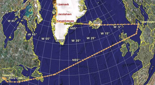
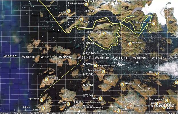
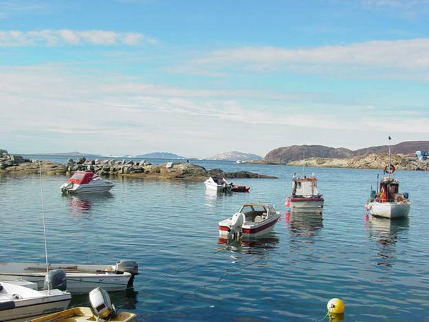
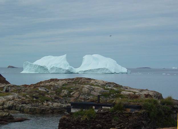
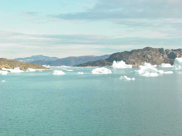
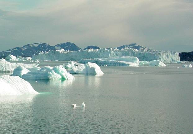
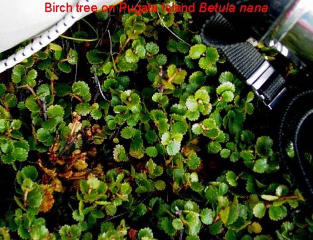
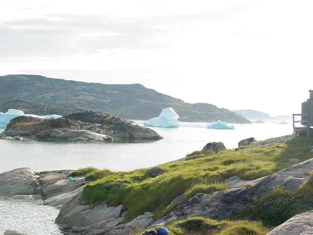
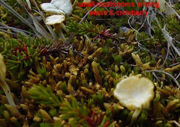
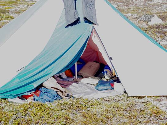
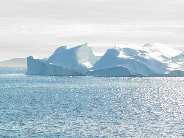
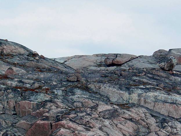
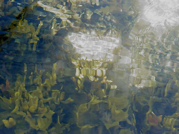
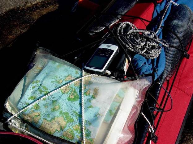
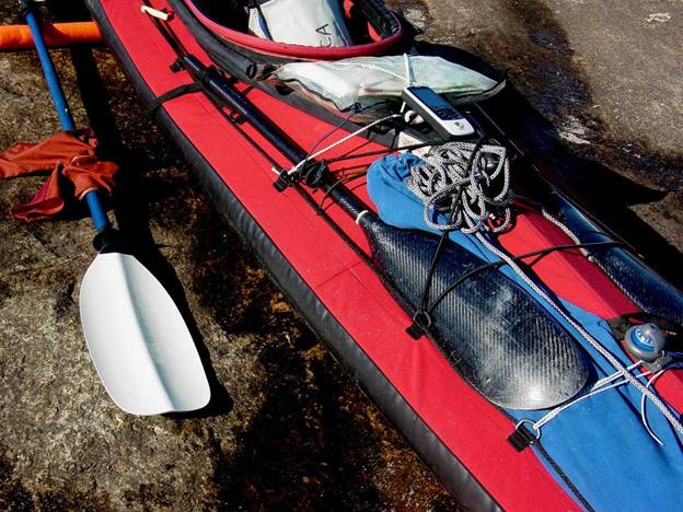
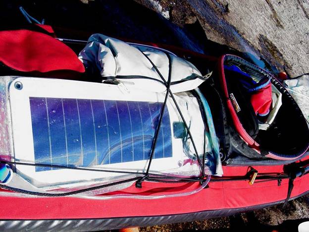
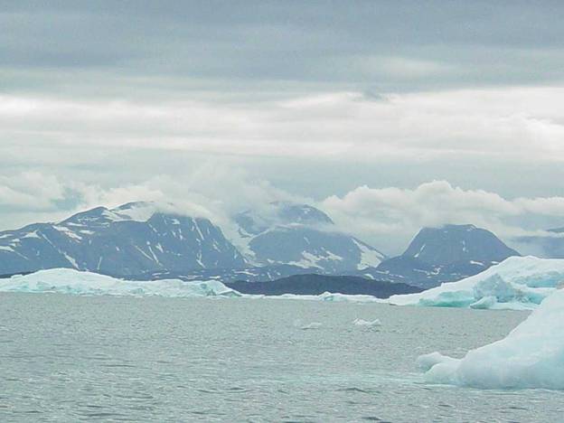
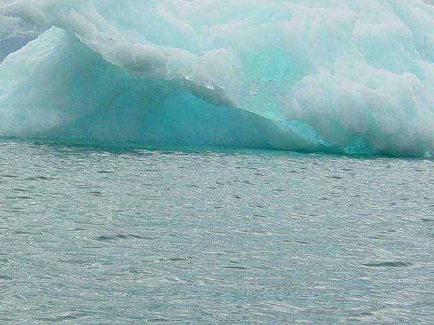
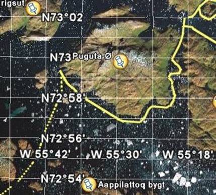
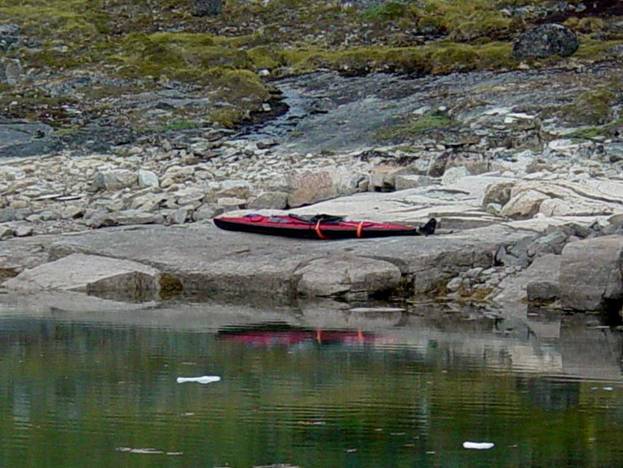
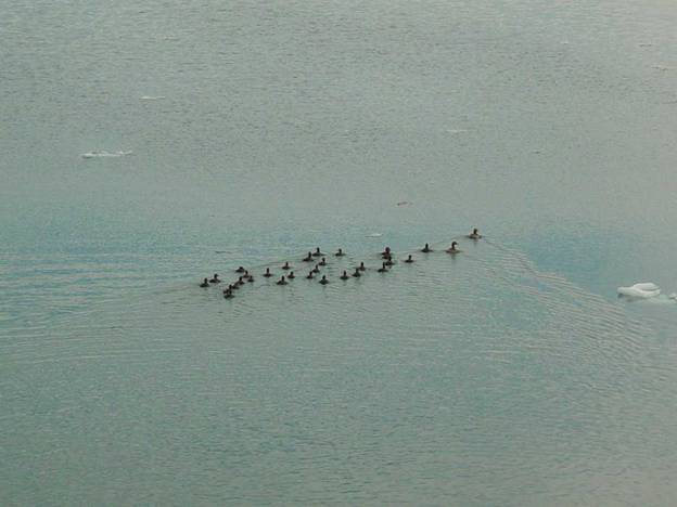
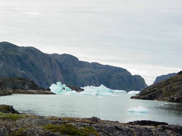
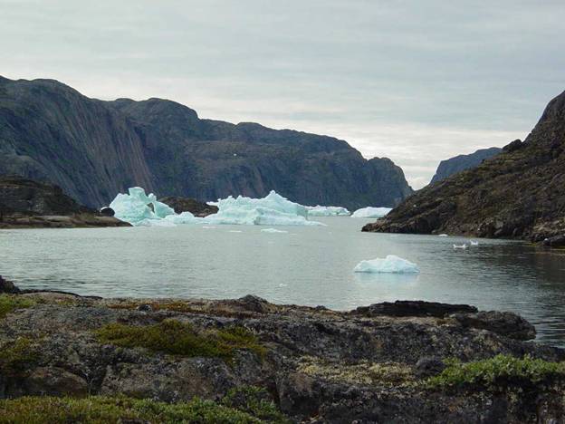
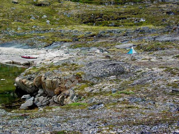
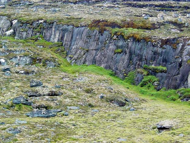
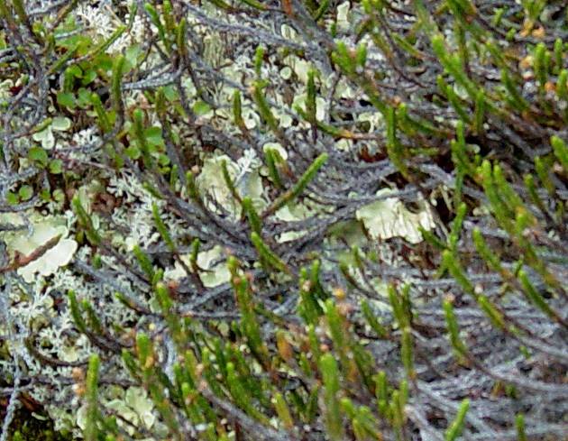
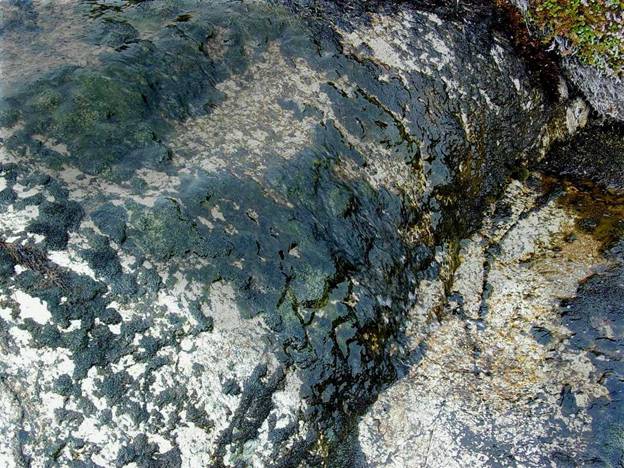
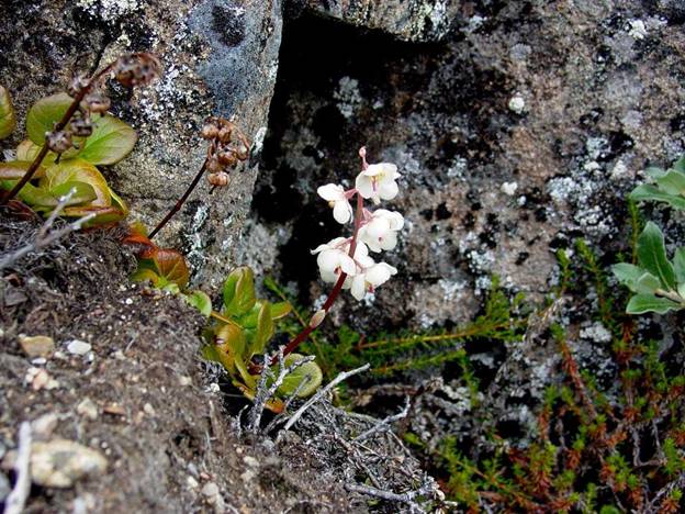
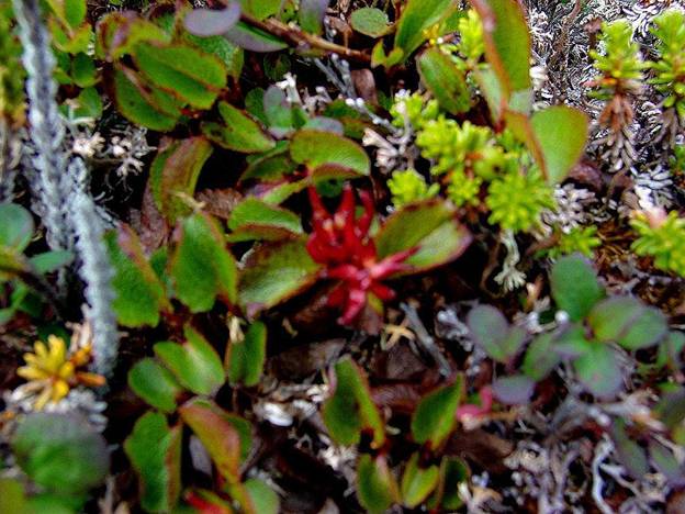
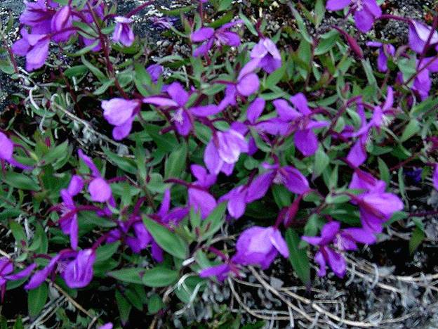
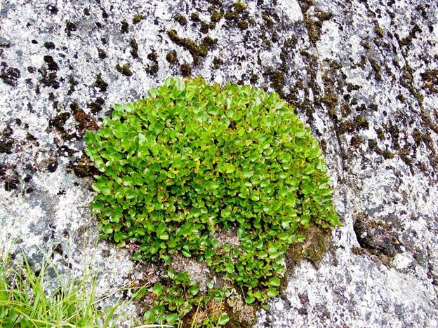
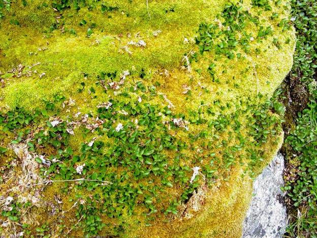
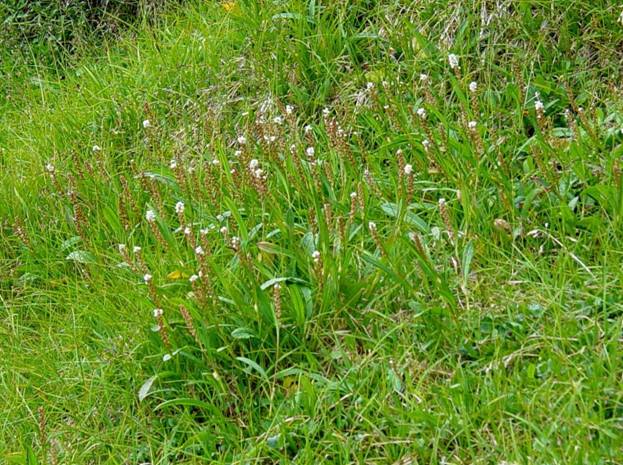
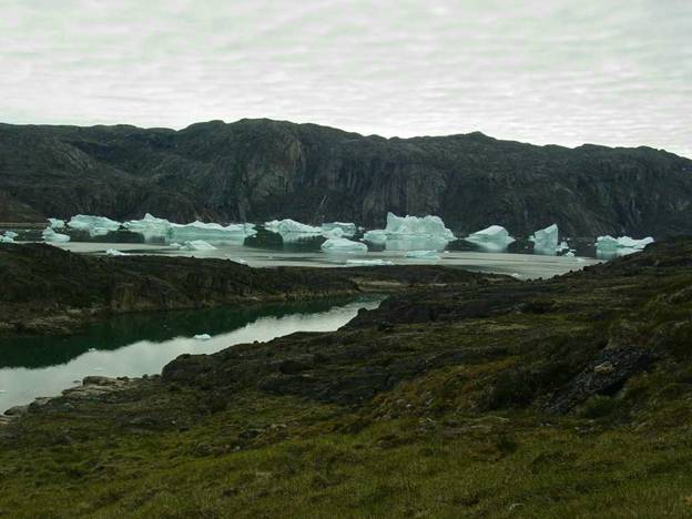
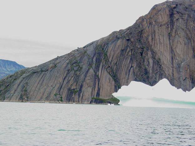
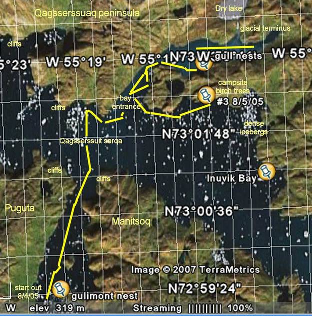
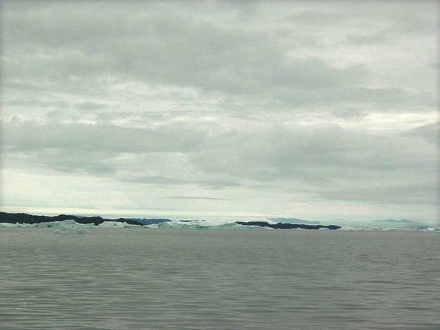
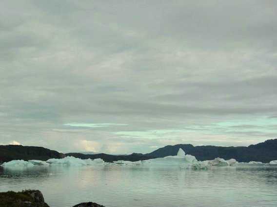
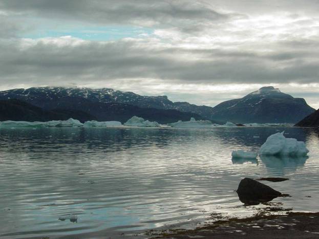
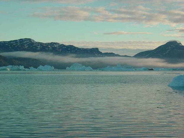
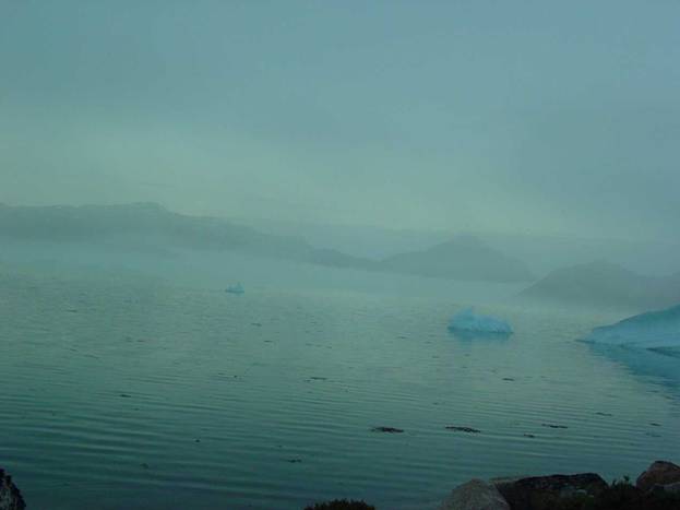
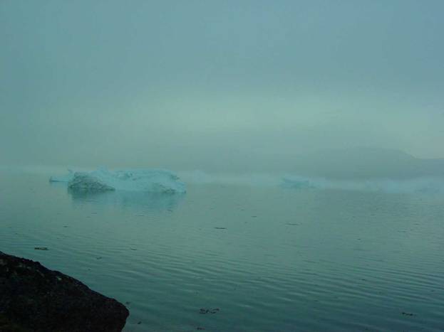
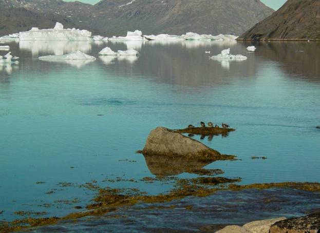
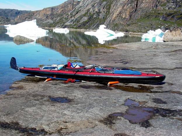
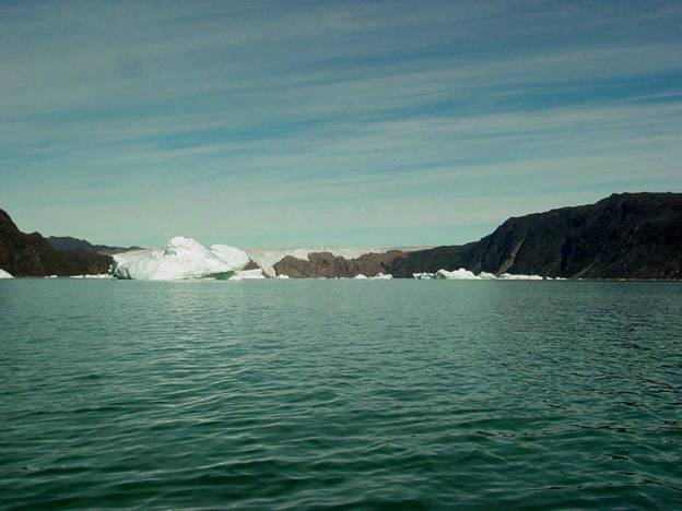
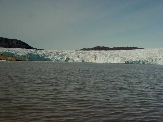
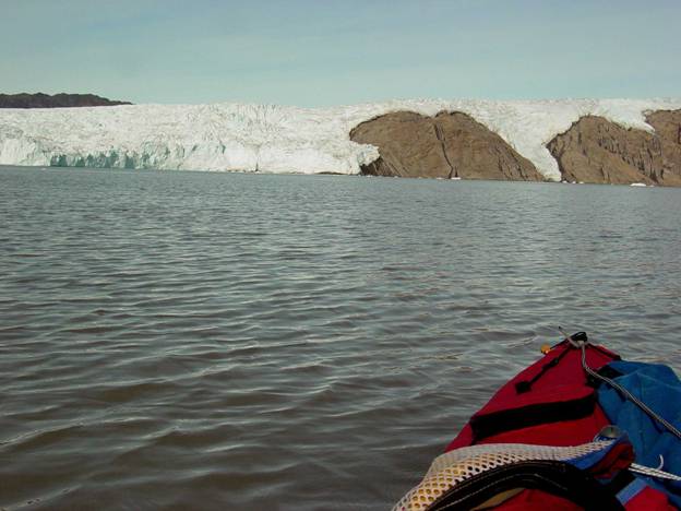
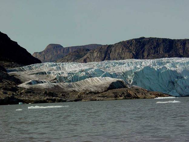
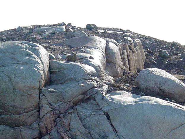
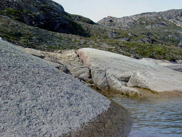
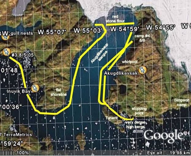
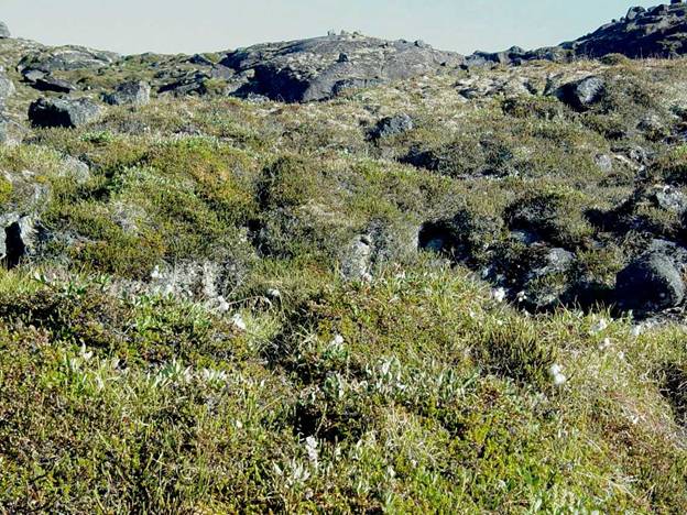
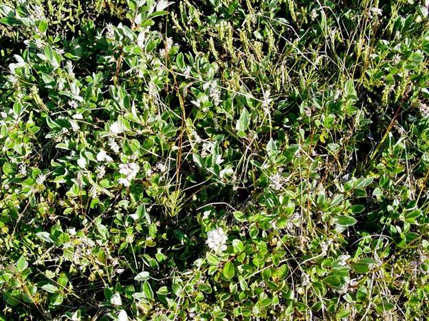
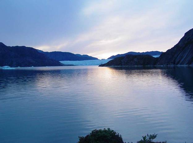
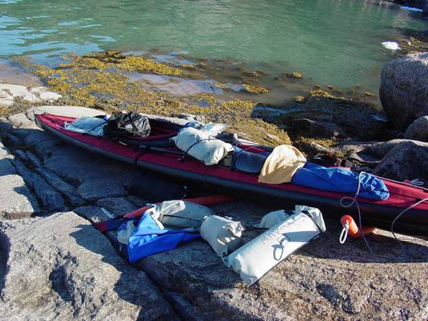
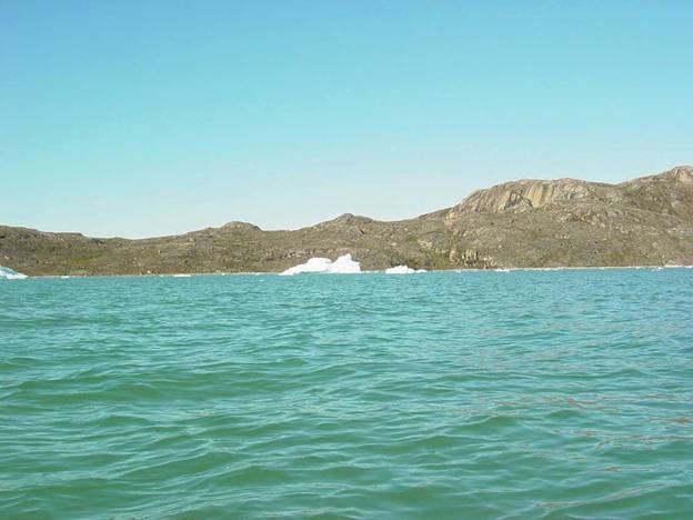
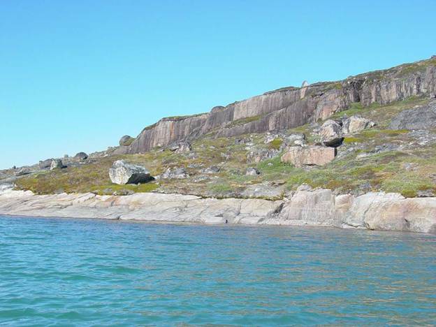
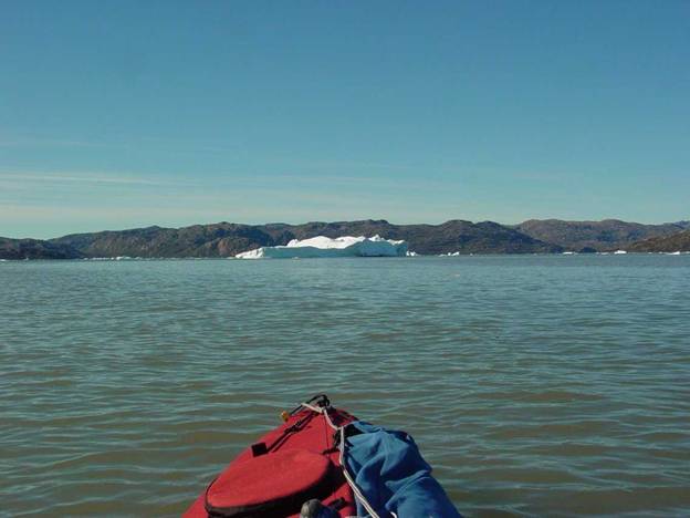
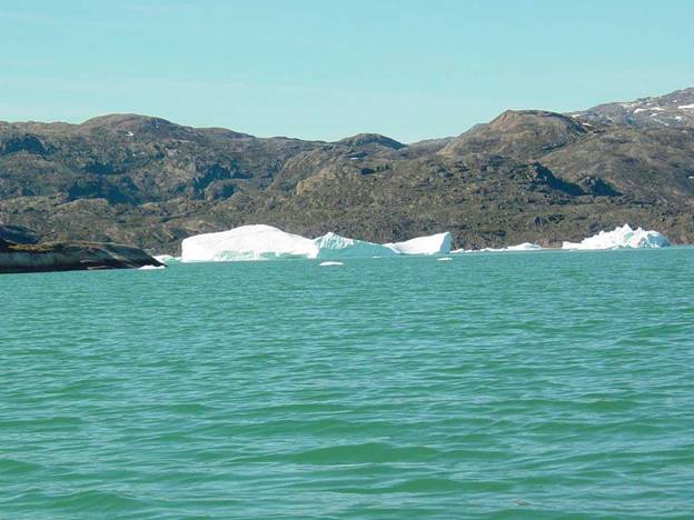
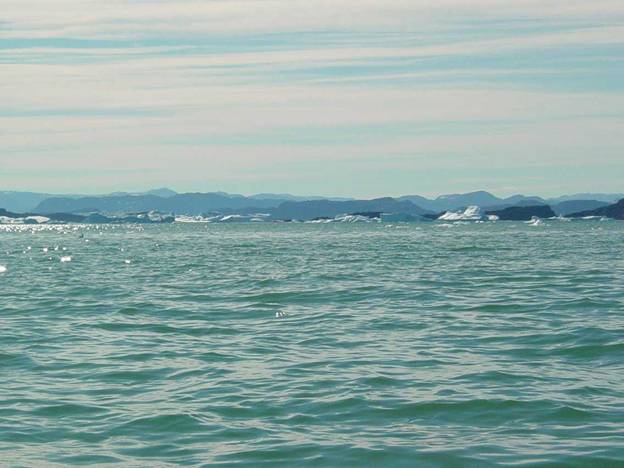
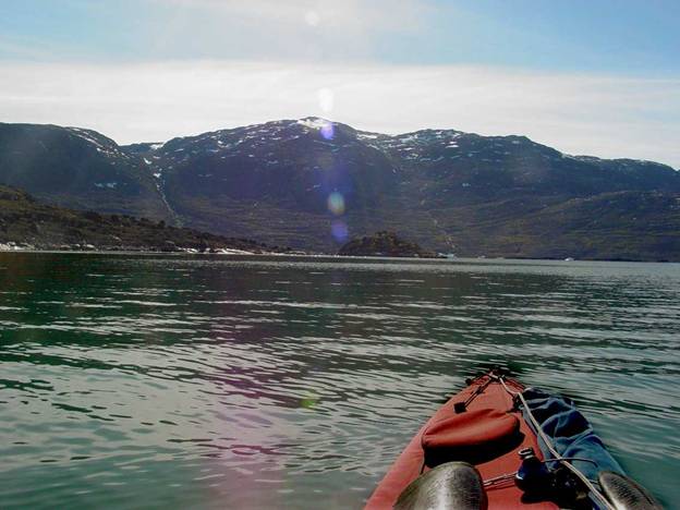
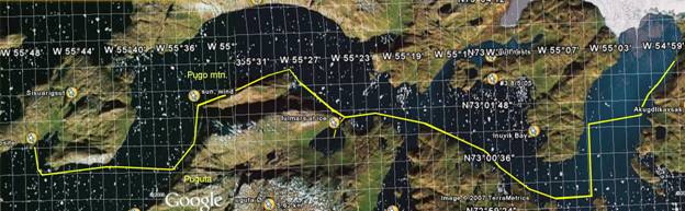
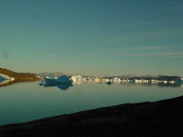
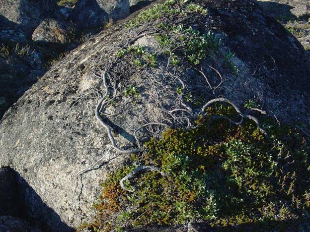
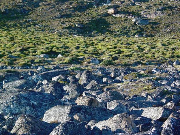
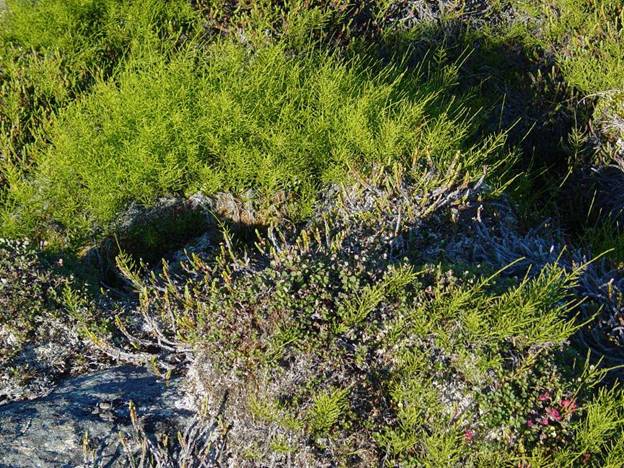
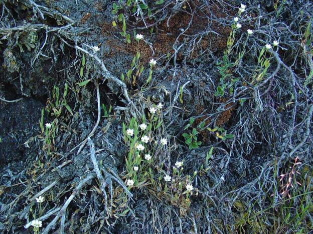
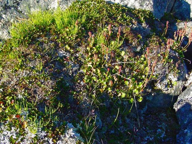 2041
2041