|
Greenland
Paddling 2003 my first paddle in my new kayak, Long Haul Mark I Gail Ferris www.nkhorizons.com/2003Upernavik.htm |
|
I arrived in
Upernavik after hauling with me on the plane all my equipment. Whew that was
an expensive exhausting ordeal. I made
the flight all in one day Then I had to
overnight in Ilulissat and fly to Upernavik the next day arriving Some deal I can
tell you. It is possible to
actually fly on Tuesday all the way up |
|
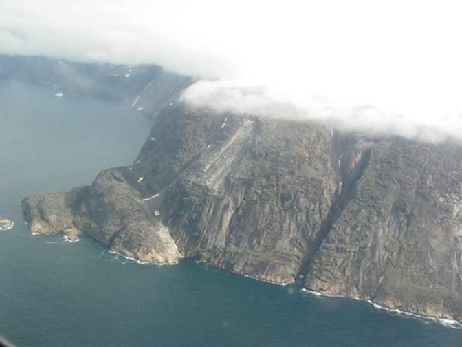
Below is the
appearance of Upernavik on approach in the DeHaviland Dash 7. This is the first I arrived in Upernavik
via fixed wing air craft. I had left
town in 1999 while this airstrip was being built. What
a thrill to finally fly into Upernavik by fixed wing aircraft, a Dash 7. I was
completely surprised that the pilot flew over Sanderson’s at 1042 meters and
in 3.5 nautical miles dropped down to 220 meters altitude. |
|
|
|
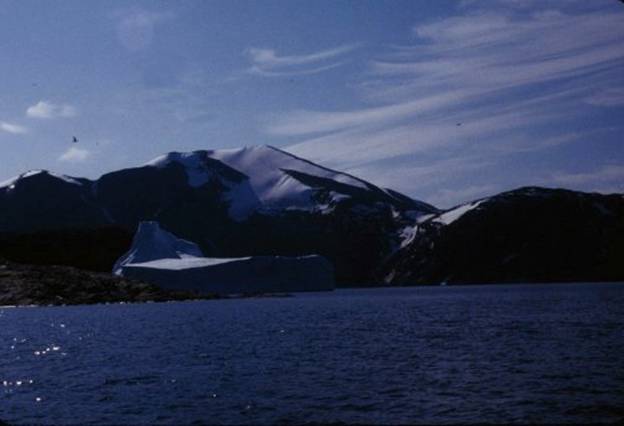
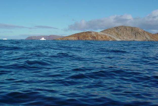
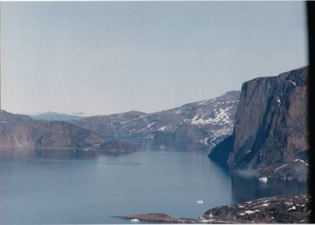
Such
a joy it was to feel the airplane glide low over Lang Ø. In this photo below I am in my kayak
looking toward Umiaq mountain to the left is the low topography of Lang
island. |
|
|
|
Below
is what Upernavik looks like from the air just as I was coming in. I am just over Lang island where there is a
lake in view from the air but not from the water. |
|
|
|
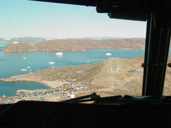
Then
in 1 nautical mile the plane just kissed the ground on touch down. This photo was
not taken in 2003 but on a sunnier day in 2009 when I had the privilege of
being in the cockpit between the pilots. |
|
|
|
The
pilot had landed us in 150 meters without gaining speed. Just
as the pilot brought us down he reversed props just about dime landing us at
the very start of the runway. I would
describe as “dime” landing. Dash 7 aircraft are designed as short
runway aircraft and in this experience of landing at Upernavik the Dash 7
sure showed her colors! |
|
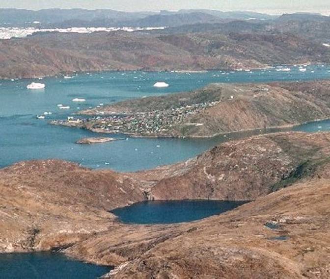
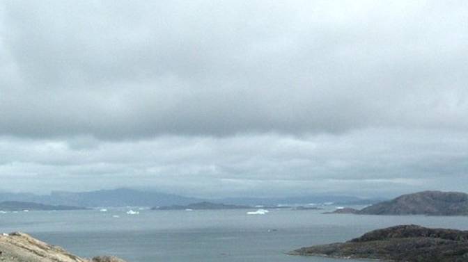
There I was at
the airport with this view out over the islands all around the horizon and
the icebergs drifting by Upernavik to the east. |
|
|
|
This time, when I arrived at Upernavik just
by coincidence by my own innocent mistake I thought I recognized a fellow who
was solid looking hardworking gentleman as being the school janitor. Well actually he was not. So there I was strutting about the airport,
“Miss wise guy”, the wise guy of the century having just landed in
Upernavik. “You know that American
lady – she comes here all the time and she paddles that ridiculous
kayak. See, there it is, in those bags
she has with her. She has more bags
with her than a family with ten children!” I remember in 1996 I did something really
outrageous and my Danish husband just said “well what do you expect, she is
an American!” I thought that, just as in the past, that I
could simply ask him for a free ride with all my bags down the hill to the
water or where ever. This time I felt my gratis request was even
more justified because I was looking for HC Hjort the school director who is
a very dear friend. Oh the things we do, and so innocently too! I
walked up to Lars whom I had mistaken as the school janitor. Even though he drove a truck for Lasø
Company I just assumed the truck was on loan to the school for some temporary
reason. What
emboldened me further was that Lars happened resembled my dear friend HC a
very solid older Dane, the best type. And
the plot thickens! Unawares
I told Lars from Lasø that I wanted to find HC. I was very serious about it and he took me
very seriously. So
there we are the two of us making this assumption that he was supposed to
transport me. We
started off by driving to HC’s house but he was not at home. |
|
So
next we continued, driving down to the bottom of the hill to the harbor
because we knew that HC keeps his boat there.
We both decided that he must be there. Sure
enough HC was on his boat. He was not
off sailing because he was involved with some repair. After waiting
around HC recognized my silhouette and I got to chat with him about
conditions. HC told me that
Upernavik had just endured several days of strong windy weather from the
north. Waves were still out there from
this storm. Aha I thought to
myself, “this is perfect, I want to catch these waves and run south on them. Little did I
realize that this storm had really set everyone on edge because it is not all
that often there is such a strong long lasting storm that forces everyone to
stay home until the waves die down. |
|
06 |
|
Lars kindly stuck it out with me all the
while, even though he was actually supposed to be on a job. He dropped my baggage which consisted of my
kayak and all my camping gear at the |
|
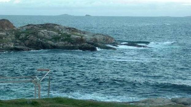
Below is a photo
showing a wave coming in from the north.
This is near the island just off the museum taken that afternoon of my
arrival. You can see that it does not
very inviting out there, then. |
|
|
|
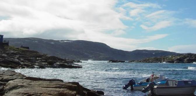
Next morning the
weather all had changed and it was just bright and sunny Below you can see
the standard motor boats which are the most common boat used for travel
between the towns in this part of |
|
|
|
Unfortunately
this size motorboat does not do too well in following seas as it has a low
transom which could easily take a wave. This photo was
taken |
|
The waves were
showing, yes indeed those are real waves out there, but you can see that they
are roughly only two feet - just a nice size to run down south on, not large
enough to suddenly slew my bow about. Right! I thought
to myself, how perfect I thought to myself as I figured I could take
advantage of this nice little situation.
With this nice
following sea I could get a free ride down hill, so to speak, with the wind
pushing me all the way or as far as I could take advantage of the wind
blowing out of the north to push me down to Prøven Kangersuatsiaq. What a neat idea now how can anybody
especially somebody in a kayak ever pass up a free ride. I could run those waves right down the
coast just zoom along past all that boring stuff I had already paddled by in
1993. |
|
09 |
|
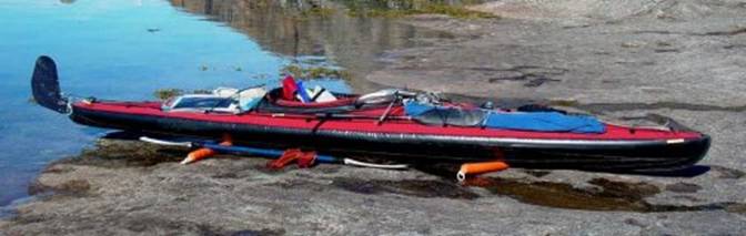
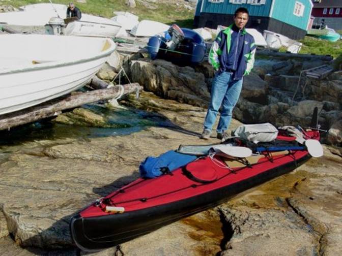
This trip in 2003
was my first time paddling my Long Haul Mark I folding kayak. |
|
|
|
I have spent many
years paddling the Klepper Aerius I and I knew very well how very seaworthy
the Klepper is. The Long Haul Mark I is designed on the Klepper but extended to 16 feet 6
inches. I can tell you
that a lot of major design work in choices of materials went into this
creation by Mark Ekhardt. All the rib
fittings of spring loaded white metal that break had been changed to bayonet
clip together stainless steel fittings that do not come apart and not break. |
|
11 |
|
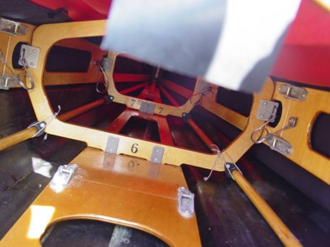
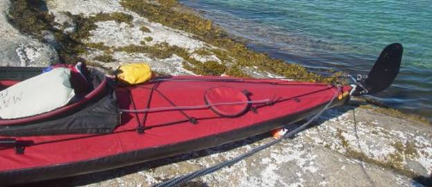
I assembled my
Long Haul Mark I kayak. I packed it
with all my food and camping gear I can tell you I
never packed a kayak as quickly as this one.
It made my head spin. This is my first
time loading a kayak with deck ports.
Believe me, there is nothing like decent loading ports. Long Haul was
kind enough to ask me where I wanted the ports positioned. One thing I knew for from my many kayak
tours was that I wanted those ports to definitely be on the same side. I already knew from those very awkward
experienced of attempting to safely step over my kayak without somehow
catching my foot and accidentally tripping and falling into the across the
deck when stepping over a beached kayak. Trying to step
gingerly over a kayak while I am preoccupied and wearing my drysuit makes me
hopelessly awkward. I happen to have
short legs to start with. So I knew that I
really wanted these ports to be located on the same side. Because all I would have to do is just walk
up and down the kayak shoving drybags into the ports. I am never so
organized to not at the last have to put a drybag, one here in the bow and
another there in the stern. I decided that
the left side or port side of the bow and stern would be perfect. The loading went so easily and rapidly it
made my head spin! |
|
12 |
|
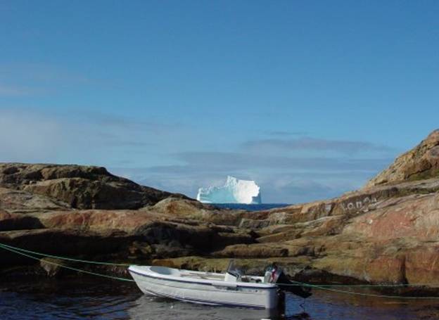
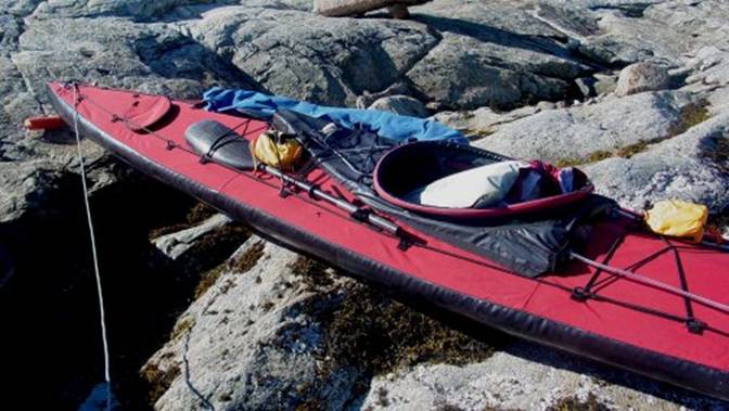
Then I launched
from those convenient smooth granite rock slabs you see in this photo below
on the
|
|
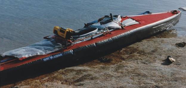
After all these
years of that horrible struggle to load the Klepper Aerius I which at that
time had no loading ports. Whew! What
a change. |
|
Below is a photo
of my Klepper in 1992 on the rocks off Aappilattoq.
I so unfondly
remember being just exhausted after loading the Klepper in this photo above,
standing on my head fishing things deep within the narrow confines below deck
using my paddle to prod and poke the stuff bags in the dark recesses figuring
out how to fish this and that inside so that nothing would be on the deck.
|
|
|
|
In the photo above you
can see waves are coming in. Actually
these waves are just swinging around the corner from the right side or north
and I have it figured that I am going to grab a free ride on these following seas
all the way, or as far as they will carry me, south to Prøven/Kangersuatsiaq. Nothing like a free ride! I can sure tell you how
boring it is to paddle down in that direction with anything but a free ride
rather with current against and swells against me and waves broadside that is a drag! And there is not much I in my kayak can do
about it other than keep paddling.
Eventually I will get there or somewhere, sooner or more likely later. 15 |
|
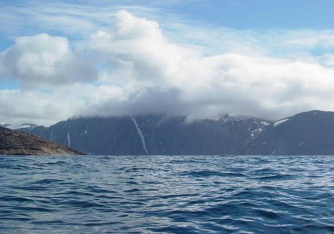
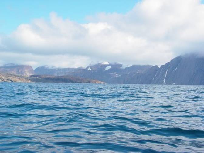
Actually it is well known
in Upernavik that a cloud cover on Sandersons Hope as you see in this photo
taken conditions are considered very nasty. Here in this photo I am
already on the water just at the end of Lang Ø about 5 miles from Upernavik. What a delight to just
glide along. My new kayak with its
longer bow was more seaworthy and carried on the waves much more nicely. Below is a photo I took
just a half a mile after launching my bow was just in a dip at the
moment. Wow what a nice day, at last I
was on my way.
the same topography only it is an aerial view on a
flat day |
|
In the photo
below I am just off Lang Ø/Akia looking at the base of Sandersons Hope
heading southward. The waves are not
all that threatening. I am very
comfortable in my new kayak. I was
just so delighted to be off and heading south in these two foot waves which
are just the perfect size for me. All I had to do
was just sit back and paddle I did not have to worry about being slewed
broadside my rudder was holding me just fine.
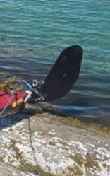
This Long Haul kayak rudder is designed as a modified sailing rudder. I was to find that this rudder worked much
better in not just ordinary paddling than the barndoor rudder of the
Klepper. Later I had one of those
moments in really demanding conditions where I had to reverse direction in 25
knot winds and paddle down wind. I was
able to control my helm with this rudder.
I did not get stuck broadside to the oncoming waves as I was reversing
from paddling upwind to downwind. This
rudder offers much less friction when partially deployed for maintaining the
bow than the barndoor rudder, allowing me to paddle with less effort many
miles. |
|
|
|
|
|
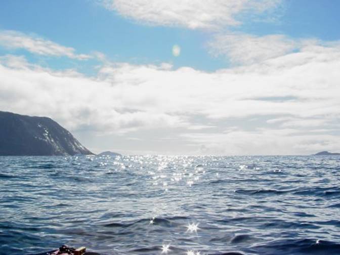
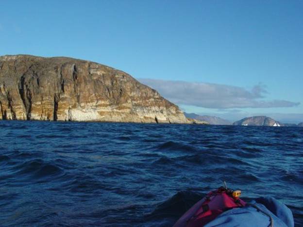
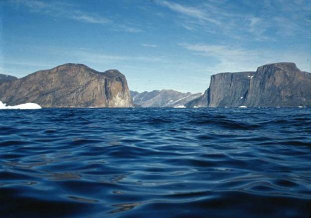
Below is a
delightful photo from my kayak of the passage between Lang ø and Sandersons.
I am in my glory just so enjoying my ride south among these waves. This is a couple
miles from my last on the water photo the rhythm of the waves was just
lovely. A few low clouds are hanging
over Sanderson’s you see on the right winding in a wall of basalt just past
the middle of this photo. What is so
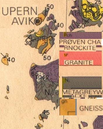
strange is that Lang island is of yellow granitic rock probably metamorphosed
sea sediments and just over the other side is the straight up and down basalt
of Sanderson’s. I always like
paddling in this region because from place to place the geology can be
completely different. In one nook on an
island the plants and soil can be completely different and very interesting. The currents in
this area are very powerful; something like 7 knots and the depths can be
very deep in the thousands of feet.
Because of these depth extremes ships have to go to known anchorage
areas. Walking on ice in
this area is very tricky because a thin spot created by these currents can be
anywhere. Digging a hole through the
ice at low tide for fishing or setting nets near an ice berg can result in a
geyser erupting. |
|
|
|
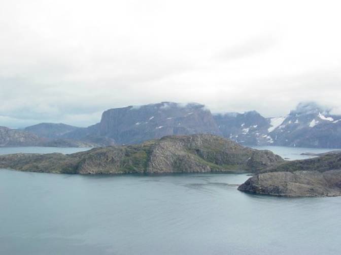
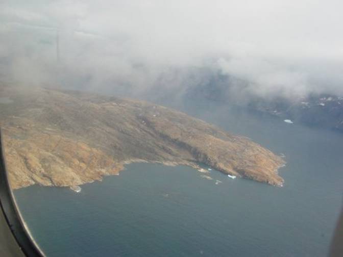
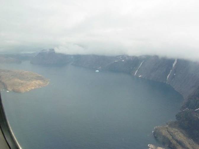
Below is an
aerial view taken the day before of this same passage between Lange and
Sanderson’s Hope.
You can see how shockingly vertical the basalt rock edge of Sandersons
is and believe me there is absolutely no place to land unless you are a
fly. The other side to the left on
Lange island is much more benign but the distance across is probably half a
mile. |
|
Next is the aerial view just outside Sanderson’s
along the |
|
|
|
23 |
|
I had just the
best time hope skipping along past this coastline in the photo above. This was actually the first time I paddled
this coastline in the early afternoon sunlight. I started heading
out toward some islands which I have never seen other than as some backlit
dark lumps. This time with the sun
near |
|
24 |
|
|
|
It is always
surprising to be paddling in the same area with different light, especially
in this mountainous area. The dark
brown on the islands above is probably a heavy deposit of iron. After this point
I just hunkered down and paddled south I was making such good time. My plan was to
take GPS readings and record approximate numbers of birds on the islands. |
|
|
|
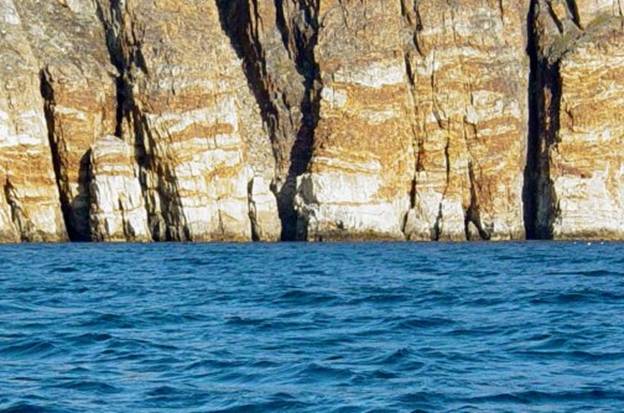
These are cliff
faces just before the crossing which are very uninteresting in the morning
when back lit but now in the height of the sunlight they are just spectacular
to witness these colors in their strata. Only once before
in 1993 had I seen these cliffs in this light. I knew that they were there
all along but it was hard to believe these spectacular colors. Around the corner
this same strata looked pink and that was really difficult to imagine
possible. In my kayak I can
take the time to look and enjoy these views. |
|
Below I have made
it most of the way down along Sanderson’s/Qaersorssuaq island I am looking at
Ingia point and you can see there is no place to land but the tall cliffs
past the end of the point are the opening of Sortehul. |
|
28 |
|
These same rock strata a little closer with some
Guillemots on the right, they nest there! |
|
29 |
|
30 |
|
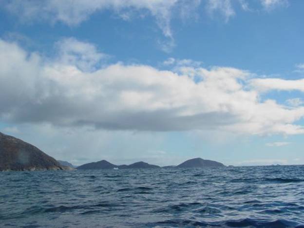
When you compare
the colors in the photo above and below you can see that the colors are
changing as I come closer to the islands their colors are changing from
bluish tones to browns and some yellows. In the photo Tina
and Anana islands look as if they are just over there, in reality the
distance is a few miles. |
|
31 |
|
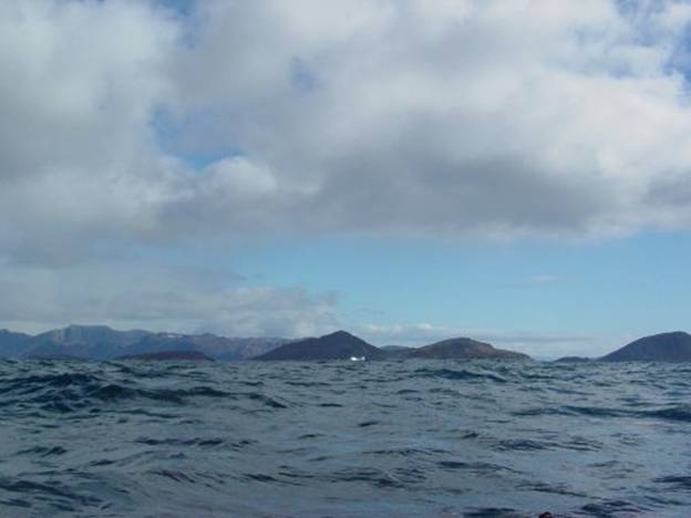
Same iceberg only
now I am a little closer near Tina island. Because I am a
mile or so off shore my view of the Sortehulle passage in the background is
starting to develop. In this view
below this same iceberg in the photo above is off Tina island. |
|
32 |
|
Below is a photo taken from my cockpit in 1993 of
Sortehul while I was paddling across. |
|
33 |
|
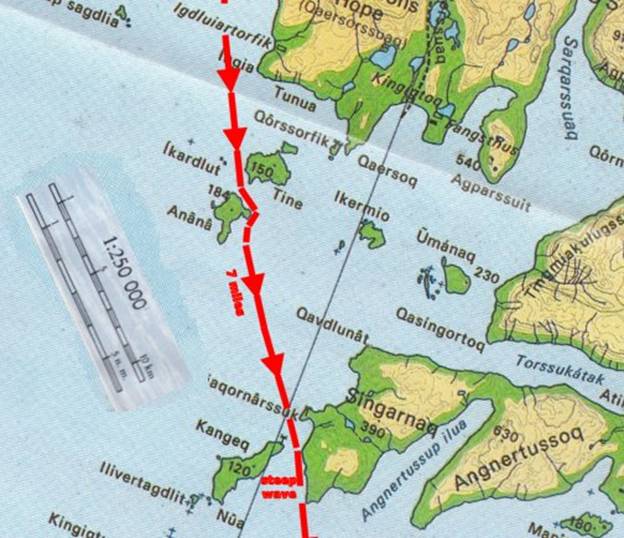
I paddled just
enjoying the way my new kayak was handling open water even though during this
upcoming crossing I would pass between islands with a seven mile gap. Not being able to look at land makes me
somewhat anxious but in reality looking at land with no place to land is not
any better than going between islands where there is nothing but water. So what am I going to do other than smother
my fearful thoughts about handling the openwater. Below is another view of
Sortehulle and I have yet to summon the nerve to paddle this passage because
it can have large waves develop during the tide change. Six foot standing waves I am not especially
interested in trying. John Kislov told
me he has had this experience in a motor boat. You can see the possibility that this
passage can become dicey in a tide change or a strong wind. |
|
34 I took this from a helicopter on approach to
Upernavik 1993 |
|
I was having such
a great time looking for birds on the islands Tina Anana and others on this
crossing. I took GPs readings but
forgot to take pictures. Next I made the
five crossing Anana and Kangeq at the end of Sortehul. I was relieved I just
headed for the next two islands Kangeq and Singarnaq because they were the
most direct line to Prøven/Kangersuatsiaq.
Time was about |
|
|
|
Then all was fine
as I was still running nicely down hill on the following seas which had not
changed in character since my initial launch but I had not considered what
the effect of the long open fetch might have on my next passage between two
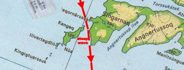
islands. As I was paddling
along I happened to pass closely to the steep straight sided west face of
Singarnaq. There I was so
innocently running on the waves riding them to beat the band through this
straight passage between these two islands.
This opening was
not like all of the other passages indeed it was just exactly in an
unobstructed straight line with this fetch. Oh boy, at first
all looked so innocent from my cockpit, just some more waves, when suddenly
as I heard the sound of these large plunging waves along the rock faces. I looked to the side and then at my bow
just in time to realize that I was about accelerating down the steep face at
an outrageous speed that could only end with my bow underwater and abruptly
lurching into a pitchpole. There I was close
to the rock wall near the end as I was uplifted and heading for an ender down
the face of a six foot wave. Luckily I did not
loose my cool. I knew enough to lean
out on my paddle with a strong low brace slowing the boat down before she
pitch poled. That was close
and I thanked my many years of experience especially the experience I had in
Arctic Bay where I found my boat being propelled madly down the bay by some
very powerful winds, just as if I were being towed doing some
waterskiing. Whew that was a really
dicey moment but at least from then on I knew what leaning out on my paddle
and tilting up wave would do in an otherwise out of control situation where I
would be going over one way or another. It comes to in a
kayak, don’t be afraid to wear the wave and lean toward the wave or wind. |
|
|
|
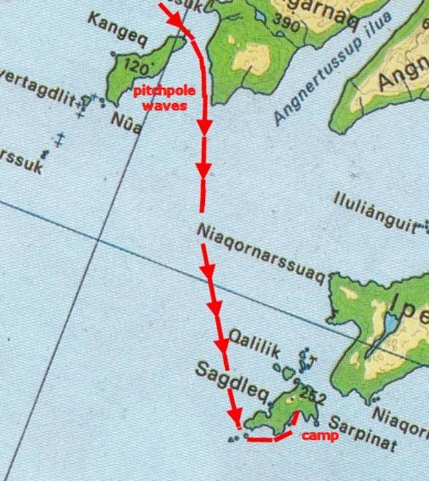
After my fun when
I nearly pitchpoled I headed for the next pair of islands. The crossing was easy no turning tides no threatening seas even though I was crossing the opening
of Angmarsaq passage. I realized as I
neared Sagdleq that I was beginning to feel tired.
I was not just tired but sleepy and I was starting to fall asleep in my
seat. I realized how comfortable this
seat in my new kayak is when I just started to doze off. |
|
|
|
Just exhausted I
passed by and pulled in after passing a hunters cabin. I just took a chance that there would be
some sort of place I could bring my kayak in. There was no
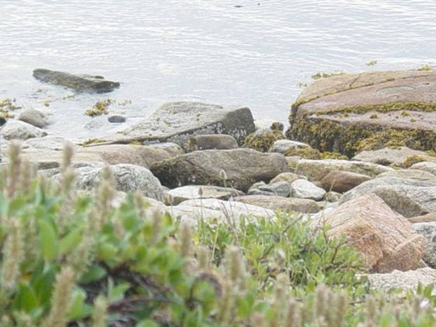
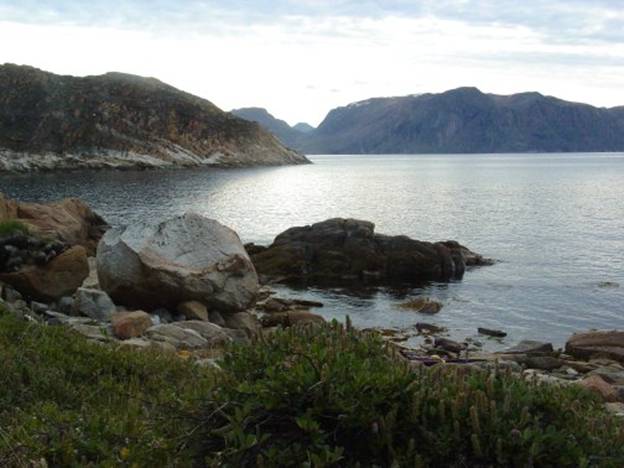
beach but I found a protected slope with large boulders on the beach. Now doesn’t this
look innocent? What you do not see is
all the boulders that revealed themselves in the morning at maximum low tide. One of those
nasty traits of this area with the tides is that there are two kinds of high
and low tides. The lowest tide is much
lower than what you see in this photo below. I awoke to find
my brand new kayak sitting precariously on the rocks with the rudder jammed
in them. |
|
|
|
I had a very
difficult time getting myself out of my cockpit because I was really down in
there. After heaving and hauling I
finally wedged myself upward and was able to sort of put my leg over the side
on the rocks in this calm water. I
carefully engineered standing up on my leg without doing some motion my
artificial hip could not tolerate.
That was tricky! But at least the water was calm in this lee
area. All the waves from the wind were
on the north side which was just rock faces. All the islands I
had seen seemed not to offer any place to get out on and I was really
concerned as I paddled past the hunters cabin that
there would be some sort of place to get out at. Just any old nook was alright with me! I was really desperately tired at this
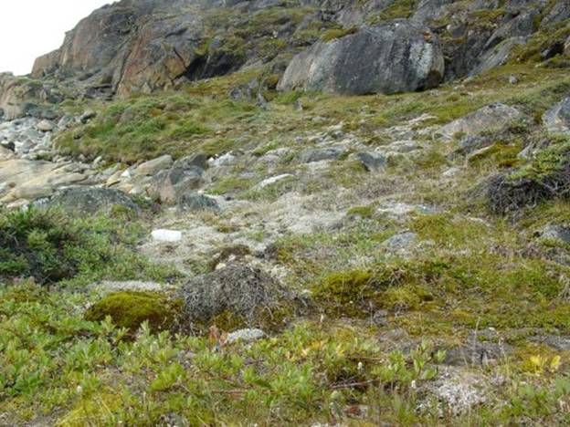
point and I did not feel able to paddle much further. When I rounded
the corner and found these friendly rocks with this bank covered with lush
vegetation I knew this had to be a nice place. |
|
|
|
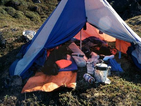
I literally
stumbled up the rocks, tied off my kayak and dragged out my camping gear. Later I dragged
my kayak up as high as I could get it by lugging and dragging over the
exposed rocks. The light was dim
as I gallantly proceeded to set up camp.
It was only 10 in the evening and on the south side all was grey. First I pulled r
things had changed from when this photo was taken in 1993. My tent however was not okey and it should
have looked like this. However it had
decomposed and all that remained was the orange nylon liner and the pole you
see in this photo below. |
|
|
|
I just thought to
myself that since it is an absolutely quiet evening and the ground because
this faced south was covered with soft willows and warm I bet I can sleep
here without any tent. I just took my solar
blankets, my sleeping bag and Thermarest air pad out, got out of my dry suit,
crawled in and fell asleep hoping that my kayak would be alright over night. |
|
|
|
Next morning I
awoke to this. |
|
|
|
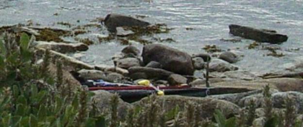
There was my
kayak way up there! In the photo
below you can see the bright yellow pool noodles tied around the hull to
protect it from abrasion but the rudder really was jammed into the rocks and
the weight of the boat was bearing on it.
I am surprised the rudder survived undamaged.
|
|
This is the story so far gaileferris@hotmail.com www.nkhorizons.com/2003Upernavik.htm
www.nkhorizons.com 2 28 2011 |
|
|